Joan Blaeu’s Map of Historic Monmouthshire
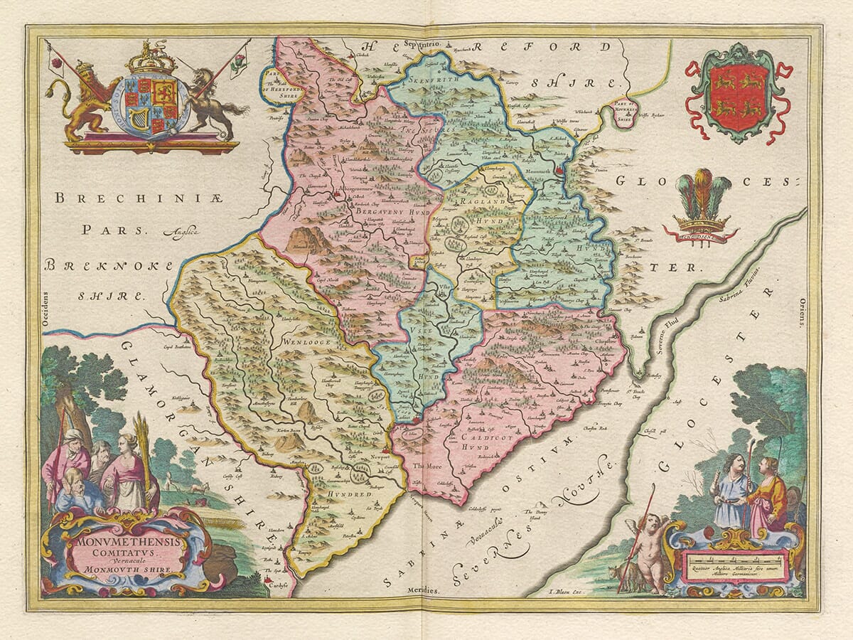
Joan Blaeu’s map of Monmouthshire was first published in Amsterdam in 1645 as part of the fourth volume of his Theatrum Orbis Terrarum, sive Atlas Novus. Its engraved title, Monumethensis Comitatus, Vernacule Monmouth Shire, may be understood as “The County of Monmouth, commonly called Monmouthshire.”
The map formed part of Blaeu’s important collection of English and Welsh county maps. Produced in one of Europe’s foremost centres of cartography, the series combined inherited geographical knowledge with exceptionally fine engraving, ornamental cartouches and heraldic decoration.
Joan Blaeu and the Amsterdam Atlas Trade
Joan Blaeu inherited the family publishing house following the death of his father, Willem Blaeu, in 1638. He subsequently expanded its atlas production and became one of the most celebrated cartographic publishers of the Dutch Golden Age.
Although the Blaeu name had already become internationally respected during Willem’s lifetime, this map belongs to the English and Welsh county volume published under Joan’s direction. It should therefore be attributed to Joan Blaeu rather than to his father.
Blaeu did not undertake a new survey of Monmouthshire. Its geographical information was based principally upon earlier English county mapping, particularly the work of Christopher Saxton and John Speed. Blaeu’s Amsterdam workshop re-engraved and refined this material, giving the finished map its distinctive typography and decorative appearance.
The plate continued to be used in later editions of Blaeu’s atlases and was eventually included in the monumental Atlas Maior. Surviving original examples may consequently carry Latin, French, Dutch or German text on the reverse and may have been published after 1645.
The Historic County Between Wales and England
Monmouthshire occupied an important borderland between Wales and England. The historic county was created during the sixteenth-century administrative reorganisation associated with the Laws in Wales Acts. Its subsequent treatment in law and administration led to a long-running ambiguity over whether it should be regarded as part of Wales or England.
This uncertainty continued for centuries and is one reason that older maps and reference works do not always classify Monmouthshire consistently. The Local Government Act 1972 removed any remaining legal ambiguity by expressly placing the county within Wales from 1974.
Blaeu’s map presents the historic county bounded broadly by the River Wye and the English border to the east, Breconshire to the north, Glamorgan to the west and the Severn Estuary to the south. The mountainous northern landscape contrasts with the lower valleys and coastal country around Newport and the estuary.
Monmouth appears close to the meeting of the Rivers Wye and Monnow. Abergavenny stands near the River Usk beneath the higher country of the north, while Usk, Chepstow and Newport mark important points along the county’s rivers and principal routes. Numerous villages, castles and smaller settlements are identified through conventional engraved symbols.
Rivers, Valleys and Border Routes
The Rivers Wye and Usk dominate the map’s geography. Both provided natural routes through otherwise difficult terrain and influenced the location of settlements, castles and agricultural land.
The Wye formed much of the county’s eastern boundary and connected Monmouth and Chepstow with the Severn. The Usk passed through Abergavenny and Usk before reaching the estuary near Newport. These waterways were important for local travel, trade and the movement of agricultural goods, although navigation varied considerably according to location and season.
Blaeu represents hills through pictorial profiles rather than measured contours, while woodland appears as clusters of individual trees. Roads are not systematically shown, and distances should not be judged by modern surveying standards. Nevertheless, the density of place names and the clearly engraved river systems make the map an absorbing record of how the county was understood in the seventeenth century.
Monmouthshire During the Civil War
The map was published during the First English Civil War. Monmouthshire’s castles, river crossings and routes between Wales and western England gave the county considerable strategic importance.
Raglan Castle became one of the most significant Royalist strongholds in Wales. It remained in Royalist hands after the main field armies had been defeated and surrendered to Parliamentary forces only in August 1646, following a prolonged siege. Chepstow and Monmouth also experienced military occupation and changes of control during the conflict.
Blaeu’s engraving does not record these events and was not intended as a military map. Its publication date nevertheless places its seemingly peaceful landscape within a period of considerable disruption and political uncertainty.
Cartouches and Heraldic Decoration
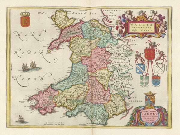
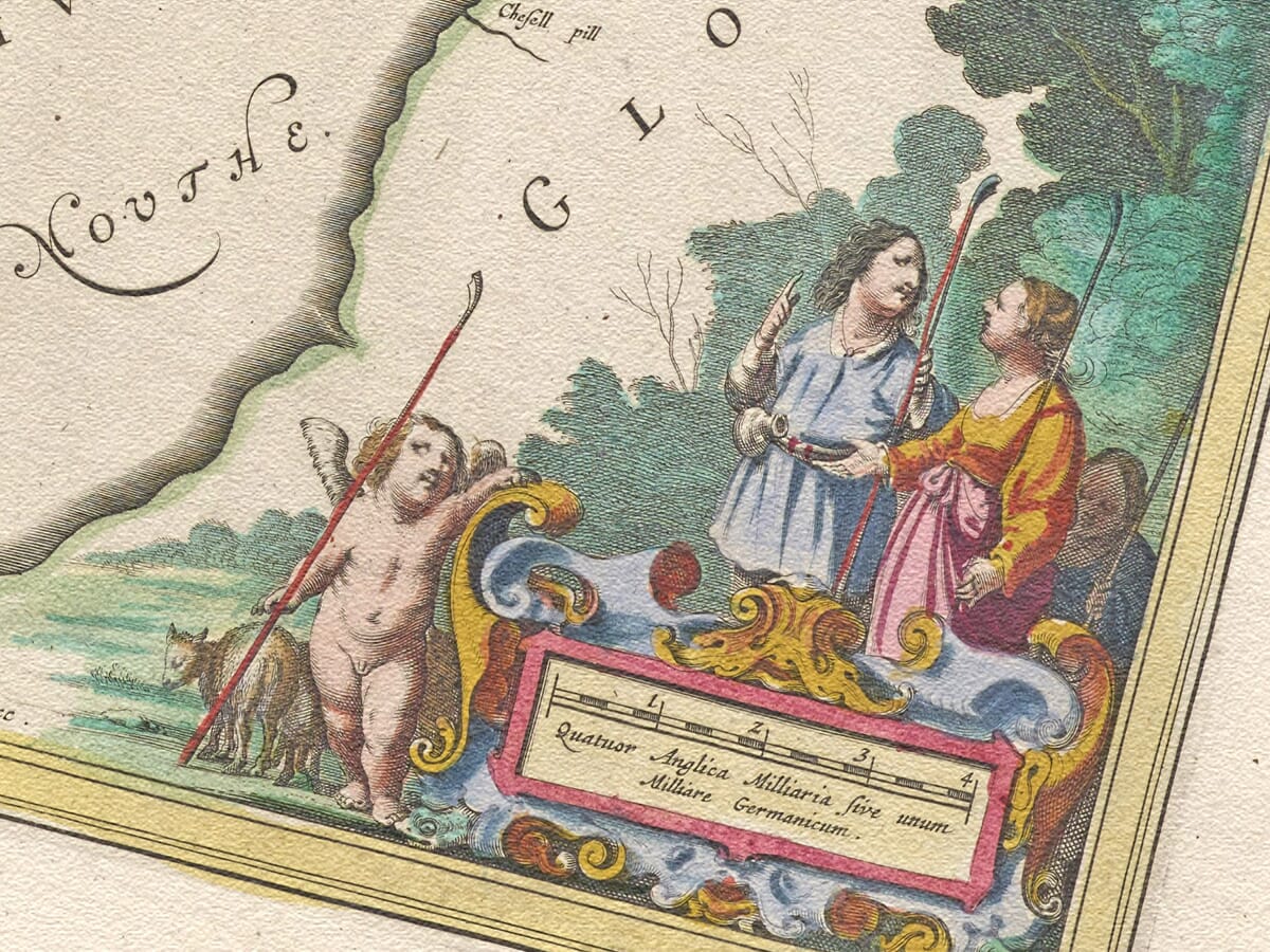
The map’s decorative design is among its most attractive features. Large cartouches contain the title and scale, accompanied by carefully engraved figures and putti. The Royal Arms provide an imposing emblem of Stuart monarchy, while the arms and feathers of the Prince of Wales reinforce the county’s association with Wales.
These ornaments were not merely additions to empty space. They helped establish the authority and prestige of the atlas while making the map desirable to wealthy European collectors. The combination of geography, calligraphy, heraldry and figure work is characteristic of the Blaeu workshop at its finest.
Today the map offers a compelling portrait of Monmouthshire before modern roads, railways and industrial development transformed its valleys and settlements. It is both an important record of the historic border county and an outstanding example of seventeenth-century decorative cartography.






 Verified owner