


London Empire
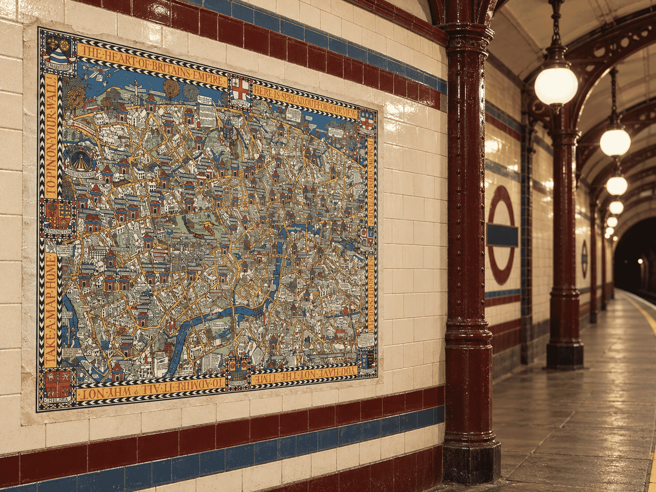
London Empire London Pictorial Map Wonderground Map displayed on a vintage London Underground station wall Tube Promotion

Vintage London Underground Poster

Price range: £35.55 through £59.95

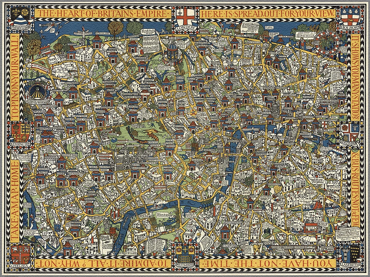
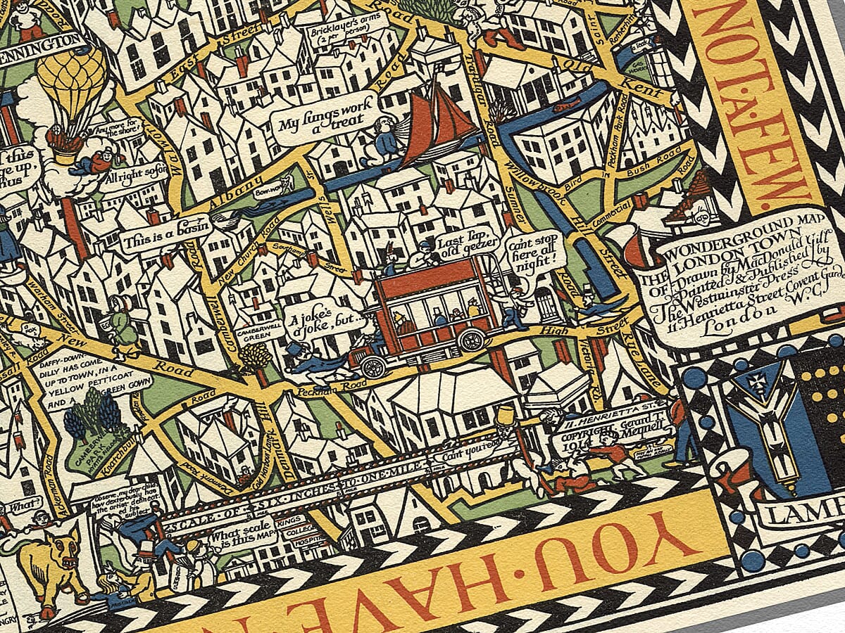
The Wonderground Map of London by MacDonald Gill, 1924 This vintage London Underground poster reproduces the colourful 1924 edition of MacDonald Gill’s celebrated Wonderground Map of London. Gill’s original design first appeared in 1914 as part of the Underground’s imaginative campaign to encourage Londoners to use public transport for leisure as well as work. London is presented as a densely packed pictorial city filled with Underground stations, buses, landmarks, parks, winding roads and humorous observations. Bold primary colours and decorative lettering make the map entertaining to examine while retaining a recognisable picture of the capital. This later edition includes the “On to Wembley” reference associated with the British Empire Exhibition of 1924. It is a fascinating piece of London transport history and an exceptionally detailed fine-art print for admirers of the capital, pictorial maps and vintage Underground design.
+ read more

A stunning certified FINE ART PRINT on heavy textured art paper

  • Direct from the publisher — no middlemen
  • Printed in-house in Cornwall
  • Free UK delivery — international shipping available
  • Produced to meet — and often exceed — museum-quality standards

SELECT SIZE

Inspecting Vintage Map Reproduction

Fine Art Map Reproductions – Museum-Quality Printing

Unlike most online offerings, our maps are produced entirely in-house, not outsourced to print-on-demand or drop-shipping services. This allows complete control over quality while offering better value. Each map begins with a high-resolution original, carefully enhanced and printed to order using archival papers and pigment inks for exceptional clarity, depth, and longevity. Every piece is personally overseen — no map leaves our workshop unless it is of a quality we would be proud to display ourselves.

Hand hold a magnifying glass over West Cornwall Map

Authentic Old Map Paper & Accurate Colour Reproduction

Paper choice is essential to the authenticity of our maps. We use specially sourced 190gsm paper made in the UK from pure materials and traditionally pressed with natural woollen felts. This process creates a subtle, randomly textured surface that closely resembles an original antique document. Likewise the use of premium quality ink fully saturates the paper, producing remarkable clarity, depth, and historical character. Colour fastness and sharpness will remain good for in excess of 100 years!

Map in Postal Tube
Buy Old Maps Online in the UK Today Trading online since 1999

The Old Map Company of Great Britain offers a vast and carefully curated collection of the very finest expertly reproduced vintage maps. Our range includes works by renowned cartographers such as John Speed and Willem Blaeu, covering Scotland, England, and beyond. Free UK courier delivery is included, with EU, USA, and worldwide shipping available at cost and calculated at checkout. If you need assistance, our team is always happy to help you choose the perfect map.

RECENT REVIEWS

Daz
DazGB
Verified ownerVerified owner
5/5

Speedy delivery A beautiful representation

2 months ago
David H
David H
Verified ownerVerified owner
5/5

Got there in time and loves it! Cheers David [Gift from US to UK]

4 months ago
Ellan C-S
Ellan C-S
Verified ownerVerified owner
5/5

Thanks Lauren. We received it today - it's gorgeous! Thank you, Ellan

4 months ago
Ivano Di Battista
Ivano Di Battista
Verified ownerVerified owner
5/5

Thank you for your prompt service. I have a gallery and framing business in South Wales. I'm so pleased it is printed in the UK

5 months ago
Robert B
Robert B
Verified ownerVerified owner
5/5

My Isles of Scilly map arrived safely and I'm delighted with it!

5 months ago
Andrew T
Andrew T
Reviewer
5/5

The print arrived safely and we're delighted with it - a lovely reminder of our honeymoon 15 years ago.

5 months ago
Hannah J
Hannah J
Verified ownerVerified owner
5/5

I have just received them! I'm sure our clients will be pleased with them and there could be more projects off the back of this one where we can use more. [Interior Designers]

5 months ago
Sean MacManus
Sean MacManus
Verified ownerVerified owner
5/5

I just received my map of Ireland by Ewart today and, as usual, I am delighted by its quality. The crispness and fineness of detail is excellent and the colour reproduction surpasses my expectations. Please relay my thanks to Steve for another fine effort!

6 months ago
John G
John G
Verified ownerVerified owner
5/5

Many thanks, Lauren. Very pleased with the map and the service: would recommend The Old Map Company to anyone interested in Old Maps.

8 months ago
Lois K
Lois K
Verified ownerVerified owner
5/5

Thrilled , Lauren! Thank You

8 months ago
Ed Simpson
Ed Simpson
Verified ownerVerified owner
5/5

Many thanks, the map arrived safely this morning, and I’m really pleased with it. A stunning reproduction, just as I had hoped. I will keep browsing your website, and may yet be tempted by more of your items! Have a great weekend.

8 months ago
Daniel McCade
Daniel McCade
Verified ownerVerified owner
5/5

Just arrived, wonderful map! Thanks very much!

9 months ago
Jonathon R
Jonathon R
Verified ownerVerified owner
5/5

The map – beautiful – arrived safely, very many thanks.

1 year ago
Rasa Terbetiene
Rasa Terbetiene
Verified ownerVerified owner
5/5

Thank you, I have already found the map. It’s wonderfull! Good luck! Rasa

4 years ago
Mina M.
Mina M.
Verified ownerVerified owner
5/5

My apologies for the very late reply. I wanted to reach out to thank you so much for rushing my order. My partner absolutely loved it. I am amazed with the service so that is a five-star from me. I wish you all the best.


4 years ago

Historical Background

MacDonald Gill’s Wonderground Map began as a large advertising poster commissioned for the Underground in 1913 and displayed at stations from 1914.

Rather than producing a conventional transport diagram, Gill transformed London into an elaborate illustrated world. The poster was intended to entertain passengers and encourage them to use public transport for leisure as well as the daily commute.

Map Details

  • Original title: The Wonderground Map of London Town
  • Cartographer and artist: Leslie MacDonald Gill
  • Commissioned by: Frank Pick for the Underground Electric Railways Company of London
  • Original design: 1914
  • Edition reproduced: Later state associated with the 1924 British Empire Exhibition
  • Printer of the later map: The Westminster Press
  • Area shown: Central London and its surrounding districts
  • Orientation: North approximately towards the top
  • Map style: Decorative pictorial advertising map
  • Notable feature: “On to Wembley” reference added for the 1924 edition

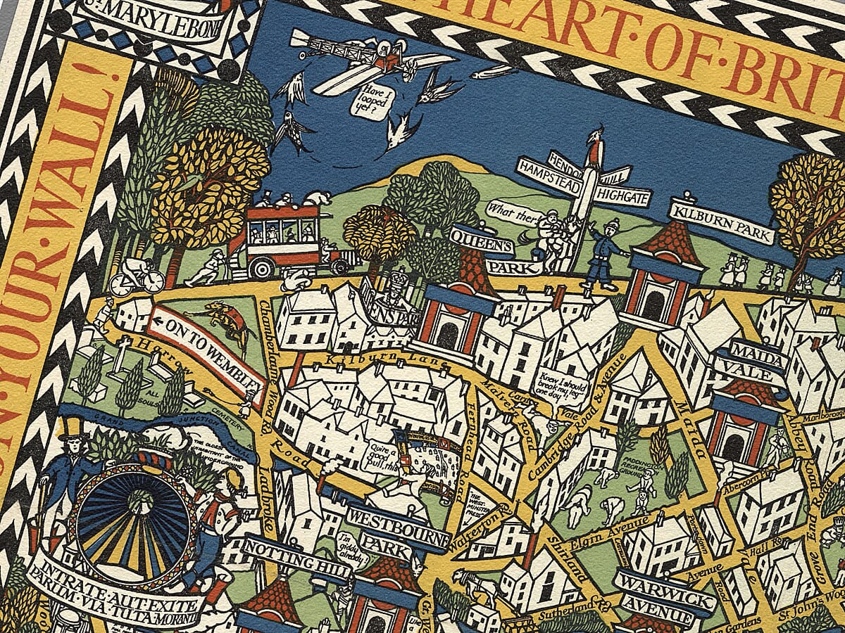
Underground stations appear as repeated red-and-blue entrances distributed throughout the city. Yellow roads connect districts on both sides of the Thames, while buses, trains and other forms of transport move among the buildings.

Hyde Park and Regent’s Park provide prominent areas of green within the tightly packed townscape. Real streets and landmarks are combined with speech bubbles, visual jokes and imaginary incidents, rewarding repeated inspection.

Gill surrounded the map with a bold black-and-white chevron border. Decorative panels identify St Marylebone, Holborn, Kensington, Southwark, Chelsea, Westminster and Lambeth, giving the design something of the appearance of an illuminated medieval map.

The upper border carries the words “The Heart of Britain’s Empire Here Is Spread Out for Your View.” This language reflects the imperial outlook promoted in Britain during the 1920s and is especially relevant to this edition’s connection with the British Empire Exhibition at Wembley.

The small “On to Wembley” detail helps distinguish this later state from Gill’s original 1914 design. It refers to the enormous exhibition opened at Wembley in April 1924, which was served by London’s expanding public transport network and heavily promoted to visitors.

The Wonderground Map became one of the best-known examples of early Underground publicity. It demonstrated that transport advertising could be informative, humorous and artistically ambitious, helping to establish the enduring relationship between London’s public transport system and graphic design.

You may also like…

×
Product added to cart
No products in the cart.