Vintage Map of Middlesex by Joan Blaeu, 1645

Price range: £35.55 through £59.95

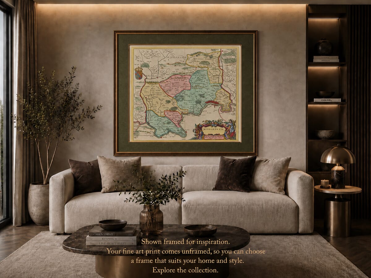
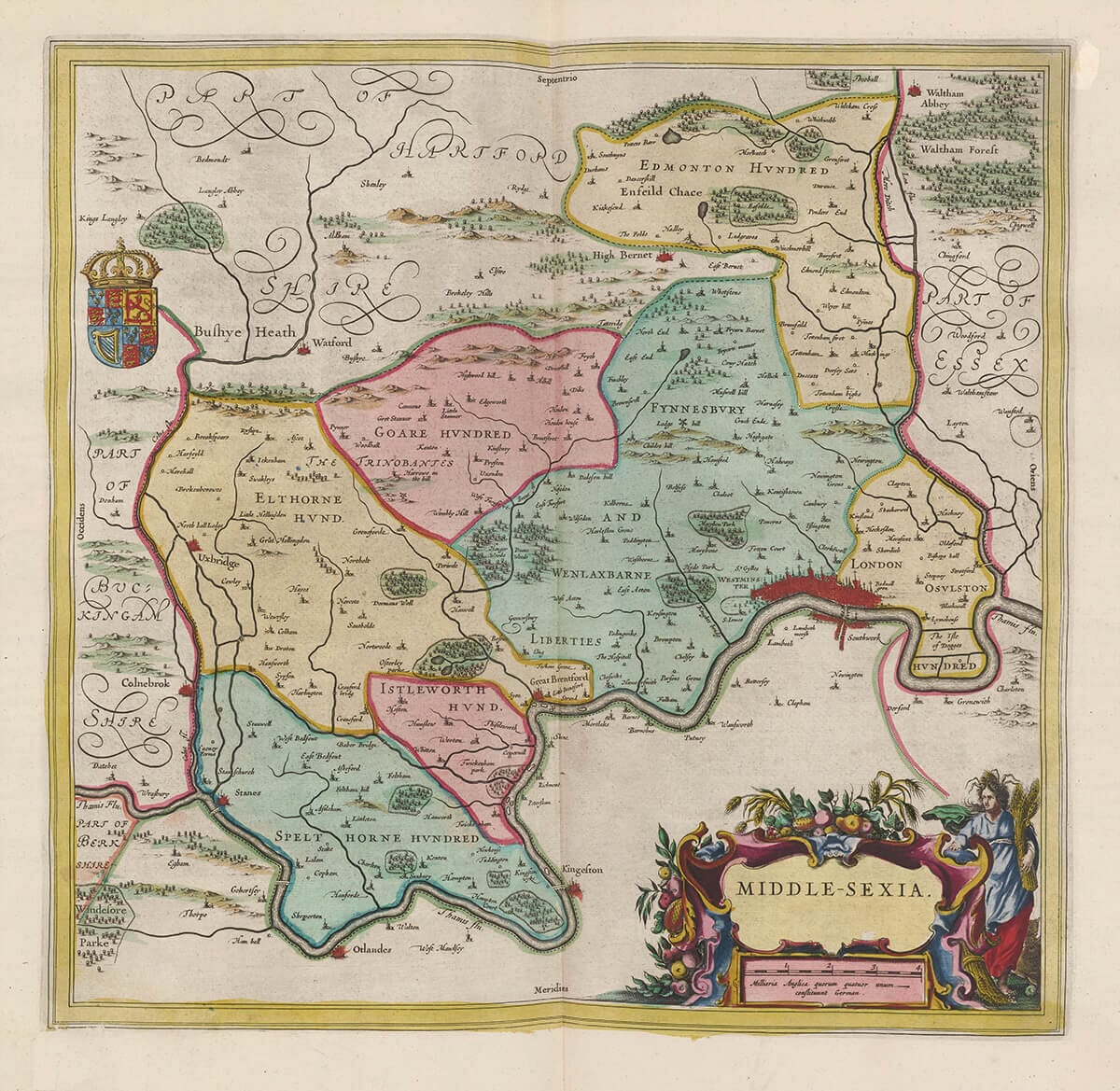
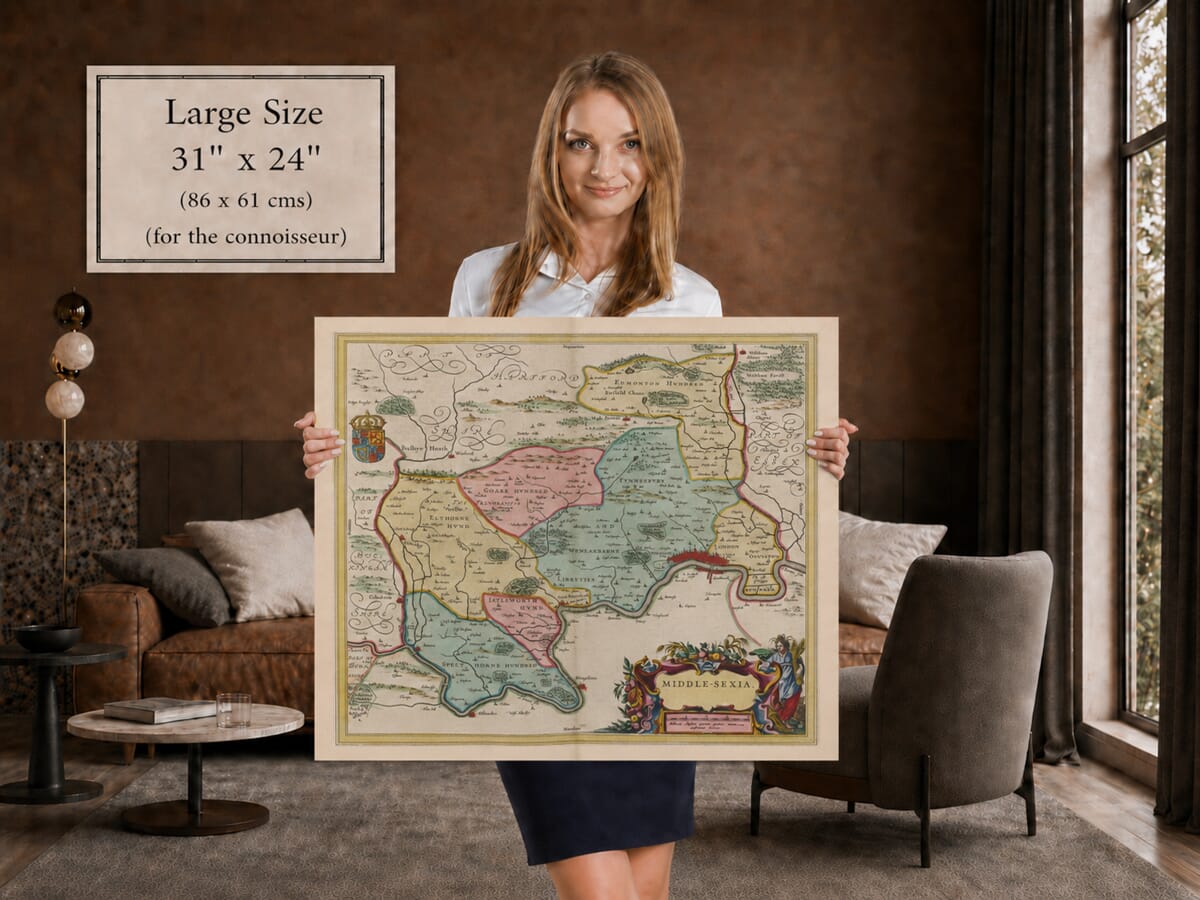
This richly detailed vintage map of Middlesex was created by Joan Blaeu and first published in Amsterdam in 1645. Entitled Middle-Sexia, it presents the historic county before the expansion of London transformed much of its countryside.

The engraving extends from London and Westminster westwards along the Thames towards Brentford, Isleworth, Twickenham and Hampton, and north towards Harrow, Uxbridge, Enfield and the Hertfordshire border. Rivers, villages, woodland and pictorial hills evoke a landscape that was still predominantly rural beyond the capital.

An elaborate figure cartouche and the Stuart royal arms complement the map’s finely engraved place names and geographical detail. Our reproduction preserves the colour, intricate linework and decorative character of the original copperplate map and is produced as a fine art print on subtly textured paper.
+ read more

A stunning certified FINE ART PRINT on heavy textured art paper — not a poster

  • Direct from the publisher — no middlemen
  • Printed in-house in Cornwall
  • Free UK delivery — international shipping available
  • Produced to meet — and often exceed — museum-quality standards

SELECT SIZE

Inspecting Vintage Map Reproduction

Fine Art Map Reproductions – Museum-Quality Printing

Unlike most online offerings, our maps are produced entirely in-house, not outsourced to print-on-demand or drop-shipping services. This allows complete control over quality while offering better value. Each map begins with a high-resolution original, carefully enhanced and printed to order using archival papers and pigment inks for exceptional clarity, depth, and longevity. Every piece is personally overseen — no map leaves our workshop unless it is of a quality we would be proud to display ourselves.

Hand hold a magnifying glass over West Cornwall Map

Authentic Old Map Paper & Accurate Colour Reproduction

Paper choice is essential to the authenticity of our maps. We use specially sourced 190gsm paper made in the UK from pure materials and traditionally pressed with natural woollen felts. This process creates a subtle, randomly textured surface that closely resembles an original antique document. Likewise the use of premium quality ink fully saturates the paper, producing remarkable clarity, depth, and historical character. Colour fastness and sharpness will remain good for in excess of 100 years!

Map in Postal Tube
Buy Old Maps Online in the UK Today Trading online since 1999

The Old Map Company of Great Britain offers a vast and carefully curated collection of the very finest expertly reproduced vintage maps. Our range includes works by renowned cartographers such as John Speed and Willem Blaeu, covering Scotland, England, and beyond. Free UK courier delivery is included, with EU, USA, and worldwide shipping available at cost and calculated at checkout. If you need assistance, our team is always happy to help you choose the perfect map.

RECENT REVIEWS

Daz
DazGB
Verified ownerVerified owner
5/5

Speedy delivery A beautiful representation

2 months ago
David H
David H
Verified ownerVerified owner
5/5

Got there in time and loves it! Cheers David [Gift from US to UK]

4 months ago
Ellan C-S
Ellan C-S
Verified ownerVerified owner
5/5

Thanks Lauren. We received it today - it's gorgeous! Thank you, Ellan

4 months ago
Ivano Di Battista
Ivano Di Battista
Verified ownerVerified owner
5/5

Thank you for your prompt service. I have a gallery and framing business in South Wales. I'm so pleased it is printed in the UK

4 months ago
Robert B
Robert B
Verified ownerVerified owner
5/5

My Isles of Scilly map arrived safely and I'm delighted with it!

4 months ago
Andrew T
Andrew T
Reviewer
5/5

The print arrived safely and we're delighted with it - a lovely reminder of our honeymoon 15 years ago.

5 months ago
Hannah J
Hannah J
Verified ownerVerified owner
5/5

I have just received them! I'm sure our clients will be pleased with them and there could be more projects off the back of this one where we can use more. [Interior Designers]

5 months ago
Sean MacManus
Sean MacManus
Verified ownerVerified owner
5/5

I just received my map of Ireland by Ewart today and, as usual, I am delighted by its quality. The crispness and fineness of detail is excellent and the colour reproduction surpasses my expectations. Please relay my thanks to Steve for another fine effort!

5 months ago
John G
John G
Verified ownerVerified owner
5/5

Many thanks, Lauren. Very pleased with the map and the service: would recommend The Old Map Company to anyone interested in Old Maps.

7 months ago
Lois K
Lois K
Verified ownerVerified owner
5/5

Thrilled , Lauren! Thank You

7 months ago
Ed Simpson
Ed Simpson
Verified ownerVerified owner
5/5

Many thanks, the map arrived safely this morning, and I’m really pleased with it. A stunning reproduction, just as I had hoped. I will keep browsing your website, and may yet be tempted by more of your items! Have a great weekend.

7 months ago
Daniel McCade
Daniel McCade
Verified ownerVerified owner
5/5

Just arrived, wonderful map! Thanks very much!

8 months ago
Jonathon R
Jonathon R
Verified ownerVerified owner
5/5

The map – beautiful – arrived safely, very many thanks.

1 year ago
Rasa Terbetiene
Rasa Terbetiene
Verified ownerVerified owner
5/5

Thank you, I have already found the map. It’s wonderfull! Good luck! Rasa

4 years ago
Mina M.
Mina M.
Verified ownerVerified owner
5/5

My apologies for the very late reply. I wanted to reach out to thank you so much for rushing my order. My partner absolutely loved it. I am amazed with the service so that is a five-star from me. I wish you all the best.

4 years ago

Joan Blaeu’s Middle-Sexia: Middlesex Before Greater London

Joan Blaeu’s map of Middlesex, entitled Middle-Sexia, was first published in Amsterdam in 1645. It formed part of the fourth volume of his Theatrum Orbis Terrarum, sive Atlas Novus, devoted to England and Wales. This ambitious volume brought the English counties into one of the most celebrated European atlases of the seventeenth century.

Although Joan inherited the Blaeu publishing house from his father, Willem Blaeu, the map belongs to Joan’s period of leadership and should be attributed to him. By 1640, Joan was directing the Amsterdam firm and expanding its atlas collection in competition with the rival mapmaking house of Johannes Janssonius. Blaeu’s volume of English and Welsh county maps appeared in 1645, a year before Janssonius published his competing collection.

A County Beside the Capital

Historic Middlesex occupied the territory immediately north and west of London. Its southern boundary followed the River Thames, while the rivers Lea and Colne helped define its eastern and western limits. To the north, the county extended towards the higher ground adjoining Hertfordshire.

The name Middlesex derives from the “Middle Saxons”, although the county had developed a distinct administrative identity long before Blaeu’s map was produced. It was one of England’s smallest historic counties, yet its position beside London gave it an importance far beyond its geographical size.

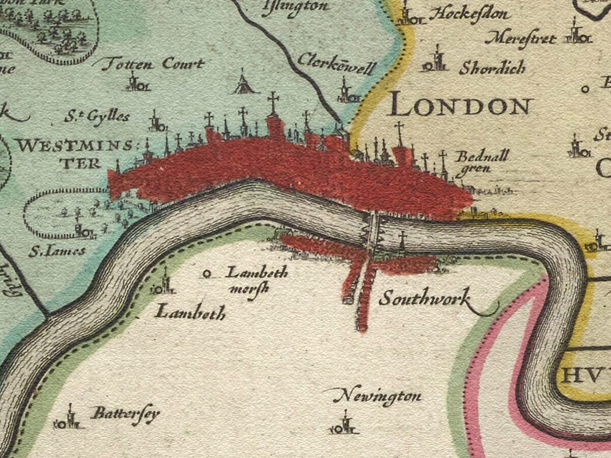
The City of London was legally separate from Middlesex, having its own government and privileges. Nevertheless, Blaeu included the densely built city on the right-hand side of the map because it provided essential geographical context. Westminster, by contrast, lay within Middlesex, alongside settlements that would eventually become familiar parts of modern London.

Reading the Seventeenth-Century Landscape

The map records a Middlesex that would be almost unrecognisable today. London and Westminster occupy only a small part of the county, while the surrounding landscape is filled with individual villages, market towns, fields, woodland and open country.

Along the Thames appear communities such as Chelsea, Fulham, Hammersmith, Brentford, Isleworth, Twickenham and Hampton. Further north and west, the map identifies places including Harrow, Uxbridge, Edmonton, Enfield, Tottenham and Hampstead. Many were then independent settlements separated from London by farmland and commons.

Middlesex was closely connected to the life of the capital. Its farms, gardens and estates supplied London with hay, grain, fruit, vegetables, livestock and building materials. Rivers and established routes connected these settlements with the city’s markets, while wealthy Londoners increasingly acquired houses and estates in the surrounding countryside.

Blaeu’s engraving was not intended to function like a modern road map. Settlements are indicated with conventional pictorial symbols, while small clusters of buildings distinguish more important towns. Rivers are given particular prominence, and shaded hill forms suggest the shape of the landscape. Historic spellings add to the character of the map and reflect the lack of standardised place names during the period.

Middlesex in 1645

The publication date places the map in the middle of the English Civil War. London and Westminster were central to Parliament’s political, financial and military strength, making the surrounding approaches through Middlesex strategically important. Roads across the county carried soldiers, supplies, correspondence and travellers between the capital and other parts of England.

Blaeu’s map does not depict the conflict directly. Instead, it presents an orderly and decorative image of the county, characteristic of a prestigious European atlas. For its original owners, the map combined geographical information with the craftsmanship and visual splendour expected from the Blaeu publishing house.

Decorative Design and Later Editions

The map’s decorative treatment is a significant part of its appeal. An elaborate figure cartouche in the lower-right area contains the Latin title and scale, while the British royal arms provide a prominent heraldic feature. These ornaments balance the densely engraved representation of London and the numerous place names spread across the county.

Printed from a copperplate, Middle-Sexia appeared in successive editions of Blaeu’s atlases, accompanied by text in different European languages. The map was later incorporated into the monumental Atlas Maior, first issued during the 1660s. Surviving examples therefore vary in their accompanying text and colouring, although the underlying engraved design remained substantially the same.

Today the map offers a compelling portrait of Middlesex before the enormous growth of London absorbed most of the historic county. Familiar districts can still be located, but they appear as small and separate communities within a predominantly rural landscape—making the map especially fascinating for anyone interested in London, Middlesex or local family history.


You may also like…

×
Product added to cart
No products in the cart.