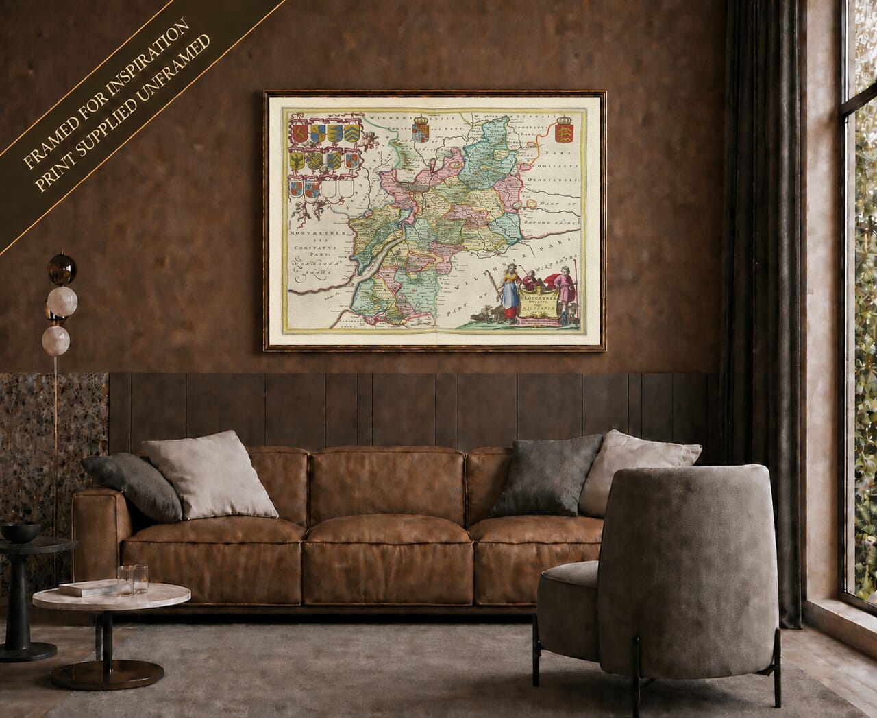
Early Map of Gloucestershire
Early Map of Gloucestershire Detail from an old map of Gloucestershire 1645 Detail from an old map of Gloucestershire 1645

Vintage Map of Gloucestershire by Joan Blaeu, 1645

Price range: £35.55 through £59.95

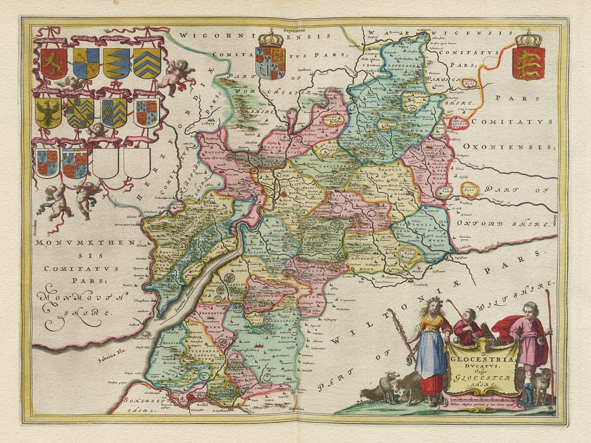
Joan Blaeu’s decorative 1645 vintage map of Gloucestershire was published under the title Glocestria Ducatus; Vulgo Glocester Shire. It presents the historic county divided into its traditional hundreds, with towns, villages, rivers, forests and neighbouring counties carefully named.

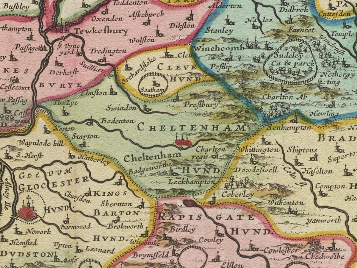
The River Severn forms the map’s central geographical feature, passing Gloucester on its course towards the Severn Estuary. Other recognisable places include Cirencester, Tewkesbury, Cheltenham, Stroud, Dursley and Chipping Campden, with Bristol appearing at the southern edge.

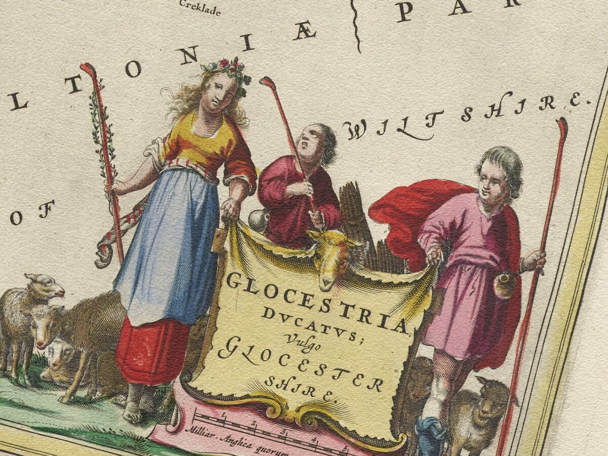
The engraving is enriched by royal heraldry, a decorative arrangement of ten family coats of arms and two blank shields, and an elaborate title cartouche accompanied by pastoral figures and livestock.

Carefully reproduced as a fine art print, this historic old map brings together the distinctive geography of the Cotswolds, the Severn Vale and the Forest of Dean in Joan Blaeu’s celebrated seventeenth-century style.
+ read more

A stunning certified FINE ART PRINT on heavy textured art paper — not a poster

  • Direct from the publisher — no middlemen
  • Printed in-house in Cornwall
  • Free UK delivery — international shipping available
  • Produced to meet — and often exceed — museum-quality standards

SELECT SIZE

Inspecting Vintage Map Reproduction

Fine Art Map Reproductions – Museum-Quality Printing

Unlike most online offerings, our maps are produced entirely in-house, not outsourced to print-on-demand or drop-shipping services. This allows complete control over quality while offering better value. Each map begins with a high-resolution original, carefully enhanced and printed to order using archival papers and pigment inks for exceptional clarity, depth, and longevity. Every piece is personally overseen — no map leaves our workshop unless it is of a quality we would be proud to display ourselves.

Hand hold a magnifying glass over West Cornwall Map

Authentic Old Map Paper & Accurate Colour Reproduction

Paper choice is essential to the authenticity of our maps. We use specially sourced 190gsm paper made in the UK from pure materials and traditionally pressed with natural woollen felts. This process creates a subtle, randomly textured surface that closely resembles an original antique document. Likewise the use of premium quality ink fully saturates the paper, producing remarkable clarity, depth, and historical character. Colour fastness and sharpness will remain good for in excess of 100 years!

Map in Postal Tube
Buy Old Maps Online in the UK Today Trading online since 1999

The Old Map Company of Great Britain offers a vast and carefully curated collection of the very finest expertly reproduced vintage maps. Our range includes works by renowned cartographers such as John Speed and Willem Blaeu, covering Scotland, England, and beyond. Free UK courier delivery is included, with EU, USA, and worldwide shipping available at cost and calculated at checkout. If you need assistance, our team is always happy to help you choose the perfect map.

RECENT REVIEWS

Daz
DazGB
Verified ownerVerified owner
5/5

Speedy delivery A beautiful representation

1 month ago
David H
David H
Verified ownerVerified owner
5/5

Got there in time and loves it! Cheers David [Gift from US to UK]

3 months ago
Ellan C-S
Ellan C-S
Verified ownerVerified owner
5/5

Thanks Lauren. We received it today - it's gorgeous! Thank you, Ellan

3 months ago
Ivano Di Battista
Ivano Di Battista
Verified ownerVerified owner
5/5

Thank you for your prompt service. I have a gallery and framing business in South Wales. I'm so pleased it is printed in the UK

4 months ago
Robert B
Robert B
Verified ownerVerified owner
5/5

My Isles of Scilly map arrived safely and I'm delighted with it!

4 months ago
Andrew T
Andrew T
Reviewer
5/5

The print arrived safely and we're delighted with it - a lovely reminder of our honeymoon 15 years ago.

4 months ago
Hannah J
Hannah J
Verified ownerVerified owner
5/5

I have just received them! I'm sure our clients will be pleased with them and there could be more projects off the back of this one where we can use more. [Interior Designers]

4 months ago
Sean MacManus
Sean MacManus
Verified ownerVerified owner
5/5

I just received my map of Ireland by Ewart today and, as usual, I am delighted by its quality. The crispness and fineness of detail is excellent and the colour reproduction surpasses my expectations. Please relay my thanks to Steve for another fine effort!

5 months ago
John G
John G
Verified ownerVerified owner
5/5

Many thanks, Lauren. Very pleased with the map and the service: would recommend The Old Map Company to anyone interested in Old Maps.

6 months ago
Lois K
Lois K
Verified ownerVerified owner
5/5

Thrilled , Lauren! Thank You

7 months ago
Ed Simpson
Ed Simpson
Verified ownerVerified owner
5/5

Many thanks, the map arrived safely this morning, and I’m really pleased with it. A stunning reproduction, just as I had hoped. I will keep browsing your website, and may yet be tempted by more of your items! Have a great weekend.

7 months ago
Daniel McCade
Daniel McCade
Verified ownerVerified owner
5/5

Just arrived, wonderful map! Thanks very much!

8 months ago
Jonathon R
Jonathon R
Verified ownerVerified owner
5/5

The map – beautiful – arrived safely, very many thanks.

1 year ago
Rasa Terbetiene
Rasa Terbetiene
Verified ownerVerified owner
5/5

Thank you, I have already found the map. It’s wonderfull! Good luck! Rasa

3 years ago
Mina M.
Mina M.
Verified ownerVerified owner
5/5

My apologies for the very late reply. I wanted to reach out to thank you so much for rushing my order. My partner absolutely loved it. I am amazed with the service so that is a five-star from me. I wish you all the best.

4 years ago

Gloucestershire in Joan Blaeu’s Atlas

Joan Blaeu first published this map of Gloucestershire in Amsterdam during the mid-1640s as part of the English county volume of his Atlas Novus. Its engraved title reads Glocestria Ducatus; Vulgo Glocester Shire.

The map was produced as a copperplate engraving and subsequently appeared in several language editions of Blaeu’s atlas. Surviving examples are generally around 41 by 50 centimetres within the engraved area, although sheet dimensions and the text printed on the reverse vary between editions.

The live product page presently attributes the engraving to William Blaeu. This is incorrect: William died in 1638, several years before the map’s first publication. Joan Blaeu, who continued the family’s Amsterdam publishing business, was responsible for this edition.

The River Severn and Gloucestershire’s Contrasting Landscapes

The River Severn dominates the western half of the map, flowing past Gloucester before widening towards the estuary. Its tributaries help connect settlements across the county and provide a recognisable framework for exploring the engraving.

To the east are the higher Cotswold areas, represented using the pictorial hill symbols typical of seventeenth-century maps. Gloucester, Cirencester, Tewkesbury, Cheltenham, Chipping Campden and numerous smaller settlements are identified through engraved names and conventional town or church symbols.

The Forest of Dean occupies the land west of the Severn. It had been established as a royal hunting forest by the medieval period and possessed a long history of woodland management and ironworking. Blaeu’s map identifies its settlements, waterways and wooded landscape, but it should not be treated as a detailed survey of mines, furnaces or individual forest boundaries.

Hundreds and Historic Boundaries

Gloucestershire is divided into its traditional hundreds, with their names placed within the relevant areas. These longstanding administrative districts were used for purposes including local justice, taxation and organisation.

Among the names visible are Berkeley, Bisley, Bradley, Brightwells Barrow, Deerhurst, Kiftsgate, Longtree, Rapsgate, St Briavels, Slaughter and Tewkesbury. Colours and boundary lines make the divisions relatively easy to distinguish.

The map provides valuable evidence of how the county was organised and understood, but its boundaries should not be interpreted with the precision expected of a modern cadastral or Ordnance Survey map.

The Cotswolds and the Wool Trade

By the seventeenth century, generations of wool production and clothmaking had shaped the towns and countryside of the Cotswolds. Wealth created by the medieval wool trade contributed to the churches, manor houses and market towns for which the region remains known.

During the seventeenth and eighteenth centuries, cloth production also became important in valleys around Stroud, Dursley, Chalford and Painswick.

This history offers useful context for settlements appearing on Blaeu’s map. However, the engraving itself does not plot individual sheep farms, cloth mills, markets or trading routes. Its pastoral decoration should not be treated as a statistical or economic record.

Heraldry and Pastoral Decoration

At the upper left is a decorative arrangement of twelve shields: ten display family coats of arms and two have deliberately been left blank. Small cherub-like figures support the heraldic display.

The Royal Arms occupy the upper centre, with another crowned heraldic shield at the upper right. At the lower right, Blaeu placed the map’s title within an ornamental cartouche accompanied by pastoral figures and livestock.

These figures complement Gloucestershire’s rural character and the map’s decorative composition. It is reasonable to describe the scene as pastoral, but the individual figures should not be assigned invented identities or claimed to represent particular trades.

Gloucestershire During the Civil War

The map appeared during the First English Civil War, only around two years after the important siege of Gloucester in 1643. Gloucester remained in Parliamentarian hands after resisting the Royalist army of Charles I, frustrating the King’s attempt to secure the Severn Valley.

That event forms relevant historical context for a map published in the mid-1640s, but Blaeu’s engraving does not depict the siege, armies or contemporary fortifications. Its geography was derived from established English county mapping rather than gathered as a new military survey.

Like many Blaeu county maps, its cartographic content ultimately drew upon the earlier work of Christopher Saxton and John Speed. Blaeu’s contribution was to recast that inherited geographical information through exceptionally refined engraving, lettering, colouring, heraldry and ornamental design.

Today, the map provides an attractive record of historic Gloucestershire, linking the county town and Severn Vale with the Cotswolds, Forest of Dean and the communities distributed among its traditional hundreds.


You may also like…

×
Product added to cart
No products in the cart.