£35.55 – £59.95Price range: £35.55 through £59.95
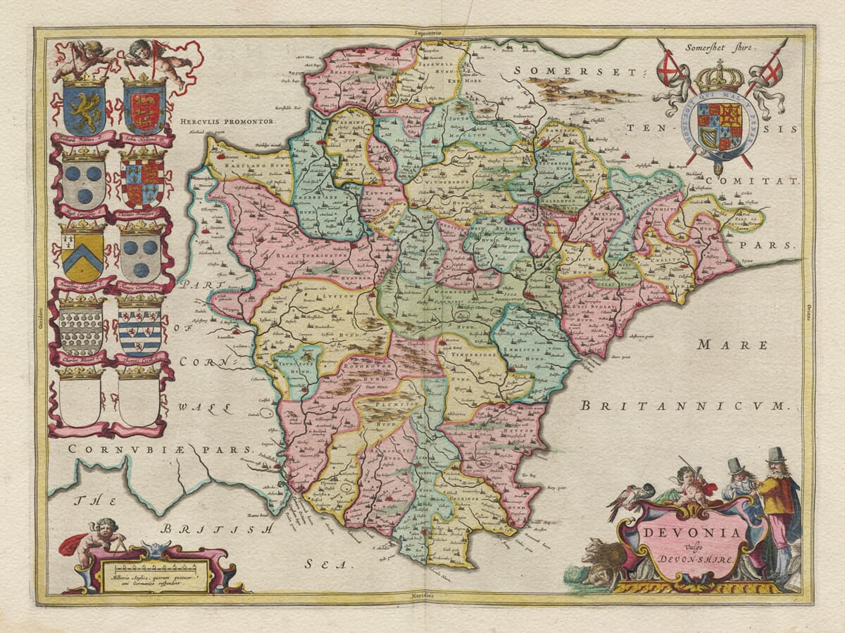
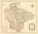
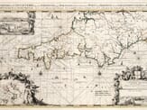
Joan Blaeu’s vintage map of Devon, first published in Amsterdam in 1645, portrays the county beneath its Latin title, Devonia vulgo Devon-Shire. Exeter, Plymouth, Barnstaple, Tiverton, Totnes and numerous smaller settlements appear within Devon’s distinctive two-coast geography.
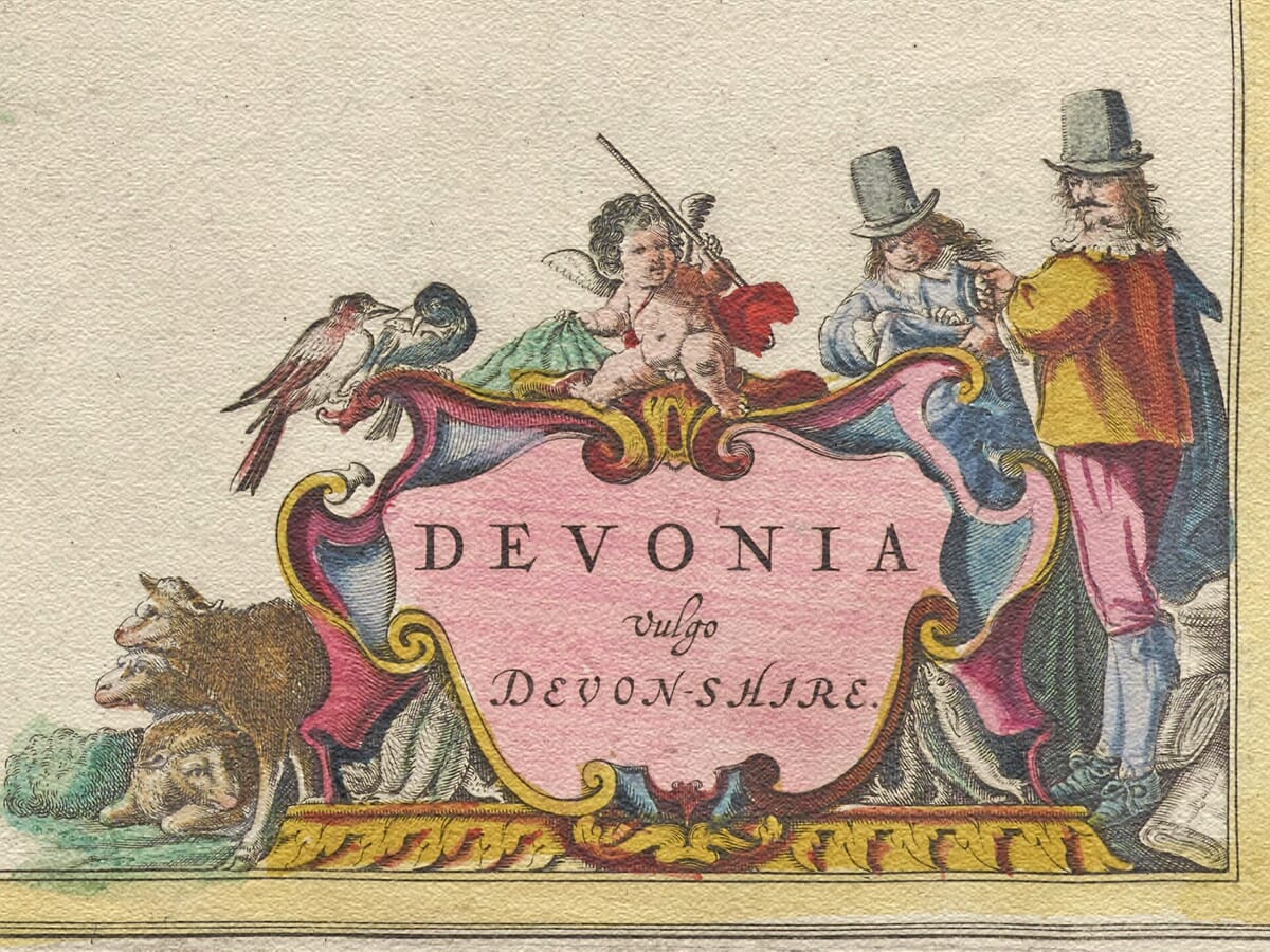
The engraving is enriched by ten family shields, including two left blank, together with the royal arms and two finely worked cartouches. Its pastoral title decoration incorporates rustic figures, sheep, birds and fish, while a putto holding dividers accompanies the scale.
Carefully reproduced as a fine art print, this richly decorative map makes an attractive gift for anyone with family, historical or personal connections to Devon.A stunning certified FINE ART PRINT on heavy textured art paper — not a poster
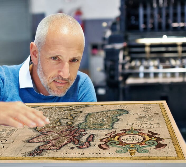
Unlike most online offerings, our maps are produced entirely in-house, not outsourced to print-on-demand or drop-shipping services. This allows complete control over quality while offering better value. Each map begins with a high-resolution original, carefully enhanced and printed to order using archival papers and pigment inks for exceptional clarity, depth, and longevity. Every piece is personally overseen — no map leaves our workshop unless it is of a quality we would be proud to display ourselves.
Paper choice is essential to the authenticity of our maps. We use specially sourced 190gsm paper made in the UK from pure materials and traditionally pressed with natural woollen felts. This process creates a subtle, randomly textured surface that closely resembles an original antique document. Likewise the use of premium quality ink fully saturates the paper, producing remarkable clarity, depth, and historical character. Colour fastness and sharpness will remain good for in excess of 100 years!
The Old Map Company of Great Britain offers a vast and carefully curated collection of the very finest expertly reproduced vintage maps. Our range includes works by renowned cartographers such as John Speed and Willem Blaeu, covering Scotland, England, and beyond. Free UK courier delivery is included, with EU, USA, and worldwide shipping available at cost and calculated at checkout. If you need assistance, our team is always happy to help you choose the perfect map.
Speedy delivery A beautiful representation
Got there in time and loves it! Cheers David [Gift from US to UK]
Thanks Lauren. We received it today - it's gorgeous! Thank you, Ellan
Thank you for your prompt service. I have a gallery and framing business in South Wales. I'm so pleased it is printed in the UK
My Isles of Scilly map arrived safely and I'm delighted with it!
The print arrived safely and we're delighted with it - a lovely reminder of our honeymoon 15 years ago.
I have just received them! I'm sure our clients will be pleased with them and there could be more projects off the back of this one where we can use more. [Interior Designers]
I just received my map of Ireland by Ewart today and, as usual, I am delighted by its quality. The crispness and fineness of detail is excellent and the colour reproduction surpasses my expectations. Please relay my thanks to Steve for another fine effort!
Many thanks, Lauren. Very pleased with the map and the service: would recommend The Old Map Company to anyone interested in Old Maps.
Many thanks, the map arrived safely this morning, and I’m really pleased with it. A stunning reproduction, just as I had hoped. I will keep browsing your website, and may yet be tempted by more of your items! Have a great weekend.
Just arrived, wonderful map! Thanks very much!
The map – beautiful – arrived safely, very many thanks.
Thank you, I have already found the map. It’s wonderfull! Good luck! Rasa
My apologies for the very late reply. I wanted to reach out to thank you so much for rushing my order. My partner absolutely loved it. I am amazed with the service so that is a five-star from me. I wish you all the best.
Joan Blaeu published this map in Amsterdam in 1645 under the title Devonia vulgo Devon-Shire. The Latin word vulgo indicates the name used commonly or in everyday language, giving the sense “Devonia, commonly called Devonshire.”
The first edition appeared in Le Théâtre du Monde ou Nouvel Atlas, Quatriesme Partie, the French-language fourth volume of Blaeu’s expanding atlas. Later impressions were printed for Dutch, Latin, German and Spanish editions, and the plate was subsequently included in Blaeu’s much larger Atlas Maior.
Blaeu did not conduct a new survey of Devon. Like the other English county maps in this atlas, its geography was based substantially upon earlier English cartography, particularly the work associated with Christopher Saxton and John Speed. Blaeu transformed this inherited information through new engraving, decorative lettering, heraldry and elaborate cartouches.
Devon’s two coastlines give the county a particularly recognisable outline. The map extends from the Bristol Channel in the north to the English Channel—labelled Mare Britannicum and “The British Sea”—in the south. Cornwall lies to the west, while Somerset and Dorset appear beyond Devon’s eastern boundary.
Exeter is prominently named, together with Plymouth, Barnstaple, Tiverton, Totnes, Tavistock, Honiton, Okehampton and many smaller communities. Rivers including the Exe, Dart, Tamar, Taw and Torridge help organise the landscape. These waterways and settlements are depicted geographically, but the engraving should not be interpreted as a detailed survey of ports, anchorages or commercial shipping routes.
The county’s higher ground is represented by conventional groups of pictorial hills. These suggest the upland character of the areas now known as Dartmoor and Exmoor but do not identify individual peaks or provide measured elevations. Blaeu’s engraving predates contour lines, modern triangulation and Ordnance Survey mapping.
Tin working had played an important role in Devon long before the map was published. Tavistock, Plympton, Ashburton and Chagford were established stannary towns around Dartmoor, where tin was weighed, assessed and taxed. Mining was regulated through distinctive stannary institutions. Although these towns can be found on the map, Blaeu does not identify individual mines, tin streams or underground workings.
The publication date also places the map during the English Civil War. Plymouth remained an important Parliamentarian stronghold despite repeated Royalist sieges and blockades. At Dartmouth, Gallants Bower was built between 1643 and 1645 as part of the town’s Royalist defences before Parliamentarian forces captured Dartmouth in 1646. These events provide historical context, but Blaeu’s map does not record military positions or troop movements.
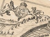
Much of the engraving’s visual character comes from its decoration. Ten family shields are arranged along the left side, with two intentionally left blank. The royal arms appear in the upper-right corner. At lower left, a putto holds dividers beside the scale cartouche.
The title cartouche at lower right is surrounded by pastoral imagery. Sheep, rustic figures and birds accompany the ornamental framework, while fish support its lower sides. These details evoke rural and coastal associations, but they should be understood as decorative symbolism rather than a literal survey of Devon’s industries.
Devonia vulgo Devon-Shire therefore combines inherited seventeenth-century geography with the sophisticated presentation of Joan Blaeu’s Amsterdam workshop. It remains a rewarding historical map for exploring familiar Devon place names while appreciating the heraldry, colouring and decorative engraving of the Dutch Golden Age.