Borealis Map
Borealis Map Borealis-Map-Detail-1 Borealis Map Detail-2

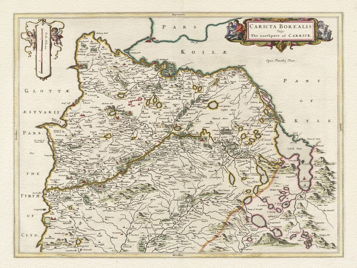
Old Map of North Carrick by Joan Blaeu, 1654

Price range: £35.55 through £59.95

Follow the historic country of North Carrick from the shores of the Firth of Clyde to the secluded waters and uplands surrounding Loch Doon. Created from the pioneering surveys of Timothy Pont and published by Joan Blaeu in 1654, this old map captures a corner of Ayrshire shaped by sea, river valleys, wooded estates and rugged hills.

Maybole stands among a scattered pattern of villages, castles and country houses, while the neighbouring district of Kyle appears beyond Carrick’s historic boundary. Pictorial hills rise across the interior and rivers wind towards the Ayrshire coast, preserving the character of the district more than three and a half centuries ago.

Richly engraved cartouches and delicately drawn landscape details make this historic county map as decorative as it is fascinating. Reproduced as a fine art print on subtly textured paper, it offers a meaningful connection with Carrick and Ayrshire for the home, or as a distinctive gift for someone with roots in the area.
+ read more

A stunning certified FINE ART PRINT on heavy textured art paper — not a poster

  • Direct from the publisher — no middlemen
  • Printed in-house in Cornwall
  • Free UK delivery — international shipping available
  • Produced to meet — and often exceed — museum-quality standards

SELECT SIZE

Inspecting Vintage Map Reproduction

Fine Art Map Reproductions – Museum-Quality Printing

Unlike most online offerings, our maps are produced entirely in-house, not outsourced to print-on-demand or drop-shipping services. This allows complete control over quality while offering better value. Each map begins with a high-resolution original, carefully enhanced and printed to order using archival papers and pigment inks for exceptional clarity, depth, and longevity. Every piece is personally overseen — no map leaves our workshop unless it is of a quality we would be proud to display ourselves.

Hand hold a magnifying glass over West Cornwall Map

Authentic Old Map Paper & Accurate Colour Reproduction

Paper choice is essential to the authenticity of our maps. We use specially sourced 190gsm paper made in the UK from pure materials and traditionally pressed with natural woollen felts. This process creates a subtle, randomly textured surface that closely resembles an original antique document. Likewise the use of premium quality ink fully saturates the paper, producing remarkable clarity, depth, and historical character. Colour fastness and sharpness will remain good for in excess of 100 years!

Map in Postal Tube
Buy Old Maps Online in the UK Today Trading online since 1999

The Old Map Company of Great Britain offers a vast and carefully curated collection of the very finest expertly reproduced vintage maps. Our range includes works by renowned cartographers such as John Speed and Willem Blaeu, covering Scotland, England, and beyond. Free UK courier delivery is included, with EU, USA, and worldwide shipping available at cost and calculated at checkout. If you need assistance, our team is always happy to help you choose the perfect map.

RECENT REVIEWS

Daz
DazGB
Verified ownerVerified owner
5/5

Speedy delivery A beautiful representation

2 months ago
David H
David H
Verified ownerVerified owner
5/5

Got there in time and loves it! Cheers David [Gift from US to UK]

4 months ago
Ellan C-S
Ellan C-S
Verified ownerVerified owner
5/5

Thanks Lauren. We received it today - it's gorgeous! Thank you, Ellan

4 months ago
Ivano Di Battista
Ivano Di Battista
Verified ownerVerified owner
5/5

Thank you for your prompt service. I have a gallery and framing business in South Wales. I'm so pleased it is printed in the UK

4 months ago
Robert B
Robert B
Verified ownerVerified owner
5/5

My Isles of Scilly map arrived safely and I'm delighted with it!

5 months ago
Andrew T
Andrew T
Reviewer
5/5

The print arrived safely and we're delighted with it - a lovely reminder of our honeymoon 15 years ago.

5 months ago
Hannah J
Hannah J
Verified ownerVerified owner
5/5

I have just received them! I'm sure our clients will be pleased with them and there could be more projects off the back of this one where we can use more. [Interior Designers]

5 months ago
Sean MacManus
Sean MacManus
Verified ownerVerified owner
5/5

I just received my map of Ireland by Ewart today and, as usual, I am delighted by its quality. The crispness and fineness of detail is excellent and the colour reproduction surpasses my expectations. Please relay my thanks to Steve for another fine effort!

5 months ago
John G
John G
Verified ownerVerified owner
5/5

Many thanks, Lauren. Very pleased with the map and the service: would recommend The Old Map Company to anyone interested in Old Maps.

7 months ago
Lois K
Lois K
Verified ownerVerified owner
5/5

Thrilled , Lauren! Thank You

7 months ago
Ed Simpson
Ed Simpson
Verified ownerVerified owner
5/5

Many thanks, the map arrived safely this morning, and I’m really pleased with it. A stunning reproduction, just as I had hoped. I will keep browsing your website, and may yet be tempted by more of your items! Have a great weekend.

7 months ago
Daniel McCade
Daniel McCade
Verified ownerVerified owner
5/5

Just arrived, wonderful map! Thanks very much!

8 months ago
Jonathon R
Jonathon R
Verified ownerVerified owner
5/5

The map – beautiful – arrived safely, very many thanks.

1 year ago
Rasa Terbetiene
Rasa Terbetiene
Verified ownerVerified owner
5/5

Thank you, I have already found the map. It’s wonderfull! Good luck! Rasa

4 years ago
Mina M.
Mina M.
Verified ownerVerified owner
5/5

My apologies for the very late reply. I wanted to reach out to thank you so much for rushing my order. My partner absolutely loved it. I am amazed with the service so that is a five-star from me. I wish you all the best.

4 years ago

Joan Blaeu’s Old Map of North Carrick

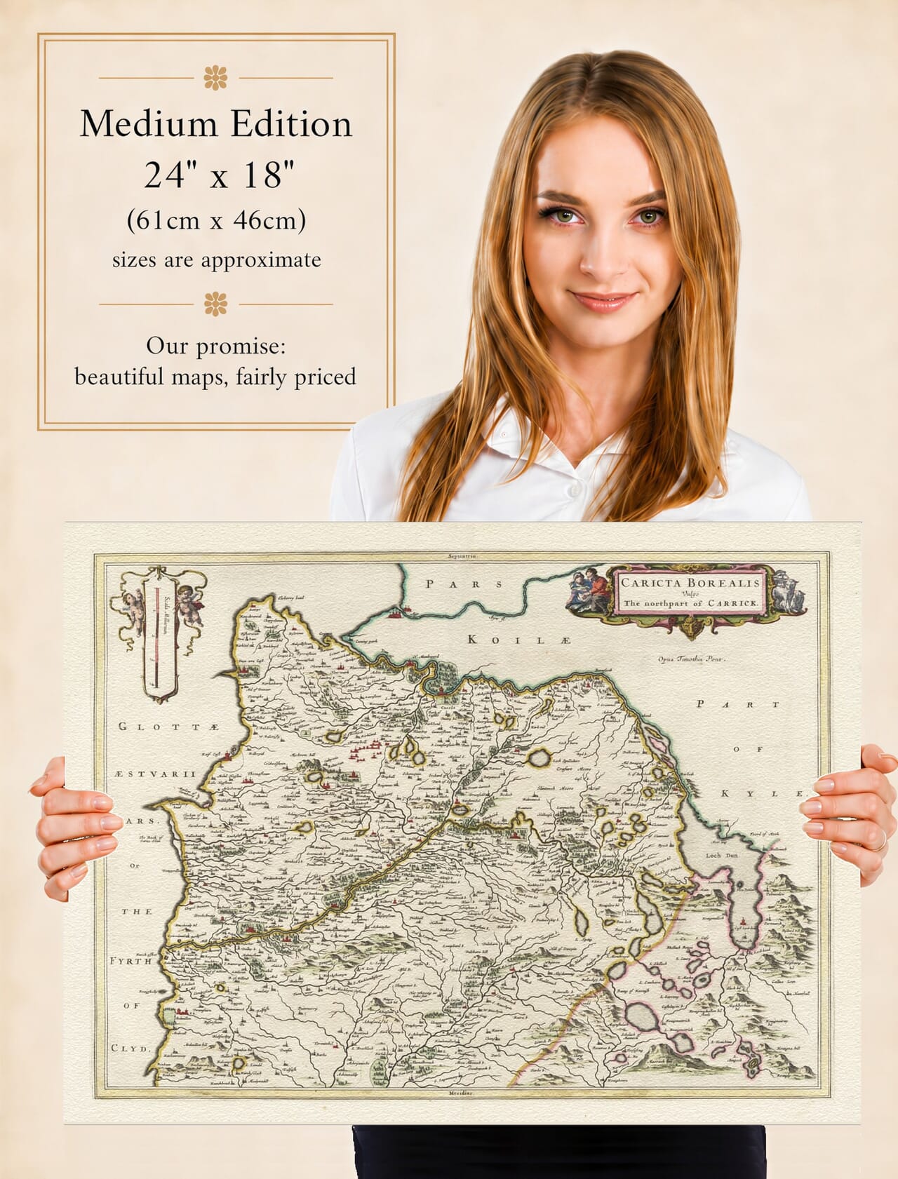
Joan Blaeu’s map of northern Carrick was first published in Amsterdam in 1654 as part of the Atlas of Scotland. Its engraved title, Caricta Borealis Vulgo The northpart of Carrick, combines Latin and English to identify the northern portion of this historic district of Ayrshire.

The map carries the inscription Opus Timothei Pont, acknowledging the Scottish surveyor Timothy Pont, whose remarkable manuscript maps provided the geographical foundation for much of Blaeu’s Scottish atlas. Through Pont’s observations and Blaeu’s accomplished engraving, the landscape between the Firth of Clyde and Loch Doon was presented to an international seventeenth-century audience.

Map details

  • Original title: Caricta Borealis Vulgo The northpart of Carrick
  • Original cartographer: Timothy Pont
  • Publisher: Joan Blaeu
  • First published: Amsterdam, 1654
  • Area shown: Northern Carrick and adjoining parts of Ayrshire, from the Firth of Clyde eastwards to Loch Doon
  • Principal places: Maybole and surrounding settlements, castles and estates
  • Source atlas: Joan Blaeu’s Atlas of Scotland
  • Product type: Fine art reproduction print of the historic map

Timothy Pont and the Mapping of Scotland

Timothy Pont travelled extensively through Scotland during the late sixteenth and early seventeenth centuries, recording settlements, rivers, coastlines, hills, estates and notable buildings. His manuscript surveys were exceptionally ambitious for their time and became an invaluable record of Scotland before systematic national mapping.

Pont died before his work could be published as a completed atlas. His manuscripts eventually came into the possession of Sir John Scot of Scotstarvit, who helped arrange for them to be taken to Amsterdam. There they were prepared for publication by Joan Blaeu, working with information and explanatory material supplied by the Scottish geographer Robert Gordon of Straloch.

The resulting atlas was published in 1654 as the fifth volume of Blaeu’s Theatrum Orbis Terrarum, sive Atlas Novus. It was the first atlas devoted entirely to Scotland and brought together maps of the nation, its regions and many of its historic districts.

The Historic District of Carrick

Carrick formed the southernmost of Ayrshire’s three traditional divisions, lying below Kyle and west of the uplands adjoining Galloway. Blaeu divided the district between two plates: this map of northern Carrick and a companion map covering its southern portion.

The northern map embraces the country south of Ayr and extends eastwards towards Loch Doon. Its western edge follows the Firth of Clyde, where bays, headlands and river mouths give the coastline its distinctive form. Inland, the ground rises through valleys and wooded estates towards the more remote hill country in the east.

Maybole occupies an important place within the map. Long associated with the administration and landed families of Carrick, it developed as a market town serving the surrounding rural district. Numerous castles, towers and substantial houses are also marked, reflecting a landscape organised around estates, kinship and local centres of power.

Carrick possessed particularly strong associations with the Scottish Crown through the medieval earldom and the family of Robert the Bruce. By Pont and Blaeu’s time, these historical connections were already woven deeply into the district’s identity, although the map itself concentrates upon geography rather than recounting its political past.

From the Ayrshire Coast to Loch Doon

The map’s west coast opens towards the Firth of Clyde and the distant approaches to Arran. Fishing, coastal movement and communication by water were important to communities along this shore, although Blaeu’s engraving presents the sea with the elegant restraint characteristic of his Scottish maps.

Further inland, rivers and burns provide the framework around which settlements and estates are arranged. Loch Doon forms a striking feature near the eastern side of the map, set among rising ground that contrasts with the gentler cultivated country nearer Maybole and the coast.

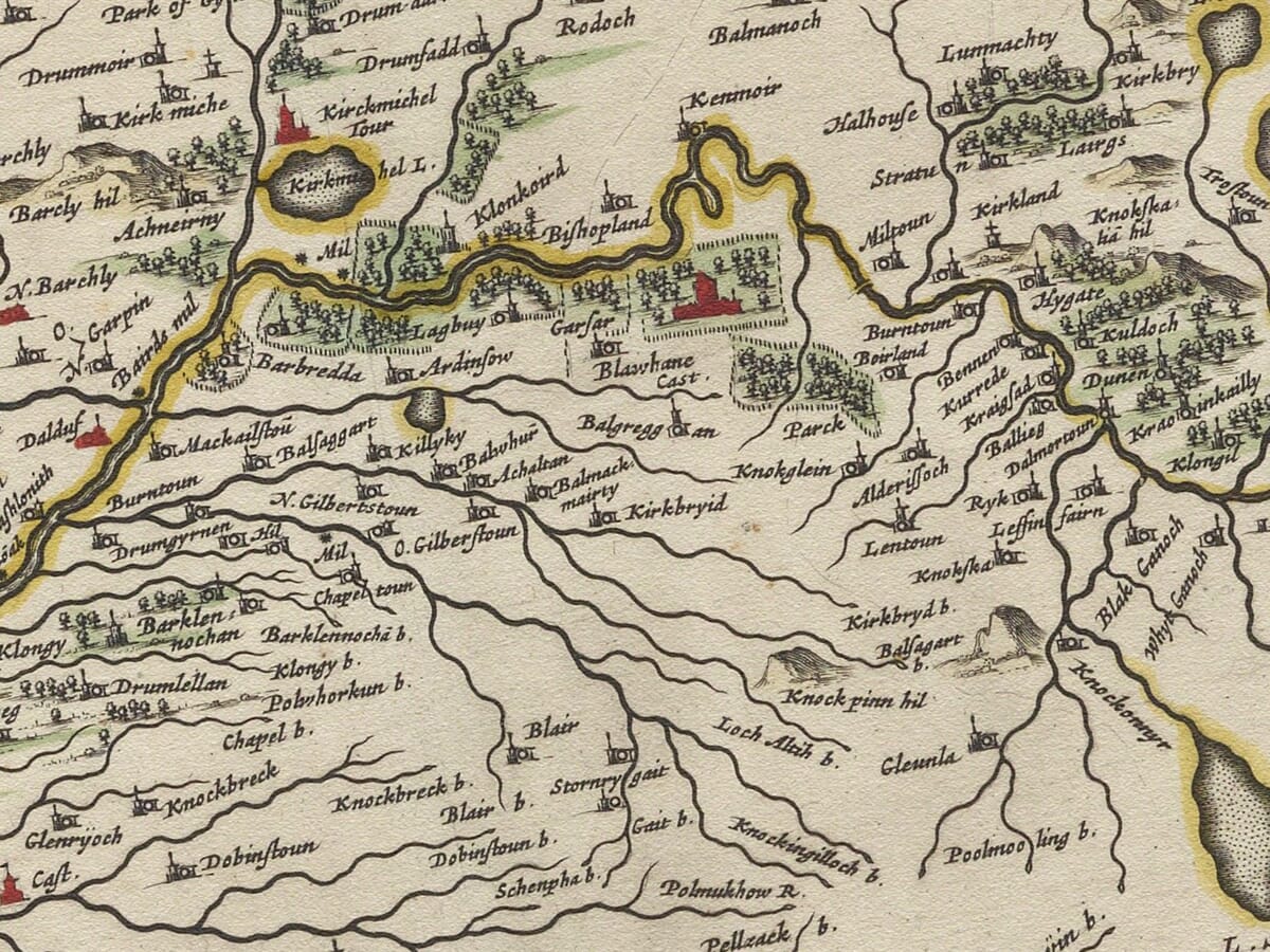
Blaeu’s map should not be interpreted as a modern measured survey. Roads are not shown systematically, distances are approximate and relief is represented by ranks of individually drawn hills. Woodland appears as groups of trees, while castles, churches and villages are distinguished through conventional pictorial symbols.

These features do not lessen the map’s historical value. They reveal how Pont observed the countryside and which places were considered significant enough to record. Older spellings also allow familiar Ayrshire names to be encountered in forms used more than three centuries ago.

Decorative Cartography

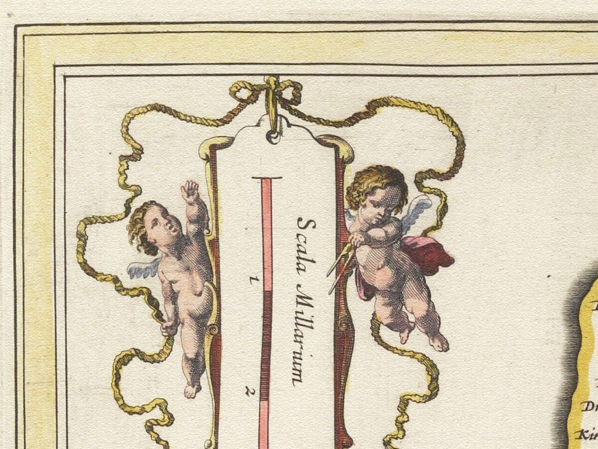
The title appears in an elaborate cartouche in the upper-right corner, accompanied by figures that give the composition a sense of ceremony and movement. A separate scale cartouche in the upper-left is attended by two putti.

Such decoration was a hallmark of the Blaeu workshop. It transformed Pont’s detailed geographical record into a map suited to one of Europe’s most prestigious atlases, balancing close observation of the Scottish landscape with the artistry of Dutch Golden Age engraving.

For the country immediately to the south, see the companion old map of Carrick. Together, the two prints present a fascinating portrait of historic Carrick from its northern boundary to the coast and glens of southern Ayrshire.

You may also like…

  • Detail from early norway mapOld Map of Stavanger - NorwayAdd to Basket This product has multiple variants. The options may be chosen on the product page

    Stavanger Norway

    Price range: £35.55 through £59.95
  • Detail from an old town plan of NorwayOld Map of NorwayAdd to Basket This product has multiple variants. The options may be chosen on the product page

    Old Map of Norway by Joan Blaeu, 1662

    Price range: £35.55 through £59.95
  • Detail from an old map of IcelandOld Map of icelandAdd to Basket This product has multiple variants. The options may be chosen on the product page

    Iceland

    Price range: £35.55 through £59.95
×
Product added to cart
No products in the cart.