James Henshall’s 1839 Plan of Birmingham
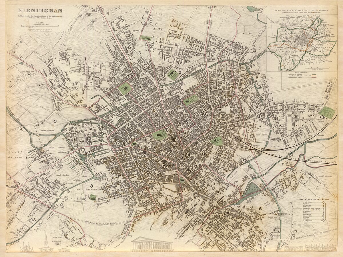
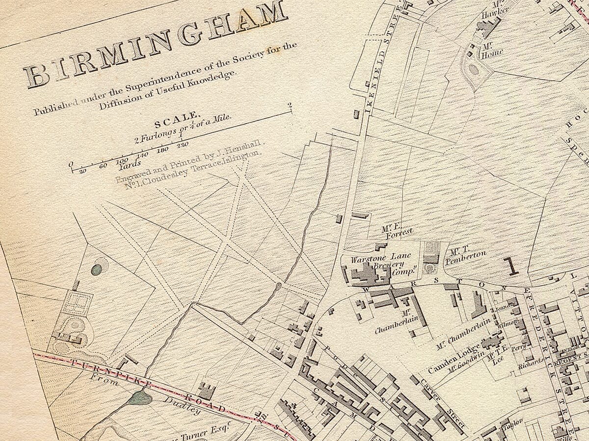
This remarkably detailed plan of Birmingham was engraved and printed by James Henshall for the Society for the Diffusion of Useful Knowledge. It was published in London on 15 May 1839, at a moment when Birmingham was undergoing extraordinary physical, industrial and political change.
The Society for the Diffusion of Useful Knowledge produced accurate and affordable maps for a broad public readership. Its town plans were particularly accomplished, combining street-level cartography with administrative information, notable buildings and decorative architectural views.
Map Details
- Original title: Birmingham
- Place shown: Birmingham, England, and its immediate environs
- Engraver and printer: James Henshall
- Publisher: Society for the Diffusion of Useful Knowledge
- Published: London, 15 May 1839
- Approximate scale: 1:8,900
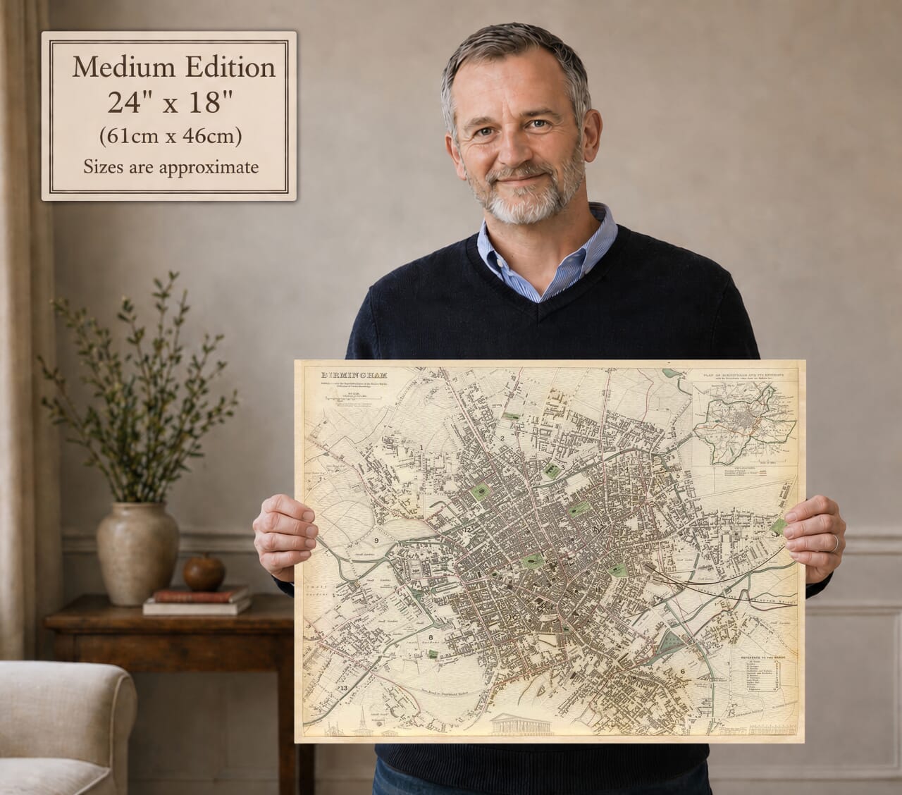
- Original dimensions: Approximately 41 × 33 cm
- Format: Engraved town plan with hand-coloured boundaries
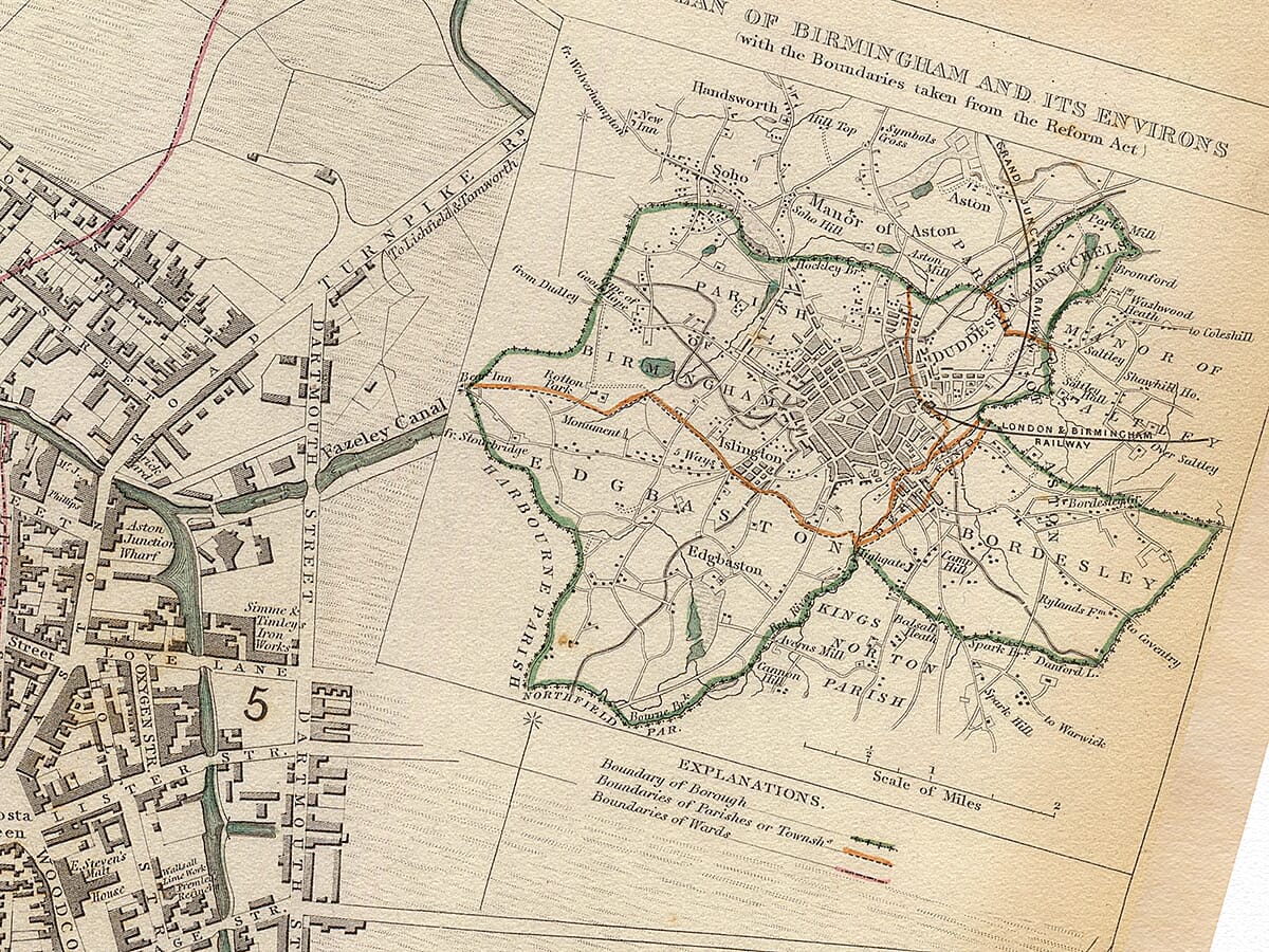
- Inset: Plan of Birmingham and its Environs
- Administrative detail: Borough, parish and ward boundaries
- Other features: Streets, canals, railway, churches, factories, gardens and public buildings
Birmingham in 1839
The map records Birmingham immediately after it received its charter of incorporation in 1838. Although still officially a town—it did not attain city status until 1889—it was already one of Britain’s largest and most important manufacturing centres.
Its tightly built central districts spread outwards into a mixture of workshops, houses, gardens and open fields. The contrast is especially clear around Hockley, Ladywood, Edgbaston, Deritend and Bordesley, where urban development gives way gradually to less densely occupied land.
The numbered divisions correspond to Birmingham’s 13 wards. A reference panel identifies All Saints, Birmingham Market, Deritend and Bordesley, Duddeston and Nechells, St George’s, Ladywood, St Peter’s, St Martin’s, St Thomas’s, St Bartholomew’s, St Mary’s, St Paul’s and Edgbaston.
Streets and Buildings of the Town Centre
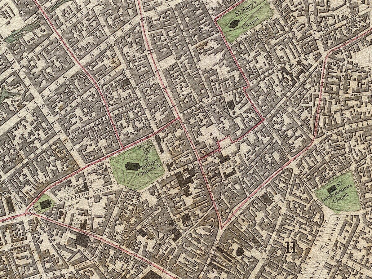
At the centre of the engraving lies a closely packed network of streets, courts and alleys. New Street, High Street, Bull Street, Snow Hill, Colmore Row, Dale End and the roads surrounding the Bull Ring can all be followed through the plan.
St Martin’s Church stands beside the Bull Ring, while St Philip’s occupies its spacious churchyard farther north. St Philip’s was then a parish church and would not become Birmingham Cathedral until 1905.
Public buildings, chapels, schools, markets and commercial premises are individually drawn. Several architectural elevations appear along the lower border, with Birmingham Town Hall occupying the central position. Completed only a few years before the map was published, its imposing classical design reflected the town’s growing confidence and civic ambition.
Canals, Wharves and Industry
Birmingham’s canals are among the strongest features of the plan. Their winding channels, basins and branches penetrate the industrial districts and connect numerous wharves, factories and workshops.
The canal system allowed coal, iron, manufactured goods and raw materials to move between Birmingham and the surrounding Black Country. Names associated with wharves, mills and works appear throughout the engraving, revealing how closely industry was woven into the town’s residential streets.
Hockley and the Jewellery Quarter are shown as developing manufacturing districts, while workshops and densely occupied courts spread around St Paul’s and St George’s. To the west, Ladywood retains more open ground, gardens and scattered development beside the canal network.
The Arrival of the Railway
The London and Birmingham Railway is clearly marked approaching from the east. The line had opened throughout in September 1838, only months before Henshall’s plan appeared.
Its arrival connected Birmingham with London on a journey measured in hours rather than days. Railway buildings and sidings occupy land near the eastern edge of the town, beginning a transformation that would eventually make Birmingham one of the country’s most important railway centres.
The map therefore records the meeting of two transport ages. Canals remain essential to Birmingham’s industries, but the railway has arrived and is already beginning to reshape the eastern approaches.
Birmingham and Its Environs
The upper-right inset is titled Plan of Birmingham and its Environs, with the Boundaries taken from the Reform Act. It places the densely built town within a much broader landscape.
Aston and Duddeston appear to the north and east, with Handsworth and Soho beyond Hockley. Edgbaston and Harborne occupy the more open western and south-western country, while Bordesley, Sparkbrook and Kings Norton extend towards the south and east.
The inset also illustrates the significance of the Reform Act of 1832. Birmingham gained parliamentary representation and was defined as a political borough, recognising the importance of a rapidly expanding town that had previously lacked its own Members of Parliament.
A City Emerging from the Landscape
Beyond the principal streets, Henshall records fields, gardens, footpaths, estates and isolated houses. Much of this open ground would disappear beneath later Victorian development.
Edgbaston was still characterised by parkland and substantial residences. Bordesley and Deritend were expanding along important roads, while Aston, Handsworth and Harborne remained separate communities rather than incorporated parts of the modern city.
The survival of these local names gives the map lasting relevance. Modern viewers can locate familiar districts while discovering the roads, waterways and older settlements from which Birmingham developed.
James Henshall’s engraving captures Birmingham at a decisive moment: newly incorporated, connected to London by railway and rapidly spreading beyond its earlier boundaries. Its exceptional street-level detail makes it both a handsome work of cartography and an absorbing record of the industrial town that was becoming a modern city.






 Verified owner