Verified owner
Got there in time and loves it! Cheers David [Gift from US to UK]
 Verified owner
Thanks Lauren. We received it today - it's gorgeous! Thank you, Ellan
 Verified owner
Thank you for your prompt service. I have a gallery and framing business in South Wales. I'm so pleased it is printed in the UK
 Verified owner
My Isles of Scilly map arrived safely and I'm delighted with it!

The print arrived safely and we're delighted with it - a lovely reminder of our honeymoon 15 years ago.
 Verified owner
I have just received them! I'm sure our clients will be pleased with them and there could be more projects off the back of this one where we can use more. [Interior Designers]
 Verified owner
I just received my map of Ireland by Ewart today and, as usual, I am delighted by its quality. The crispness and fineness of detail is excellent and the colour reproduction surpasses my expectations. Please relay my thanks to Steve for another fine effort!
 Verified owner
Many thanks, Lauren. Very pleased with the map and the service: would recommend The Old Map Company to anyone interested in Old Maps.
 Verified owner
Many thanks, the map arrived safely this morning, and I’m really pleased with it. A stunning reproduction, just as I had hoped. I will keep browsing your website, and may yet be tempted by more of your items! Have a great weekend.
 Verified owner
Just arrived, wonderful map! Thanks very much!
 Verified owner
The map – beautiful – arrived safely, very many thanks.
 Verified owner
Thank you, I have already found the map. It’s wonderfull! Good luck! Rasa
 Verified owner
My apologies for the very late reply. I wanted to reach out to thank you so much for rushing my order. My partner absolutely loved it. I am amazed with the service so that is a five-star from me. I wish you all the best.
 (3) The air is temperate, and the soil bountiful — especially in the north, where the River Ouse flows through many winding paths.
The south is more barren and produces less, but it still yields good barley, which isn’t easily surpassed elsewhere. Generally, this county is fertile and fruitful, though some places are sprinkled with pasture and woods.
(4) The ancient inhabitants, known to the Romans, that lived in this shire were part of the Cattieuchlani, a strong and warlike tribe. Later they came under Roman control when Caesar brought Britain into a Roman province. His legions stationed at Salena and Magintum — now Sandy and Dunstable, notable Roman sites in the county.
Afterwards, when the Saxons sought to reclaim the land, they took it from the Britons under Cuthwulf, a West-Saxon leader, around the year 572, and the Mercians later held it as part of their kingdom.
(5) In the year 1399, during the wars between the Princes of Lancaster and York, the River Ouse near Newport Pagnell suddenly dried up and wouldn’t flow further — revealing the very depth of its channel. Afterward, it returned as strongly as ever, which was seen as a sign of future political upheaval.
(6) The county suffered heavily during the Danish invasions. The Danes occupied the area. During King Stephen’s reign, the town and castle were seized by Empress Maud, and much blood was shed. In King John’s time, the people rebelled, and later King Henry III destroyed the castle entirely.
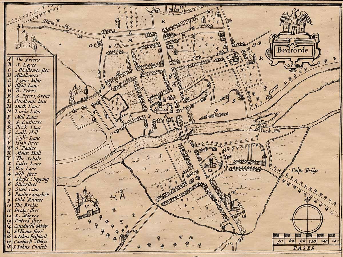
(7) The town of Bedford, the county capital, was once called Lettidur by the Britains and Bedford by the Saxons. It is the most important town in the county, named after the River Ouse and pleasantly located. A stone bridge crosses the river in the middle of town. There are two gates to lock it, which could stop traffic in times of trouble.
Notable places include:
St. Leonard’s Hospital for Lazars
Churches of St. John and St. Mary
The town’s parish churches: St. Cuthbert, St. Peter, St. Loyes, Allhallows, and Cardinal’s Abbey
Former Chapel of King Offa, where his body was supposedly buried after being swept away by the river. A piece of lead (said to be his tomb) was once found, though others say it was not his.
(8) Dunstable has a tale of a robber named Dun, punished by King Henry I, but it is more likely that it was a Roman town, as it had Roman legions. A nearby village is still called Maiden-mongery, showing the Roman influence.
(9) Important castles in the shire include:
Woodhill, Eaton. Tempsford and Ampthill
Ampthill was once held by the Crown, and many relics and devotions were offered there. These were destroyed during King Henry VIII’s reign when many shrines were demolished.
(10) Geography:
The town of Bedford lies 52 degrees and 30 minutes north latitude, and about 16 minutes west of the Prime Meridian.
(11) Notable noble families bear the titles of Dukes and Earls. The shire is divided into nine Hundreds (districts), with seven Market Towns and 156 parish churches.
(3) The air is temperate, and the soil bountiful — especially in the north, where the River Ouse flows through many winding paths.
The south is more barren and produces less, but it still yields good barley, which isn’t easily surpassed elsewhere. Generally, this county is fertile and fruitful, though some places are sprinkled with pasture and woods.
(4) The ancient inhabitants, known to the Romans, that lived in this shire were part of the Cattieuchlani, a strong and warlike tribe. Later they came under Roman control when Caesar brought Britain into a Roman province. His legions stationed at Salena and Magintum — now Sandy and Dunstable, notable Roman sites in the county.
Afterwards, when the Saxons sought to reclaim the land, they took it from the Britons under Cuthwulf, a West-Saxon leader, around the year 572, and the Mercians later held it as part of their kingdom.
(5) In the year 1399, during the wars between the Princes of Lancaster and York, the River Ouse near Newport Pagnell suddenly dried up and wouldn’t flow further — revealing the very depth of its channel. Afterward, it returned as strongly as ever, which was seen as a sign of future political upheaval.
(6) The county suffered heavily during the Danish invasions. The Danes occupied the area. During King Stephen’s reign, the town and castle were seized by Empress Maud, and much blood was shed. In King John’s time, the people rebelled, and later King Henry III destroyed the castle entirely.
(7) The town of Bedford, the county capital, was once called Lettidur by the Britains and Bedford by the Saxons. It is the most important town in the county, named after the River Ouse and pleasantly located. A stone bridge crosses the river in the middle of town. There are two gates to lock it, which could stop traffic in times of trouble.
Notable places include:
St. Leonard’s Hospital for Lazars
Churches of St. John and St. Mary
The town’s parish churches: St. Cuthbert, St. Peter, St. Loyes, Allhallows, and Cardinal’s Abbey
Former Chapel of King Offa, where his body was supposedly buried after being swept away by the river. A piece of lead (said to be his tomb) was once found, though others say it was not his.
(8) Dunstable has a tale of a robber named Dun, punished by King Henry I, but it is more likely that it was a Roman town, as it had Roman legions. A nearby village is still called Maiden-mongery, showing the Roman influence.
(9) Important castles in the shire include:
Woodhill, Eaton. Tempsford and Ampthill
Ampthill was once held by the Crown, and many relics and devotions were offered there. These were destroyed during King Henry VIII’s reign when many shrines were demolished.
(10) Geography:
The town of Bedford lies 52 degrees and 30 minutes north latitude, and about 16 minutes west of the Prime Meridian.
(11) Notable noble families bear the titles of Dukes and Earls. The shire is divided into nine Hundreds (districts), with seven Market Towns and 156 parish churches.
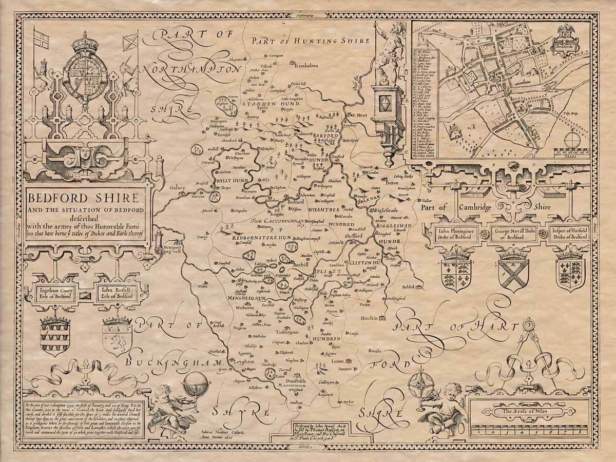
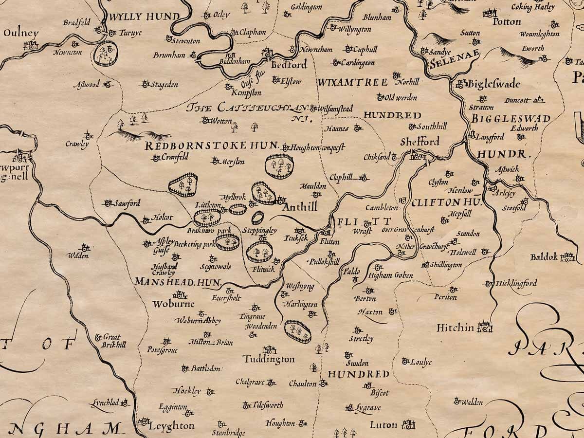
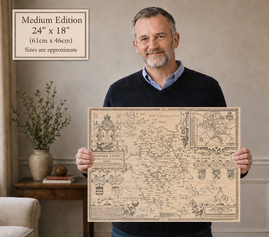
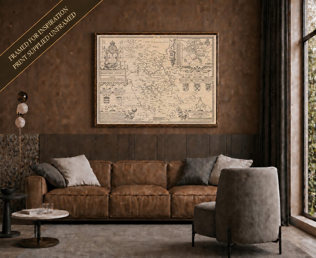
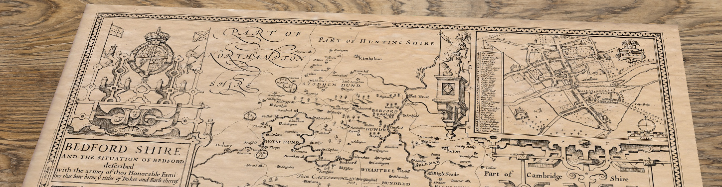
John Speed’s map records many of Bedfordshire’s principal towns and villages as they were known in the early seventeenth century. Clearly identifiable places include Bedford, Luton, Dunstable, Leighton Buzzard, Woburn, Ampthill, Biggleswade, Potton, Sandy, Shefford, Harrold, Sharnbrook, Clapham, Bletsoe, Turvey, Stevington, Bromham, Kempston, Elstow, Cardington, Willington, Blunham, Tempsford, Roxton, Thurleigh, Wilden, Cople, Southill, Toddington, Houghton, Caddington and Studham.
The map also includes numerous smaller settlements, estates and older spellings, making it possible to trace the historic pattern of roads, rivers and communities across the county. The River Great Ouse is especially prominent as it winds through Bedford and the surrounding villages.
Some modern Bedfordshire towns, suburbs and neighbourhoods are not named because they developed later, expanded from smaller settlements, or were known by different names in Speed’s time. Even where a present-day place is not labelled, its location can still be identified within the landscape shown on the map, offering a fascinating view of the area before later industrial growth, railway development and suburban expansion.
Bedfordshire Place NamesA
Aley Green, Apsley End, Arlesey, Aspley Guise, Astwick
B
Backnoe End, Barford, Great, Barford, Little, Barton-Le-Clay, Basmead Manor, Battlesden, Batts Ford, Beadlow, Beckerings Park, Beeston, Beeston Green, Beggary, Bell End, Biddenham, Bidwell, Billington, Birchmoor, Biscot, Black Tom, Bolnoe, Boot End, Bott End, Boughton End, Bourne End, Bramingham, Breach, Brickhill, Bridge End, Broad Green, Brook End, Brook End Green, Broom, Budna, Bury End, Bury Park, Bushmead
C
Cainhoe, California, Campton, Carlton & Chellington, Caulcott, Causeway End, Chadwell End, Chalgrave, Chalton, Channels End, Chapel End, Chaul End, Chawston, Chicksands, Chiltern Green, Church End, Clapham Folly, Clapham Green, Clifton, Clipstone, Clophill, Cockayne Hatley, Coffle End, Colesden, Colmworth, Colworth, Cotton End, Cranfield, Crawley, Crawley Green, Cross End, Crosshall
D
Deadmans Cross, Dean, Denel End, Dilwick, Duck End, Ducksworth, Duloe, Dunton
E
East End, East Hyde, Eastcotts, Eaton Bray, Eaton Ford, Eaton Green, Eaton Socon, Edworth, Eggington, Elms Farm, Elvedon, Etonbury, Eversholt, Everton, Eyeworth
F
Faldo, Fancott, Felmersham, Felmersham Hardwick, Fenlake, Flexmore End, Flitton, Flitwick, Folly
G
Gastlings, Girtford, Goldington, Goldington Highfields, Gossards Green, Goswell End, Gravenhurst, Great Billington, Greathampstead, Green End, Greenfield, Grovebury
H
Hall End, Hanscombe End, Hardwick End, Harlington, Harlington Woodend, Harrowden, Hart Hill, Hatch, Hatch End, Haynes, Heath, Heath & Reach, Henlow, Herrings Green, High Town, Higham Gobion, Higher Berry End, Higher Rads End, Hillfoot End, Hills End, Hinwick, Hockliffe, Holme, Holwellbury, Honeydon, Houchens End, How End, Hulcote, Humbershoe, Husborne Crawley
I
Ickwell, Ickwell Green, Ion, Ireland
K
Keeley Green, Keeley Lane, Kempston Church End, Kempston Hardwick, Kempston West End, Kensworth, Keysoe, Keysoe Row, Kitchen End, Knotting, Knotting Green
L
Langford, Langford End, Leagrave, Lewsey, Lidlington, Limbersey, Limbury, Little End, Little Odell, Littleworth, Lower Billington, Lower Bury End, Lower Caldecote, Lower East End, Lower End, Lower Rads End, Lower Stondon, Luton Hoo
M
Marsh Farm, Marston Moretaine, Maulden, Mavourn, Melchbourne, Meppershall, Middle End, Millbrook, Millow, Milton Bryan, Milton Ernest, Mogerhanger, Moor End, Mowsbury
N
Nares Gladley, New Town, Newmill End, Newnham, Newton, North End, Northill, Northwood End
O
Oakley, Odell, Old Warden
P
Park End, Park Town, Pavenham, Pegsdon, Pepperstock, Pertenhall, Podington, Potsgrove, Potter’s End, Pudde Hill, Pulloxhill
Q
Queens Park
R
Radwell, Ramridge End, Ravensden, Reach, Renhold, Ridgmont, Riseley, Risinghoe, Roothams Green, Round Green, Rowney, Runley, Rushmere
S
Salford, Salford Ford, Salph End, Scald End, Seddington, Segenhoe, Sevick End, Sewell, Sharpenhoe, Sheep Lane, Shefford Hardwick, Shelton, Shillington, Shirdon, Shortstown, Silsoe, Silver End, Slip End, Someries, Souldrop, Southcott, Stagsden, Stagsden West End, Stanbridge, Stanbridgeford, Stanford, Staploe, Staughton, Little, Steppingley, Stockwood, Stondon, Upper, Stopsley, Stotfold, Stotfold Green, Stratford, Stratton, Streatley, Sundon, Sutton, Swineshead
T
Tags End, Tartlett End, Tebworth, Tetworth, The City, The Creakers, The Green, The Hassells, Thistley Green, Thorn, Thorncote, Thrales End, Thrup End, Tilwick, Tithe Farm, Top End, Totternhoe, Tyrells End
U
Up End, Upbury, Upper Caldecote, Upper East End, Upper Houghton Regis, Upper Staploe, Upper Sundon, Upton End
V
Valance End, Vicarage Green
W
Wadlow, Wakes End, Warden Hill, Warden Street, Wardhedges, Water End, West End, West Hyde, Westoning, Westoning Woodend, Wharley End, Whipsnade, Whitnoe, Wick End, Wickey, Wilshamstead, Wingfield, Witts End, Wood End, Woodmer End, Wootton, Wootton Bourne End, Wootton Broadmead, Wootton Green, Wootton Pillinge, Workhouse End, Worthy End, Wrest Park, Wrestlingworth, Wyboston, Wymington
Y
Yielden