Verified owner
Got there in time and loves it! Cheers David [Gift from US to UK]
 Verified owner
Thanks Lauren. We received it today - it's gorgeous! Thank you, Ellan
 Verified owner
Thank you for your prompt service. I have a gallery and framing business in South Wales. I'm so pleased it is printed in the UK
 Verified owner
My Isles of Scilly map arrived safely and I'm delighted with it!

The print arrived safely and we're delighted with it - a lovely reminder of our honeymoon 15 years ago.
 Verified owner
I have just received them! I'm sure our clients will be pleased with them and there could be more projects off the back of this one where we can use more. [Interior Designers]
 Verified owner
I just received my map of Ireland by Ewart today and, as usual, I am delighted by its quality. The crispness and fineness of detail is excellent and the colour reproduction surpasses my expectations. Please relay my thanks to Steve for another fine effort!
 Verified owner
Many thanks, Lauren. Very pleased with the map and the service: would recommend The Old Map Company to anyone interested in Old Maps.
 Verified owner
Many thanks, the map arrived safely this morning, and I’m really pleased with it. A stunning reproduction, just as I had hoped. I will keep browsing your website, and may yet be tempted by more of your items! Have a great weekend.
 Verified owner
Just arrived, wonderful map! Thanks very much!
 Verified owner
The map – beautiful – arrived safely, very many thanks.
 Verified owner
Thank you, I have already found the map. It’s wonderfull! Good luck! Rasa
 Verified owner
My apologies for the very late reply. I wanted to reach out to thank you so much for rushing my order. My partner absolutely loved it. I am amazed with the service so that is a five-star from me. I wish you all the best.
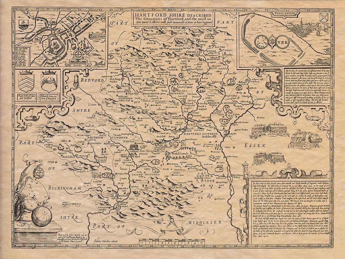
John Speed’s map was prepared for The Theatre of the Empire of Great Britaine, first published in 1611–12. It combines a county map with town views, heraldry and historical scenes, presenting Hertfordshire as both a geographical place and a setting for important events in English history.
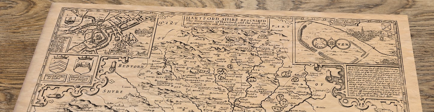
Original title: Hartford Shire Described, The Situations of Hartford and the Most Ancient Towne S. Albons with Such Memorable Actions as Have Happened
Cartographer: John Speed
Engraver: Jodocus Hondius
First publishers: John Sudbury and George Humble
First published: London, 1611–12
Source: The Theatre of the Empire of Great Britaine
Area shown: The historic county of Hertfordshire and its borders
Orientation: North at the top
Original method: Copperplate engraving
Reproduced publisher state: Thomas Bassett and Richard Chiswell; associated with their London atlas edition of 1676
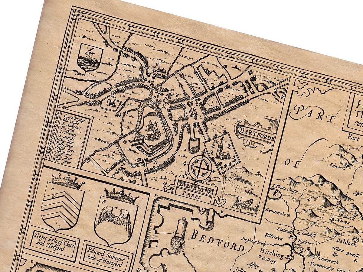
The inset plan of Hertford is believed to be the earliest printed plan of the county town. Streets and buildings gather around the River Lea, with Hertford Castle occupying a prominent position. This small plan is especially valuable because it records the town before later expansion altered its historic centre.
The second inset looks towards St Albans from the remains of Roman Verulamium. Its walls and ruins recall the settlement that preceded the medieval town, while St Albans Abbey rises in the distance. Speed’s decision to show both places connects Hertfordshire’s Roman past with the county familiar to his seventeenth-century audience.
Alongside the map are scenes associated with battles fought in and around St Albans during the Wars of the Roses. The First Battle of St Albans in 1455 opened the conflict, while further fighting followed in 1461. The Battle of Barnet in 1471, fought close to Hertfordshire’s southern boundary, helped bring the struggle towards its conclusion.
These scenes are not merely decoration. They reflect Speed’s wider purpose in The Theatre: to combine maps with the historical events and antiquities attached to each county.
Across the main map, familiar places appear in forms that sometimes differ from modern spelling. Hertford, Ware, Hitchin, Stevenage, Hatfield, Watford, Rickmansworth, Berkhamsted, Royston and Bishop’s Stortford can all be identified, together with numerous villages and smaller settlements.
Rivers form much of the visible structure of the landscape. The Lea passes through the eastern part of the county, while the Colne and other waterways help define the western districts. Neighbouring Bedfordshire, Cambridgeshire, Essex, Middlesex and Buckinghamshire are named around the irregular county boundary.
Speed’s map appeared when county identity was becoming an increasingly important subject for printed histories and atlases. Its combination of geography, local history and decorative engraving made it more than a practical map. It offered seventeenth-century readers a portrait of Hertfordshire and its place within the history of England.