Willem Blaeu’s Old Map of Europe
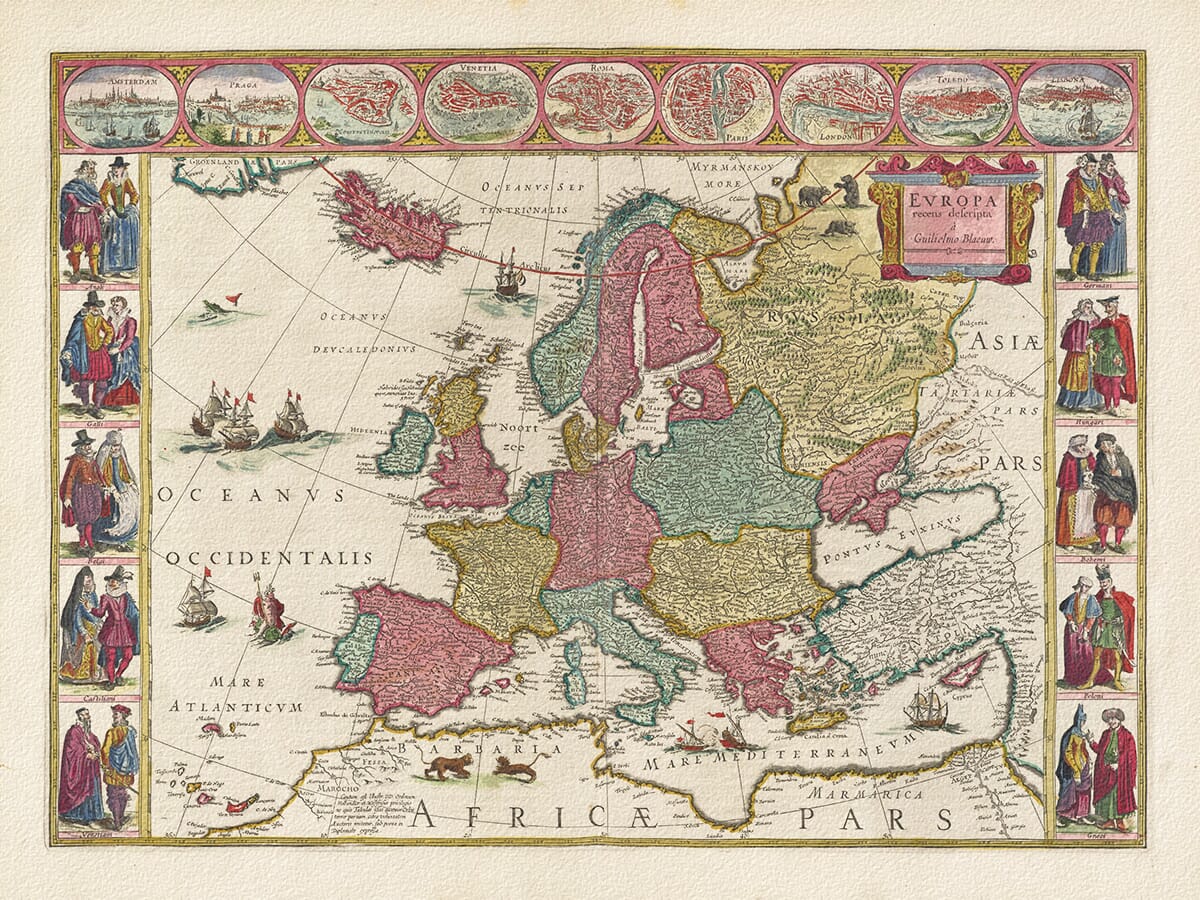
Willem Blaeu’s Europa recens descripta presents Europe within one of the most elaborate decorative borders created during the Dutch Golden Age of mapmaking. The single-sheet map was first published in Amsterdam in 1617, drawing much of its geographical and decorative content from Blaeu’s larger wall map of Europe produced in 1608.
The cartouche on the reproduced map credits “Guilielmo Blaeuw”. This identifies it as the third state of the plate, introduced for Blaeu’s Atlantis Appendix in 1630 and subsequently used in later atlas editions. The impression reproduced here has traditionally been dated to around 1645.
Map Details
- Original title: Europa recens descripta à Guilielmo Blaeuw
- English meaning: Europe Newly Described by Willem Blaeu
- Cartographer and publisher: Willem Janszoon Blaeu
- Place of publication: Amsterdam
- First issued separately: 1617
- State shown: Third state, introduced in 1630
- Impression reproduced: Mid-seventeenth century, traditionally dated c.1645
- Cartographic basis: Blaeu’s wall map of Europe, published in 1608
- Approximate scale: 1:14,500,000
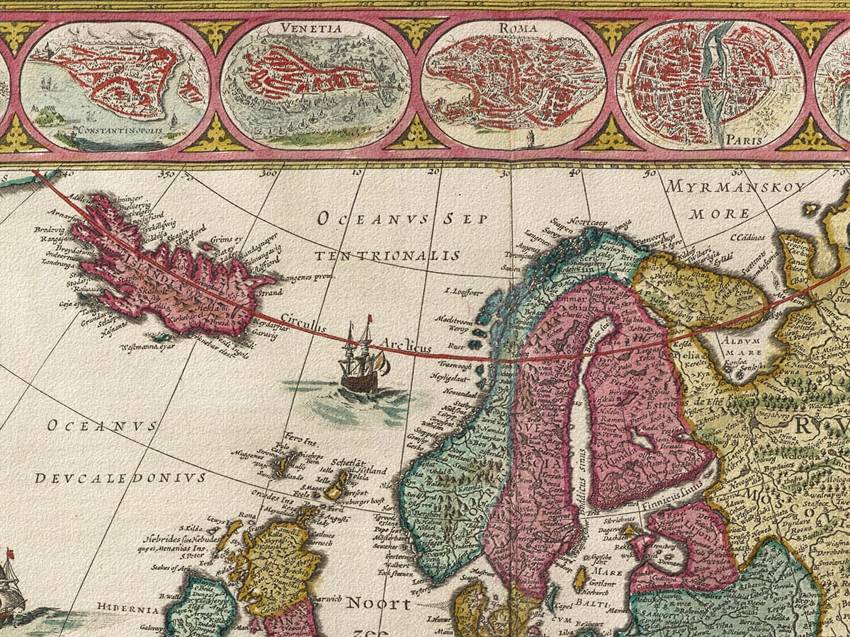
- City views: Amsterdam, Prague, Constantinople, Venice, Rome, Paris, London, Toledo and Lisbon
- Format: Hand-coloured copperplate engraving
- Decorative features: Costumed figures, ships, sea creatures, animals and ornamental cartouches
- Notable geographical feature: The mythical island of Frisland
A Map with More Than One Date
The distinction between 1617, 1630 and c.1645 is important. Blaeu first released the single-sheet map in 1617 under the name Guilielmus Janssonius. The date was removed from the second state, and the cartographer’s name was changed to Guilielmo Blaeuw for the third state in 1630.
That revised plate remained in use after Willem Blaeu’s death in 1638, when his sons Joan and Cornelis continued the family publishing house. Consequently, individual impressions may carry a publication date from the 1630s, 1640s or later while preserving essentially the same engraved geography.
The visible Blaeuw signature establishes the state of this map but cannot, without its accompanying atlas text, provide an exact printing year. Dating the reproduced impression to approximately 1645 acknowledges its likely mid-century origin without confusing that date with the map’s first publication.
Nine Cities Across Europe
A sequence of nine oval views runs across the top of the engraving. Amsterdam occupies the first position, followed by Prague, Constantinople, Venice, Rome, Paris, London, Toledo and Lisbon.
These are not merely labels placed upon the map. Each city is presented as a miniature prospect or plan, with buildings, walls, waterways and surrounding landscape compressed into a small ornamental frame. Together they represent important commercial, political and religious centres extending from Portugal to the Ottoman capital.
Amsterdam’s prominent position reflects the city in which Blaeu worked and where the map was printed. During the early seventeenth century, it was becoming one of Europe’s leading centres for publishing, navigation and international trade.
Europeans in National Dress
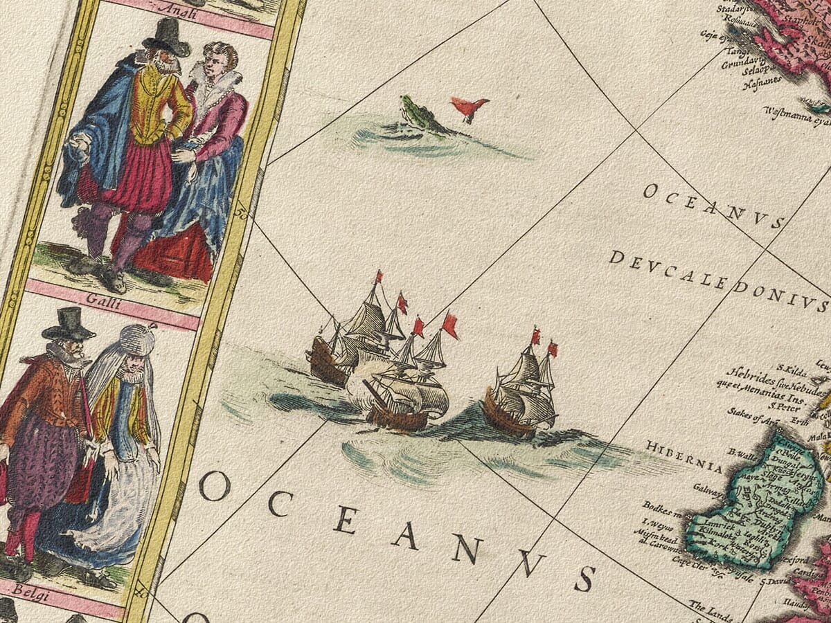
Five pairs of figures flank each side of the map. The left-hand border depicts the English, French, inhabitants of the Low Countries, Castilians and Venetians. The opposing border represents Germans, Hungarians, Bohemians, Poles and Greeks.
Identified by the Latin names Angli, Galli, Belgi, Castiliani, Venetiani, Germani, Hungari, Bohemi, Poloni and Graeci, the figures wear clothing intended to distinguish different European peoples.
These costumes reflect seventeenth-century Dutch ideas about national identity rather than an objective record of how entire populations dressed. Their inclusion transformed the sheet from a purely geographical map into a visual survey of European cities and societies.
Europe and Its Surrounding Lands
The map covers the whole of Europe, including Scandinavia, the British Isles, the Iberian Peninsula, Italy, the Balkans and European Russia. It also extends beyond the continent to include Iceland, Greenland, North Africa and a substantial part of western Asia.
Modern political borders are absent. Europe is instead organised through kingdoms, principalities, regions, coastlines, rivers and settlements. The Mediterranean forms a strong southern boundary, while the Baltic, Black Sea and Atlantic connect the continent with the wider maritime world.
Blaeu fills the seas with sailing vessels and a sea creature. Bears appear in the northern lands, while lions occupy North Africa. These additions animate areas that would otherwise have remained visually empty and contribute to the map’s richly theatrical character.
The Mythical Island of Frisland
One of the map’s most revealing errors appears in the North Atlantic. Southwest of Iceland lies Frisland, an island that does not exist.
Frisland originated in an earlier published account and was subsequently repeated by influential sixteenth- and seventeenth-century mapmakers. Its presence on Blaeu’s map demonstrates how geographical errors could survive when later cartographers relied upon respected printed sources.
The island remained on early states of Europa recens descripta but was removed from a later version used in Joan Blaeu’s Atlas Maior. It is therefore both a cartographic curiosity and a useful clue to the state of the engraving.
A Decorative Map from Amsterdam
The map belongs to the style now commonly called a carte à figures: a geographical map surrounded by figures, costumes or city views. Blaeu used this format for his celebrated maps of Europe, Asia, Africa and the Americas.
Its success rests upon the balance between information and ornament. Dense networks of rivers, towns and coastlines occupy the central map, while the surrounding figures and views give the sheet an architectural structure resembling an elaborate picture frame.
For anyone interested in European history, Amsterdam mapmaking or the visual culture of the seventeenth century,
Europa recens descripta offers far more than a record of boundaries. It shows how Willem Blaeu and his contemporaries imagined Europe, its peoples and its position within the wider world.





 Verified owner