
Old world maps record how cartographers understood the globe during a period of exploration, incomplete geographical knowledge and rapidly developing map production.
This collection includes seventeenth-century maps by John Speed, Willem Blaeu, Henricus and Jodocus Hondius, Pieter Goos, Nicolaes Visscher and Gerard van Schagen. Many use the characteristic double-hemisphere format, surrounded by celestial diagrams, sailing ships, allegorical figures and scenes representing the continents, seasons or elements.
Features such as California shown as an island, unfinished Australian coastlines and speculative southern lands preserve ideas that were later revised as new voyages and surveys added to European geographical knowledge.
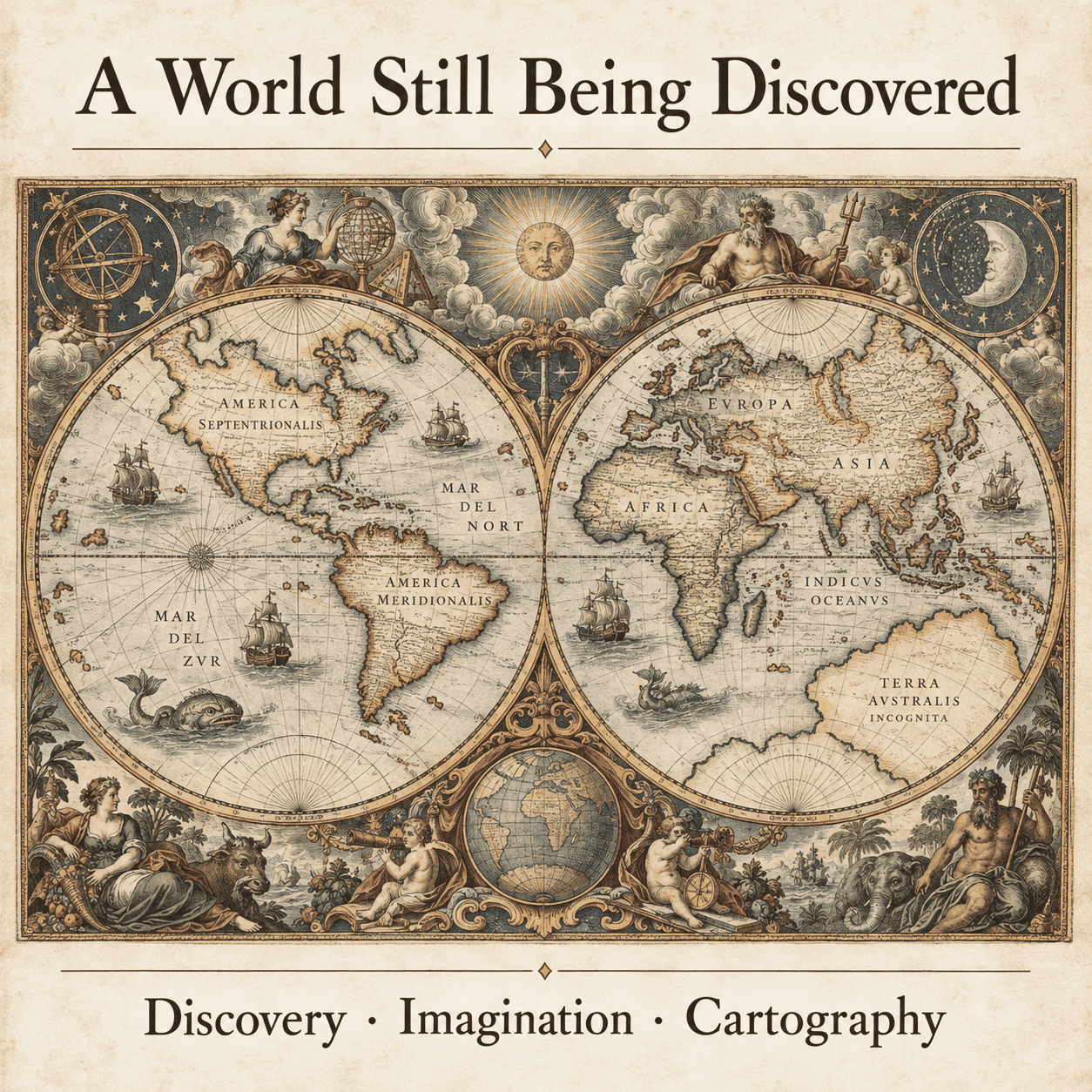
A world map asks the cartographer to compress oceans, continents and competing geographical ideas into one coherent image. Early publishers commonly used paired hemispheres, filling the surrounding space with celestial diagrams, portraits, allegorical figures or scenes representing the continents. The result was both a practical summary of knowledge and a statement of artistic and intellectual ambition.
Historic world maps are compelling partly because they preserve ideas that were later corrected. California may appear as an island, Australia’s coastline may be incomplete and a vast southern continent may occupy unknown waters. Such features are not defects in the artwork. They reveal how evidence from voyages, inherited texts and speculation was combined before modern surveying and global communication.
The seventeenth century was an important period in the development and publication of world maps, particularly in Amsterdam and London. Cartographers including Willem Blaeu, Jodocus Hondius, John Speed, Nicolaes Visscher and Jacob van Schagen produced maps that combined geographical information with detailed engraving and ornament. Their work helped shape how contemporary readers understood and pictured the world.
Historic world maps record more than geographical information. Their speculative coastlines, engraved lettering, celestial diagrams and allegorical figures reveal how seventeenth-century publishers organised and presented knowledge for contemporary readers. Examined closely, they provide evidence of exploration, inherited geographical ideas and the artistic conventions of early map publishing.
Modern fine art reproductions of historic maps, rather than original antique sheets.


