



£29.95 – £49.95Price range: £29.95 through £49.95
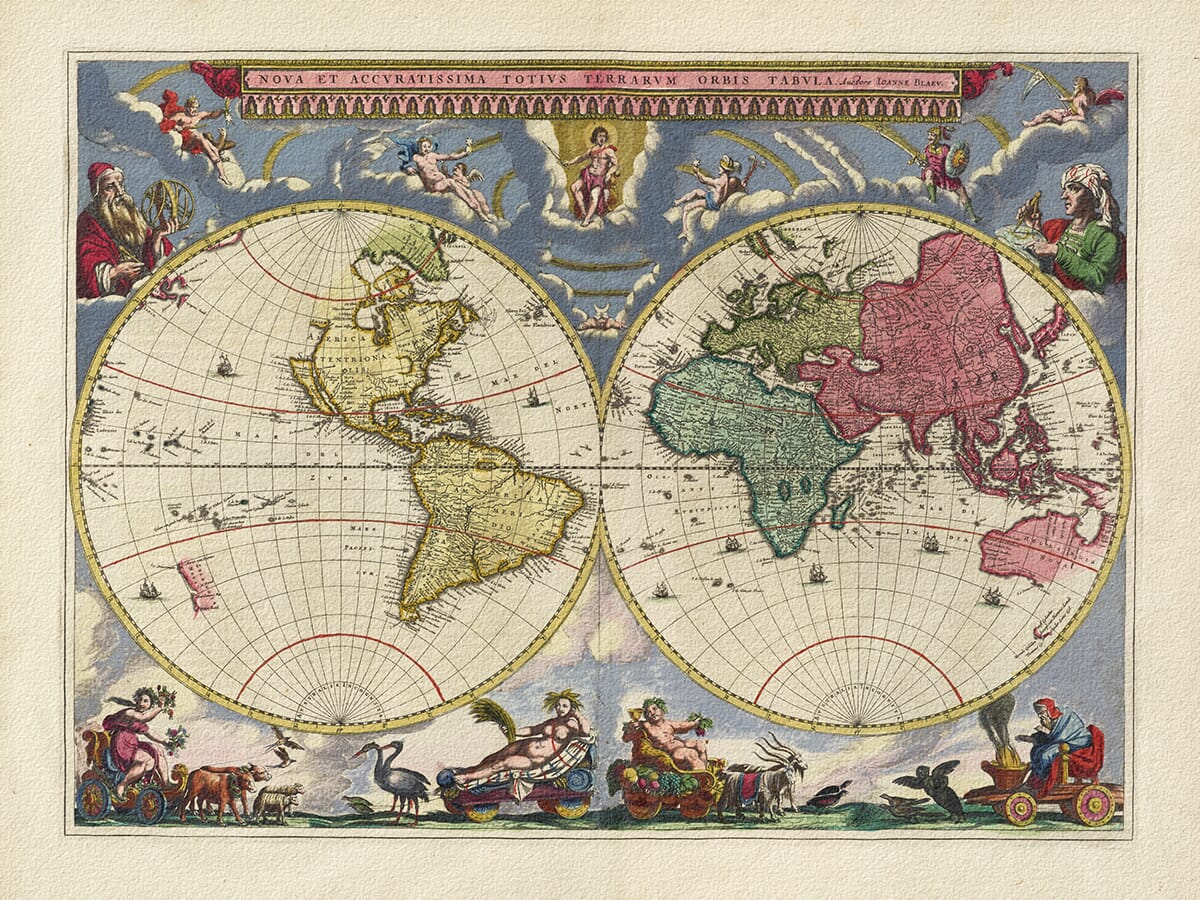
Pieter Goos published this remarkable double-hemisphere map in Amsterdam in 1666 under the title Orbis Terrarum Nova et Accuratissima Tabula.
It appeared in his celebrated sea atlas, De Zee-Atlas ofte Water-Weereld—the Sea Atlas or Water World—at a time when Amsterdam stood at the centre of European map publishing, maritime trade and overseas exploration.
The colouring of this particular reproduction gives the map a lighter and cooler appearance than many seventeenth-century designs. Soft blue seas and cloud-filled skies create a restful decorative quality, while the intricate engraving preserves the richness and curiosity of the original.
The two hemispheres sit at the centre of an extraordinary theatrical composition.
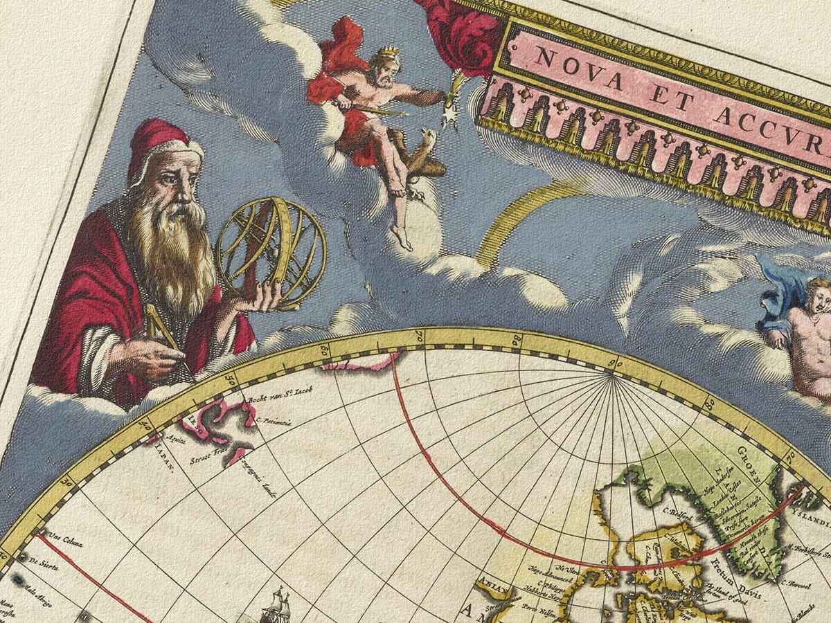
Above them, the sun breaks through swirling clouds as birds cross the sky. Among the flock is a goose, included as a playful reference to the cartographer’s surname, Goos.
Around the map, faces emerging from the clouds represent the winds that carried ships across the oceans. The effect is full of movement: the world appears suspended beneath an immense sky, surrounded by currents of air, weather and flight.
Small maps of the northern and southern polar regions sit beneath the hemispheres. The north contains a developing picture of the Arctic, while the south remains largely empty—a visual reminder of how much of the globe was still unknown to European cartographers.
Across the lower border, four beautifully engraved scenes represent spring, summer, autumn and winter, as well as the different stages of human life.
Spring is accompanied by flowers and a pot of tulips. Summer and autumn are surrounded by crops, fruit and the abundance of the harvest. Winter sits wrapped against the cold, smoking a long pipe as tiny figures skate across a frozen landscape.
These charming Dutch details bring the map down from the scale of continents and oceans to the familiar rhythms of everyday life.
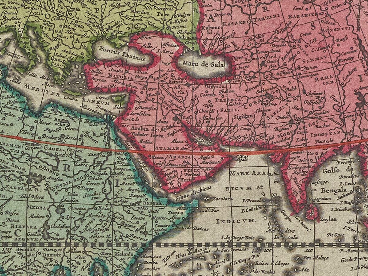
The geography records a mixture of genuine discovery, incomplete information and inherited myth.
California appears as an island separated from mainland North America. The northwest coast of the continent simply disappears, reflecting the absence of reliable European knowledge about the northern Pacific.
Australia appears as Nova Hollandia, or New Holland, with sections of its northern, western and southern coastline gradually taking shape from Dutch voyages. Tasmania is also shown following the journeys of Abel Tasman, although Australia’s eastern coast remained largely unknown.
The empty spaces and uncertain shorelines are among the map’s most appealing features. They allow us to see the world not as a finished picture, but as something being assembled slowly from voyages, sailors’ reports, trading records and earlier charts.
Although created more than three centuries ago, this blue-toned edition has a surprisingly versatile appearance.
The cooler colouring works particularly well with natural wood, off-white, blue-grey, stone and neutral interiors. From a distance, the twin hemispheres create a strong and balanced design. Viewed more closely, the map reveals ships, animals, seasonal scenes, unfamiliar place names and geographical curiosities.
It makes an unusual focal point for a home office, library, hallway or living room, and a thoughtful gift for anyone interested in travel, maritime history, geography or historic design.
Carefully reproduced and printed individually to order in our Cornwall workshop using archival pigment inks and traditionally textured fine art paper. The print is supplied unframed, allowing you to select a frame that complements your own room.
Unlike most online offerings, our maps are produced entirely in-house, not outsourced to print-on-demand or drop-shipping services. This allows complete control over quality while offering better value. Each map begins with a high-resolution original, carefully enhanced and printed to order using archival papers and pigment inks for exceptional clarity, depth, and longevity. Every piece is personally overseen — no map leaves our workshop unless it is of a quality we would be proud to display ourselves.
Paper choice is essential to the authenticity of our maps. We use specially sourced 190gsm paper made in the UK from pure materials and traditionally pressed with natural woollen felts. This process creates a subtle, randomly textured surface that closely resembles an original antique document. Likewise the use of premium quality ink fully saturates the paper, producing remarkable clarity, depth, and historical character. Colour fastness and sharpness will remain good for in excess of 100 years!
The Old Map Company of Great Britain offers a vast and carefully curated collection of the very finest expertly reproduced vintage maps. Our range includes works by renowned cartographers such as John Speed and Willem Blaeu, covering Scotland, England, and beyond. Free UK courier delivery is included, with EU, USA, and worldwide shipping available at cost and calculated at checkout. If you need assistance, our team is always happy to help you choose the perfect map.
Got there in time and loves it! Cheers David [Gift from US to UK]
Thanks Lauren. We received it today - it's gorgeous! Thank you, Ellan
Thank you for your prompt service. I have a gallery and framing business in South Wales. I'm so pleased it is printed in the UK
My Isles of Scilly map arrived safely and I'm delighted with it!
The print arrived safely and we're delighted with it - a lovely reminder of our honeymoon 15 years ago.
I have just received them! I'm sure our clients will be pleased with them and there could be more projects off the back of this one where we can use more. [Interior Designers]
I just received my map of Ireland by Ewart today and, as usual, I am delighted by its quality. The crispness and fineness of detail is excellent and the colour reproduction surpasses my expectations. Please relay my thanks to Steve for another fine effort!
Many thanks, Lauren. Very pleased with the map and the service: would recommend The Old Map Company to anyone interested in Old Maps.
Many thanks, the map arrived safely this morning, and I’m really pleased with it. A stunning reproduction, just as I had hoped. I will keep browsing your website, and may yet be tempted by more of your items! Have a great weekend.
Just arrived, wonderful map! Thanks very much!
The map – beautiful – arrived safely, very many thanks.
Thank you, I have already found the map. It’s wonderfull! Good luck! Rasa
My apologies for the very late reply. I wanted to reach out to thank you so much for rushing my order. My partner absolutely loved it. I am amazed with the service so that is a five-star from me. I wish you all the best.
This beautifully coloured reproduction of Pieter Goos’s 1666 world map has a distinctly cooler character than many traditional antique maps.
Blue-grey clouds, pale oceans and softly aged colour surround two great hemispheres, while birds cross the sky and the seasons unfold beneath the world. Small polar maps, sailing ships and unfinished coastlines reveal a globe that was still being explored and imagined.
Decorative enough to transform a room yet detailed enough to reward close study, this historic blue world map print works especially well in a study, home office, library or calm contemporary interior.



