A masterpiece of Dutch Golden Age cartography
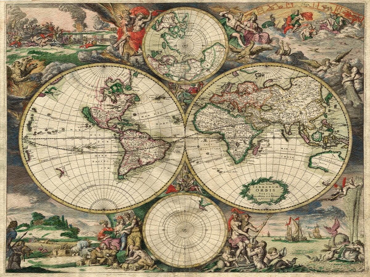
Published in Amsterdam in 1689, Gerard van Schagen’s Nova Totius Terrarum Orbis Tabula is one of the most elaborate decorative world maps of the late seventeenth century.
The known world is arranged across two large hemispheres, with smaller geographical projections and an extraordinary series of engraved scenes filling the surrounding space. Rather than treating the border as mere decoration, Van Schagen created a carefully balanced composition in which geography, mythology, astronomy and maritime power all form part of the same story.
Van Schagen was an Amsterdam engraver and cartographer who supplied maps to several of the leading Dutch publishers of his day. This world map was closely related to Frederick de Wit’s celebrated maritime cartography, although Van Schagen introduced his own geographical and decorative details.
Mythology, nature and the order of the world
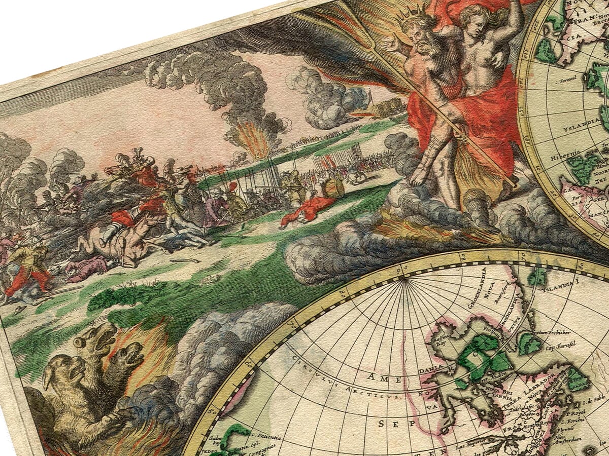
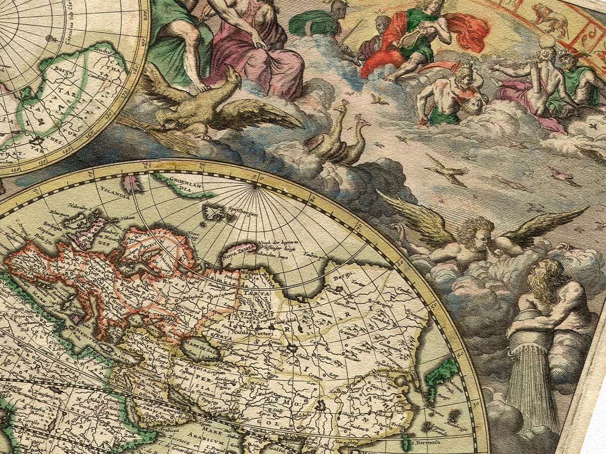
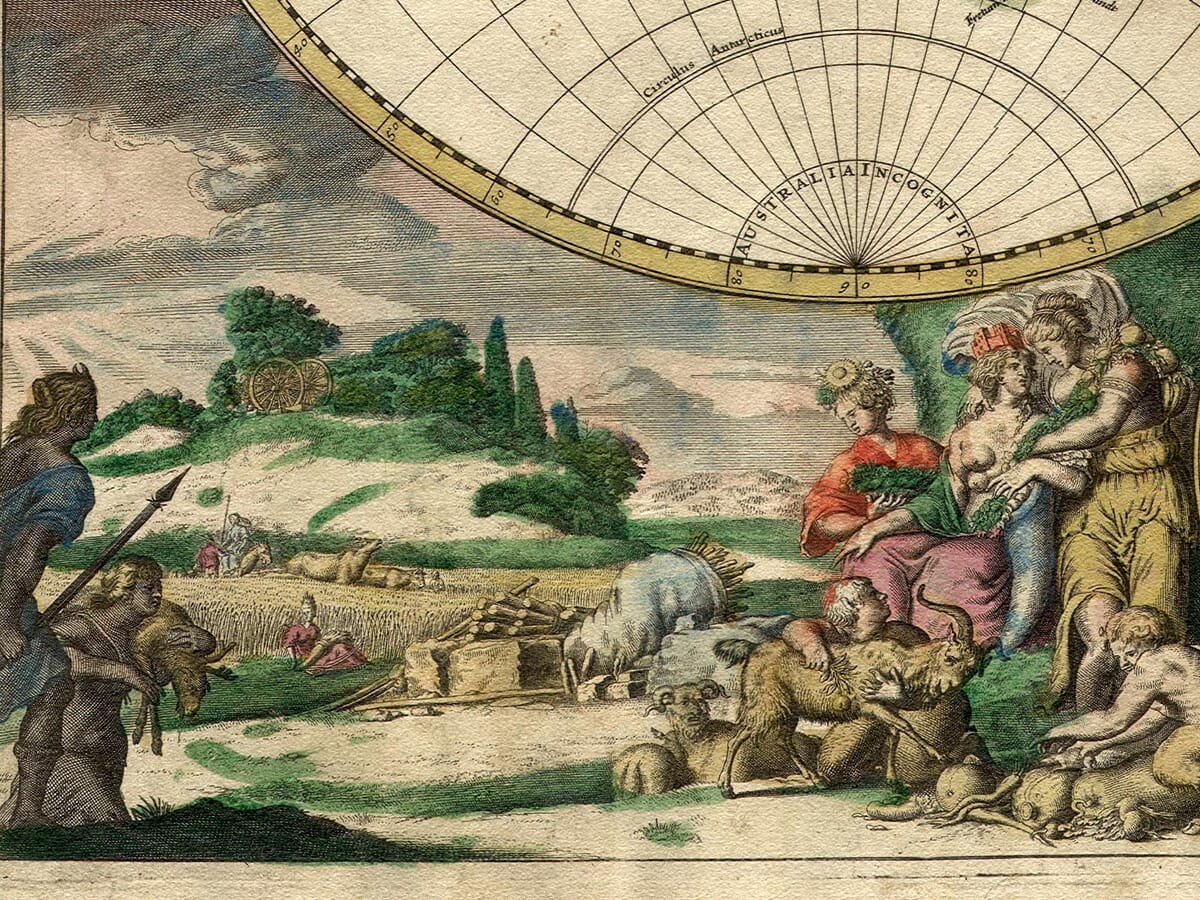
The four corners are devoted to the classical elements of Fire, Air, Earth and Water.
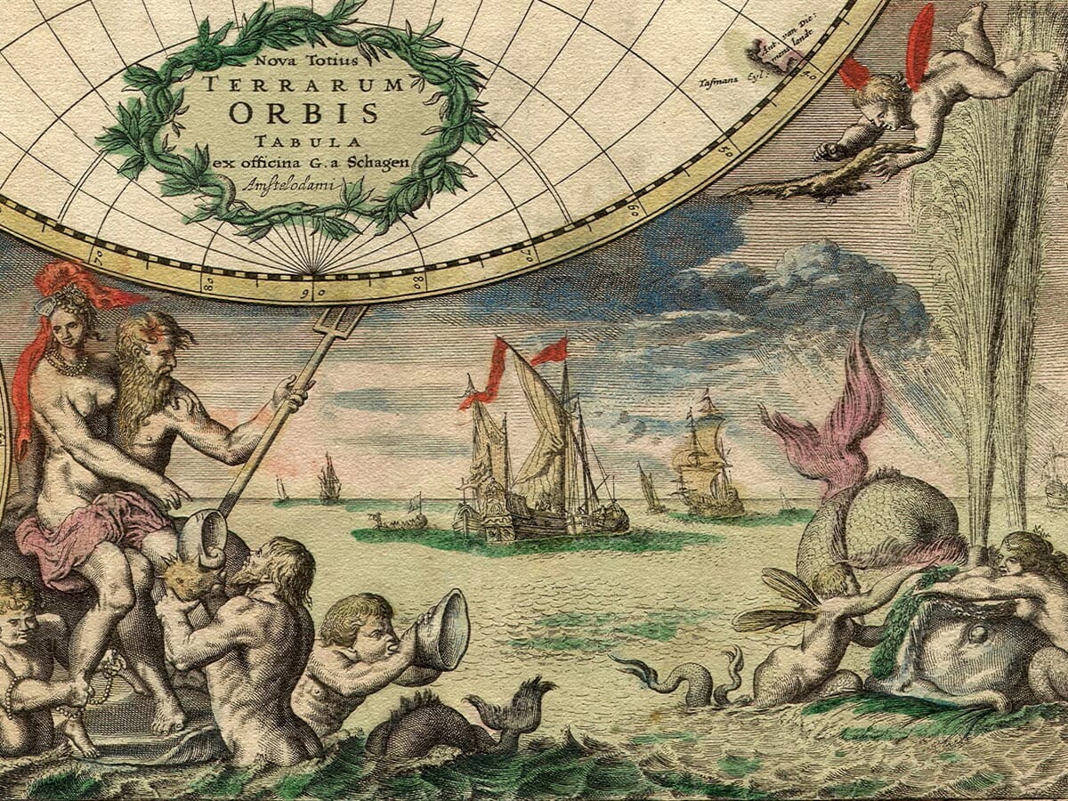
Gods and allegorical figures appear among scenes of warfare, agriculture, trade and navigation. Neptune presides over the seas, while Dutch merchant ships sail through the surrounding waters. Elsewhere, figures associated with the planets and the changing seasons suggest a universe in which geography formed part of a larger natural and celestial order.
These lavish scenes are believed to have been adapted from designs by the celebrated Dutch artist and engraver Romeyn de Hooghe. Their theatrical character gives the map an almost Baroque appearance, making it as much a work of decorative art as a practical representation of the world.
A changing picture of the globe
The map also records the rapid expansion of European geographical knowledge during the seventeenth century.
California is still represented as an island, while the interior and northwest of North America remain uncertain. By contrast, the Great Lakes are shown in a more developed form than on many earlier maps.
Particular attention is given to Hollandia Nova, or New Holland. Sections of the northern, western and southern coastline of Australia reflect the voyages of Dutch navigators, including Abel Tasman and his predecessors. The enormous imaginary southern continent found on many earlier world maps has largely disappeared, replaced by fragments of coastline gradually assembled from actual voyages.
Japan, Siberia and the islands of the northern Pacific also reveal how reports from sailors and merchants were continually reshaping European ideas about distant parts of the globe.
The result is a map poised between knowledge and speculation: familiar continents sit beside uncertain coastlines, imagined islands and regions that had not yet been fully explored.
With its warm colouring, dense engraved detail and magnificent decorative border, Van Schagen’s map makes an impressive centrepiece for a study, library, office or living space. It also makes a particularly thoughtful gift for anyone interested in maritime history, world exploration, Dutch art or antique cartography.
Carefully reproduced and printed individually to order in our Cornwall workshop using archival pigment inks and heavy, traditionally textured fine art paper. The print is supplied unframed, allowing you to choose a frame that complements your own interior.
What this historic world map shows
- Eastern and western hemispheres
- California shown as an island
- Early Dutch mapping of Hollandia Nova
- Developing outlines of the Great Lakes
- Arctic and polar geography
- Dutch merchant and sailing ships
- Classical gods and mythological figures
- The four elements: Earth, Air, Fire and Water
- Seventeenth-century Latin place names
- Richly engraved Baroque-style decoration





 Verified owner












