A world map created to rival Blaeu
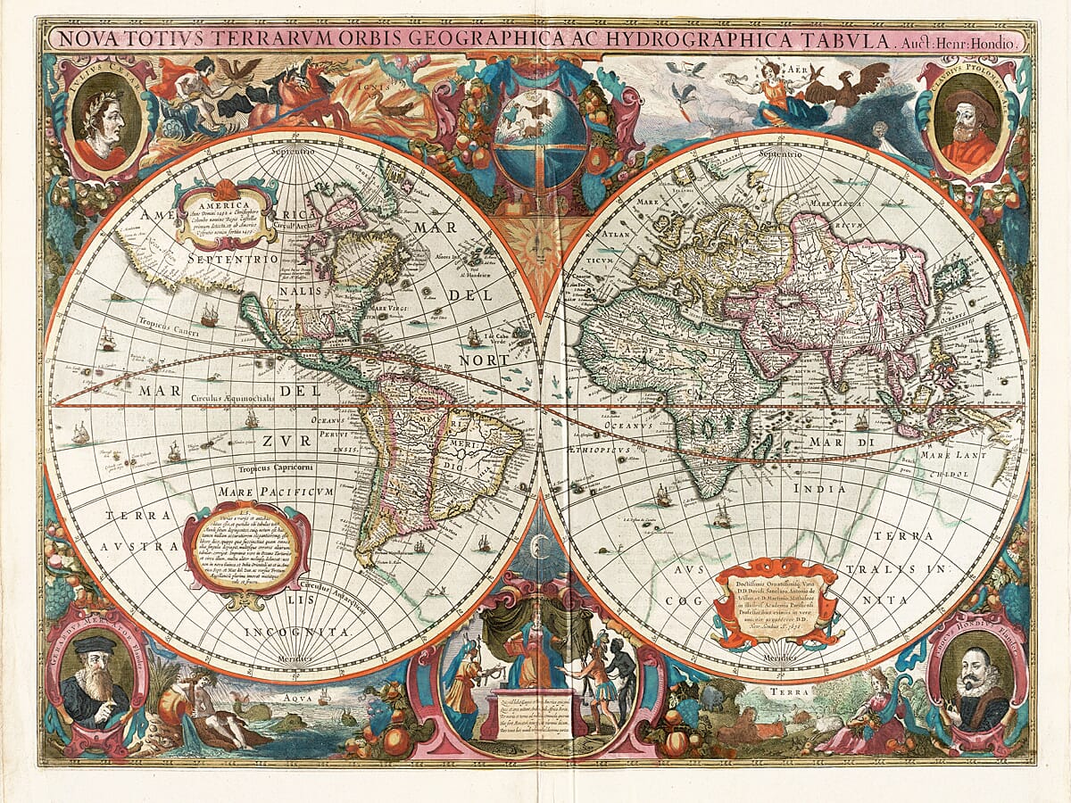
Henricus Hondius produced this celebrated double-hemisphere world map in 1630 while working with his brother-in-law, the Amsterdam publisher Jan Janssonius.
The pair were revising the enormously successful Mercator-Hondius atlas at a time when the rival Blaeu publishing house was becoming a serious commercial threat. A new and visually arresting world map was needed for the opening of their atlas, and Hondius responded with one of the most elaborate examples of Dutch seventeenth-century mapmaking.
The result combined the latest available geographical reports with a border intended to impress. Geography, astronomy, mythology and dynastic cartographic history are all brought together in a single composition.
An important early map of Australia
One of the map’s most significant features is its treatment of the northern Australian coastline.
Hondius included information gathered during Dutch voyages to the Gulf of Carpentaria, showing part of the coast extending south of New Guinea. It is regarded as the earliest dated world map in an atlas to record a Dutch discovery in Australia.
Place names associated with voyages by Willem Jansz and Jan Carstensz appear along the coast, although the mapmaker had not yet recognised Australia as an independent continent. The coast is still entangled with older ideas surrounding Terra Australis Incognita—the vast and largely imaginary Southern Unknown Land.
This makes the map particularly fascinating: it captures the moment when direct observation was beginning to replace inherited geographical theory, but before the true outline of Australia had become clear.
California as an island
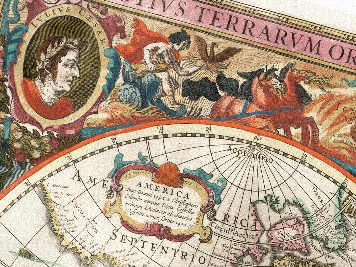
Across the Pacific, California is prominently represented as a large island separated from mainland North America.
This misconception became one of the most persistent cartographic myths of the seventeenth and early eighteenth centuries. Hondius was among the early European atlas makers to adopt the island form, partly following geographical ideas already appearing on John Speed’s world map.
Elsewhere, the map shows an improved outline of northeastern Canada, with Baffin Island correctly surrounded by water, together with early interpretations of the Great Lakes, New England and the coastline around Cape Horn.
Cartographers, emperors and the four elements
The decoration surrounding the two hemispheres is every bit as compelling as the geography.
Portrait medallions show Julius Caesar and the ancient geographer Claudius Ptolemy in the upper corners. Below appear Gerard Mercator and Jodocus Hondius, the mapmaker’s father, linking the classical tradition of geography with the great Dutch atlas makers.
The surrounding scenes represent the four elements—Fire, Air, Water and Earth—rather than the four seasons. A celestial globe appears between the hemispheres, while Europe sits enthroned below, receiving tribute from figures representing the other continents. Ships, fish, mythical creatures and richly coloured allegorical scenes complete the border.
The theatrical arrangement gives the map a distinctly Baroque character. It was designed not merely to describe the world, but to present mapmaking itself as a combination of science, commerce, art and power.
A remarkable piece of cartographic history
With its warm hand-coloured appearance, dense engraved detail and extraordinary mixture of fact and conjecture, Hondius’s map remains one of the most engaging world maps of the Dutch Golden Age.
It makes an impressive centrepiece for a study, library, office or living space, as well as a thoughtful gift for anyone interested in early Australia, maritime exploration, world history or antique cartography.
Carefully reproduced and printed individually to order in our Cornwall workshop using archival pigment inks and heavy, traditionally textured fine art paper. The print is supplied unframed, ready for a setting chosen to complement your own interior.
What this historic world map shows
- The eastern and western hemispheres
- An early Dutch depiction of northern Australia
- The Gulf of Carpentaria coastline
- California represented as an island
- Terra Australis Incognita
- Baffin Island surrounded by open water
- Early mapping of New England and the Great Lakes
- Sailing ships, sea creatures and mythical beasts see also Carta Marina
- Portraits of Caesar, Ptolemy, Mercator and Jodocus Hondius
- Allegorical representations of Fire, Air, Water and Earth
- A celestial globe and seventeenth-century Latin place names






 Verified owner












