£29.95 – £59.95Price range: £29.95 through £59.95
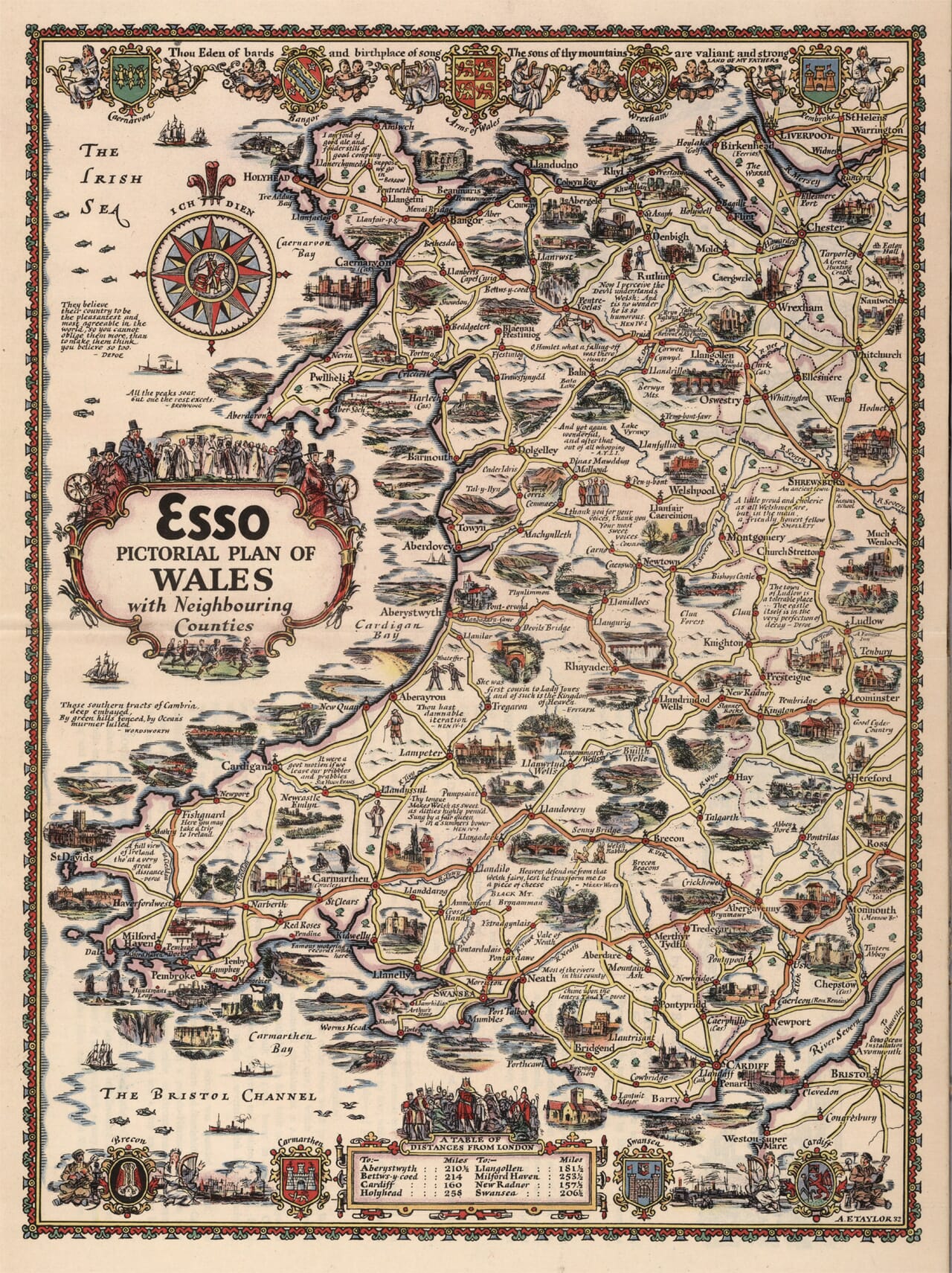
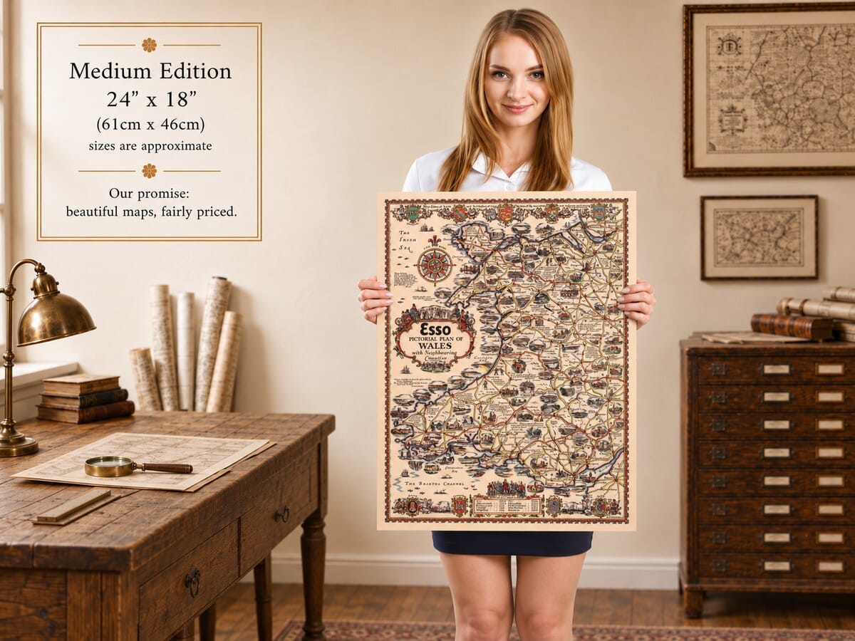
Wales with Neighbouring Counties, by Alfred E. Taylor, from a design dated 1932.
Mountains, castles and coastal towns crowd this decorative Esso map of Wales and the border country. Anglesey and the north coast lead into the mountains around Snowdon, while Cardigan Bay curves south towards Pembrokeshire and the ports of the Bristol Channel. Taylor extends the view eastwards to Chester, Shrewsbury and Hereford, connecting Wales with the roads through its neighbouring counties. Heraldic shields, musicians and literary quotations surround the familiar place names, with a large compass rose set in the Irish Sea. This fine art reproduction combines the appeal of a vintage motoring map with a wealth of regional detail, making it an engaging choice for anyone with Welsh connections or memories of travelling through its varied landscapes.
Size
UK delivery just £4.95 per order · International delivery available.
Unlike most online offerings, our maps are produced entirely in-house, not outsourced to print-on-demand or drop-shipping services. This allows complete control over quality while offering better value. Each map begins with a high-resolution original, carefully enhanced and printed to order using archival papers and pigment inks for exceptional clarity, depth, and longevity. Every piece is personally overseen — no map leaves our workshop unless it is of a quality we would be proud to display ourselves.
Paper choice is essential to the authenticity of our maps. We use specially sourced 190gsm paper made in the UK from pure materials and traditionally pressed with natural woollen felts. This process creates a subtle, randomly textured surface that closely resembles an original antique document. Likewise the use of premium quality ink fully saturates the paper, producing remarkable clarity, depth, and historical character. Colour fastness and sharpness will remain good for in excess of 100 years!
The Old Map Company of Great Britain offers a vast and carefully curated collection of the very finest expertly reproduced vintage maps. Our range includes works by renowned cartographers such as John Speed and Willem Blaeu, covering Scotland, England, and beyond. UK delivery is just £4.95 per order, with EU, USA, and worldwide shipping available at cost and calculated at checkout. If you need assistance, our team is always happy to help you choose the perfect map.
Speedy delivery A beautiful representation
Got there in time and loves it! Cheers David [Gift from US to UK]
Thanks Lauren. We received it today - it's gorgeous! Thank you, Ellan
Thank you for your prompt service. I have a gallery and framing business in South Wales. I'm so pleased it is printed in the UK
My Isles of Scilly map arrived safely and I'm delighted with it!
The print arrived safely and we're delighted with it - a lovely reminder of our honeymoon 15 years ago.
I have just received them! I'm sure our clients will be pleased with them and there could be more projects off the back of this one where we can use more. [Interior Designers]
I just received my map of Ireland by Ewart today and, as usual, I am delighted by its quality. The crispness and fineness of detail is excellent and the colour reproduction surpasses my expectations. Please relay my thanks to Steve for another fine effort!
Many thanks, Lauren. Very pleased with the map and the service: would recommend The Old Map Company to anyone interested in Old Maps.
Many thanks, the map arrived safely this morning, and I’m really pleased with it. A stunning reproduction, just as I had hoped. I will keep browsing your website, and may yet be tempted by more of your items! Have a great weekend.
Just arrived, wonderful map! Thanks very much!
The map – beautiful – arrived safely, very many thanks.
Thank you, I have already found the map. It’s wonderfull! Good luck! Rasa
My apologies for the very late reply. I wanted to reach out to thank you so much for rushing my order. My partner absolutely loved it. I am amazed with the service so that is a five-star from me. I wish you all the best.
Wales occupies the full height of Taylor’s composition, from Anglesey in the north to the Bristol Channel below. Its western shore is open to the Irish Sea, while the eastern edge continues into neighbouring English counties. That wider setting matters: Chester, Shrewsbury and Hereford are part of the road network through which many travellers would approach Wales. The map therefore presents a connected touring region rather than a country isolated within its borders.
The north offers a close arrangement of castles, coastal resorts and mountain routes. Holyhead and the roads across Anglesey lead towards the Menai Strait, with Beaumaris and Bangor nearby. Conwy and Llandudno mark the northern shore, while Caernarfon provides another prominent historical landmark. Inland, Betws y Coed and the country around Snowdon introduce a more rugged landscape. Taylor places recognisable buildings beside mountain sketches, allowing scenery and architecture to share the work of identifying a place.
The western coast continues around the Llŷn peninsula through Pwllheli and Criccieth, then towards Harlech and Barmouth. Farther south, Aberystwyth stands on Cardigan Bay, with Aberaeron and Cardigan continuing the coastal route. Inland roads lead through places such as Machynlleth, Dolgellau and Bala. Lakes and upland names interrupt the chain of settlements, making this central portion feel less densely built than the southern industrial districts. The changing balance of pictures helps convey the country’s regional contrasts.
Pembrokeshire introduces another distinctive coastline. Fishguard, St Davids and Haverfordwest lead the eye around a shore of projecting headlands and sheltered waters. Milford Haven and Pembroke occupy the southwest, while Tenby appears farther east. Taylor includes both ecclesiastical and military landmarks, but he also gives space to small coastal scenes. The effect encourages an unhurried circuit, with individual towns acting as starting points for nearby discoveries rather than merely stops on a single direct route.
Across the south, Carmarthen and Llanelli connect towards Swansea, Neath and Cardiff. The valleys inland are closely threaded with roads and settlements, including Merthyr Tydfil and the towns around the approaches to Newport. Their compact arrangement contrasts sharply with the open mountain country farther north. To the east, Monmouth, Chepstow and the Wye country provide a transition towards the border. Tintern appears among these landmarks, giving an architectural focus to this quieter river landscape.
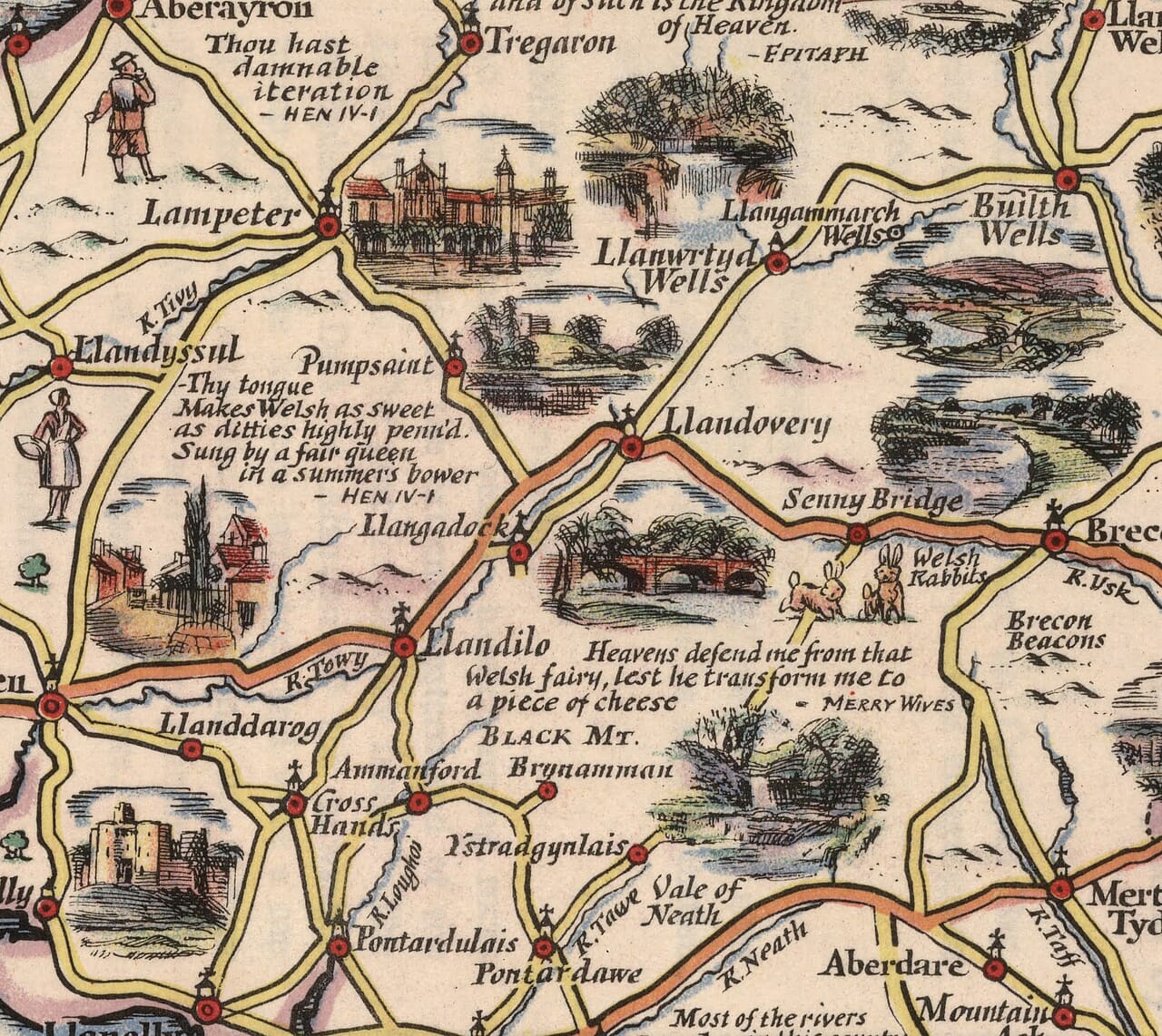
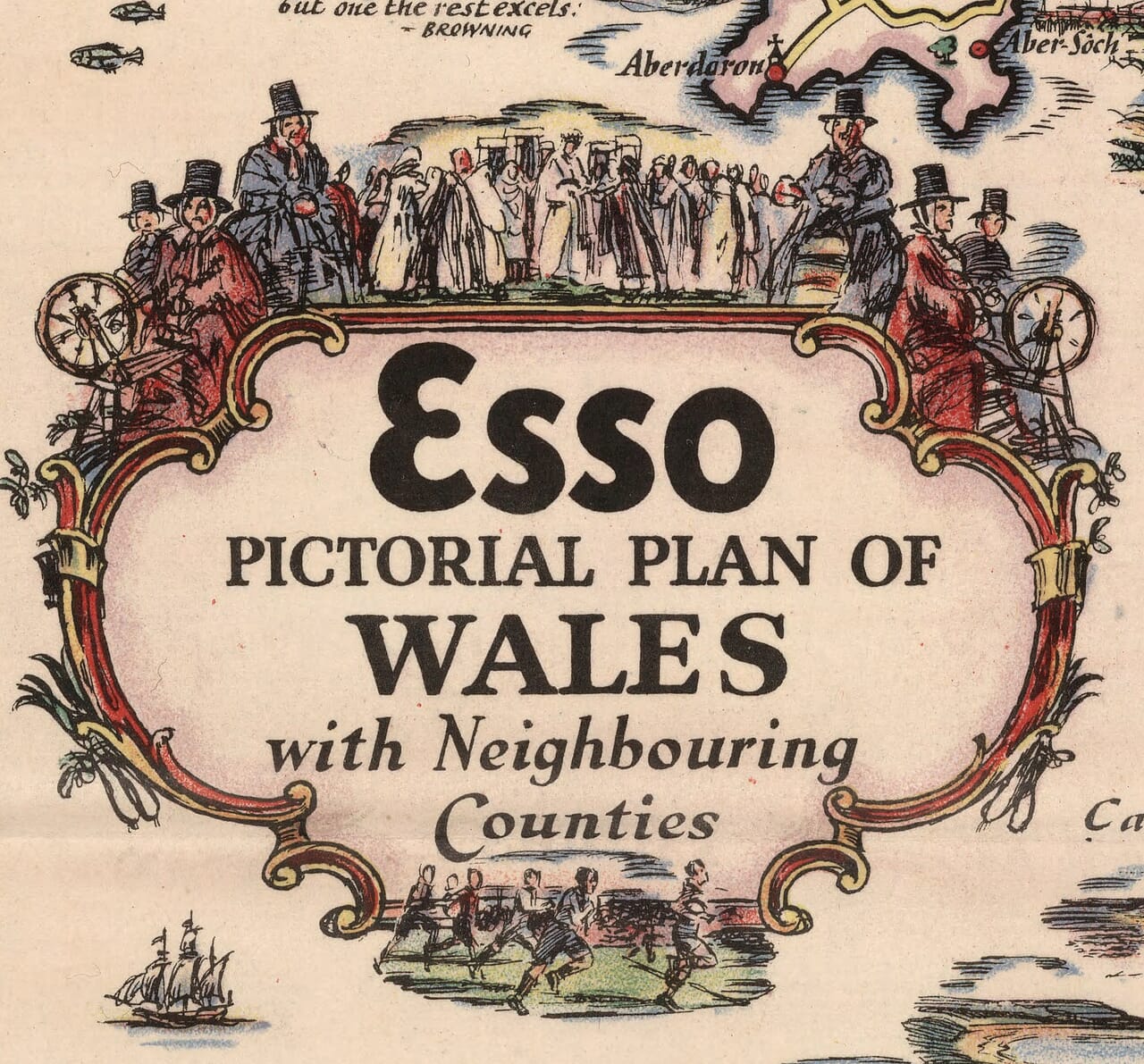
Much of the map’s personality comes from its margins and annotations. Musicians and groups of figures accompany the heraldry, while quotations introduce voices and associations beyond straightforward topography. The title itself acknowledges neighbouring counties, and a distance table keeps the original motoring purpose in view. Yet the illustrations repeatedly encourage the traveller to pause. A castle can dominate a small town; a mountain can become the main feature between two roads. Read slowly, the sheet becomes a conversation between familiar names and less familiar details. It is particularly satisfying to trace a fondly remembered journey and see which places Taylor chose to celebrate, then follow a neighbouring road into another part of Wales that the viewer may still have waiting to discover on a future visit.