
£29.95 – £59.95Price range: £29.95 through £59.95
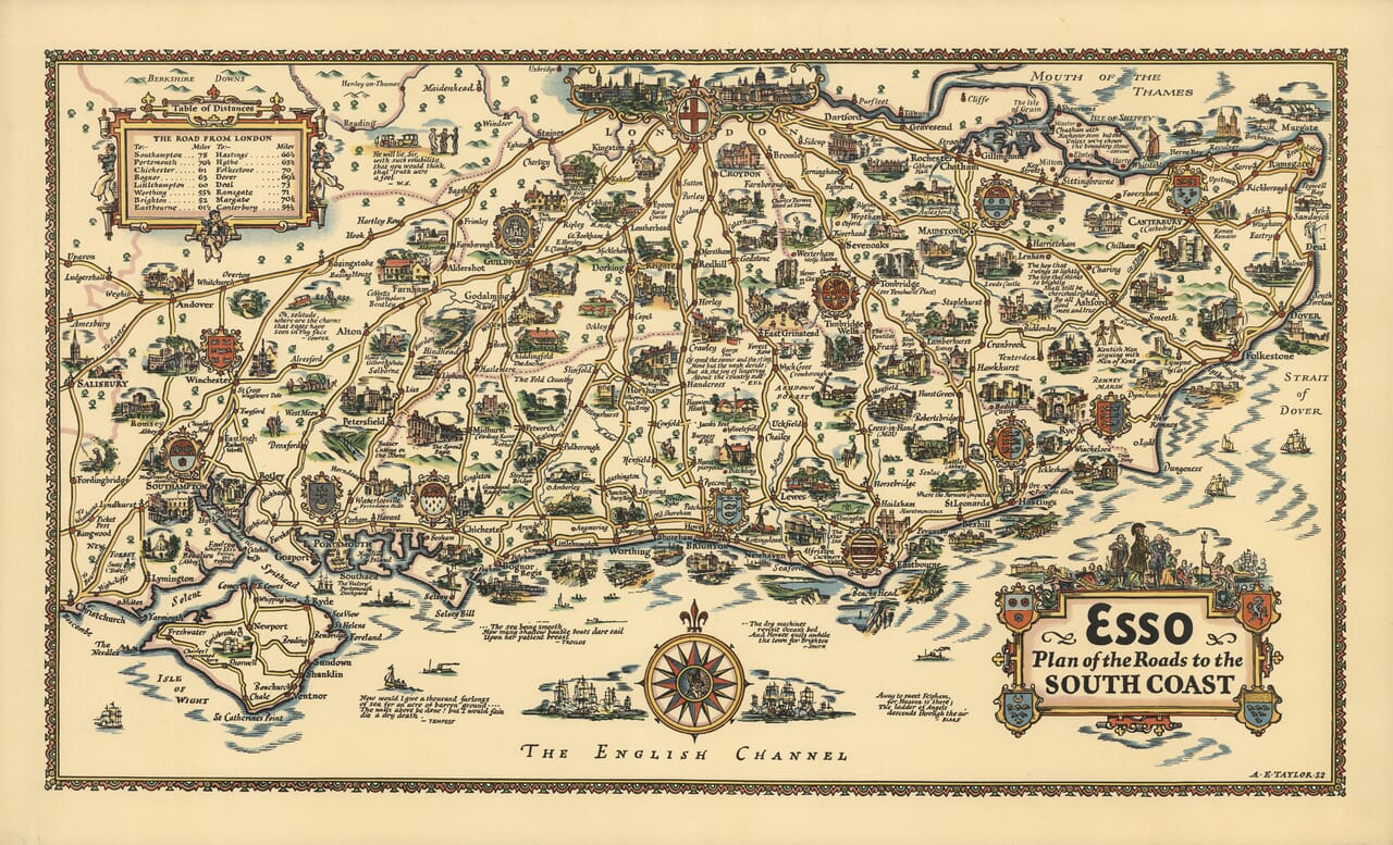
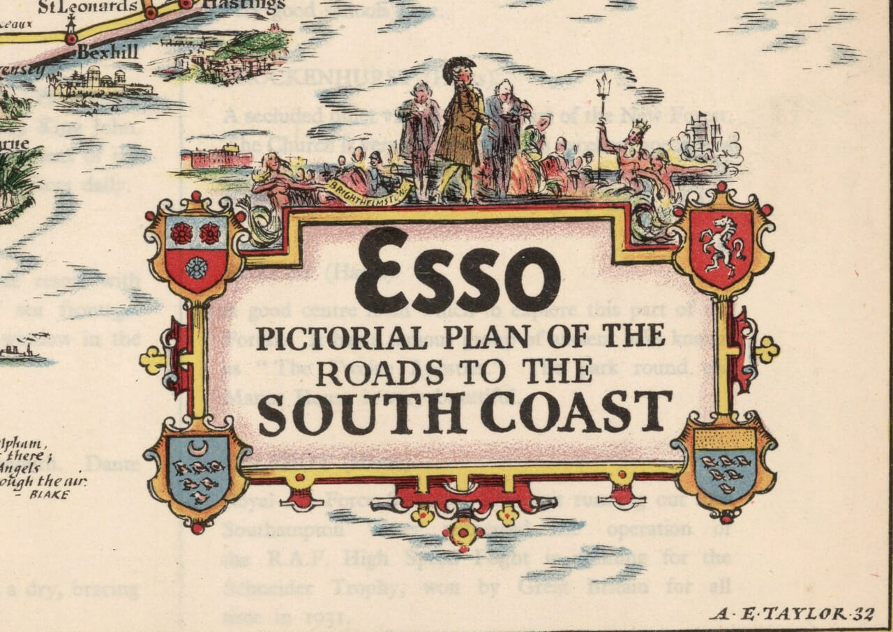
Roads to the South Coast, by Alfred E. Taylor, from a design dated 1932.
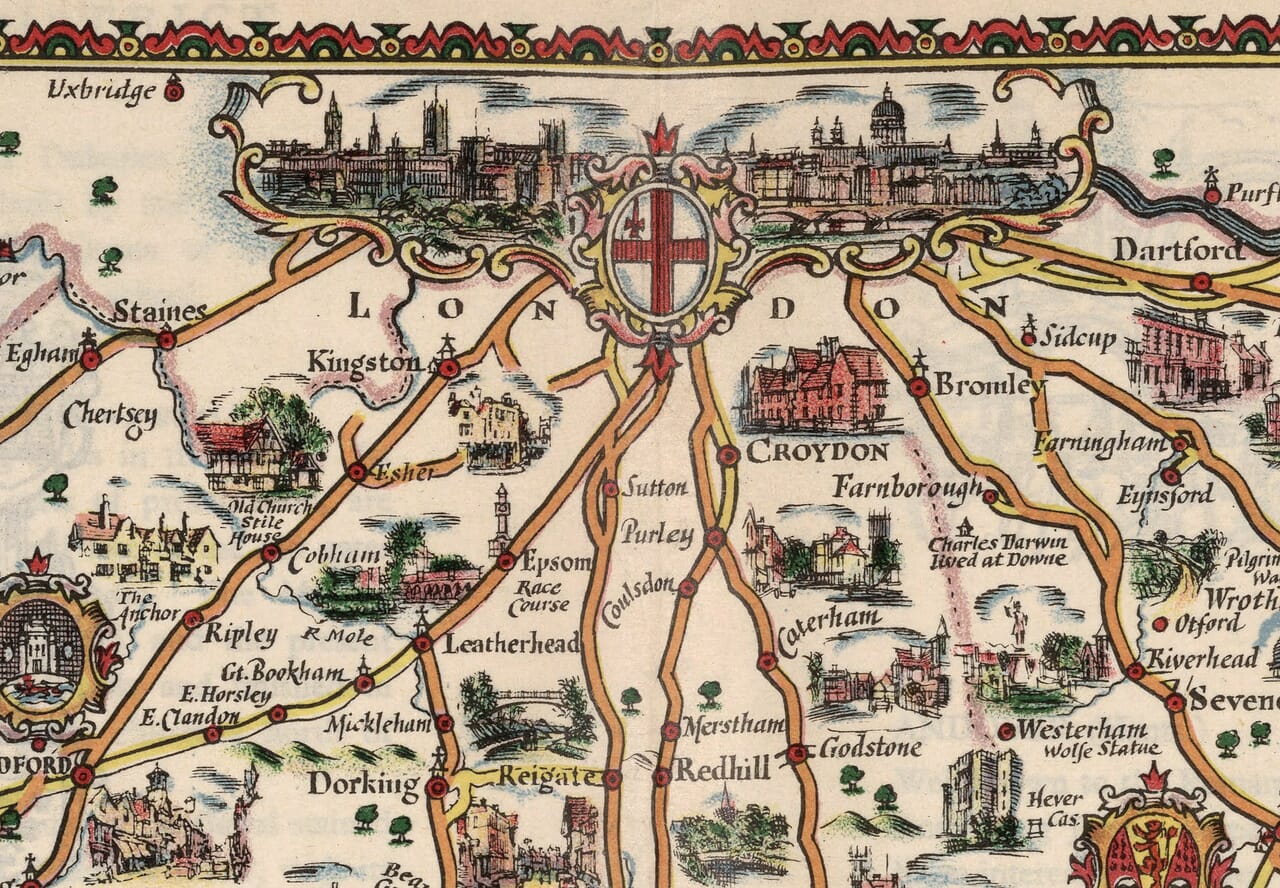
London’s roads lead towards the sea in this colourful Esso map of southern England. From Salisbury and the New Forest to Dover and the Kent coast, Taylor fills the countryside with castles, churches, literary connections and small scenes of local life. Southampton, Portsmouth, Brighton and Eastbourne line the shore, while the Isle of Wight sits prominently across the Solent. Inland, Winchester, Guildford and Canterbury provide further landmarks within the branching routes. Sailing ships and an elaborate compass rose decorate the Channel, balancing the lively detail on land. Reproduced as a fine art print, this is a map for remembering seaside holidays, tracing familiar roads and enjoying the character of southern England before the motorway age.
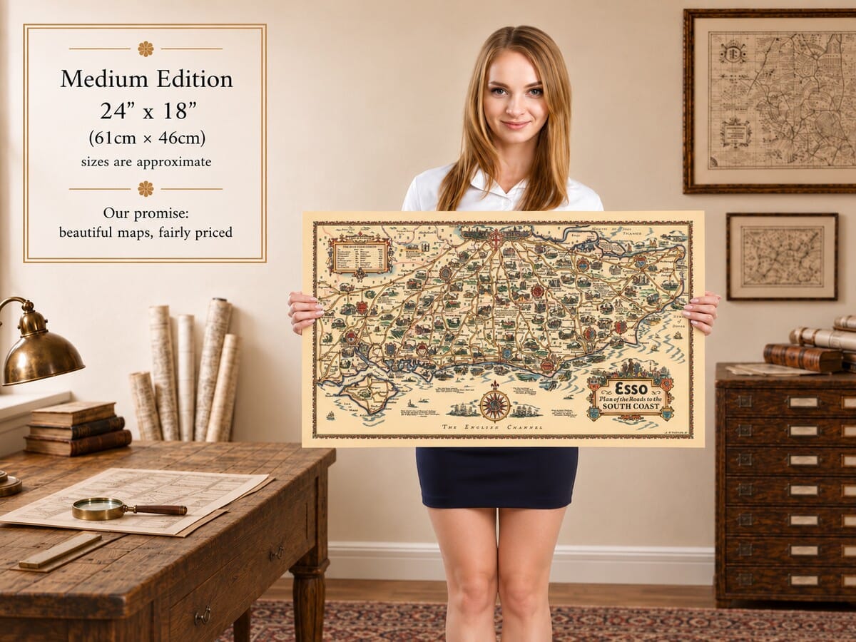
Size
UK delivery just £4.95 per order · International delivery available.
Unlike most online offerings, our maps are produced entirely in-house, not outsourced to print-on-demand or drop-shipping services. This allows complete control over quality while offering better value. Each map begins with a high-resolution original, carefully enhanced and printed to order using archival papers and pigment inks for exceptional clarity, depth, and longevity. Every piece is personally overseen — no map leaves our workshop unless it is of a quality we would be proud to display ourselves.
Paper choice is essential to the authenticity of our maps. We use specially sourced 190gsm paper made in the UK from pure materials and traditionally pressed with natural woollen felts. This process creates a subtle, randomly textured surface that closely resembles an original antique document. Likewise the use of premium quality ink fully saturates the paper, producing remarkable clarity, depth, and historical character. Colour fastness and sharpness will remain good for in excess of 100 years!
The Old Map Company of Great Britain offers a vast and carefully curated collection of the very finest expertly reproduced vintage maps. Our range includes works by renowned cartographers such as John Speed and Willem Blaeu, covering Scotland, England, and beyond. UK delivery is just £4.95 per order, with EU, USA, and worldwide shipping available at cost and calculated at checkout. If you need assistance, our team is always happy to help you choose the perfect map.
Speedy delivery A beautiful representation
Got there in time and loves it! Cheers David [Gift from US to UK]
Thanks Lauren. We received it today - it's gorgeous! Thank you, Ellan
Thank you for your prompt service. I have a gallery and framing business in South Wales. I'm so pleased it is printed in the UK
My Isles of Scilly map arrived safely and I'm delighted with it!
The print arrived safely and we're delighted with it - a lovely reminder of our honeymoon 15 years ago.
I have just received them! I'm sure our clients will be pleased with them and there could be more projects off the back of this one where we can use more. [Interior Designers]
I just received my map of Ireland by Ewart today and, as usual, I am delighted by its quality. The crispness and fineness of detail is excellent and the colour reproduction surpasses my expectations. Please relay my thanks to Steve for another fine effort!
Many thanks, Lauren. Very pleased with the map and the service: would recommend The Old Map Company to anyone interested in Old Maps.
Many thanks, the map arrived safely this morning, and I’m really pleased with it. A stunning reproduction, just as I had hoped. I will keep browsing your website, and may yet be tempted by more of your items! Have a great weekend.
Just arrived, wonderful map! Thanks very much!
The map – beautiful – arrived safely, very many thanks.
Thank you, I have already found the map. It’s wonderfull! Good luck! Rasa
My apologies for the very late reply. I wanted to reach out to thank you so much for rushing my order. My partner absolutely loved it. I am amazed with the service so that is a five-star from me. I wish you all the best.
The organisation of this map reflects its title: roads lead from London towards the South Coast. The capital occupies the upper centre, while the English Channel stretches across the bottom. Salisbury and Christchurch define the western reach, and the Kent coast closes the eastern side. Taylor uses the intervening countryside generously, giving inland towns and villages almost as much visual interest as the seaside destinations that provide the journey’s apparent goal.
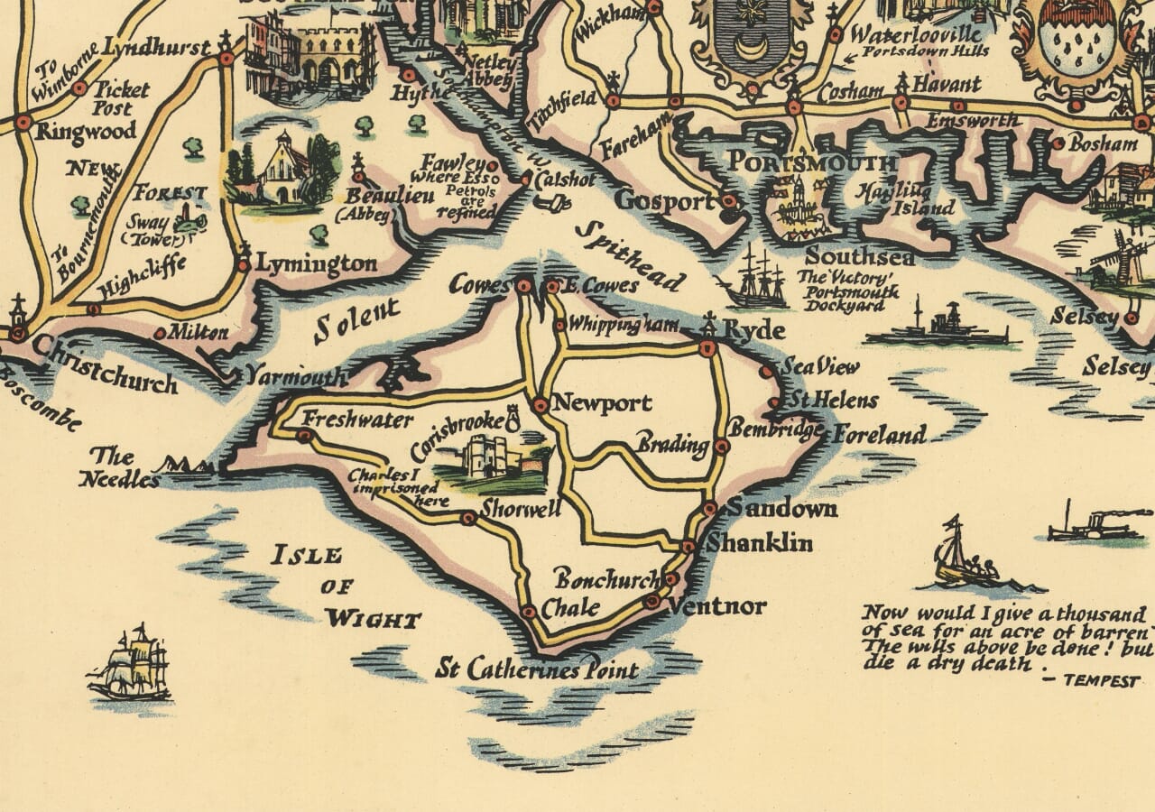
In the west, Salisbury and Winchester offer prominent architectural landmarks before the routes reach Southampton and the New Forest. Lyndhurst, Beaulieu and Lymington appear among the forest roads, with small scenes suggesting a landscape distinct from the more closely settled country farther east. Southampton faces its water, while Portsmouth and Southsea form another maritime focus. The Solent links these mainland places visually with the Isle of Wight, whose outline receives unusually generous space within the composition.
The island can be read almost as a map within the map. Cowes, Newport and Ryde provide principal points of reference, while Sandown, Shanklin and Ventnor follow the eastern and southern shore. The Needles mark the western end, and inland routes connect the coastal settlements. This clear separation by water makes the Isle of Wight immediately recognisable, yet its road network keeps it part of the larger touring landscape rather than simply a decorative offshore shape.
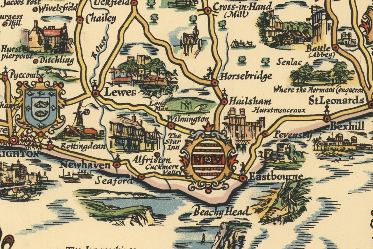
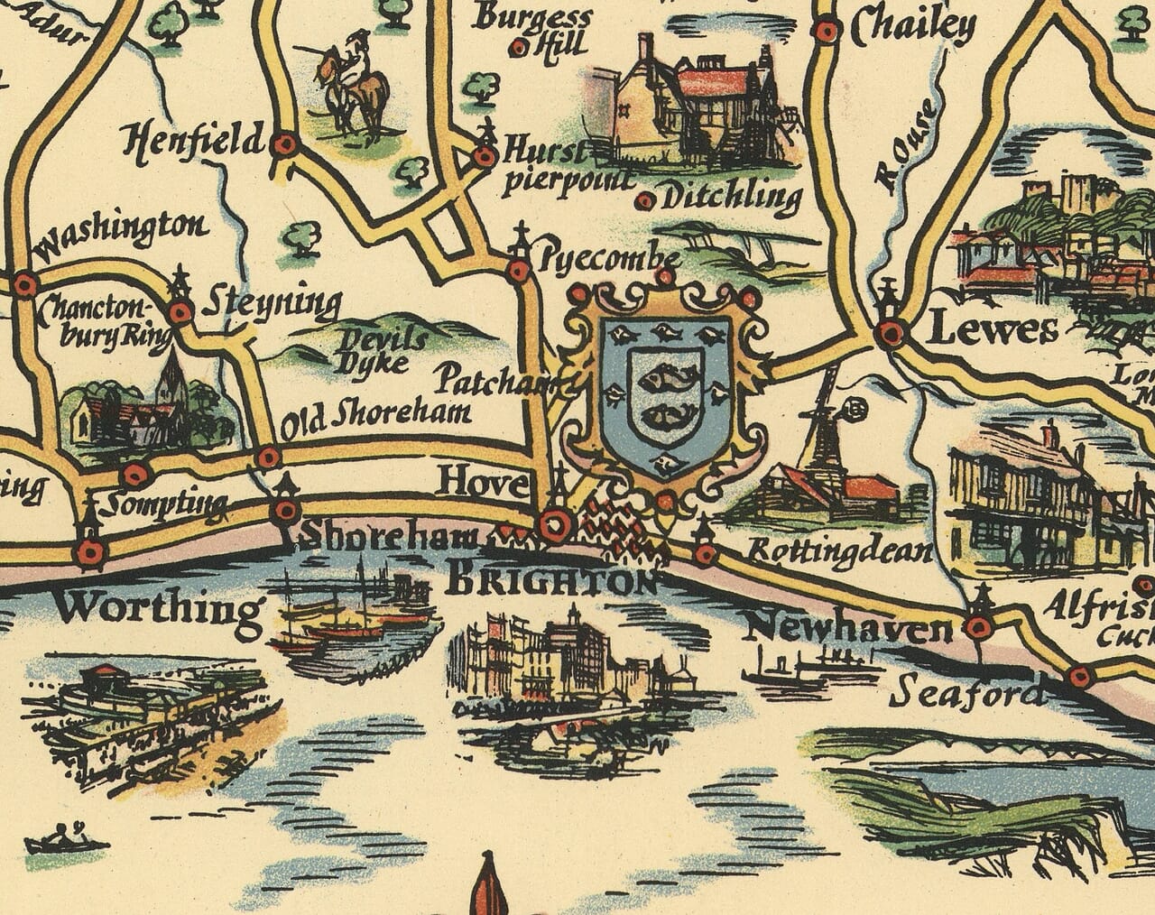
Across Sussex, the coastline moves through Chichester’s neighbourhood towards Bognor Regis, Worthing and Brighton. Inland, Arundel, Midhurst and Petworth create alternative routes through the countryside. Farther east, Lewes stands behind the coast, while Beachy Head is given a strong visual presence near Eastbourne. Hastings, Rye and Winchelsea continue the sequence. The small illustrations constantly change the scale of attention, taking the viewer from a broad coastal journey to a particular building or nearby historical association.
Kent occupies the eastern third of the sheet. Canterbury sits within a network reaching Margate, Ramsgate, Sandwich and Dover, with Folkestone farther along the Channel shore. The Medway towns appear to the north, linked towards the Thames estuary. Between the coasts, Maidstone, Sevenoaks and Tunbridge Wells provide inland centres, while the map identifies castles and country houses among the connecting roads. Romney Marsh has its own distinctive quieter pattern of scattered places beside the southeastern edge.
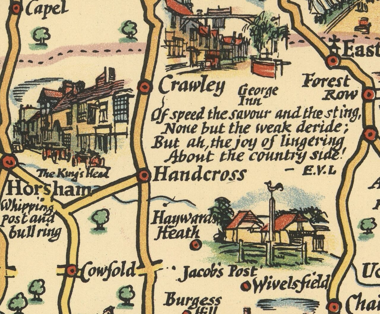
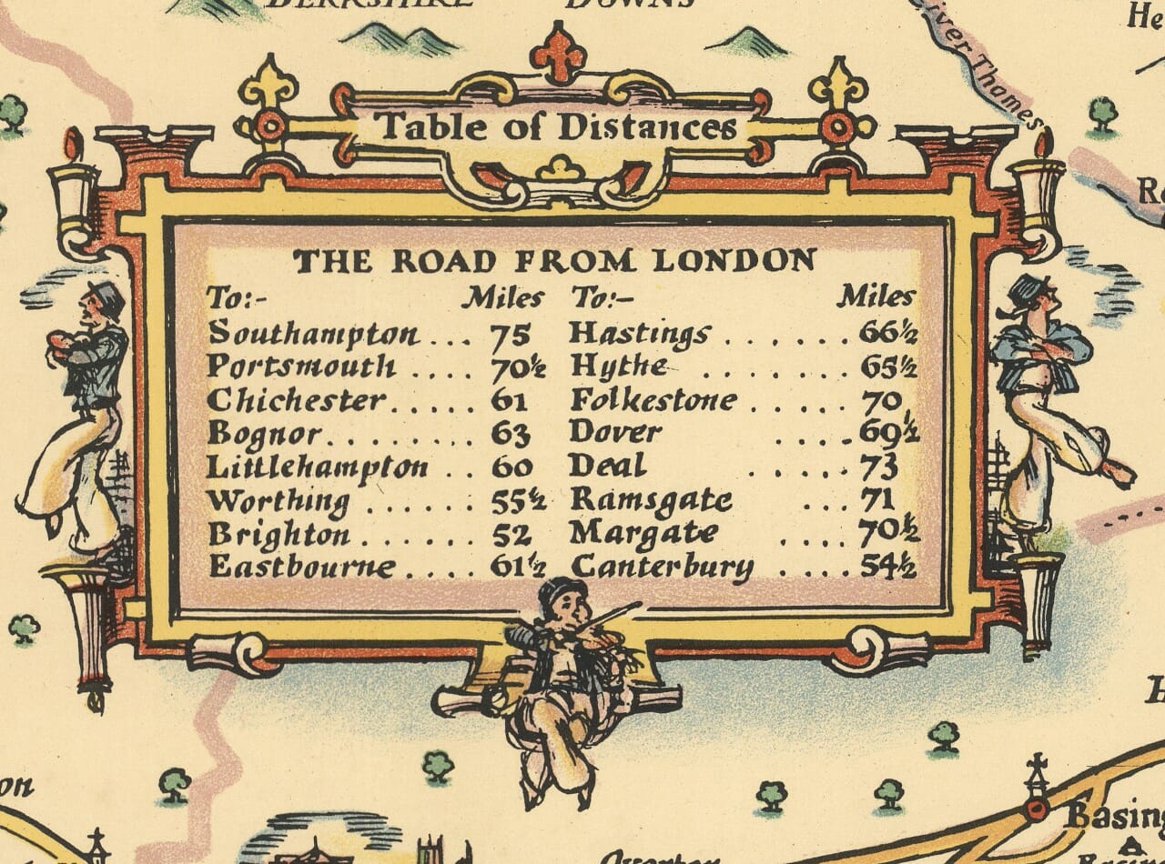
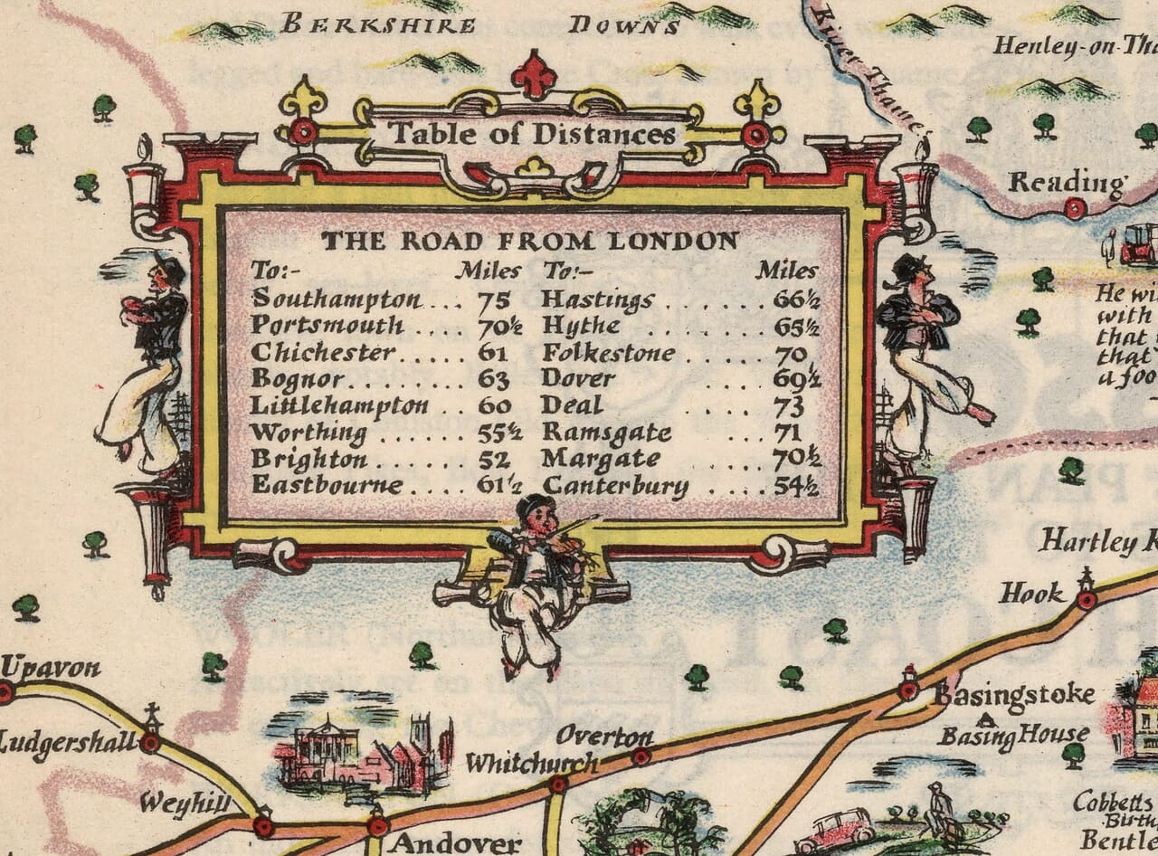
The country between London and the coast is equally rewarding. Guildford, Dorking and Reigate give structure to the Surrey routes, with literary and personal associations scattered nearby. A table of distances from London supplies the practical counterpart to Taylor’s fanciful figures and decorative borders. Sailing vessels fill the Channel, and the large compass rose turns open water into an important part of the design. Together these elements evoke a journey undertaken for pleasure, with time to stop and look. For a viewer today, the pleasure can be more personal: recognising a childhood resort, finding the town where relatives lived, or following a once familiar road through a landscape still recognisable beneath the artist’s playful selection of buildings, characters and stories from the southern counties of England.