Vintage Esso Map of the Eastern Counties and Midlands by Alfred E. Taylor, 1930s pictorial road map
Vintage Esso Map of the Eastern Counties and Midlands by Alfred E. Taylor, 1930s pictorial road map Vintage Esso Map of the Eastern Counties and Midlands — illustrated map detail 1 Vintage Esso Map of the Eastern Counties and Midlands — illustrated map detail 2 Vintage Esso Map of the Eastern Counties and Midlands — illustrated map detail 3 Vintage Esso Map of the Eastern Counties and Midlands — illustrated map detail 4 Esso Eastern Counties Midlands map held by model showing the medium edition print

Vintage Esso Map of the Eastern Counties and Midlands

Price range: £29.95 through £59.95

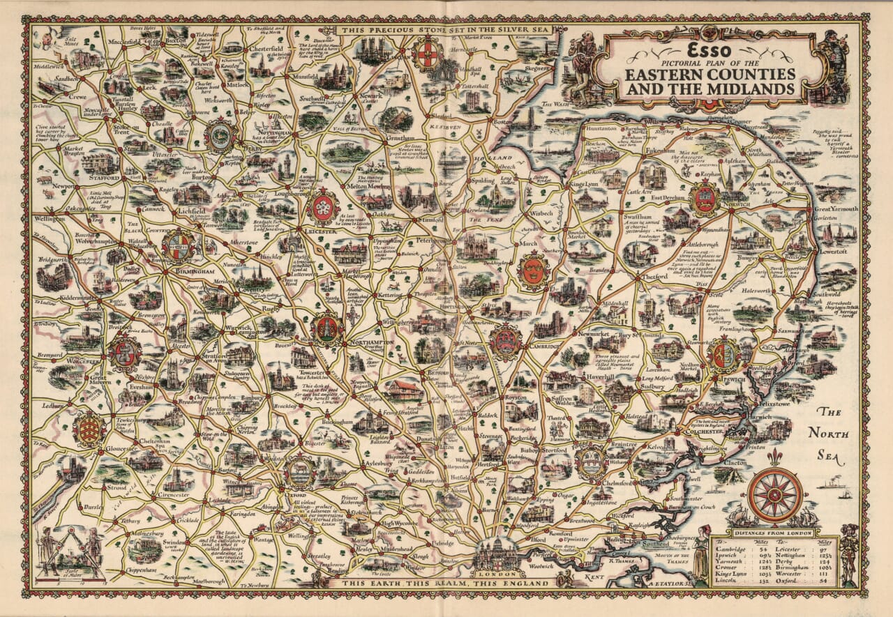
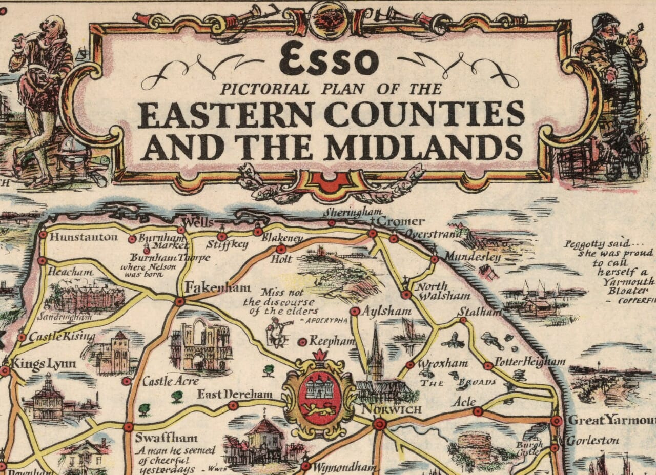
The Eastern Counties and Midlands in pictures, by Alfred E. Taylor, from a design dated 1932.

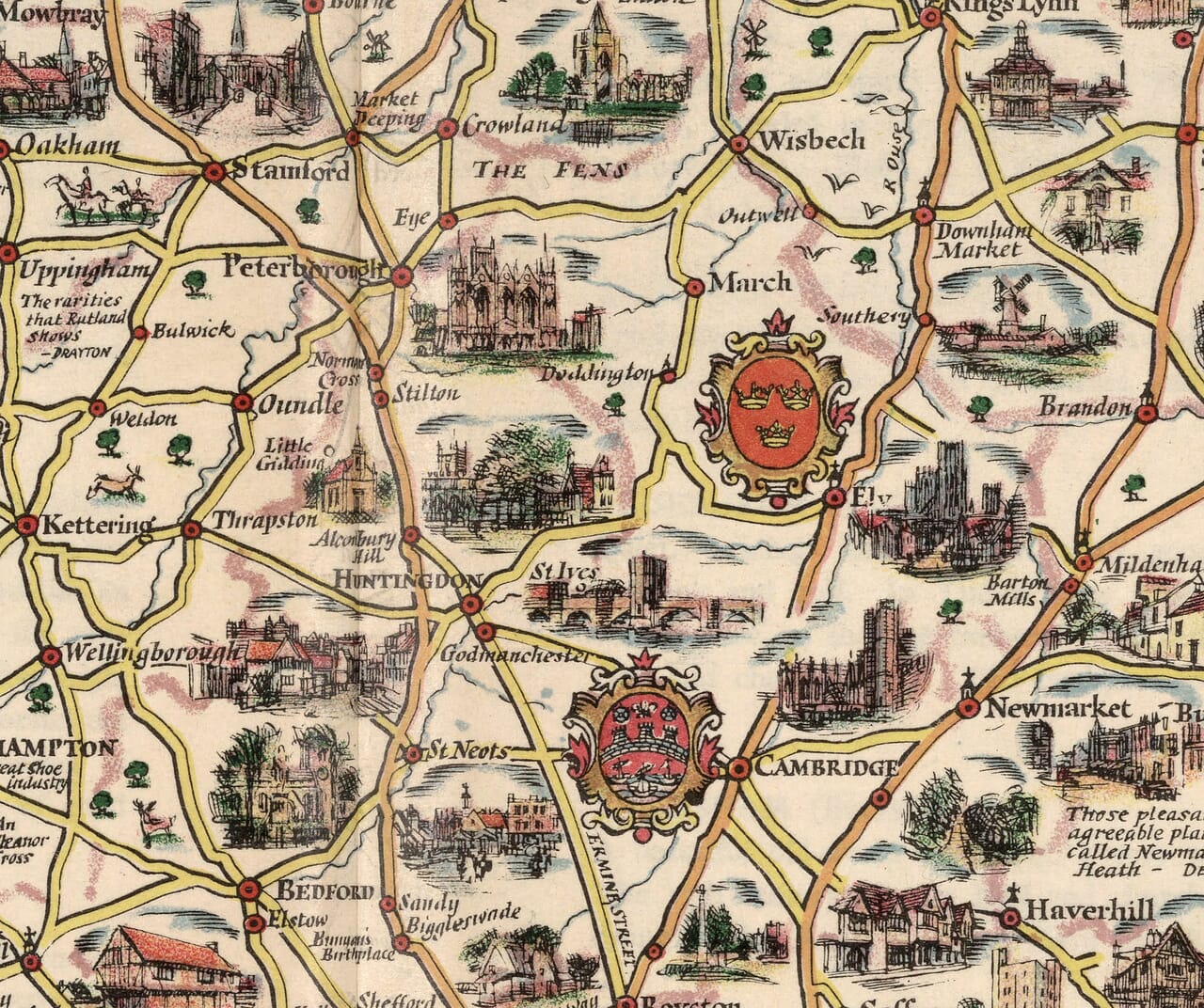
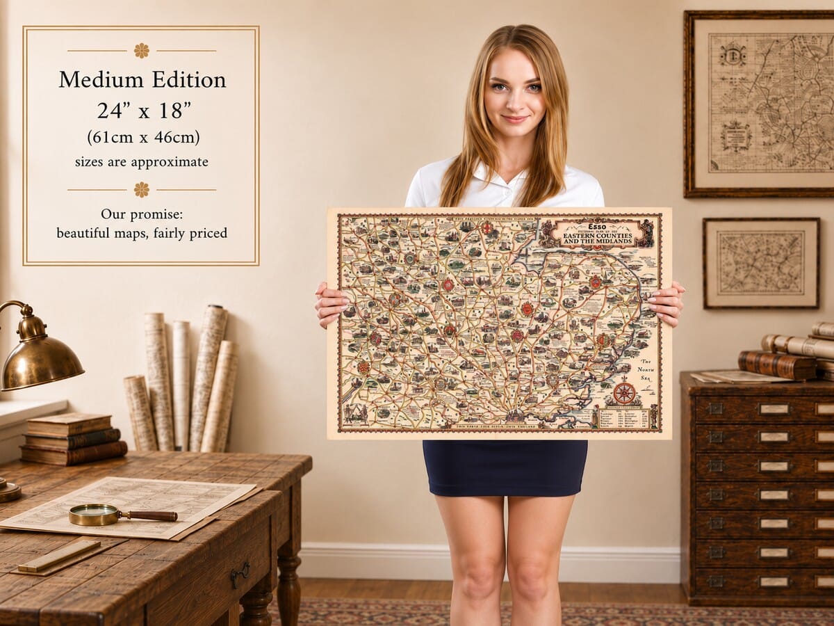
This richly illustrated Esso map brings together the Midlands, East Anglia and the roads north from London. Birmingham and Nottingham share the sheet with Cambridge, Norwich and the coastal towns of Norfolk, Suffolk and Essex. Between them, Taylor draws cathedral towers, country houses, village scenes and reminders of local trades, turning a road map into a collection of miniature stories. Shakespeare’s country, the waterways of the Broads and the broad expanse of the Fens all find their place. An ornamental border, bright heraldic shields and a compass rose complete the design. As a fine art print, it makes an engaging companion for anyone whose interests or family connections stretch across this varied part of England.

+ Read more

Size

Size

UK delivery just £4.95 per order · International delivery available.

Inspecting Mercator's 1623 old map of Great Britain and Ireland

Fine Art Map Reproductions – Museum-Quality Printing

Unlike most online offerings, our maps are produced entirely in-house, not outsourced to print-on-demand or drop-shipping services. This allows complete control over quality while offering better value. Each map begins with a high-resolution original, carefully enhanced and printed to order using archival papers and pigment inks for exceptional clarity, depth, and longevity. Every piece is personally overseen — no map leaves our workshop unless it is of a quality we would be proud to display ourselves.

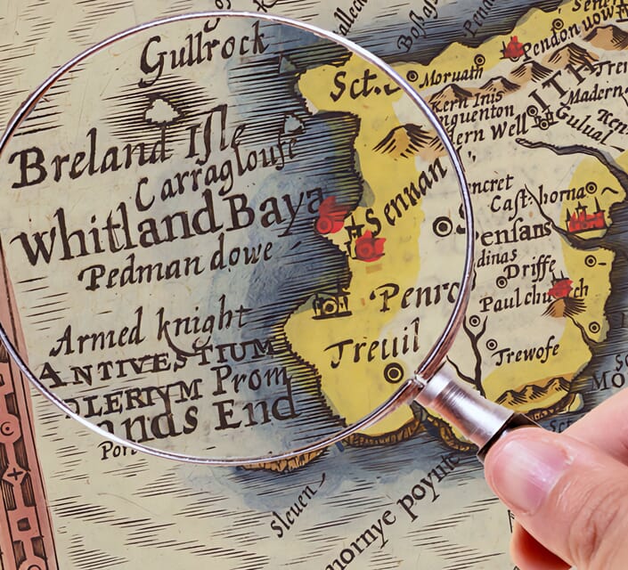
Hand hold a magnifying glass over West Cornwall Map

Authentic Old Map Paper & Accurate Colour Reproduction

Paper choice is essential to the authenticity of our maps. We use specially sourced 190gsm paper made in the UK from pure materials and traditionally pressed with natural woollen felts. This process creates a subtle, randomly textured surface that closely resembles an original antique document. Likewise the use of premium quality ink fully saturates the paper, producing remarkable clarity, depth, and historical character. Colour fastness and sharpness will remain good for in excess of 100 years!

Map in Postal Tube

Buy Old Maps Online in the UK Today Trading online since 1999

The Old Map Company of Great Britain offers a vast and carefully curated collection of the very finest expertly reproduced vintage maps. Our range includes works by renowned cartographers such as John Speed and Willem Blaeu, covering Scotland, England, and beyond. UK delivery is just £4.95 per order, with EU, USA, and worldwide shipping available at cost and calculated at checkout. If you need assistance, our team is always happy to help you choose the perfect map.

RECENT REVIEWS

Daz
DazGB
Verified ownerVerified owner
5/5

Speedy delivery A beautiful representation

4 months ago
David H
David H
Verified ownerVerified owner
5/5

Got there in time and loves it! Cheers David [Gift from US to UK]

6 months ago
Ellan C-S
Ellan C-S
Verified ownerVerified owner
5/5

Thanks Lauren. We received it today - it's gorgeous! Thank you, Ellan

6 months ago
Ivano Di Battista
Ivano Di Battista
Verified ownerVerified owner
5/5

Thank you for your prompt service. I have a gallery and framing business in South Wales. I'm so pleased it is printed in the UK

6 months ago
Robert B
Robert B
Verified ownerVerified owner
5/5

My Isles of Scilly map arrived safely and I'm delighted with it!

7 months ago
Andrew T
Andrew T
Reviewer
5/5

The print arrived safely and we're delighted with it - a lovely reminder of our honeymoon 15 years ago.

7 months ago
Hannah J
Hannah J
Verified ownerVerified owner
5/5

I have just received them! I'm sure our clients will be pleased with them and there could be more projects off the back of this one where we can use more. [Interior Designers]

7 months ago
Sean MacManus
Sean MacManus
Verified ownerVerified owner
5/5

I just received my map of Ireland by Ewart today and, as usual, I am delighted by its quality. The crispness and fineness of detail is excellent and the colour reproduction surpasses my expectations. Please relay my thanks to Steve for another fine effort!

7 months ago
John G
John G
Verified ownerVerified owner
5/5

Many thanks, Lauren. Very pleased with the map and the service: would recommend The Old Map Company to anyone interested in Old Maps.

9 months ago
Lois K
Lois K
Verified ownerVerified owner
5/5

Thrilled , Lauren! Thank You

9 months ago
Ed Simpson
Ed Simpson
Verified ownerVerified owner
5/5

Many thanks, the map arrived safely this morning, and I’m really pleased with it. A stunning reproduction, just as I had hoped. I will keep browsing your website, and may yet be tempted by more of your items! Have a great weekend.

9 months ago
Daniel McCade
Daniel McCade
Verified ownerVerified owner
5/5

Just arrived, wonderful map! Thanks very much!

10 months ago
Jonathon R
Jonathon R
Verified ownerVerified owner
5/5

The map – beautiful – arrived safely, very many thanks.

1 year ago
Rasa Terbetiene
Rasa Terbetiene
Verified ownerVerified owner
5/5

Thank you, I have already found the map. It’s wonderfull! Good luck! Rasa

4 years ago
Mina M.
Mina M.
Verified ownerVerified owner
5/5

My apologies for the very late reply. I wanted to reach out to thank you so much for rushing my order. My partner absolutely loved it. I am amazed with the service so that is a five-star from me. I wish you all the best.

4 years ago

Around the area

The breadth of this map is apparent. London occupies the lower edge, while the upper border reaches the Peak District and Lincolnshire coast. Across its width, the industrial Midlands give way to the Fens and the North Sea. Taylor joins these different landscapes with a conspicuous road network, but the little pictures between the roads make clear that this is also a map of places worth noticing along the way.

On the western side, Birmingham sits among the closely connected towns of the Black Country. Wolverhampton, Walsall and Dudley appear within a compact area, while Stoke and the Potteries occupy the northwest. Taylor allows workshops, buildings and local references to sit beside more conventional visitor attractions. This gives the region a broader identity than a procession of picturesque villages: work, manufacture and commerce are part of its character, alongside old churches and surviving castles.

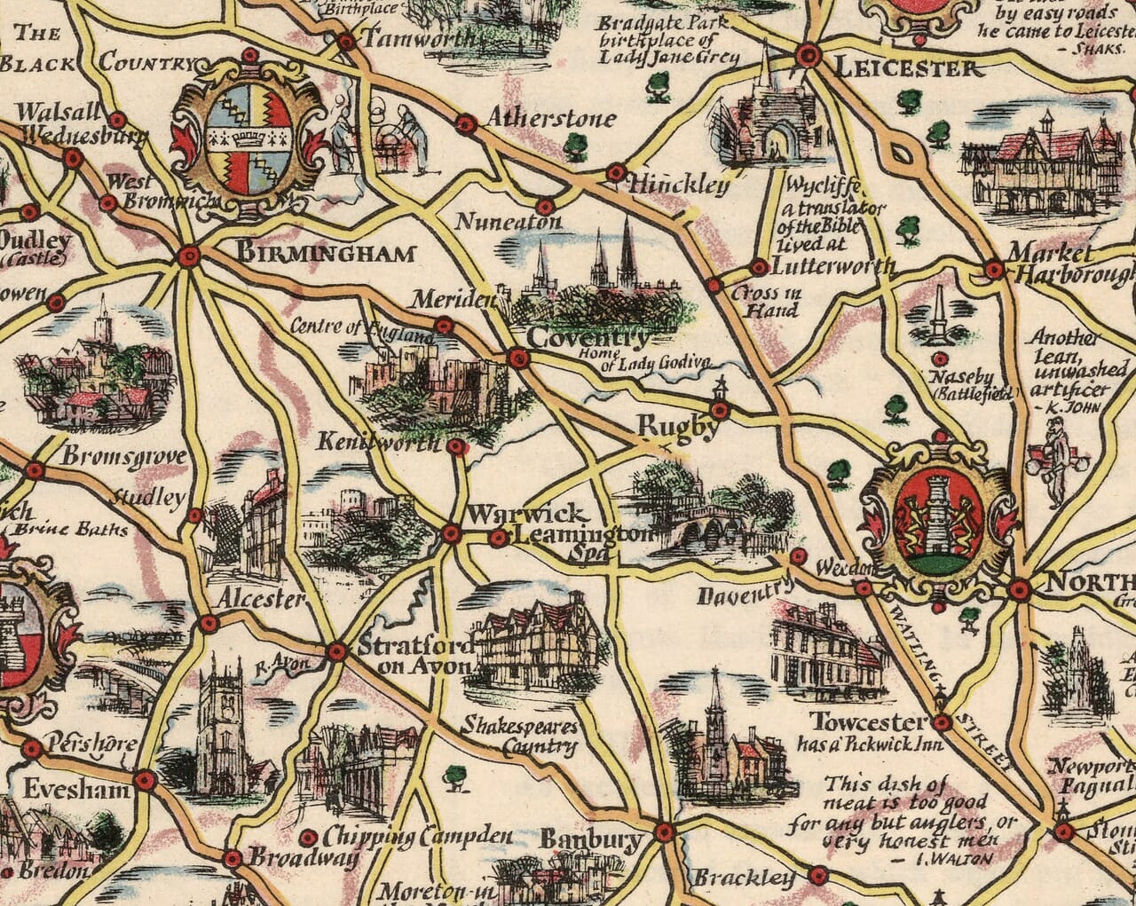
Southwards, Warwick, Kenilworth and Stratford upon Avon lead into an altogether different set of associations. Shakespeare’s country is explicitly identified, and the roads continue towards the Cotswold towns and Oxford. The map places literary memory alongside architecture, encouraging the traveller to connect a name with a person or story. Banbury, Chipping Norton and Stow on the Wold provide smaller points of recognition between the larger centres, keeping the countryside present within the busy design.

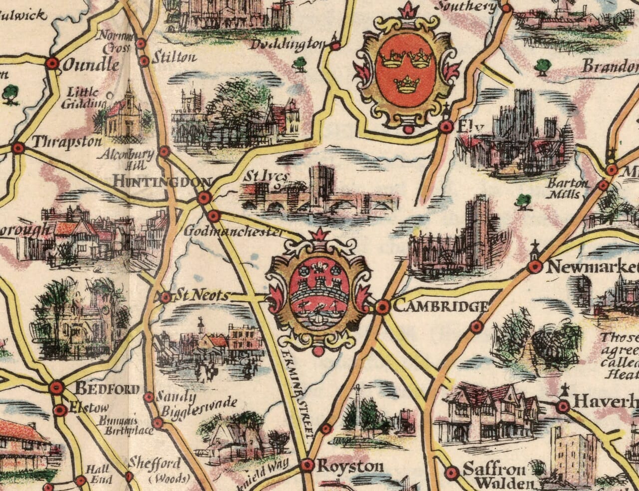
Towards the middle of the sheet, Northampton, Bedford and Peterborough mark routes into the eastern counties. Ely’s cathedral rises prominently from the surrounding landscape, while Cambridge appears beneath its own heraldic decoration. The Fens are given a recognisable expanse around places such as Wisbech and March. Here the relative openness contrasts with the crowded western towns. Rivers, settlements and roads create a different pattern, reflecting a country of low horizons rather than upland scenery.

Norfolk occupies much of the upper right. Norwich stands at the centre of converging routes, with the Broads illustrated towards Wroxham and the coast. Cromer, Sheringham and Great Yarmouth suggest seaside journeys, while inland towns such as Aylsham and East Dereham retain their place in the network. Suffolk continues the theme southwards through Bury St Edmunds, Lavenham and Ipswich. Along the shore, Southwold, Aldeburgh and Orford provide a sequence of smaller coastal destinations.

Essex brings the journey back towards London through Colchester and Chelmsford, with Harwich and the Thames estuary emphasising the region’s maritime edge. Throughout the composition, quotations and local anecdotes interrupt the practical business of finding a route. A table of distances from London supplies useful context, yet the drawings repeatedly tempt the eye away from direct travel. The pleasure lies in those diversions: a cathedral beside a market town, an unexpected literary reference, or a tiny scene recalling a local industry. Even the large geographical sweep remains approachable because Taylor breaks it into recognisable episodes. For someone with connections across several counties, this is a map to return to repeatedly, finding a familiar name first and then discovering the surrounding places that give it a wider setting within the landscape of eastern and central England.