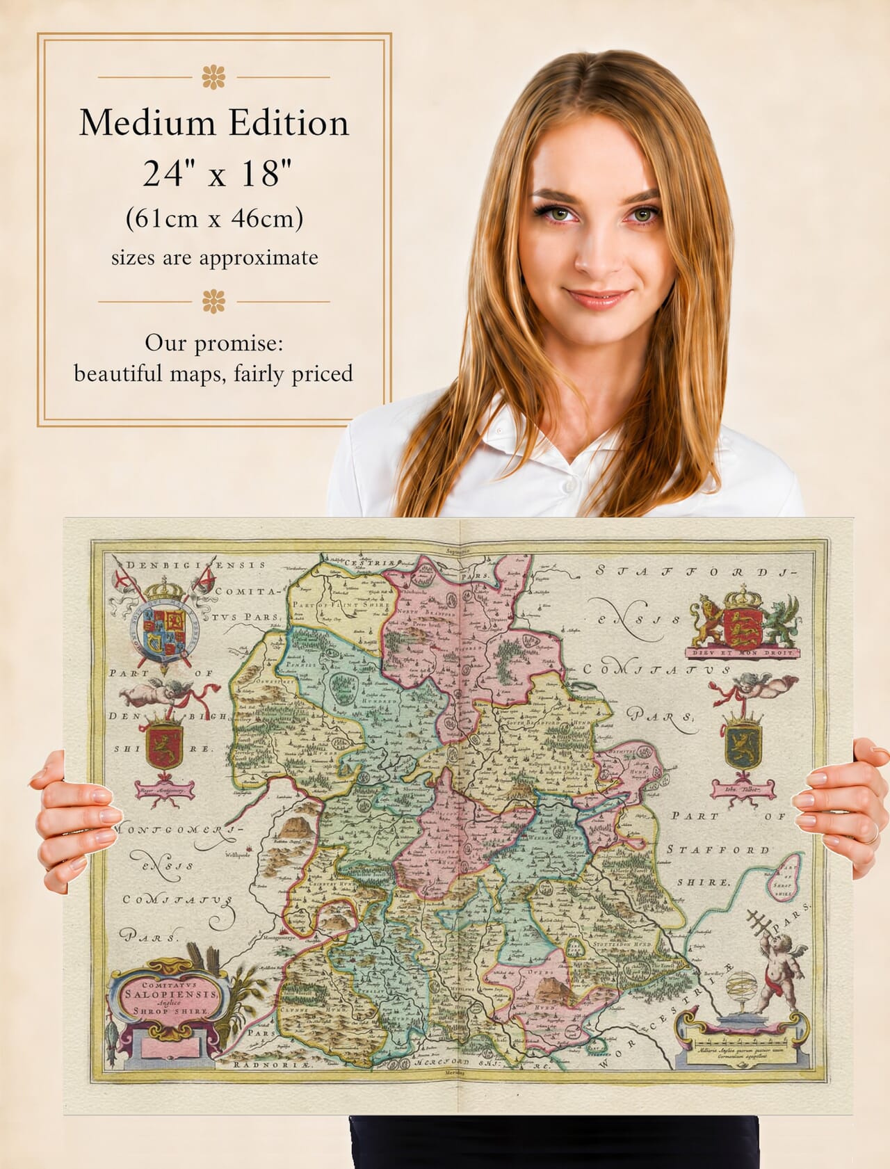
Joan Blaeu’s Map of Shropshire: Comitatus Salopiensis
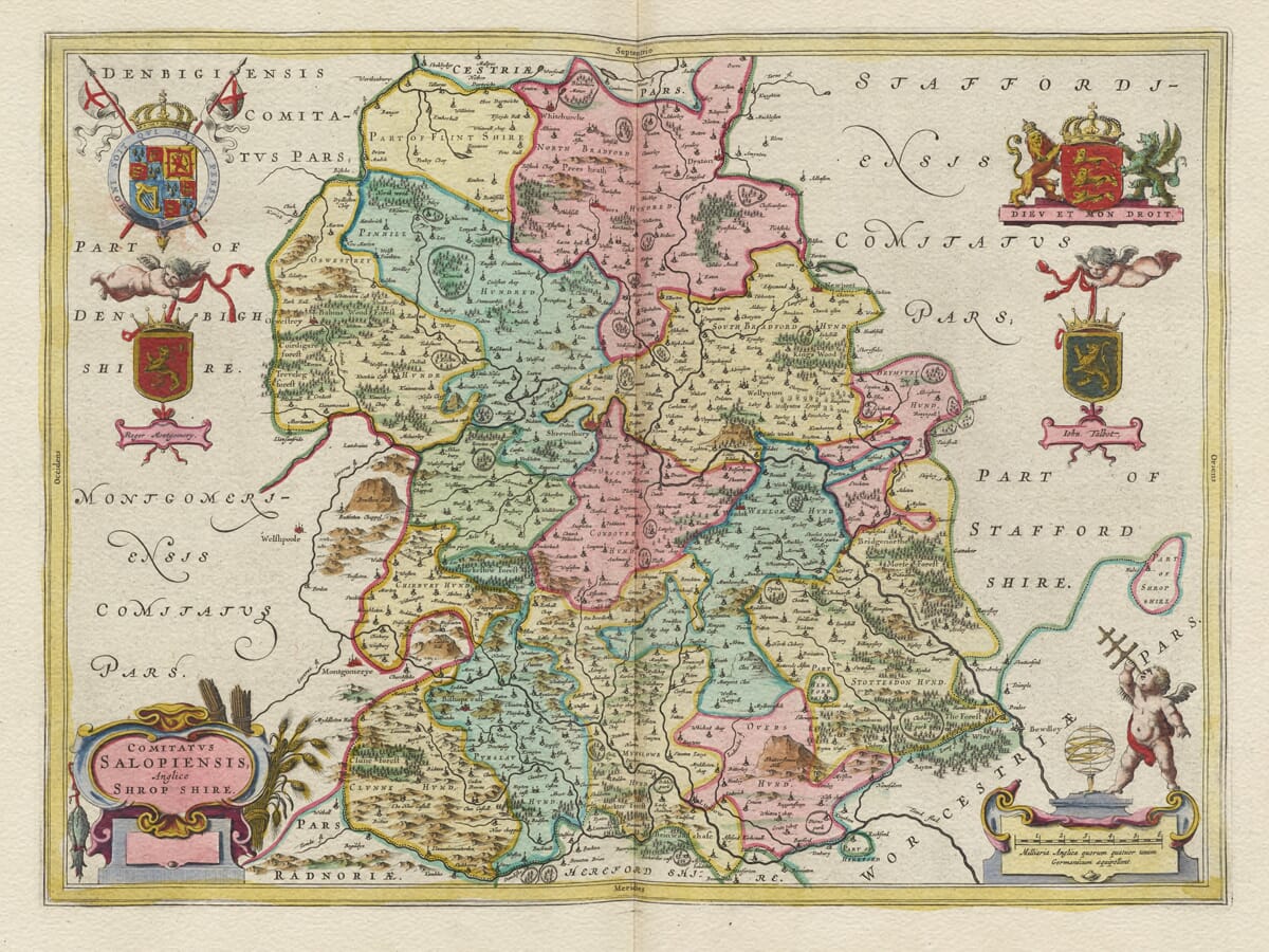
Joan Blaeu’s map of Shropshire was first published in Amsterdam in 1645 as part of the fourth volume of his Theatrum Orbis Terrarum, sive Atlas Novus. This volume presented an extensive collection of English and Welsh county maps to the international audience for Blaeu’s prestigious atlases.
The engraved title, Comitatus Salopiensis, Anglice Shrop Shire, may be understood as “The County of Salop, in English Shrop Shire.” Salop was a long-established alternative name for Shropshire, while Salopiensis was its Latinised form.
Although the existing product description attributes the map to William Blaeu, William died in 1638. The Shropshire plate was produced and published while his son Joan Blaeu was directing the family business and should be attributed to Joan.
From the Welsh Border to the Severn Valley
Shropshire’s position on the boundary between England and Wales is central to its history. For centuries, this was a frontier landscape of castles, fortified settlements, market towns and estates. The county formed part of the Welsh Marches, where powerful medieval lords had exercised exceptional authority.
Blaeu’s map records Shrewsbury in a prominent position within a great loop of the River Severn. The county town had long served as an administrative centre, market and gateway for trade between England and Wales. Its castle, abbey, churches and medieval streets reflected centuries of political and commercial importance.
The Severn provides one of the map’s strongest geographical features. It enters the county from Wales, passes through Shrewsbury and continues southeast towards Bridgnorth. Tributaries and smaller waterways connect a dense pattern of villages and rural communities.
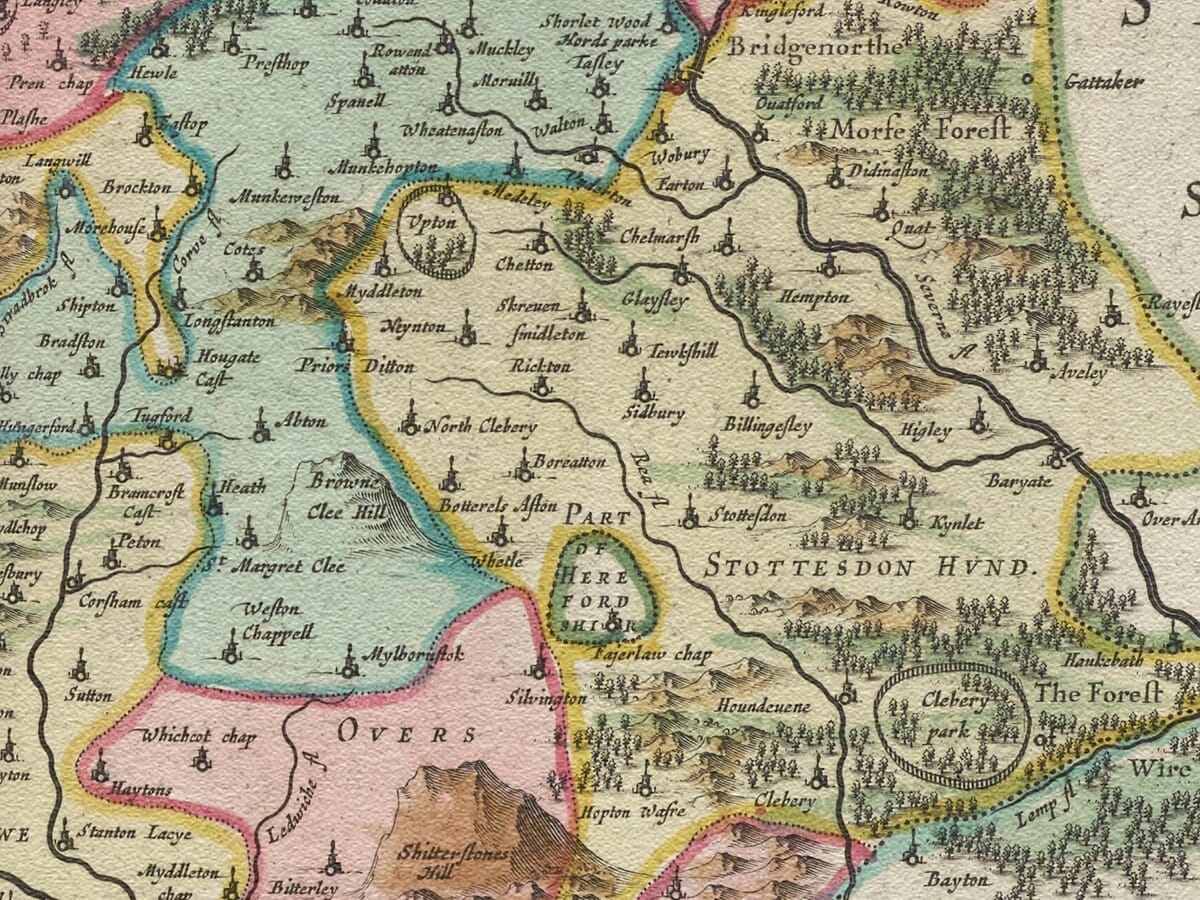
Other recognisable towns include Oswestry and Whitchurch in the north, Market Drayton and Newport towards the east, Much Wenlock and Bridgnorth beside the Severn, and Ludlow in the south. Historic spellings often differ from their modern forms, making the engraving particularly engaging for local and family-history research.
A County of Contrasting Landscapes
The geography of Shropshire changes considerably from north to south. The northern part of the county contains lower agricultural country, while the south and southwest are characterised by hills, valleys and higher ground extending towards Wales.
Blaeu represents this varied terrain through pictorial hill symbols and groups of individually engraved trees. Features associated with the Shropshire Hills, including the Long Mynd, the Clee Hills and the higher border country, are suggested artistically rather than measured through contours.
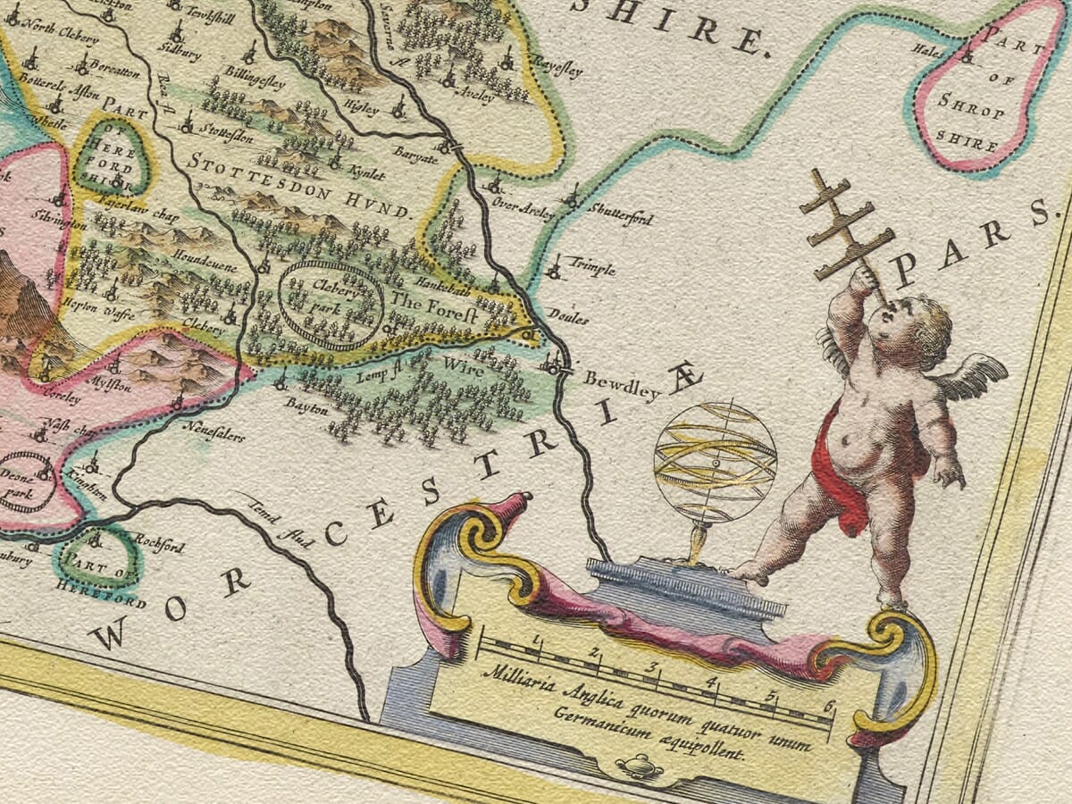
Forests and enclosed estates are also marked, demonstrating that the map was intended to communicate more than the position of towns alone. Nevertheless, it should not be interpreted as a modern survey. Roads are not systematically recorded, distances are approximate and the size of a settlement symbol may reflect perceived importance rather than its physical extent.
The landscape shown predates the industrial development for which parts of Shropshire later became internationally famous. Coalbrookdale, the Iron Bridge and the industrial settlements around the modern town of Telford belong principally to later centuries. Blaeu instead presents a predominantly agricultural county of estates, market towns and long-established villages.
Shropshire During the Civil War
The year of publication gives the map an especially significant historical setting. Shropshire initially became an important Royalist county during the First English Civil War. King Charles I visited Shrewsbury in 1642, and its castle became a centre of Royalist operations.
On 22 February 1645, the same year in which Blaeu’s map appeared, Parliamentarian forces captured Shrewsbury. The change of control weakened the Royalist position in the region and gave Parliament an important base close to the Welsh border.
Other Shropshire strongholds remained contested. Shrawardine Castle was besieged and surrendered to Parliamentarian forces in 1645, while Ludlow and Bridgnorth remained under Royalist control until 1646.
Blaeu’s map does not record these campaigns. It was created as a county map for an atlas rather than as a military document. Its towns, castles and river crossings nevertheless acquired immediate strategic importance during the conflict, giving the apparently peaceful engraving a compelling relationship with the events of its publication year.
The Blaeu Workshop and Earlier Surveys
Joan Blaeu did not undertake a fresh survey of Shropshire. The geography of his English county maps was based largely upon the earlier mapping traditions established by Christopher Saxton and John Speed.
The Amsterdam workshop refined and re-engraved this inherited information, combining it with clear typography, pictorial landscape symbols and lavish ornament. The map subsequently appeared in further editions and was eventually incorporated into Blaeu’s monumental Atlas Maior during the 1660s. Surviving originals may therefore carry Latin, French, Dutch, German or Spanish text on the reverse.
Heraldry and Decorative Cartography
The title appears within an elaborate cartouche, while royal heraldry and additional armorial shields give the composition a ceremonial character. Among the historic arms associated with the map are those of Roger de Montgomery and John Talbot, prominent holders of the title Earl of Shrewsbury in the medieval period.
These heraldic devices link the county’s geography with its history of lordship, landownership and defence. They also made the map more attractive to the prosperous European collectors for whom Blaeu’s atlases were produced.
Printed from an engraved copperplate, the map combines exceptionally fine linework with carefully arranged ornament. Colour was applied separately to selected impressions, so surviving originals vary according to their edition and later treatment.
Blaeu’s map preserves a fascinating portrait of Shropshire before industrialisation, railways and modern urban development transformed parts of the county. It remains both an important historical record and an outstanding example of decorative seventeenth-century cartography.





 Verified owner