



Old Seville Map
Old Seville Map Old Seville Map Detail Seville Map

Old Map of Seville

Price range: £35.55 through £59.95

Old Map of Seville by Braun and Hogenberg, 1588

This detailed bird’s-eye view presents sixteenth-century Seville beside the River Guadalquivir, with its walls, cathedral, Giralda, busy waterfront and the neighbouring district of Triana. Ships fill the river below a city whose prosperity depended upon maritime trade with Spain’s expanding overseas empire.
+ read more

A stunning certified FINE ART PRINT on heavy textured art paper — not a poster

  • Direct from the publisher — no middlemen
  • Printed in-house in Cornwall
  • Free UK delivery — international shipping available
  • Produced to meet — and often exceed — museum-quality standards

SELECT SIZE

Inspecting Vintage Map Reproduction

Fine Art Map Reproductions – Museum-Quality Printing

Unlike most online offerings, our maps are produced entirely in-house, not outsourced to print-on-demand or drop-shipping services. This allows complete control over quality while offering better value. Each map begins with a high-resolution original, carefully enhanced and printed to order using archival papers and pigment inks for exceptional clarity, depth, and longevity. Every piece is personally overseen — no map leaves our workshop unless it is of a quality we would be proud to display ourselves.

Hand hold a magnifying glass over West Cornwall Map

Authentic Old Map Paper & Accurate Colour Reproduction

Paper choice is essential to the authenticity of our maps. We use specially sourced 190gsm paper made in the UK from pure materials and traditionally pressed with natural woollen felts. This process creates a subtle, randomly textured surface that closely resembles an original antique document. Likewise the use of premium quality ink fully saturates the paper, producing remarkable clarity, depth, and historical character. Colour fastness and sharpness will remain good for in excess of 100 years!

Map in Postal Tube
Buy Old Maps Online in the UK Today Trading online since 1999

The Old Map Company of Great Britain offers a vast and carefully curated collection of the very finest expertly reproduced vintage maps. Our range includes works by renowned cartographers such as John Speed and Willem Blaeu, covering Scotland, England, and beyond. Free UK courier delivery is included, with EU, USA, and worldwide shipping available at cost and calculated at checkout. If you need assistance, our team is always happy to help you choose the perfect map.

RECENT REVIEWS

Daz
DazGB
Verified ownerVerified owner
5/5

Speedy delivery A beautiful representation

2 months ago
David H
David H
Verified ownerVerified owner
5/5

Got there in time and loves it! Cheers David [Gift from US to UK]

4 months ago
Ellan C-S
Ellan C-S
Verified ownerVerified owner
5/5

Thanks Lauren. We received it today - it's gorgeous! Thank you, Ellan

4 months ago
Ivano Di Battista
Ivano Di Battista
Verified ownerVerified owner
5/5

Thank you for your prompt service. I have a gallery and framing business in South Wales. I'm so pleased it is printed in the UK

5 months ago
Robert B
Robert B
Verified ownerVerified owner
5/5

My Isles of Scilly map arrived safely and I'm delighted with it!

5 months ago
Andrew T
Andrew T
Reviewer
5/5

The print arrived safely and we're delighted with it - a lovely reminder of our honeymoon 15 years ago.

5 months ago
Hannah J
Hannah J
Verified ownerVerified owner
5/5

I have just received them! I'm sure our clients will be pleased with them and there could be more projects off the back of this one where we can use more. [Interior Designers]

5 months ago
Sean MacManus
Sean MacManus
Verified ownerVerified owner
5/5

I just received my map of Ireland by Ewart today and, as usual, I am delighted by its quality. The crispness and fineness of detail is excellent and the colour reproduction surpasses my expectations. Please relay my thanks to Steve for another fine effort!

6 months ago
John G
John G
Verified ownerVerified owner
5/5

Many thanks, Lauren. Very pleased with the map and the service: would recommend The Old Map Company to anyone interested in Old Maps.

8 months ago
Lois K
Lois K
Verified ownerVerified owner
5/5

Thrilled , Lauren! Thank You

8 months ago
Ed Simpson
Ed Simpson
Verified ownerVerified owner
5/5

Many thanks, the map arrived safely this morning, and I’m really pleased with it. A stunning reproduction, just as I had hoped. I will keep browsing your website, and may yet be tempted by more of your items! Have a great weekend.

8 months ago
Daniel McCade
Daniel McCade
Verified ownerVerified owner
5/5

Just arrived, wonderful map! Thanks very much!

9 months ago
Jonathon R
Jonathon R
Verified ownerVerified owner
5/5

The map – beautiful – arrived safely, very many thanks.

1 year ago
Rasa Terbetiene
Rasa Terbetiene
Verified ownerVerified owner
5/5

Thank you, I have already found the map. It’s wonderfull! Good luck! Rasa

4 years ago
Mina M.
Mina M.
Verified ownerVerified owner
5/5

My apologies for the very late reply. I wanted to reach out to thank you so much for rushing my order. My partner absolutely loved it. I am amazed with the service so that is a five-star from me. I wish you all the best.


4 years ago

Historical Background

This old map of Seville was published in 1588 by Georg Braun and Frans Hogenberg in Volume IV of Civitates Orbis Terrarum, the great six-volume collection of town plans and city views issued in Cologne between 1572 and 1617. It depicts Seville during the period when the city served as Spain’s principal gateway for officially regulated trade with the Americas.

Map Details

  • Original title: Sevilla
  • Editors and publishers: Georg Braun and Frans Hogenberg
  • First published: Cologne, 1588
  • Original publication: Civitates Orbis Terrarum, Volume IV
  • Format: Engraved bird’s-eye city view
  • Area shown: Walled Seville, the Guadalquivir and Triana
  • Viewpoint: Looking across the Guadalquivir from the Triana side towards the city
  • Notable features: Seville Cathedral, the Giralda, Torre del Oro, city walls, boat bridge and river traffic

Seville and the Guadalquivir

The Guadalquivir dominates the foreground and separates the walled city from Triana. A bridge formed from boats crosses the river at the left, providing an important connection between the two communities before Seville acquired a permanent bridge. On the city side, the Torre del Oro stands prominently beside the waterfront.

Numerous vessels occupy the river, ranging from small local craft to larger sailing ships. Their inclusion reflects the importance of Seville’s harbour and its position as the administrative centre of Spain’s transatlantic trade. From 1503, the Casa de Contratación regulated voyages, cargoes and commercial activity connected with Spain’s overseas territories from the city.

The Walled City

Within the walls, the closely packed streets are presented as an elevated pictorial view rather than a measured street plan. Seville Cathedral and its Giralda tower rise conspicuously above the surrounding buildings, making them the principal landmarks of the city.

The map also records gates, towers, churches and roads extending into the surrounding Andalusian countryside. Gardens and cultivated plots occupy the foreground around Triana, while small settlements, windmills and tracks appear beyond the city walls.

The Meaning of 1519

The year 1519 belongs to an event associated with Seville rather than to the publication of this map. On 10 August 1519, Ferdinand Magellan’s Armada de Molucca departed from Seville and travelled down the Guadalquivir towards Sanlúcar de Barrameda before beginning the expedition that completed the first circumnavigation of the world.

The line of shipping shown on the river has often been connected with Seville’s role in expeditions such as Magellan’s. However, Braun and Hogenberg’s engraved city view itself was not published until 1588, almost seventy years after the Armada’s departure.

Heraldry and Human Detail

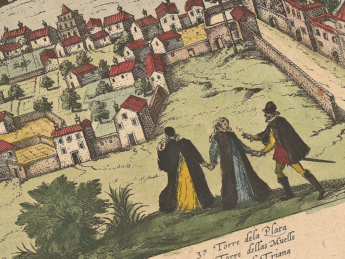
Three coats of arms decorate the sky above the city, reinforcing Seville’s civic and royal importance. Small figures appear in the foreground near Triana, while people, carts and boats lend activity to the roads and waterfront. These details transform the image from a simple map into a portrait of one of Europe’s most commercially important sixteenth-century cities.

You may also like…

×
Product added to cart
No products in the cart.


