Laurie and Whittle map of Trinidad showing the Gulf of Paria, mountains and population table, 1800
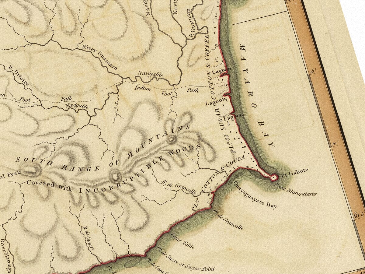
Laurie and Whittle map of Trinidad showing the Gulf of Paria, mountains and population table, 1800 old trinidad map detail detail from an old map of trinidad

Old Map of Trinidad

Price range: £35.55 through £59.95

Old Map of Trinidad by Laurie & Whittle, 1800

Based on surveys made in 1797, this detailed antique map shows Trinidad’s mountains, savannas and rivers beside the Gulf of Paria and the neighbouring mainland. A circular title, prominent compass rose and tables of quarters and population give the sheet its distinctive composition.

Engraved by George Allen and published in London, it records the island at the transition from Spanish to British rule. Reproduced as a giclée fine art print and supplied unframed.

+ Read more

A stunning certified FINE ART PRINT on heavy textured art paper — not a poster

  • Direct from the publisher — no middlemen
  • Printed in-house in Cornwall
  • Free UK delivery — international shipping available
  • Produced to meet — and often exceed — museum-quality standards

Size

Size

Inspecting Mercator's 1623 old map of Great Britain and Ireland

Fine Art Map Reproductions – Museum-Quality Printing

Unlike most online offerings, our maps are produced entirely in-house, not outsourced to print-on-demand or drop-shipping services. This allows complete control over quality while offering better value. Each map begins with a high-resolution original, carefully enhanced and printed to order using archival papers and pigment inks for exceptional clarity, depth, and longevity. Every piece is personally overseen — no map leaves our workshop unless it is of a quality we would be proud to display ourselves.

Hand hold a magnifying glass over West Cornwall Map

Authentic Old Map Paper & Accurate Colour Reproduction

Paper choice is essential to the authenticity of our maps. We use specially sourced 190gsm paper made in the UK from pure materials and traditionally pressed with natural woollen felts. This process creates a subtle, randomly textured surface that closely resembles an original antique document. Likewise the use of premium quality ink fully saturates the paper, producing remarkable clarity, depth, and historical character. Colour fastness and sharpness will remain good for in excess of 100 years!

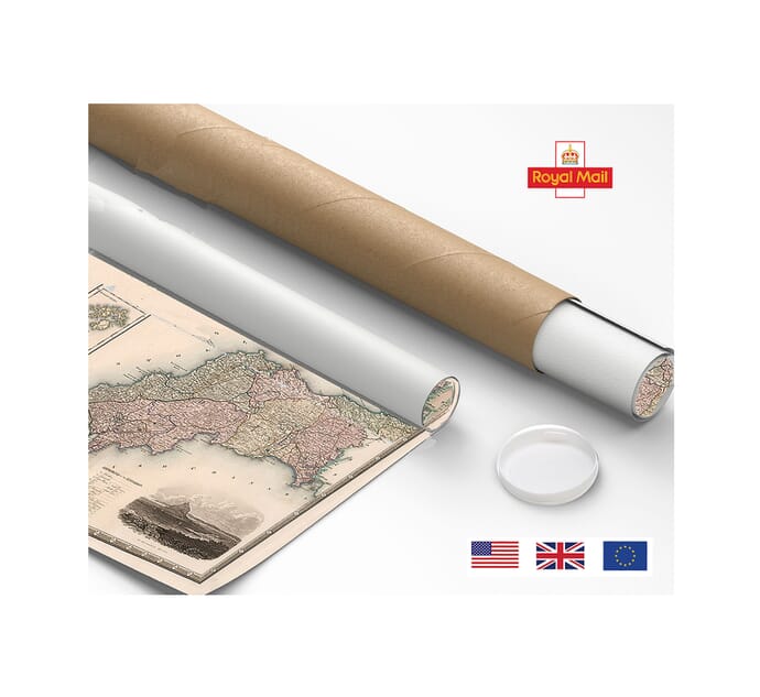
Map in Postal Tube

Buy Old Maps Online in the UK Today Trading online since 1999

The Old Map Company of Great Britain offers a vast and carefully curated collection of the very finest expertly reproduced vintage maps. Our range includes works by renowned cartographers such as John Speed and Willem Blaeu, covering Scotland, England, and beyond. Free UK courier delivery is included, with EU, USA, and worldwide shipping available at cost and calculated at checkout. If you need assistance, our team is always happy to help you choose the perfect map.

RECENT REVIEWS

Daz
DazGB
Verified ownerVerified owner

5/5

Speedy delivery A beautiful representation

3 months ago
David H
David H
Verified ownerVerified owner
5/5

Got there in time and loves it! Cheers David [Gift from US to UK]

5 months ago
Ellan C-S
Ellan C-S
Verified ownerVerified owner
5/5

Thanks Lauren. We received it today - it's gorgeous! Thank you, Ellan

5 months ago
Ivano Di Battista
Ivano Di Battista
Verified ownerVerified owner
5/5

Thank you for your prompt service. I have a gallery and framing business in South Wales. I'm so pleased it is printed in the UK

6 months ago
Robert B
Robert B
Verified ownerVerified owner
5/5

My Isles of Scilly map arrived safely and I'm delighted with it!

6 months ago
Andrew T
Andrew T
Reviewer
5/5

The print arrived safely and we're delighted with it - a lovely reminder of our honeymoon 15 years ago.

6 months ago
Hannah J
Hannah J
Verified ownerVerified owner
5/5

I have just received them! I'm sure our clients will be pleased with them and there could be more projects off the back of this one where we can use more. [Interior Designers]

6 months ago
Sean MacManus
Sean MacManus
Verified ownerVerified owner
5/5

I just received my map of Ireland by Ewart today and, as usual, I am delighted by its quality. The crispness and fineness of detail is excellent and the colour reproduction surpasses my expectations. Please relay my thanks to Steve for another fine effort!

7 months ago
John G
John G
Verified ownerVerified owner
5/5

Many thanks, Lauren. Very pleased with the map and the service: would recommend The Old Map Company to anyone interested in Old Maps.

8 months ago
Lois K
Lois K
Verified ownerVerified owner
5/5

Thrilled , Lauren! Thank You

9 months ago
Ed Simpson
Ed Simpson
Verified ownerVerified owner
5/5

Many thanks, the map arrived safely this morning, and I’m really pleased with it. A stunning reproduction, just as I had hoped. I will keep browsing your website, and may yet be tempted by more of your items! Have a great weekend.

9 months ago
Daniel McCade
Daniel McCade
Verified ownerVerified owner
5/5

Just arrived, wonderful map! Thanks very much!

10 months ago
Jonathon R
Jonathon R
Verified ownerVerified owner
5/5

The map – beautiful – arrived safely, very many thanks.

1 year ago
Rasa Terbetiene
Rasa Terbetiene
Verified ownerVerified owner
5/5

Thank you, I have already found the map. It’s wonderfull! Good luck! Rasa

4 years ago
Mina M.
Mina M.
Verified ownerVerified owner
5/5

My apologies for the very late reply. I wanted to reach out to thank you so much for rushing my order. My partner absolutely loved it. I am amazed with the service so that is a five-star from me. I wish you all the best.

4 years ago

Historical Background

This map of Trinidad records the island from surveys made in 1797, the year British forces captured it from Spain. Published by Robert Laurie and James Whittle in London in 1800, it combines a detailed physical map with tables of administrative quarters and population. Its engraved mountains, broad savannas and branching rivers describe a landscape very different from the densely settled island of today, while the names and annotations retain evidence of its Spanish colonial setting.

Map Details

  • Original title: Plan of the Isle of Trinidad, from Actual Surveys Made in the Year 1797
  • Publishers: Robert Laurie and James Whittle, 53 Fleet Street, London
  • Engraver: George Allen, 19 Shoe Lane, Fleet Street
  • Survey date: 1797
  • Publication imprint: 12 December 1800; the reproduced sheet’s exact atlas issue is not established
  • Area shown: Trinidad, the Gulf of Paria and part of the neighbouring mainland
  • Original scale: Approximately 1:180,000, with separate bars for leagues and British miles
  • Format: Engraved map with coloured coastal outlines, relief and administrative tables
  • Orientation: North towards the top

A survey at a change of government

The two dates on this antique map have distinct meanings. The title identifies the year of the surveys, while the lower margin records the London publication. Britain took control of Trinidad in 1797, but Spain’s formal cession of the island followed in 1802. The 1800 publication therefore belongs to the interval between military occupation and the treaty settlement.

That timing helps explain the map’s interest. It presents information about a newly occupied island to readers in Britain, yet preserves a landscape of established names and divisions. Spanish place names appear alongside English geographical descriptions rather than being uniformly replaced. The resulting mixture gives the sheet a particular historical character and makes it useful for comparing older names with their later forms.

The Gulf of Paria and the mainland

The Gulf of Paria occupies much of the left side of the composition. Trinidad’s western coastline curves around this broad expanse of water, while a small portion of the opposing mainland appears at the upper left. Islands and narrow passages around the north-western approach receive careful attention, showing how closely Trinidad’s geography is connected with the nearby South American coast.

Within the gulf, the map prints alternative names associated with the whale, including Golfo de Ballena and Gulf of Whale. These labels are part of the historical sheet rather than modern additions. A large compass rose sits below them, its long rays extending across the open water. The space given to the gulf allows these annotations to remain prominent without crowding the island itself.

Mountains, savannas and rivers

The northern mountains form a continuous band across the upper part of Trinidad. Lines following their slopes give the range a strongly textured appearance. Elsewhere, smaller groups of hills stand out among rivers and broad areas labelled as savannas. This engraved relief describes the character of the ground through shading and repeated strokes, rather than contour lines or measured heights.

The Great Caroni Savanna is particularly conspicuous on the western side of the interior. Numerous waterways connect inland districts with the coast, while settlements and routes are marked more lightly. Looking between the Northern Mountains and the southern shoreline reveals how the map balances physical geography with the information needed to locate inhabited areas. Coloured outlines help distinguish the island’s edge from the detailed black engraving within it.

Quarters and a population table

Below the circular title is a table listing the island’s administrative quarters. Names such as Diego Martin, Santa Cruz, Aricagua and Tacarigua give the map another connection with Trinidad’s continuing geography. The table provides an organised counterpart to the scattered names on the main map, making the administrative framework easier to read.

A second table, placed over the compass rose, records the population in 1797. Its categories reflect the racial distinctions and system of enslavement imposed by colonial government. They should be read as evidence of that system, rather than neutral descriptions of the people represented. This small feature makes the sheet more than a record of mountains and coastlines: it also documents how the authorities classified the island’s inhabitants.

George Allen’s engraving brings these varied elements into a carefully arranged sheet. The circular title, two tables and extensive gulf balance the detailed land area. Reproduced as a fine art print, this old map of Trinidad retains both the appeal of its coloured coastline and the historical information contained in its smaller lettering.