Verified owner
Got there in time and loves it! Cheers David [Gift from US to UK]
 Verified owner
Thanks Lauren. We received it today - it's gorgeous! Thank you, Ellan
 Verified owner
Thank you for your prompt service. I have a gallery and framing business in South Wales. I'm so pleased it is printed in the UK
 Verified owner
My Isles of Scilly map arrived safely and I'm delighted with it!

The print arrived safely and we're delighted with it - a lovely reminder of our honeymoon 15 years ago.
 Verified owner
I have just received them! I'm sure our clients will be pleased with them and there could be more projects off the back of this one where we can use more. [Interior Designers]
 Verified owner
I just received my map of Ireland by Ewart today and, as usual, I am delighted by its quality. The crispness and fineness of detail is excellent and the colour reproduction surpasses my expectations. Please relay my thanks to Steve for another fine effort!
 Verified owner
Many thanks, Lauren. Very pleased with the map and the service: would recommend The Old Map Company to anyone interested in Old Maps.
 Verified owner
Many thanks, the map arrived safely this morning, and I’m really pleased with it. A stunning reproduction, just as I had hoped. I will keep browsing your website, and may yet be tempted by more of your items! Have a great weekend.
 Verified owner
Just arrived, wonderful map! Thanks very much!
 Verified owner
The map – beautiful – arrived safely, very many thanks.
 Verified owner
Thank you, I have already found the map. It’s wonderfull! Good luck! Rasa
 Verified owner
My apologies for the very late reply. I wanted to reach out to thank you so much for rushing my order. My partner absolutely loved it. I am amazed with the service so that is a five-star from me. I wish you all the best.
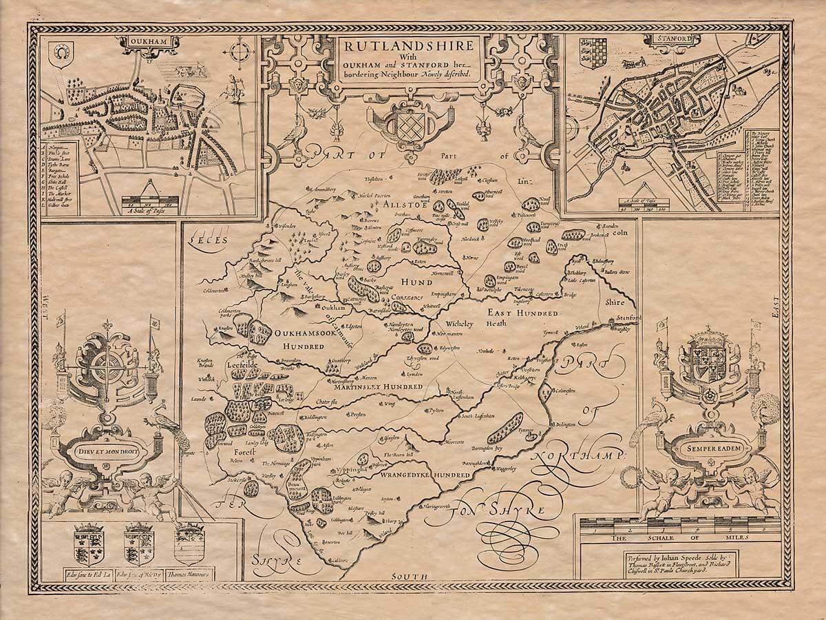
John Speed’s map of Rutland was prepared around 1610 for The Theatre of the Empire of Great Britaine, his celebrated atlas of English and Welsh counties. The plate was engraved by Jodocus Hondius and combines a detailed county map with inset plans of Oakham and neighbouring Stamford.
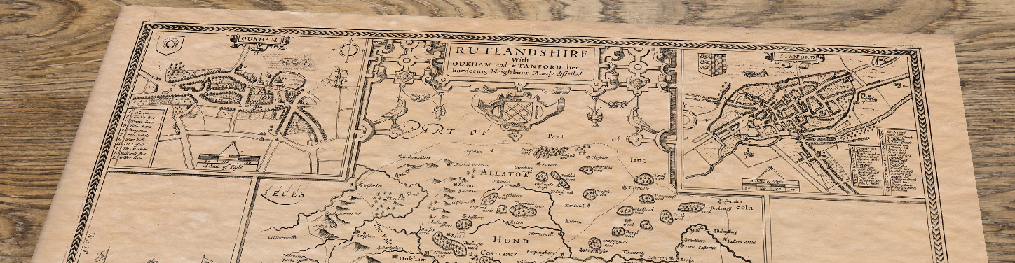
The impression reproduced here belongs to a later edition. Its lower-right imprint states that the map was sold by Thomas Bassett in Fleet Street and Richard Chiswell in St Paul’s Churchyard, identifying it as the Bassett and Chiswell edition published in 1676.
Speed died in 1629, but his county maps remained in demand for decades. Bassett and Chiswell acquired the plates and issued a new edition of the atlas in 1676, preserving Speed’s original cartography while adding their own publishing imprint.
The wording at the foot of this map therefore helps identify the particular edition represented. Although the geographical plate had first appeared earlier in the century, this impression reflects the continuing commercial life of Speed’s work more than sixty years later.
Recognising the edition also prevents the print from being described simply as a map “from 1610.” Its cartography originated around that date, but the artwork reproduced here is associated with the identifiable 1676 publication.
Speed divides Rutland into its five historic hundreds: Alstoe, East, Martinsley, Oakham Soke and Wrangdyke. These administrative districts are clearly named across the county and provide much of the map’s internal structure.
Oakham occupies a central position within Oakham Soke, while Uppingham lies farther south. Numerous smaller settlements are recorded between them, including Manton, Empingham, Ketton, Hambleton and Market Overton.
Rutland’s irregular boundary is emphasised by the surrounding parts of Leicestershire, Lincolnshire and Northamptonshire. Their inclusion demonstrates how closely the county’s settlements were connected with places beyond its compact borders.
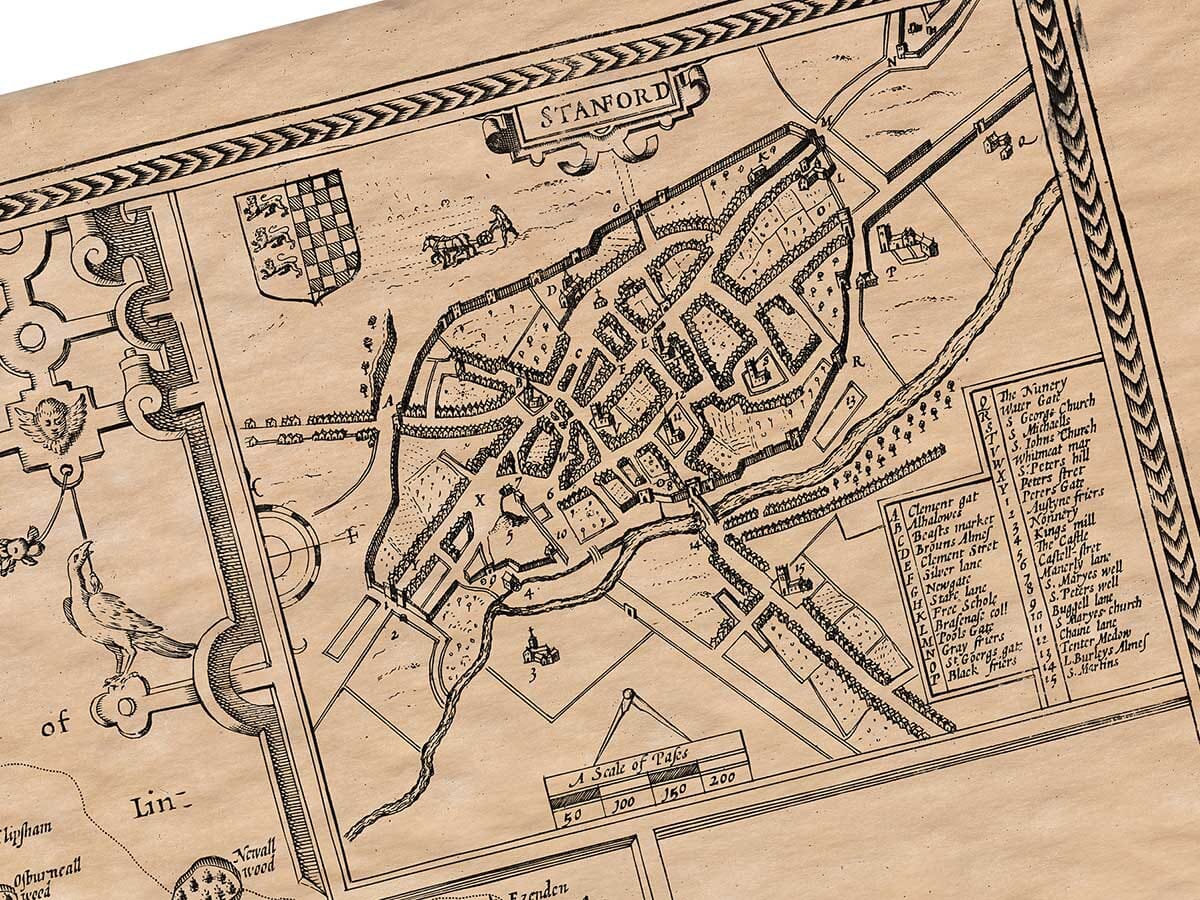
The two upper corners contain engraved town plans entitled Oukham and Stanford. Buildings are shown pictorially along individual streets, with numbered references identifying notable features. Scales measured in paces accompany the plans.
Oakham was Rutland’s county town, making its inclusion a natural choice. Stamford lay beyond the county boundary in Lincolnshire, but its commercial and geographical importance earned it equal prominence. Speed’s title explicitly calls Stamford Rutland’s “bordering neighbour.”
These are not conventional aerial pictures but carefully constructed town plans viewed from above. They rank among the earliest printed plans of Oakham and Stamford, preserving their streets and built-up areas at the beginning of the seventeenth century. British Historic Towns Atlas, Welland Antique Maps
One of the most revealing differences between Speed’s map and modern Rutland is the absence of Rutland Water. The engraving records the River Gwash flowing through an uninterrupted landscape of villages, fields and estates.
The reservoir was created during the 1970s, flooding part of the Gwash valley and fundamentally changing the county’s central geography. Middle and Nether Hambleton were cleared, while the surviving settlement of Hambleton became associated with the prominent peninsula extending into the reservoir. Leicestershire and Rutland Wildlife Trust
Speed’s plate therefore preserves the earlier relationship between Oakham, Empingham, Hambleton and the river valley. For anyone familiar with Rutland Water today, this missing expanse of water is one of the map’s most striking features.
The map is enclosed by an elaborate architectural composition. Royal emblems and coats of arms occupy the side panels, accompanied by the mottoes Dieu et mon droit and Semper eadem. Further heraldic devices appear around the title and lower border.
The inset town plans balance one another across the top corners, while a decorative scale of miles occupies the lower-right area. These elements make the engraving far more than a practical geographical record.
Speed’s combination of county cartography, urban plans and heraldry gives the map its distinctive character. It allows the viewer to examine Rutland at several levels: as a county divided into hundreds, as a network of individual communities and as part of a wider seventeenth-century political landscape.