





 Verified owner
Got there in time and loves it! Cheers David [Gift from US to UK]
 Verified owner
Thanks Lauren. We received it today - it's gorgeous! Thank you, Ellan
 Verified owner
Thank you for your prompt service. I have a gallery and framing business in South Wales. I'm so pleased it is printed in the UK
 Verified owner
My Isles of Scilly map arrived safely and I'm delighted with it!

The print arrived safely and we're delighted with it - a lovely reminder of our honeymoon 15 years ago.
 Verified owner
I have just received them! I'm sure our clients will be pleased with them and there could be more projects off the back of this one where we can use more. [Interior Designers]
 Verified owner
I just received my map of Ireland by Ewart today and, as usual, I am delighted by its quality. The crispness and fineness of detail is excellent and the colour reproduction surpasses my expectations. Please relay my thanks to Steve for another fine effort!
 Verified owner
Many thanks, Lauren. Very pleased with the map and the service: would recommend The Old Map Company to anyone interested in Old Maps.
 Verified owner
Many thanks, the map arrived safely this morning, and I’m really pleased with it. A stunning reproduction, just as I had hoped. I will keep browsing your website, and may yet be tempted by more of your items! Have a great weekend.
 Verified owner
Just arrived, wonderful map! Thanks very much!
 Verified owner
The map – beautiful – arrived safely, very many thanks.
 Verified owner
Thank you, I have already found the map. It’s wonderfull! Good luck! Rasa
 Verified owner
My apologies for the very late reply. I wanted to reach out to thank you so much for rushing my order. My partner absolutely loved it. I am amazed with the service so that is a five-star from me. I wish you all the best.
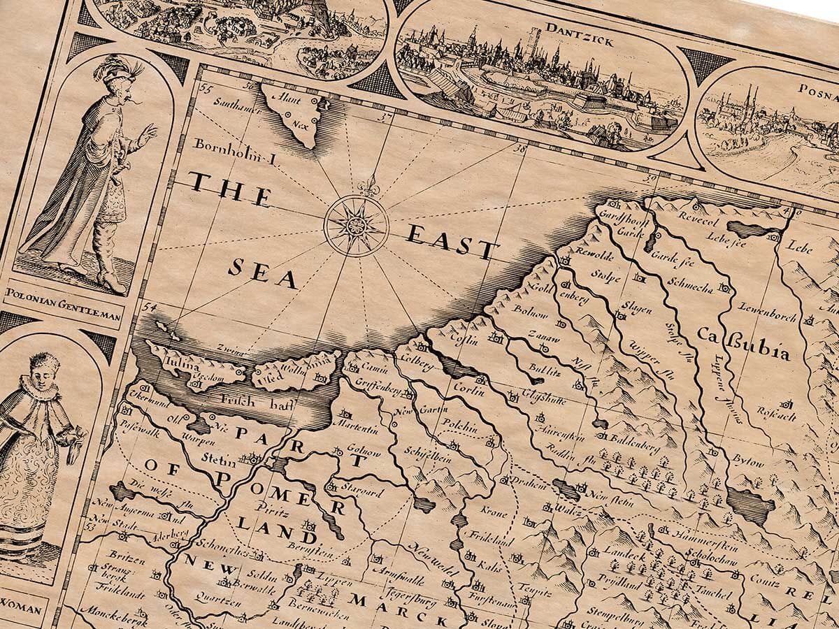
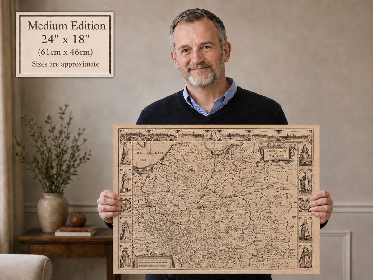
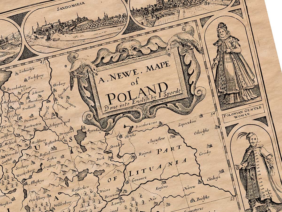
The map portrays the Polish–Lithuanian Commonwealth and neighbouring territories, extending from the Baltic Sea in the north to Silesia and Bohemia in the south, and eastwards towards Lithuania and Russia. Poland appears alongside regions including Prussia, Pomerania, Mazovia, Podlachia and parts of Livonia, reflecting the very different political geography of seventeenth-century Europe.
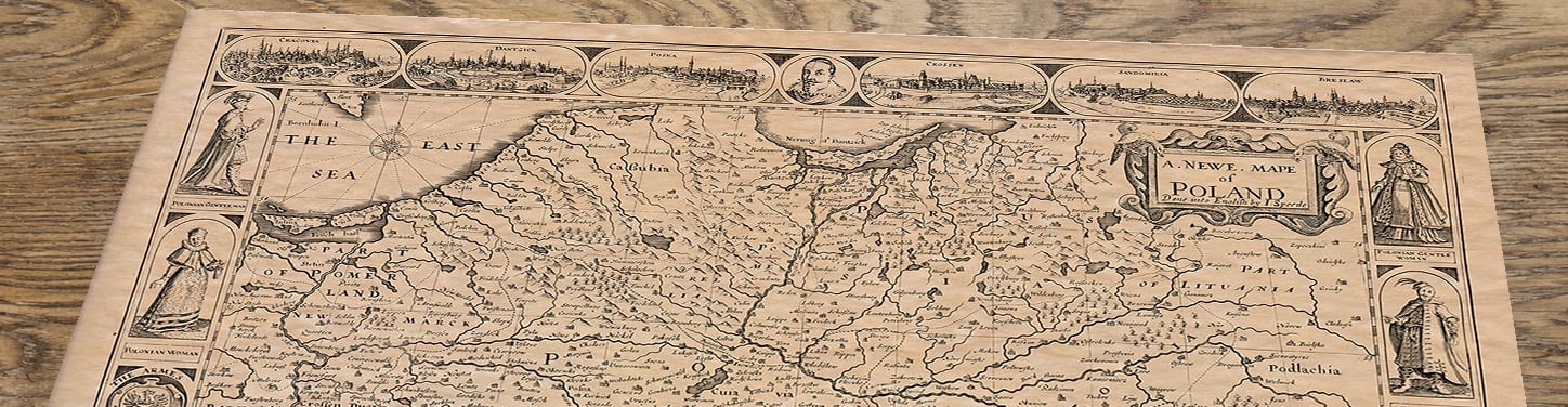
Across the upper border are engraved views of important cities, including Kraków, Gdańsk, Poznań, Krosno, Sandomierz and Wrocław. At the centre is a portrait of King Sigismund III Vasa, who ruled the Polish–Lithuanian Commonwealth during much of John Speed’s lifetime. The side borders are filled with figures dressed in Polish, Silesian and regional costume, together with the arms of Poland and Silesia.
These decorative borders make the map especially rewarding to study. It is not simply a geographical record but a carefully composed picture of Poland’s cities, people and political identity as understood by a seventeenth-century English mapmaker.
The many old spellings and former boundaries also make it an absorbing choice for anyone interested in Polish history, family origins or the changing geography of Central and Eastern Europe.











