Old map of Ukraine and the Cossack lands by Johann Baptist Homann, c.1712
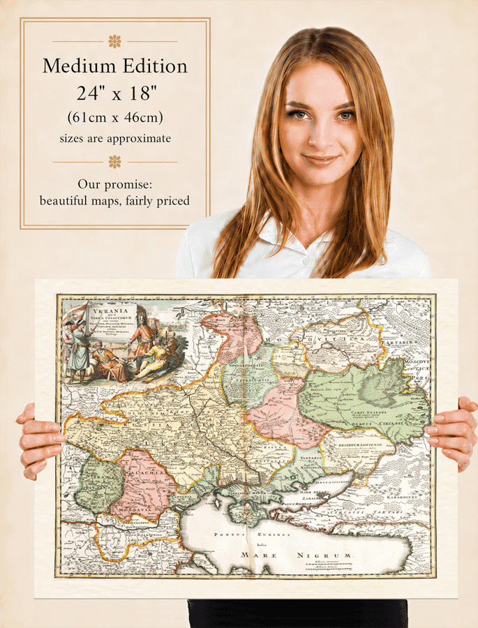
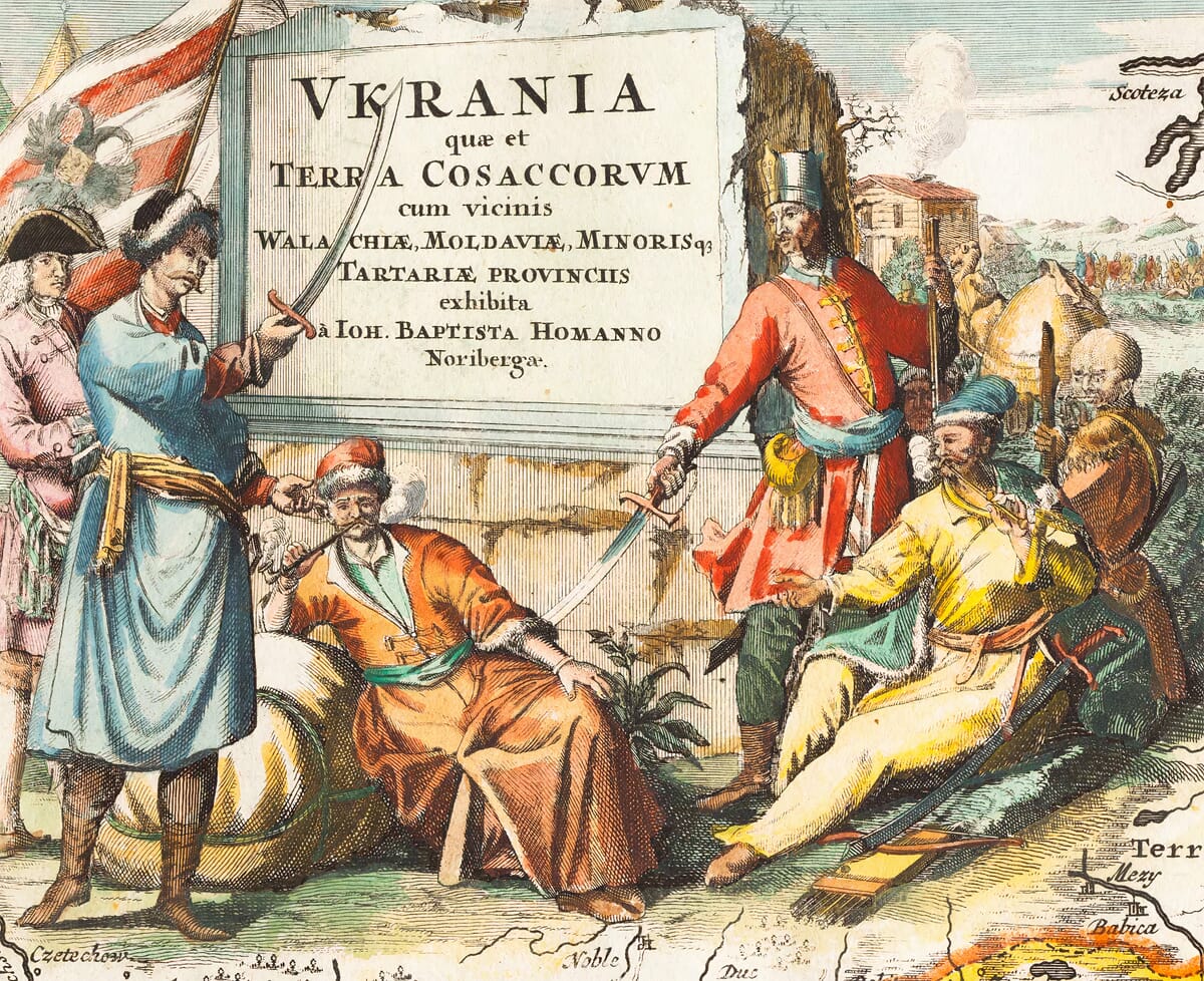
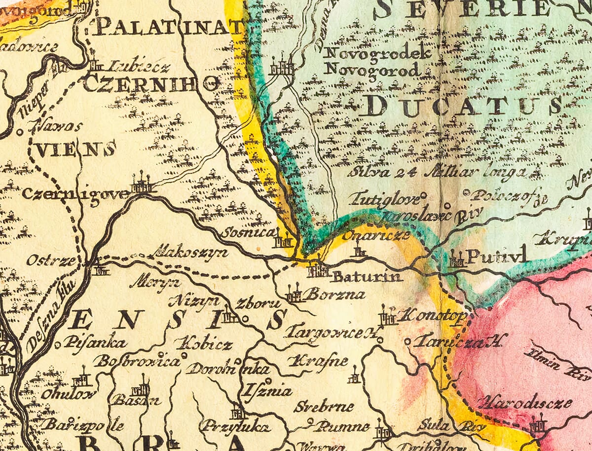
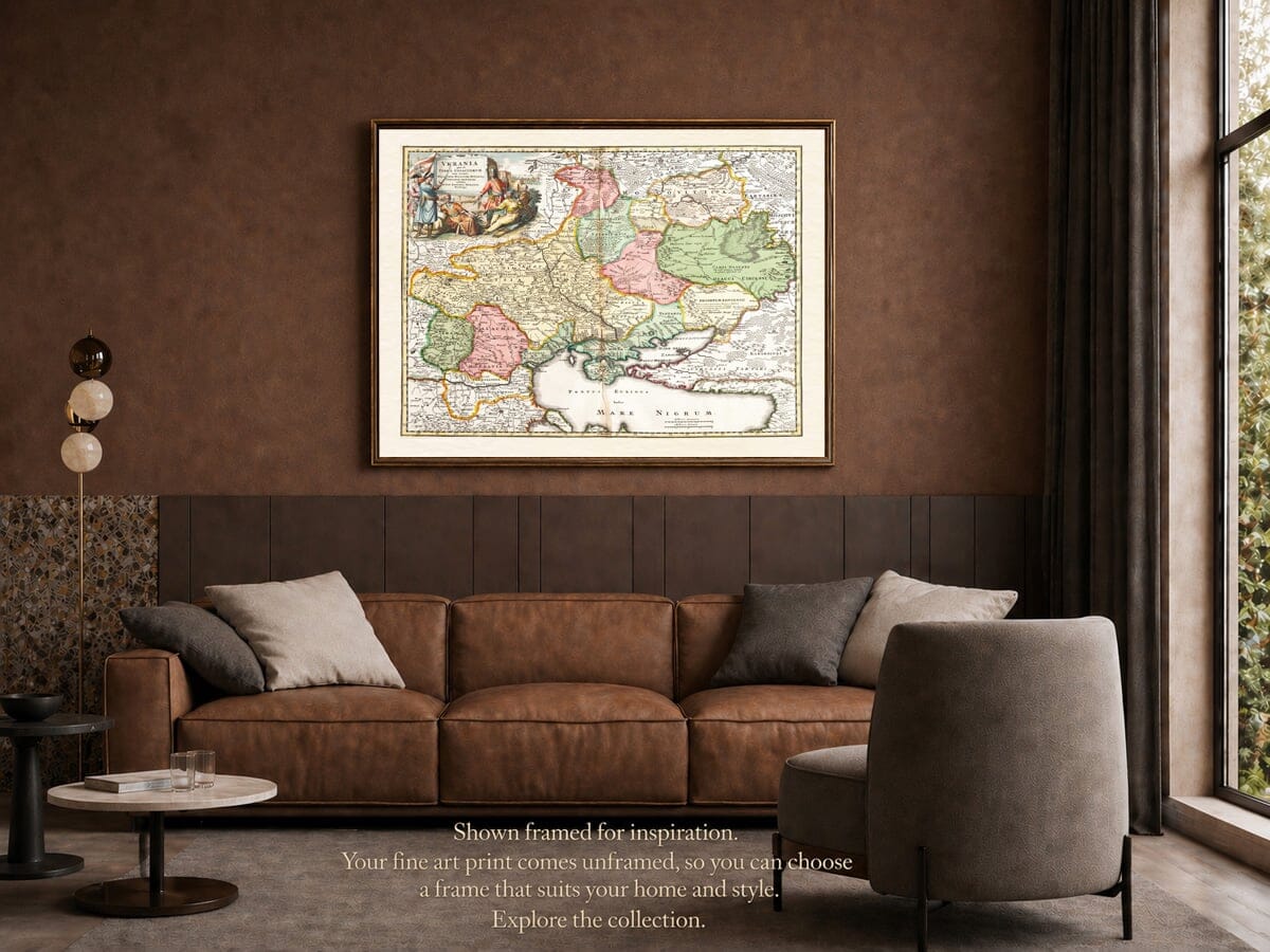
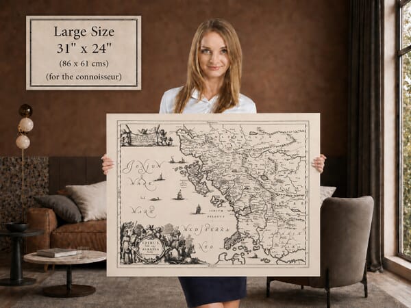
Old map of Ukraine and the Cossack lands by Johann Baptist Homann, c.1712 Woman holding the medium edition of Homann’s old map of Ukraine for size illustration Illustrated Cossack title cartouche on Homann’s c.1712 old map of Ukraine Chernigov and Novgorod Seversky detail from Homann’s c.1712 map of Ukraine Homann’s old map of Ukraine shown framed in a living room; print supplied unframed

Old Map of Ukraine by Johann Baptist Homann

Price range: £39.95 through £59.95

Johann Baptist Homann, Nuremberg, c.1712

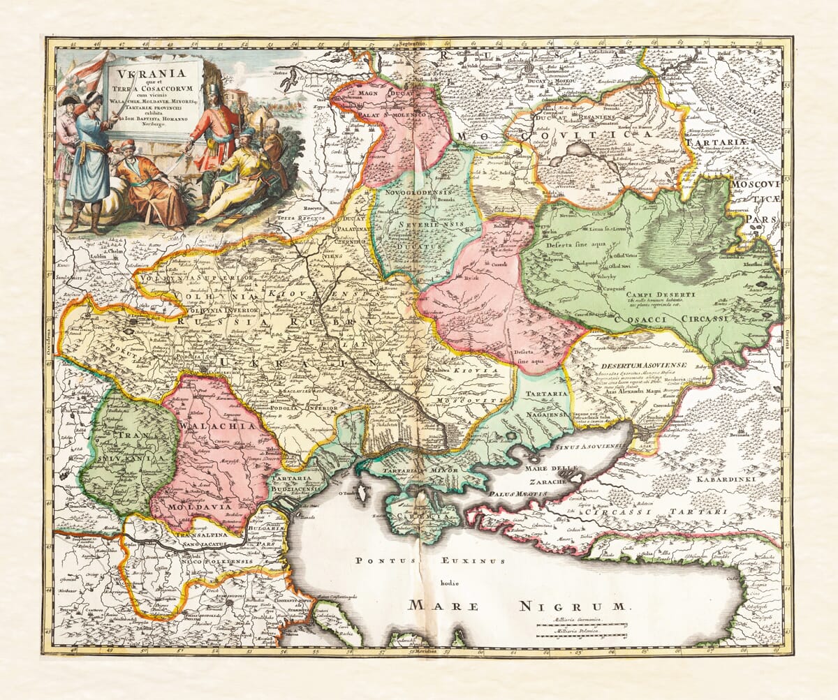
A richly coloured old map of Ukraine, titled Ukrania quae et Terra Cosaccorum—“Ukraine, or the Land of the Cossacks”.

Homann’s map extends from Moscow to the Black Sea and Constantinople, showing Ukraine, Crimea, the Cossack lands, Wallachia, Moldavia and Little Tartary. Its magnificent illustrated cartouche and extensive historical detail make this one of the most memorable early maps devoted to Ukraine.
+ read more

A fine art reproduction of Johann Baptist Homann’s historic map of Ukraine, “Ukrania Terra Cosaccorum”, showing Ukraine, the Cossack lands, Crimea, the Black Sea, Wallachia, Moldavia and Little Tartary.

A stunning certified FINE ART PRINT on heavy textured art paper — not a poster

Direct from the publisher — no middlemen

  • Printed in-house in Cornwall
  • Free UK delivery — international shipping available
  • Produced to meet — and often exceed — museum-quality standards

SELECT SIZE

Inspecting Vintage Map Reproduction

Fine Art Map Reproductions – Museum-Quality Printing

Unlike most online offerings, our maps are produced entirely in-house, not outsourced to print-on-demand or drop-shipping services. This allows complete control over quality while offering better value. Each map begins with a high-resolution original, carefully enhanced and printed to order using archival papers and pigment inks for exceptional clarity, depth, and longevity. Every piece is personally overseen — no map leaves our workshop unless it is of a quality we would be proud to display ourselves.

Hand hold a magnifying glass over West Cornwall Map

Authentic Old Map Paper & Accurate Colour Reproduction

Paper choice is essential to the authenticity of our maps. We use specially sourced 190gsm paper made in the UK from pure materials and traditionally pressed with natural woollen felts. This process creates a subtle, randomly textured surface that closely resembles an original antique document. Likewise the use of premium quality ink fully saturates the paper, producing remarkable clarity, depth, and historical character. Colour fastness and sharpness will remain good for in excess of 100 years!

Map in Postal Tube
Buy Old Maps Online in the UK Today Trading online since 1999

The Old Map Company of Great Britain offers a vast and carefully curated collection of the very finest expertly reproduced vintage maps. Our range includes works by renowned cartographers such as John Speed and Willem Blaeu, covering Scotland, England, and beyond. Free UK courier delivery is included, with EU, USA, and worldwide shipping available at cost and calculated at checkout. If you need assistance, our team is always happy to help you choose the perfect map.

RECENT REVIEWS

Daz
DazGB
Verified ownerVerified owner
5/5

Speedy delivery A beautiful representation

2 months ago
David H
David H
Verified ownerVerified owner
5/5

Got there in time and loves it! Cheers David [Gift from US to UK]

4 months ago
Ellan C-S
Ellan C-S
Verified ownerVerified owner
5/5

Thanks Lauren. We received it today - it's gorgeous! Thank you, Ellan

4 months ago
Ivano Di Battista
Ivano Di Battista
Verified ownerVerified owner
5/5

Thank you for your prompt service. I have a gallery and framing business in South Wales. I'm so pleased it is printed in the UK

4 months ago
Robert B
Robert B
Verified ownerVerified owner
5/5

My Isles of Scilly map arrived safely and I'm delighted with it!

5 months ago
Andrew T
Andrew T
Reviewer
5/5

The print arrived safely and we're delighted with it - a lovely reminder of our honeymoon 15 years ago.

5 months ago
Hannah J
Hannah J
Verified ownerVerified owner
5/5

I have just received them! I'm sure our clients will be pleased with them and there could be more projects off the back of this one where we can use more. [Interior Designers]

5 months ago
Sean MacManus
Sean MacManus
Verified ownerVerified owner
5/5

I just received my map of Ireland by Ewart today and, as usual, I am delighted by its quality. The crispness and fineness of detail is excellent and the colour reproduction surpasses my expectations. Please relay my thanks to Steve for another fine effort!

5 months ago
John G
John G
Verified ownerVerified owner
5/5

Many thanks, Lauren. Very pleased with the map and the service: would recommend The Old Map Company to anyone interested in Old Maps.

7 months ago
Lois K
Lois K
Verified ownerVerified owner
5/5

Thrilled , Lauren! Thank You

7 months ago
Ed Simpson
Ed Simpson
Verified ownerVerified owner
5/5

Many thanks, the map arrived safely this morning, and I’m really pleased with it. A stunning reproduction, just as I had hoped. I will keep browsing your website, and may yet be tempted by more of your items! Have a great weekend.

7 months ago
Daniel McCade
Daniel McCade
Verified ownerVerified owner
5/5

Just arrived, wonderful map! Thanks very much!

8 months ago
Jonathon R
Jonathon R
Verified ownerVerified owner
5/5

The map – beautiful – arrived safely, very many thanks.

1 year ago
Rasa Terbetiene
Rasa Terbetiene
Verified ownerVerified owner
5/5

Thank you, I have already found the map. It’s wonderfull! Good luck! Rasa

4 years ago
Mina M.
Mina M.
Verified ownerVerified owner
5/5

My apologies for the very late reply. I wanted to reach out to thank you so much for rushing my order. My partner absolutely loved it. I am amazed with the service so that is a five-star from me. I wish you all the best.

4 years ago

Johann Baptist Homann’s Old Map of Ukraine

Johann Baptist Homann published this important early map of Ukraine in Nuremberg during the opening decades of the eighteenth century. Its full Latin title, Ukrania quae et Terra Cosaccorum, cum vicinis Walachiae, Moldaviae, Minorisque Tartariae Provinciis, identifies Ukraine as “the Land of the Cossacks” and includes the neighbouring provinces of Wallachia, Moldavia and Little Tartary.

The title is historically significant. Ukraine is not treated merely as an unnamed borderland between larger powers. It is prominently labelled and associated directly with the Cossack territories that occupied a central place in the politics of Eastern Europe.

Ukraine and the Cossack Lands

The map was produced when the lands surrounding the Dnieper were divided between competing political and military interests. The Polish–Lithuanian Commonwealth, Muscovy, the Ottoman Empire, the Crimean Khanate and the Cossack Hetmanate all influenced the region represented by Homann.

Across the centre of the engraving appears the name Ukraina, while Russia Rubra—Red Ruthenia—is marked farther west. The Dnieper forms the map’s principal geographical thread, flowing southwards through the Cossack lands towards the Black Sea.

Homann’s treatment of Ukraine drew upon the influential seventeenth-century surveys of Guillaume Le Vasseur de Beauplan. Beauplan had travelled and worked extensively in the region and produced some of the first detailed printed maps devoted specifically to Ukraine. Homann used this geographical foundation while introducing political information relevant to the early eighteenth century.

From Moscow to the Black Sea

The map covers an extensive portion of Eastern Europe. Moscow appears towards the upper right, while Constantinople—present-day Istanbul—lies near the lower edge. Between them are the Ukrainian lands, Moldavia, Wallachia, Transylvania, Crimea, the Sea of Azov and the northern coast of the Black Sea.

Kiev appears beside the Dnieper, together with numerous smaller fortified towns and settlements. Other rivers, including the Dniester, Don and Southern Bug, cross a landscape filled with regional names, boundaries, forests and stretches of open steppe.

The Black Sea is labelled both Pontus Euxinus, its classical name, and Mare Nigrum. The Sea of Azov appears under the Italian form Mare delle Zabache. Crimea is shown as part of Little Tartary, reflecting its association with the Crimean Khanate.

These names preserve a geographical vocabulary very different from that used on a modern map. They record how an educated European audience encountered Ukraine and the Black Sea region in the early eighteenth century.

The Battle of Poltava

Homann’s map reflects events surrounding the Battle of Poltava in 1709. The battle, fought between the forces of Peter the Great and Charles XII of Sweden, marked a decisive stage in the Great Northern War.

Cossack Hetman Ivan Mazepa had broken with Peter and allied himself with the Swedish king. The defeat of the Swedish and allied Cossack forces profoundly altered the political balance of the region and strengthened Russian power in Eastern Europe.

The site of the battle is marked on the map. Its inclusion helps place the engraving close to the events it depicts and distinguishes Homann’s work from earlier maps based solely upon seventeenth-century geographical information.

Homann’s Illustrated Cartouche

The large cartouche in the upper-left corner is one of the map’s most striking features. Armed Cossack figures gather around the tablet carrying the Latin title, transforming a practical inscription into an elaborate historical scene.

The seated central figure is often interpreted as Hetman Ivan Mazepa, shown with his followers after their defeat and exile. The surrounding figures wear military dress and carry weapons, reinforcing the map’s identification of Ukraine with the Cossack world.

Whether every individual was intended as a particular historical person cannot be established with certainty. Nevertheless, the scene clearly gives the Cossacks a commanding visual presence and places their political and military identity at the heart of the composition.

Johann Baptist Homann

Johann Baptist Homann was a German engraver, cartographer and publisher based in Nuremberg. His workshop became one of the most successful mapmaking businesses in eighteenth-century Germany.

Homann’s maps are particularly recognisable for their strong engraved lines, extensive geographical coverage and imposing decorative cartouches. Original examples were frequently finished with hand-applied colour, allowing political divisions and regional boundaries to be followed across densely engraved landscapes.

This map of Ukraine is an excellent example of his approach. Geographical information, recent political events and decorative imagery are all brought together on a single plate.

Map Details

  • Original title: Ukrania quae et Terra Cosaccorum, cum vicinis Walachiae, Moldaviae, Minorisque Tartariae Provinciis
  • English translation: Ukraine, or the Land of the Cossacks, with the neighbouring provinces of Wallachia, Moldavia and Little Tartary
  • Cartographer, engraver and publisher: Johann Baptist Homann
  • Published: Nuremberg, c.1712
  • Approximate scale: 1:3,200,000
  • Original format: Copperplate engraving with hand-applied colour
  • Geographical foundation: Derived in part from Guillaume de Beauplan’s mapping of Ukraine
  • Principal places: Kiev, Moscow, Constantinople, Poltava and Azov
  • Regions shown: Ukraine, the Cossack lands, Crimea, Wallachia, Moldavia, Transylvania, Muscovy and Little Tartary
  • Seas: Black Sea and Sea of Azov
  • Notable feature: The site of the Battle of Poltava, 1709
  • Decoration: Illustrated title cartouche with Cossack figures
  • Edition represented: Early state without the later privilege inscription
Homann’s engraving preserves an unusually rich picture of Ukraine and its neighbouring lands at a defining moment in their history. The prominent use of the name Ukraine, the identification of the Cossack territories and the map’s record of the Battle of Poltava give it particular historical resonance.

You may also like…

  • Old Map of Albania . . . charting The Scale of MilesLarge Map of AlbaniaAdd to Basket This product has multiple variants. The options may be chosen on the product page

    Old Map of Albania

    Price range: £35.55 through £59.95
  • Croatia detail from an old mapOld Map of CroatiaAdd to Basket This product has multiple variants. The options may be chosen on the product page

    Croatia

    Price range: £35.55 through £59.95
  • Early map of Europe - detailOld map of Europe by Willem Blaeu with city views and national costume figuresAdd to Basket This product has multiple variants. The options may be chosen on the product page

    Old Map of Europe by Willem Blaeu, c.1645

    Price range: £35.55 through £59.95
×
Product added to cart
No products in the cart.