Joan Blaeu’s Old Map of Berwickshire
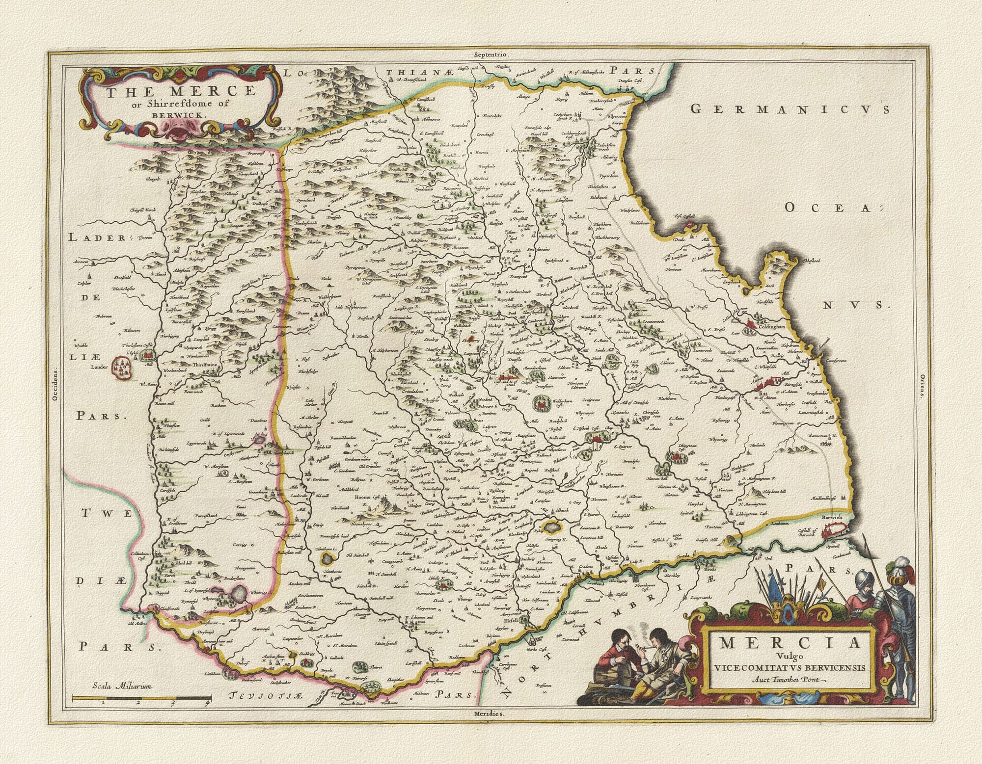
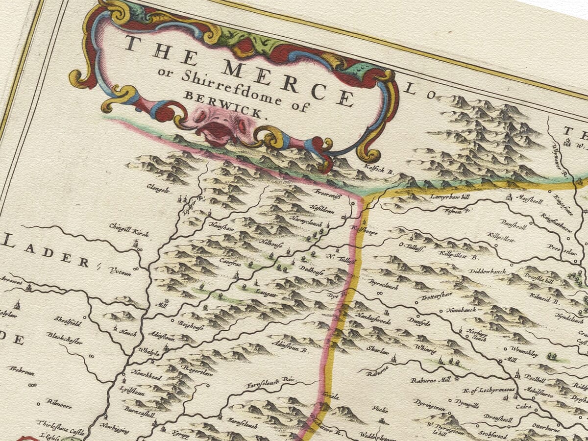
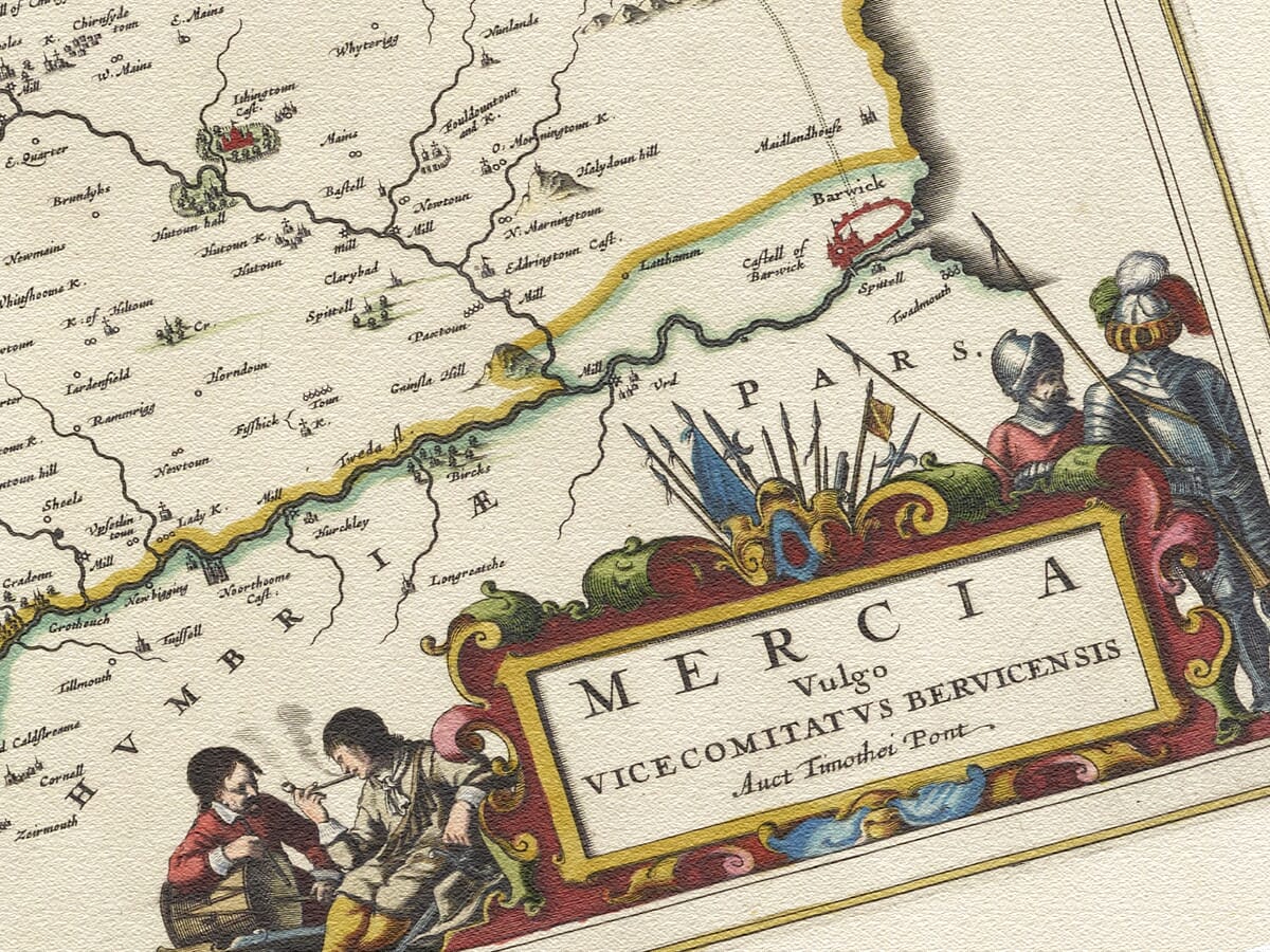
The map bears two complementary titles. The decorative cartouche at the upper left reads The Merce or Shirefdome of Berwick, while the more elaborate cartouche below gives the Latin title Mercia vulgo Vicecomitatus Bervicensis. It also acknowledges its geographical source with the words Auct. Timothei Pont—“by Timothy Pont.”
Together, these inscriptions identify the historic county of Berwickshire and its broad, fertile lowland known as the Merse. The finished copperplate map was published by Joan Blaeu in Amsterdam in 1654 as part of the first printed atlas devoted to Scotland.
Map details
Original title: Mercia vulgo Vicecomitatus Bervicensis. The Merce or Shirefdome of Berwick
Original cartographer: Timothy Pont
Publisher: Joan Blaeu
First published: Amsterdam, 1654
Area shown: Historic Berwickshire, the Merse and adjoining Border country
Source atlas: Theatrum Orbis Terrarum, sive Atlas Novus, Volume V
Product type: Fine art reproduction print of the historic map
From Pont’s Survey to Blaeu’s Atlas
Timothy Pont travelled extensively through Scotland during the late sixteenth and early seventeenth centuries, recording a country that had never previously been mapped in such local detail. His surviving manuscript work preserves thousands of settlements, rivers, estates, castles and landscape features.
Pont died before he could publish his proposed atlas. His maps and papers were later preserved and prepared for publication with the assistance of Scottish scholars and patrons, notably Sir John Scot of Scotstarvit and Robert Gordon of Straloch. The material eventually reached Joan Blaeu’s celebrated mapmaking workshop in Amsterdam.
Blaeu transformed this accumulated Scottish cartography into a series of substantial engraved maps. Published in 1654, the Scottish volume of his Atlas Novus contained 49 maps and became the first printed atlas of Scotland. The date is important: this Berwickshire plate belongs to that 1654 volume and should not be dated 1645 like Blaeu’s English county maps.
The Merse and the Lammermuir Hills
Berwickshire contained two contrasting landscapes. Across its northern reaches rise the Lammermuir Hills, represented on the engraving by tightly grouped pictorial peaks. South and east of the hills lies the Merse, a more open and fertile tract extending towards the River Tweed and the North Sea.
The historic name “Merse” is related to “march”, reflecting the district’s position within the eastern Border country. For centuries these lands stood close to the contested frontier between Scotland and England. Fortified houses and castles were therefore not simply noble residences: they formed part of a landscape repeatedly affected by raids, feuds, armies and shifting political power.
Blaeu’s map names Duns, now the principal town of Berwickshire, along with Greenlaw, which later served as the county town. Coldingham appears near the coast, recalling the ancient religious importance of Coldingham Priory. Eyemouth, Chirnside, Eccles and numerous smaller settlements can also be found among the river valleys and estates.
Hume Castle is shown in the county’s interior. Its elevated position made it one of the most conspicuous Border strongholds and an important place for warning of approaching danger. Other towers and fortified sites are distributed throughout the engraving, reminders of the long insecurity of the eastern marches.
Coast, Rivers and Frontier
The North Sea forms the eastern edge of the map, labelled in Latin as Germanicus Oceanus. Headlands, bays and small coastal settlements are carefully delineated, with the rocky country around St Abb’s Head and Coldingham giving the shoreline its distinctive form.
The River Tweed defines much of the southern boundary. At its mouth stands the heavily fortified town of Berwick-upon-Tweed, coloured prominently in red. Although Berwick had been under English control since 1482, it remained inseparable from the geography and history of the Scottish Borders. Its presence provides an immediate point of recognition and emphasises the strategic importance of the Tweed crossing and coastal route.
Neighbouring districts are named around the edges: Lothian to the north, Lauderdale and Tweeddale to the west, Teviotdale to the southwest and Northumberland to the south. This surrounding geography helps place Berwickshire within the wider Border landscape rather than presenting it in isolation.
A Landscape of Memory
The decorative cartouche in the lower-right corner is filled with armed figures and military equipment. One man appears wounded or exhausted while soldiers stand nearby. Blaeu did not explain the scene, but its martial character was especially appropriate for a county whose castles, communities and great families had been shaped by generations of Border warfare.
Elsewhere, the map’s beauty lies in its closely observed detail. Rivers thread through the Merse, hills gather towards the Lammermuirs, and tiny buildings mark places whose names remain familiar more than four centuries later. It is not a modern measured survey, but it preserves an extraordinary impression of how this corner of Scotland was known and understood in Pont’s time.
For anyone with roots in Berwickshire or an affection for the Borders, the map offers more than geographical interest. It brings together the coast, the hills and the old frontier in one richly worked image—a lasting portrait of a Scottish landscape with a powerful sense of place.





 Verified owner