Joan Blaeu’s Map of Historic Northamptonshire
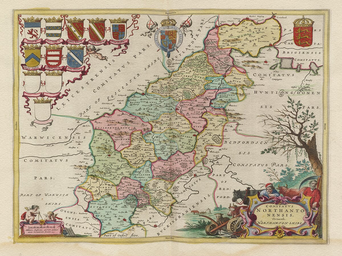
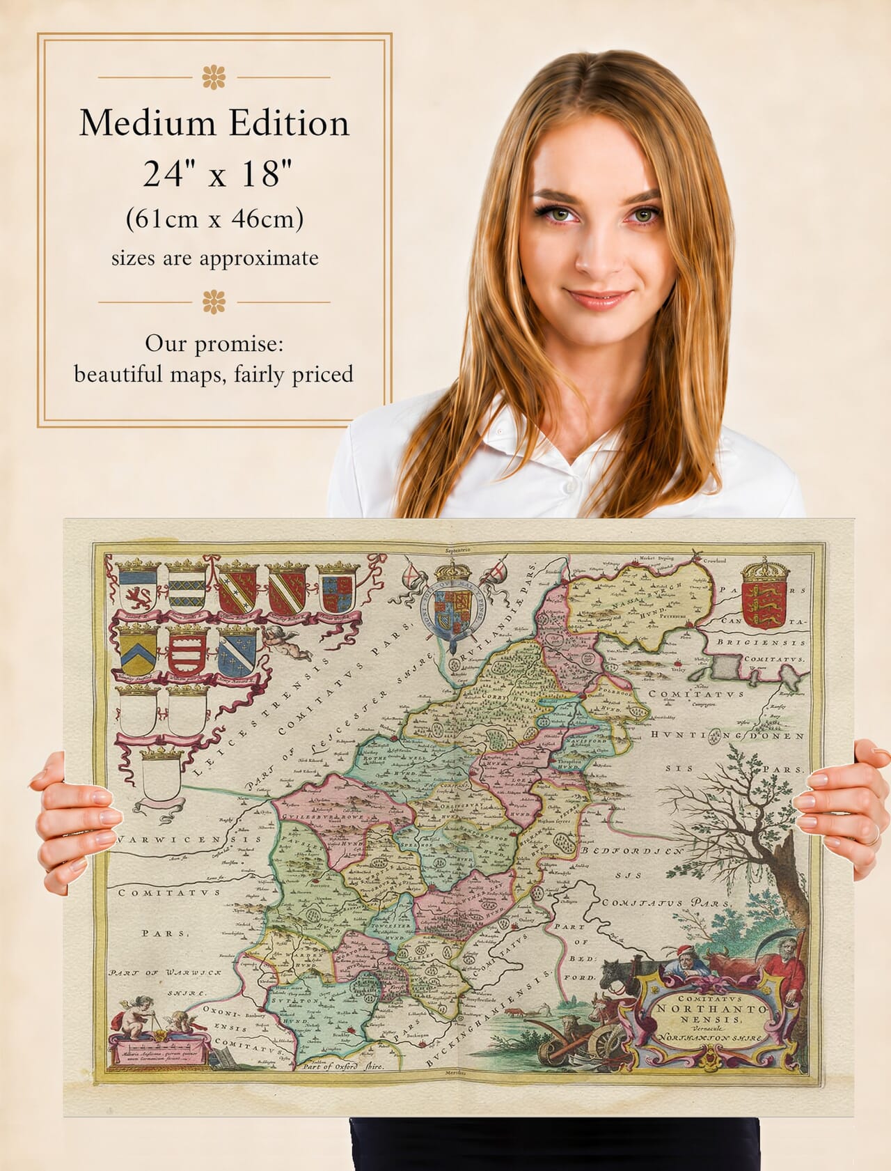
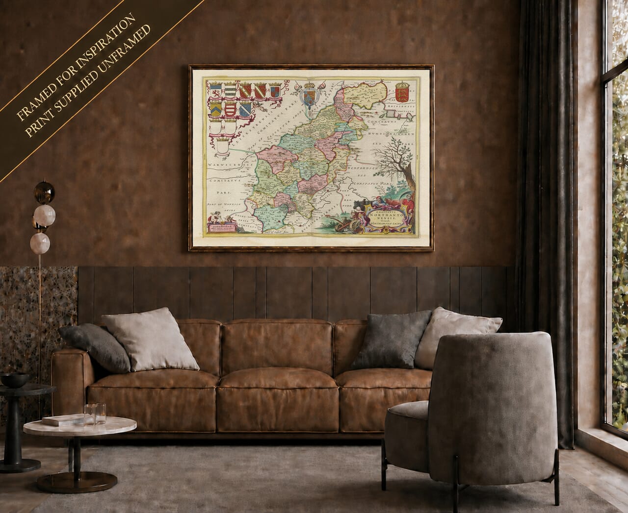
Joan Blaeu’s map of Northamptonshire was first published in Amsterdam in 1645 as part of the fourth volume of his Theatrum Orbis Terrarum, sive Atlas Novus. Its engraved title, Comitatus Northantonensis, Vernacule Northamton Shire, may be translated approximately as “The County of Northampton, commonly called Northamptonshire.”
The map belonged to Blaeu’s celebrated collection of English and Welsh county maps. These substantial copperplate engravings combined established geographical information with elaborate cartouches, heraldic devices and finely arranged typography. Produced for affluent collectors across Europe, the atlas was intended to be both informative and visually impressive.
Joan Blaeu and His County Atlas
Joan Blaeu inherited the family publishing house following the death of his father, Willem Blaeu, in 1638. He expanded the firm’s output and became one of the leading map and atlas publishers of the Dutch Golden Age.
The Northamptonshire map belongs to the county volume issued under Joan’s direction and should therefore be attributed to him rather than to his father. Blaeu did not personally survey the county. Its geographical content was based principally upon earlier English mapping, particularly the pioneering surveys of Christopher Saxton and the county map subsequently published by John Speed.
Blaeu’s Amsterdam workshop refined and re-engraved this inherited information, surrounding it with the decorative features associated with the firm. The plate continued to appear in later atlas editions and was eventually incorporated into the monumental Atlas Maior. Surviving originals may consequently have Latin, French, Dutch or German text printed on the reverse.
Northamptonshire and the River Nene
Northamptonshire is a long, relatively narrow county extending from the borders of Oxfordshire and Buckinghamshire in the southwest towards the fenland edge around Peterborough in the northeast. Its central position made it an important link between southern England, the Midlands and routes leading north.
The River Nene is one of the map’s most prominent geographical features. It passes through or close to Northampton, Wellingborough, Higham Ferrers, Oundle and Peterborough before continuing towards the Wash. The river valley supported settlements, mills, agriculture and local trade, although navigation and drainage differed greatly from their later managed forms.
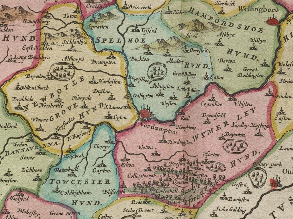
Northampton is clearly represented as the county town. By the seventeenth century it was an established market and administrative centre with a growing reputation for leatherworking and shoemaking. Its later expansion into an internationally important centre of footwear manufacture still lay largely in the future.
Other recognisable towns include Kettering, Daventry, Towcester, Brackley, Oundle and Higham Ferrers. Peterborough appears in the northeast within the historic Soke of Peterborough, an area possessing a distinctive administrative identity while remaining geographically part of Northamptonshire.
Numerous villages, estates and religious sites are shown through conventional engraved symbols. Historic spellings frequently differ from their modern forms, allowing familiar communities to be viewed through seventeenth-century eyes.
Woodland, Pasture and Rural Life
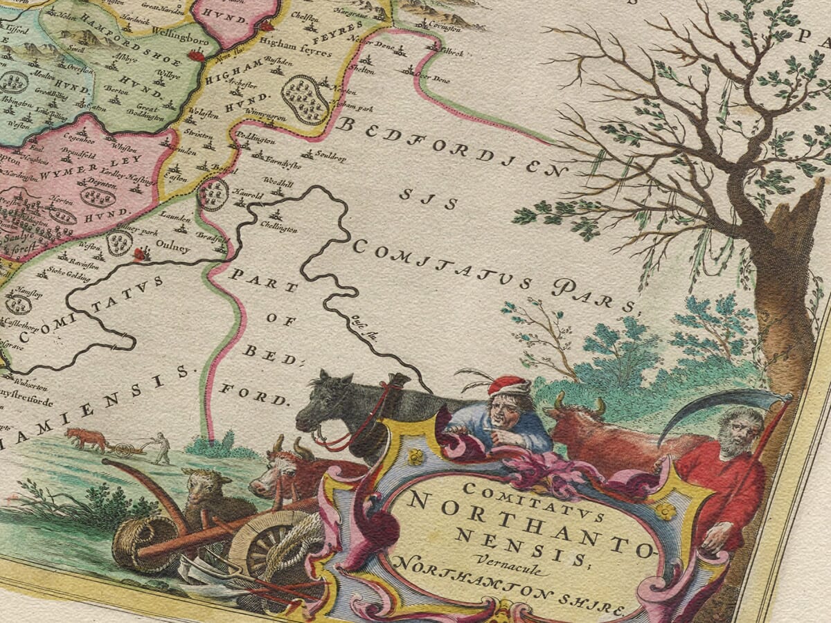
The landscape presented by Blaeu is predominantly rural. Northamptonshire contained extensive arable land, pasture, woodland and long-established estates. Sheep farming and the production of wool were important elements of its agricultural economy, a connection reflected in the pastoral figures and sheep incorporated into the title cartouche.
Rockingham Forest occupied a substantial area in the north of the county. Like other historic royal forests, it was not simply an uninterrupted expanse of trees. It included woodland, settlements, grazing land and cultivated ground governed by particular forest laws and rights.
Blaeu represents hills through pictorial profiles rather than measured contours, while woodland appears as small groups of individual trees. Roads are not systematically recorded, distances are approximate and settlement symbols do not provide a precise indication of population. The map should therefore be understood as a decorative seventeenth-century interpretation rather than a modern topographical survey.
Northamptonshire and the Battle of Naseby
The publication year gives the map exceptional historical resonance. On 14 June 1645 the Battle of Naseby was fought in the northwestern part of Northamptonshire. Parliament’s New Model Army, commanded by Sir Thomas Fairfax with Oliver Cromwell leading the cavalry, decisively defeated the Royalist army of King Charles I.
Naseby proved to be one of the most important battles of the First English Civil War. The Royalist infantry suffered heavy losses, and the King’s baggage train and private correspondence were captured. Although the war continued, the defeat seriously weakened the Royalist cause.
Northampton itself was strongly associated with Parliament, and its position on important routes made the county strategically valuable. Blaeu’s map was not created to document the conflict and contains no depiction of the battle. Nevertheless, it presents the countryside in which this decisive event occurred during the very year of the map’s first publication.
Cartouches and Heraldic Decoration
The title appears within an elaborate rural cartouche populated by figures, animals and sheep. This pastoral imagery provides a visual reference to the county’s agricultural character and the importance of livestock to its economy.
A separate scale cartouche is attended by two cherubs, while heraldic shields associate the county with its noble families, titles and traditions of landownership. These decorative elements balance the dense network of place names, rivers and settlement symbols covering the map.
Blaeu’s engraving captures Northamptonshire before canals, railways, industrial towns and modern roads transformed its landscape. It remains both an absorbing historical record and an outstanding example of the decorative county cartography produced in seventeenth-century Amsterdam.





 Verified owner