



 Verified owner
Got there in time and loves it! Cheers David [Gift from US to UK]
 Verified owner
Thanks Lauren. We received it today - it's gorgeous! Thank you, Ellan
 Verified owner
Thank you for your prompt service. I have a gallery and framing business in South Wales. I'm so pleased it is printed in the UK
 Verified owner
My Isles of Scilly map arrived safely and I'm delighted with it!

The print arrived safely and we're delighted with it - a lovely reminder of our honeymoon 15 years ago.
 Verified owner
I have just received them! I'm sure our clients will be pleased with them and there could be more projects off the back of this one where we can use more. [Interior Designers]
 Verified owner
I just received my map of Ireland by Ewart today and, as usual, I am delighted by its quality. The crispness and fineness of detail is excellent and the colour reproduction surpasses my expectations. Please relay my thanks to Steve for another fine effort!
 Verified owner
Many thanks, Lauren. Very pleased with the map and the service: would recommend The Old Map Company to anyone interested in Old Maps.
 Verified owner
Many thanks, the map arrived safely this morning, and I’m really pleased with it. A stunning reproduction, just as I had hoped. I will keep browsing your website, and may yet be tempted by more of your items! Have a great weekend.
 Verified owner
Just arrived, wonderful map! Thanks very much!
 Verified owner
The map – beautiful – arrived safely, very many thanks.
 Verified owner
Thank you, I have already found the map. It’s wonderfull! Good luck! Rasa
 Verified owner
My apologies for the very late reply. I wanted to reach out to thank you so much for rushing my order. My partner absolutely loved it. I am amazed with the service so that is a five-star from me. I wish you all the best.
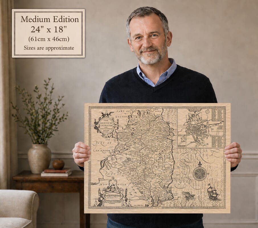
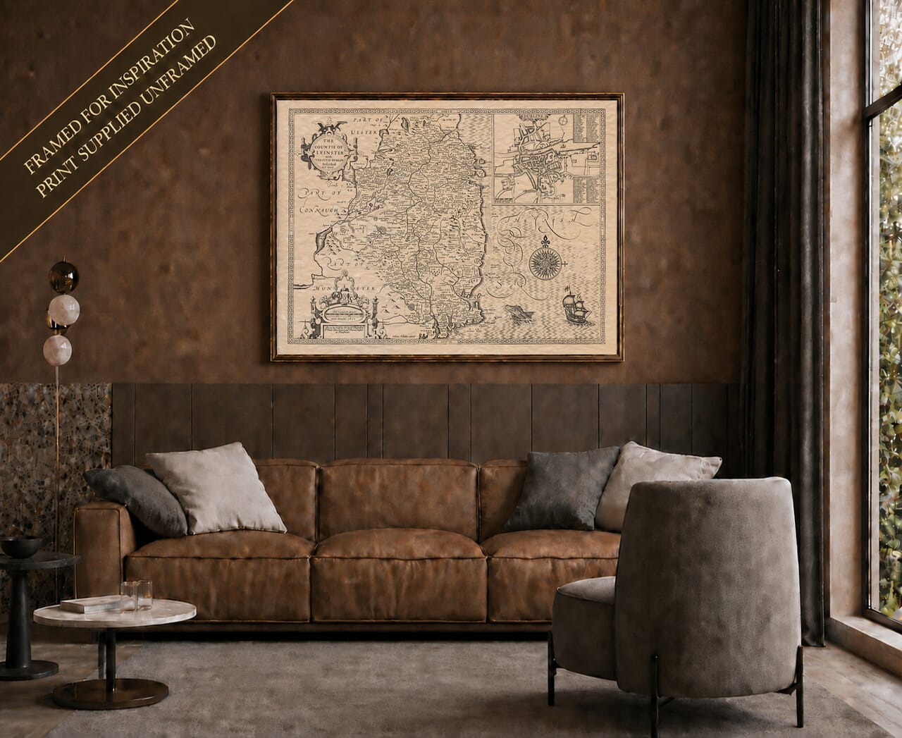
John Speed’s map places Dublin within the wider landscape of Leinster, combining a provincial survey with a detailed plan of the city. Its engraved date of 1610 belongs to the original design. The names of Richard Chiswell and Thomas Bassett on this example identify a later publishing state, associated with their 1676 edition of Speed’s atlas.
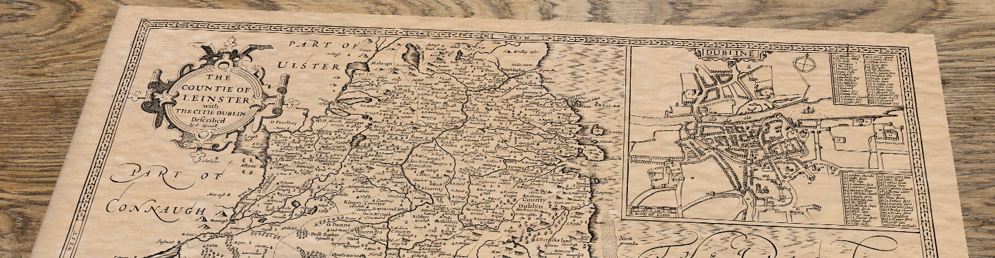
The city plan occupies the upper right of the sheet. Its compact street pattern and river crossing show how different Dublin was before its later expansion. The surrounding walls give the city a clear outline, while the key beside the plan invites the reader to identify individual buildings and places. This close view of Dublin is an important part of the map’s appeal: it makes the provincial sheet a city print as well as a map of eastern Ireland.
King’s County and Queen’s County appear among the divisions of Leinster. These are the names used before the modern Offaly and Laois, and belong to the history of English plantation and administration in Ireland. Their presence helps explain why an old map can look familiar geographically while describing the country in a very different political language. Dublin, Wicklow, Wexford and Kilkenny can be followed across the sheet, with rivers and hill symbols connecting settlements to their surroundings.
Speed’s Theatre brought regional geography together with town plans and decorative engraving. Here, the neat lines of the Dublin inset contrast with the hills and woodland symbols of the provincial map. The Irish Sea provides room for a large compass rose and maritime decoration, giving the design a pleasing balance without losing the wealth of place names on land. The later publisher’s imprint is a useful reminder that a seventeenth-century map could remain in circulation long after the date engraved on its original plate.