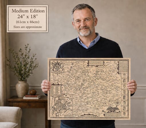
Joan Blaeu’s Map of Leicestershire: Leicestrensis Comitatus
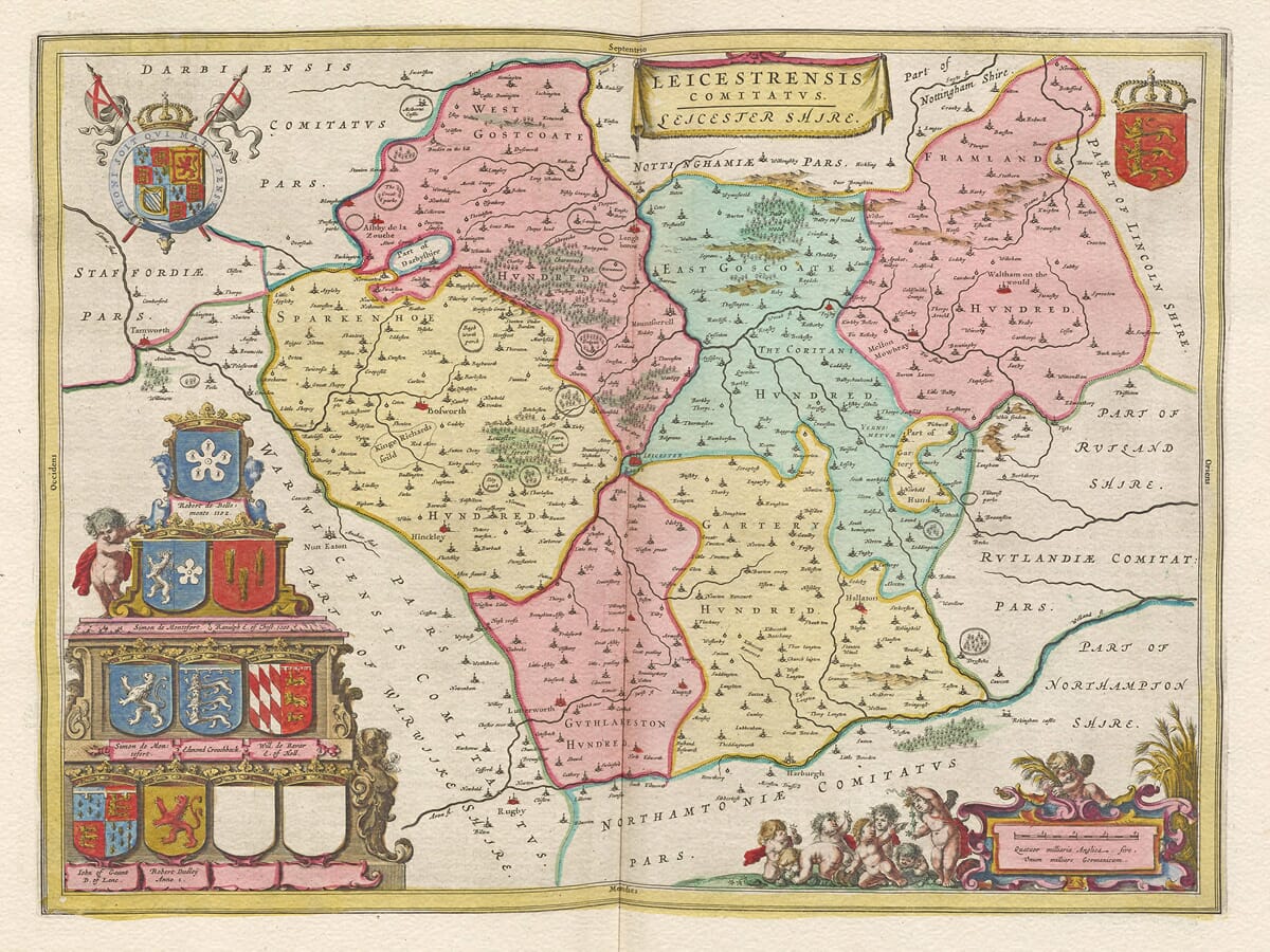
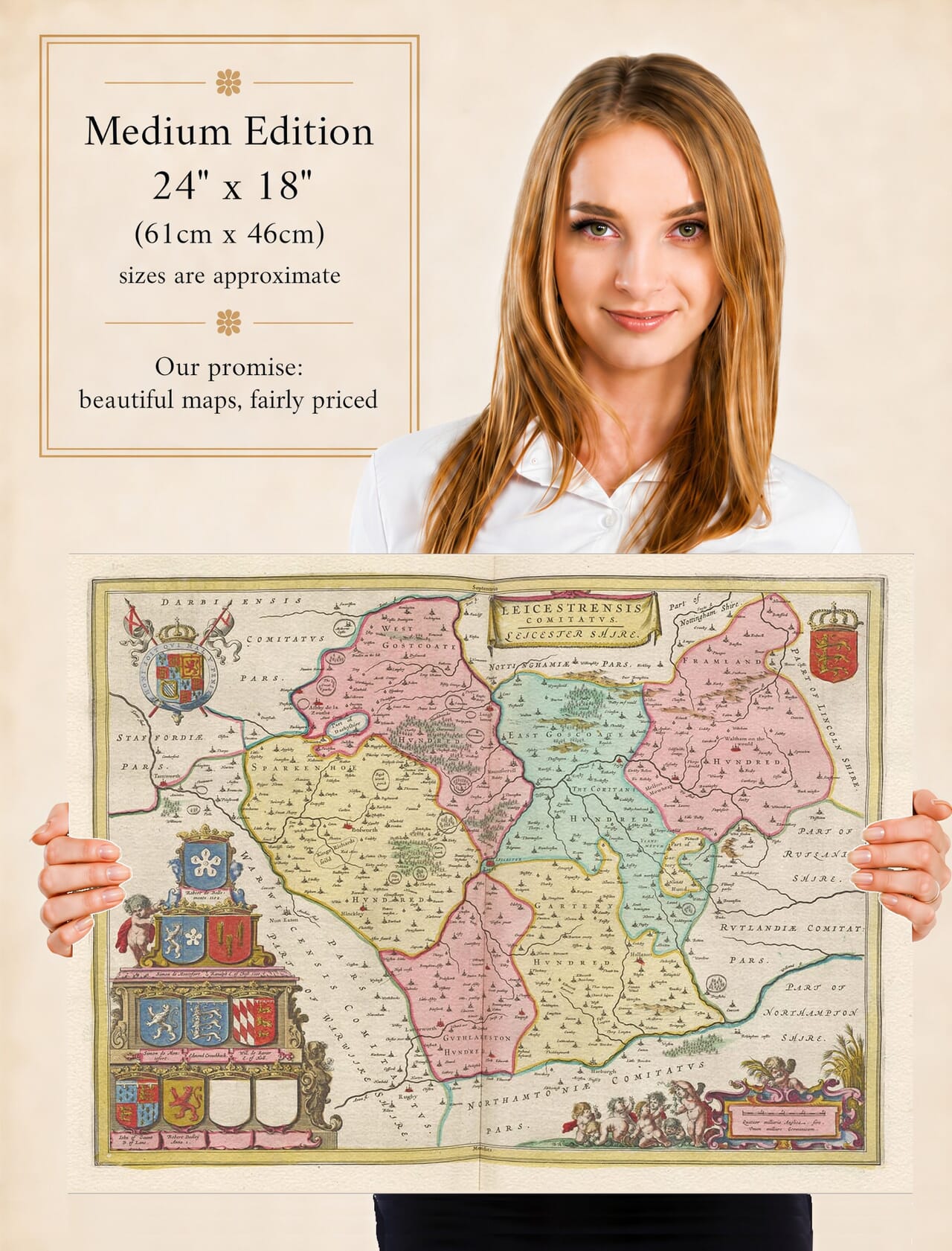
Joan Blaeu’s map of Leicestershire was first published in Amsterdam in 1645 as part of the fourth volume of his Theatrum Orbis Terrarum, sive Atlas Novus. Its engraved title, Leicestrensis Comitatus. Leicester Shire, combines the Latin name for the county with the English form familiar to its inhabitants.
The map formed part of Blaeu’s ambitious collection of English and Welsh county maps. These were produced during a period of intense competition between Amsterdam’s leading atlas publishers, whose works were sought by prosperous collectors throughout Europe. Blaeu’s atlas was admired not only for its geographical coverage but also for its fine engraving, generous format and elaborate decoration.
Joan Blaeu and His English County Maps
Joan Blaeu inherited the family publishing business following the death of his father, Willem Blaeu, in 1638. He continued expanding the firm’s atlases and became one of the most celebrated map publishers of the Dutch Golden Age.
Blaeu did not personally survey Leicestershire. The geographical information used by his workshop was derived from earlier English county mapping, particularly the work of John Speed and the surveying tradition established by Christopher Saxton. Blaeu’s engravers reorganised and refined this material to produce a map with its own distinctive artistic character.
The first edition appeared in 1645, but the copperplate continued to be used in later editions. Original examples may therefore carry Latin, French, Dutch or German text on the reverse. The map was subsequently incorporated into Blaeu’s monumental Atlas Maior during the 1660s.
Leicestershire in the Seventeenth Century
Leicester occupies a prominent central position on the map. The River Soar runs through the county from south to north, passing Leicester and Loughborough before continuing towards the Trent. Other waterways, including the Wreake, help organise the surrounding landscape and connect many of the settlements shown by Blaeu.
The county’s principal market towns can be identified, including Melton Mowbray in the northeast, Market Harborough in the southeast, Hinckley in the southwest and Ashby-de-la-Zouch in the northwest. Numerous villages and smaller communities are represented through conventional symbols, often accompanied by spellings that differ from their modern forms.
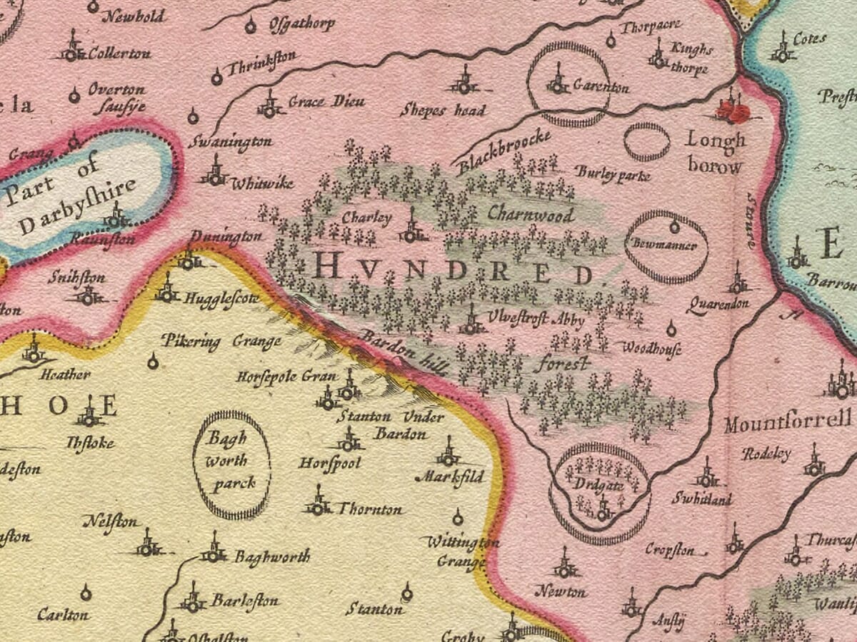
Charnwood Forest is one of the county’s most distinctive landscape features. In Blaeu’s time it was not a forest in the modern sense of continuous woodland but an extensive area of uncultivated ground, woodland, grazing and settlements subject to historic forest rights. The map represents woodland and higher land pictorially rather than through scientifically measured contours.
This was a predominantly agricultural county of pastures, arable land, estates and market communities. The growth of framework knitting, quarrying, engineering and large-scale manufacturing that later shaped Leicester and its surrounding towns had either barely begun or still lay far in the future. Blaeu’s map consequently presents Leicestershire before its industrial transformation.
It should not be read as a modern measured survey. Roads are not systematically recorded, distances are approximate and hills are shown through conventional profiles. Its importance lies in the combination of inherited geographical information, seventeenth-century place names and a highly decorative presentation of the county.
Leicester and the Civil War in 1645
The publication date gives the map a particularly striking historical context. England was experiencing the First Civil War, and Leicester became the scene of serious fighting in the same year that Blaeu’s atlas appeared.
At the end of May 1645, the Royalist army of Charles I besieged and captured the Parliamentarian town. Parliament rapidly dispatched forces to confront the King, contributing to the campaign that culminated in the decisive Royalist defeat at Naseby on 14 June. Leicester was recaptured by Parliamentary forces on 19 June 1645.
Blaeu’s map was not designed as a military document and does not record these events. Nevertheless, its publication coincided with one of the most traumatic episodes in Leicester’s history. It depicts the county’s enduring geography rather than the temporary movement of armies and therefore provides a compelling visual counterpart to the events of that year.
Ashby-de-la-Zouch Castle was another important Royalist stronghold. It remained in Royalist hands during much of the war before surrendering in 1646. The castle and Leicester’s defences remind us that the apparently peaceful landscape depicted by Blaeu existed during a period of considerable political and military upheaval.
Heraldry and Decorative Cartography
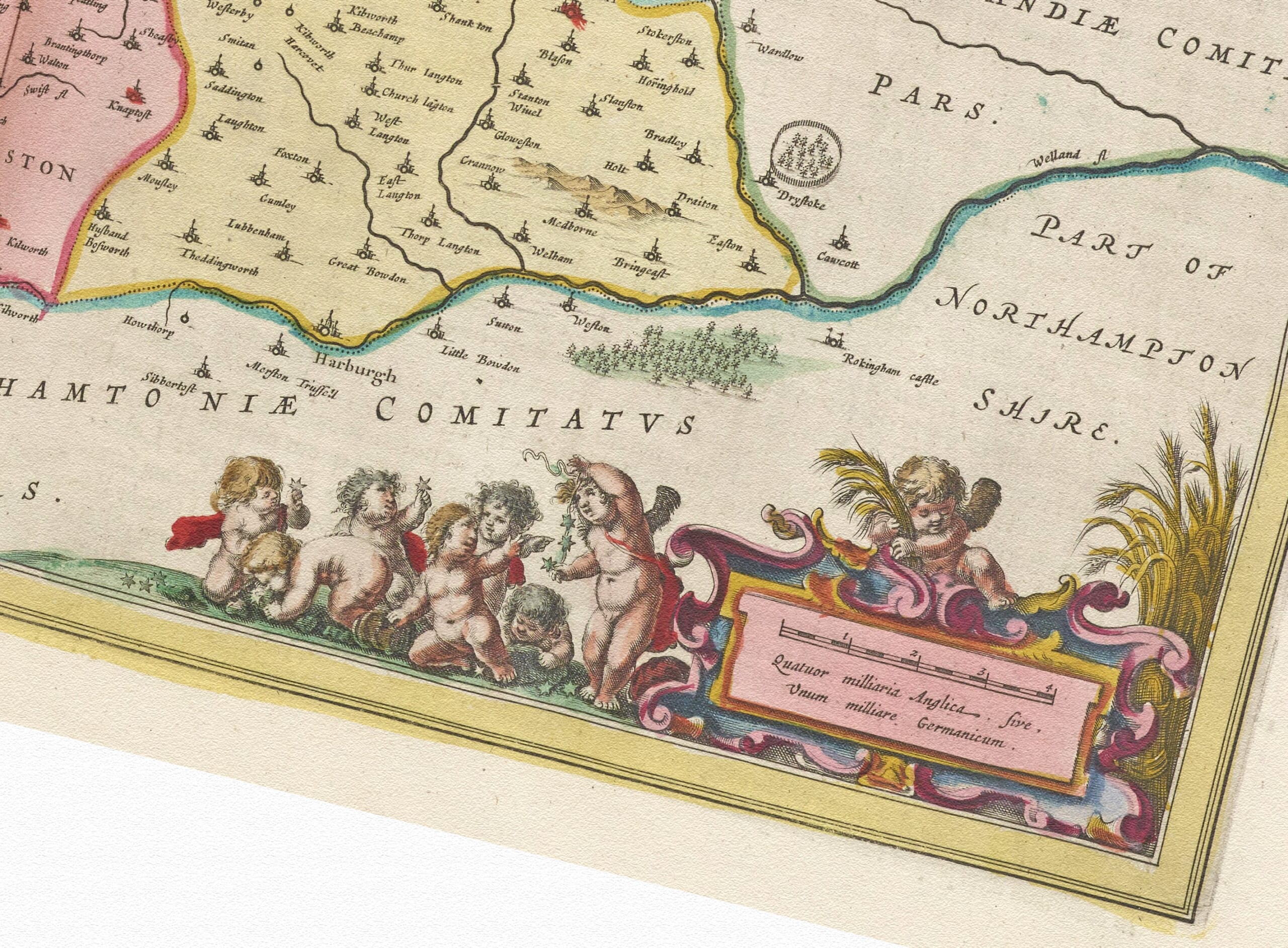
The map is framed by some of the decorative features for which the Blaeu workshop became famous. Its title and scale appear within finely engraved cartouches attended by figures and putti. Two Royal crests and an extensive arrangement of family arms give the upper part of the composition a strongly heraldic character. Some positions were deliberately left as blank shields, a feature found on a number of Blaeu’s English county maps.
These arms connected the geography of Leicestershire with its noble families, titles and traditions of landownership. They also made the map particularly attractive to the affluent international audience for whom Blaeu’s atlases were produced.
Original impressions were printed from the engraved copperplate in black ink, with colour added separately to some copies. Surviving examples can therefore vary considerably in appearance. More information can be found in our article on the colouring of old maps.
Blaeu’s map remains both an important record of historic Leicestershire and a fine example of seventeenth-century decorative cartography. It allows modern viewers to explore the county before industrial growth and urban expansion altered its towns, transport routes and landscape.





 Verified owner