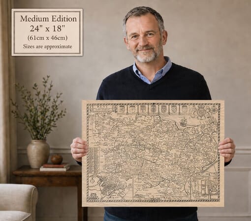
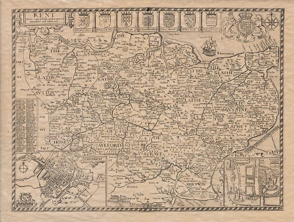
Joan Blaeu’s Map of Kent: Cantium Vernacule Kent
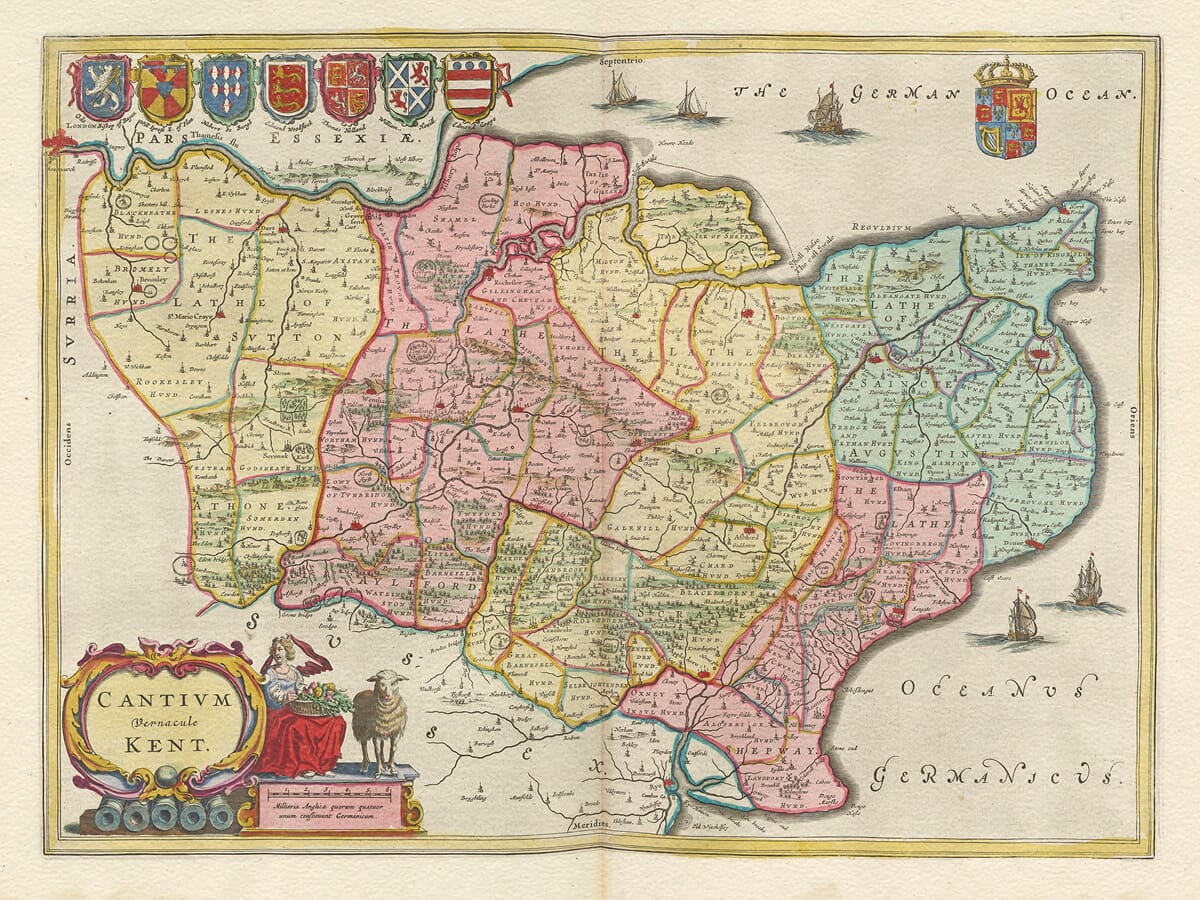
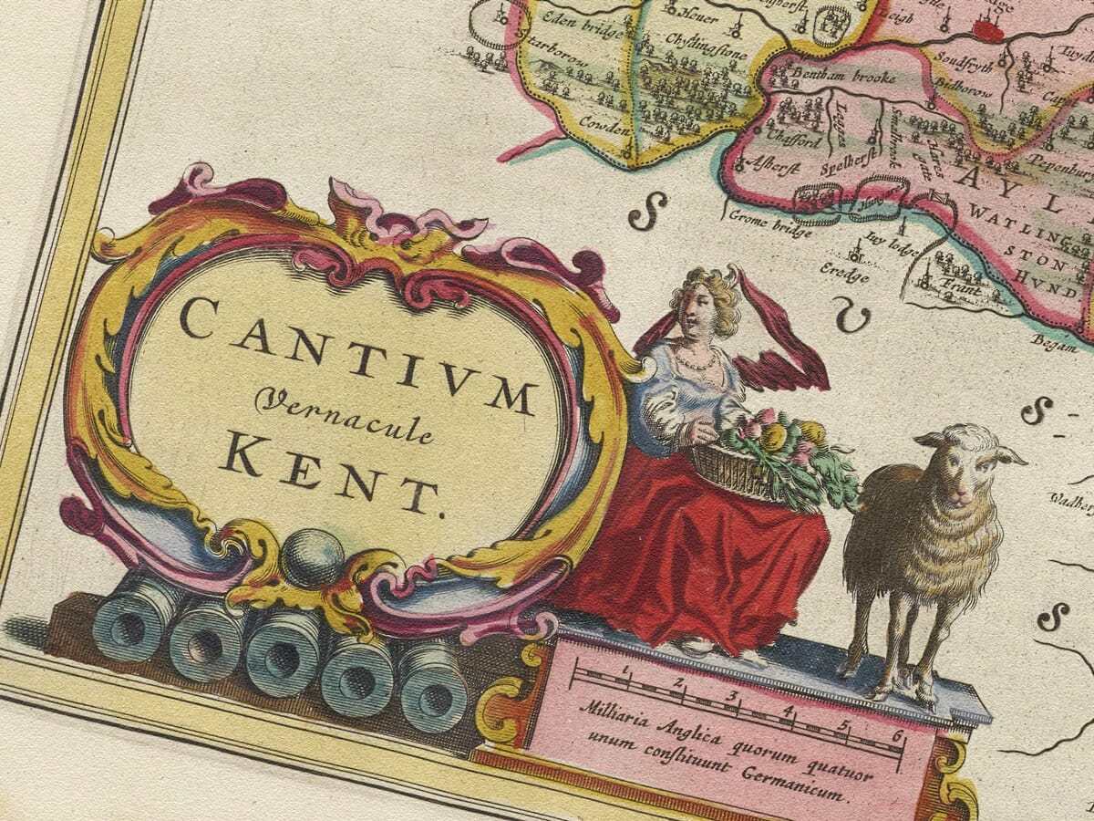
Joan Blaeu’s magnificent map of Kent was first published in Amsterdam in 1645 as part of the volume of his Theatrum Orbis Terrarum, sive Atlas Novus devoted to England and Wales. Its engraved title, Cantium vernacule Kent, can be understood as “Kent, commonly called Kent,” combining the county’s traditional Latin name with its familiar English form.
The map belongs to one of the most celebrated periods in European cartography. Amsterdam had become an important centre for mapmaking, engraving and international publishing, and the Blaeu family operated one of its most prestigious workshops. Joan Blaeu inherited the business following the death of his father, Willem Blaeu, in 1638 and continued expanding the family’s increasingly ambitious series of atlases.
By 1645 Joan Blaeu was competing with the Amsterdam publisher Jan Janssonius to produce a comprehensive collection of maps of the British Isles. Blaeu’s English and Welsh county maps appeared first and helped establish the visual character associated with his later and still more elaborate Atlas Maior. The Kent map subsequently appeared in several editions and languages, which explains why surviving original examples may carry Latin, French, Dutch or German text on the reverse.
Kent Through Seventeenth-Century Eyes
Blaeu’s map was not produced from a new survey of Kent. Its geographical content was based largely upon earlier English mapping, particularly the county map published by John Speed in the early seventeenth century. Blaeu’s achievement lay in refining this inherited information and presenting it through the exceptional engraving, typography and decorative design of his Amsterdam workshop.
The county is shown between London and the Thames in the northwest and the English Channel in the south and east. Its distinctive coastline, estuaries and river systems are immediately recognisable. The Thames Estuary dominates the northern edge, while the River Medway runs inland through Rochester and Maidstone. The Isle of Sheppey, the North Foreland, the low-lying country around Romney Marsh and the headland at Dover help give the map its unmistakably Kentish outline.
Canterbury occupies an appropriately prominent position as the historic ecclesiastical centre of England. Other towns and settlements include Maidstone, Rochester, Tonbridge, Sevenoaks, Ashford, Sandwich, Dover, Hythe and New Romney. Smaller villages are identified by a mixture of names and conventional symbols, providing a fascinating record of the places considered important when the map’s source material was assembled.
The map should not, however, be read like a modern Ordnance Survey sheet. Hills and woodland are represented pictorially rather than measured scientifically, roads are not systematically recorded, and the relative importance of places is sometimes conveyed by the size of their symbols rather than by precise population or area. Historic spellings also differ from those used today. These qualities are part of the map’s character and reveal how seventeenth-century cartographers interpreted and organised geographical information.
Maritime Kent and the Approaches to London
Kent’s position facing the Continent gave it exceptional strategic and commercial importance. Dover, Sandwich, Hythe and New Romney were members of the ancient Confederation of the Cinque Ports, which had supplied ships and men to the Crown in return for privileges. By Blaeu’s time, changes to the coastline and the silting of several harbours had altered their practical importance, but their historic status remained considerable.
The Thames and Medway provided access to London and to important anchorages and shipbuilding facilities. Rochester and Chatham were closely connected with England’s developing naval strength, while the Channel coast remained vital for communication with France and the Low Countries. The ships engraved in the waters surrounding Kent are therefore more than decoration: they reinforce the county’s maritime identity and its position at one of the principal gateways into England.
The map was issued while England was experiencing the First Civil War. Kent’s proximity to London, its ports and its route to the Continent made the county strategically sensitive, although Blaeu’s map was not intended to record military events. The major Royalist rising in Kent occurred in 1648, three years after the map’s first publication, and should not be treated as a feature of the landscape depicted in 1645.
Heraldry and Decorative Engraving
Like many of Blaeu’s finest county maps, Cantium vernacule Kent combines practical geography with elaborate visual ornament. Royal and aristocratic arms appear across the upper part of the engraving, reflecting the importance of lineage, office and inherited authority in seventeenth-century society. These heraldic devices also gave the map an appearance suited to the libraries of prosperous collectors.
The title and scale are enclosed within richly engraved cartouches populated by figures associated with Kent’s rural life and agricultural prosperity. Ships, compass roses and sea creatures animate the surrounding waters without obscuring the coastline. Together, these elements transform the map from a geographical document into a highly decorative work of art.
Original Blaeu maps were printed from copperplates in black ink, with colour added separately to some examples. Colouring therefore varies between surviving copies and editions. You can Read more about the methods used and their effect on historic engravings in our article on the colouring of old maps. The finely engraved place names, delicate pictorial hills, heraldic shields and maritime decoration demonstrate why Blaeu’s county maps have remained so admired.
More than three and a half centuries after its first publication, this map offers both a portrait of historic Kent and an outstanding example of Dutch Golden Age cartography. It records the county before railways, modern roads and large-scale urban expansion transformed its landscape, while celebrating Kent’s enduring relationship with London, the sea and continental Europe.





 Verified owner