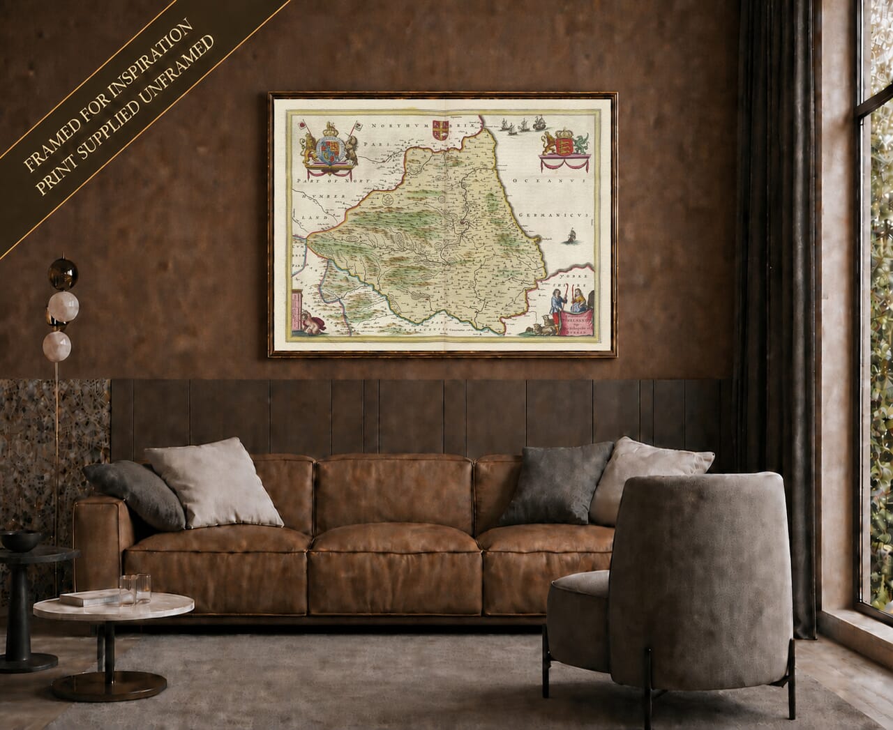
Durham – 1645

Price range: £35.55 through £59.95

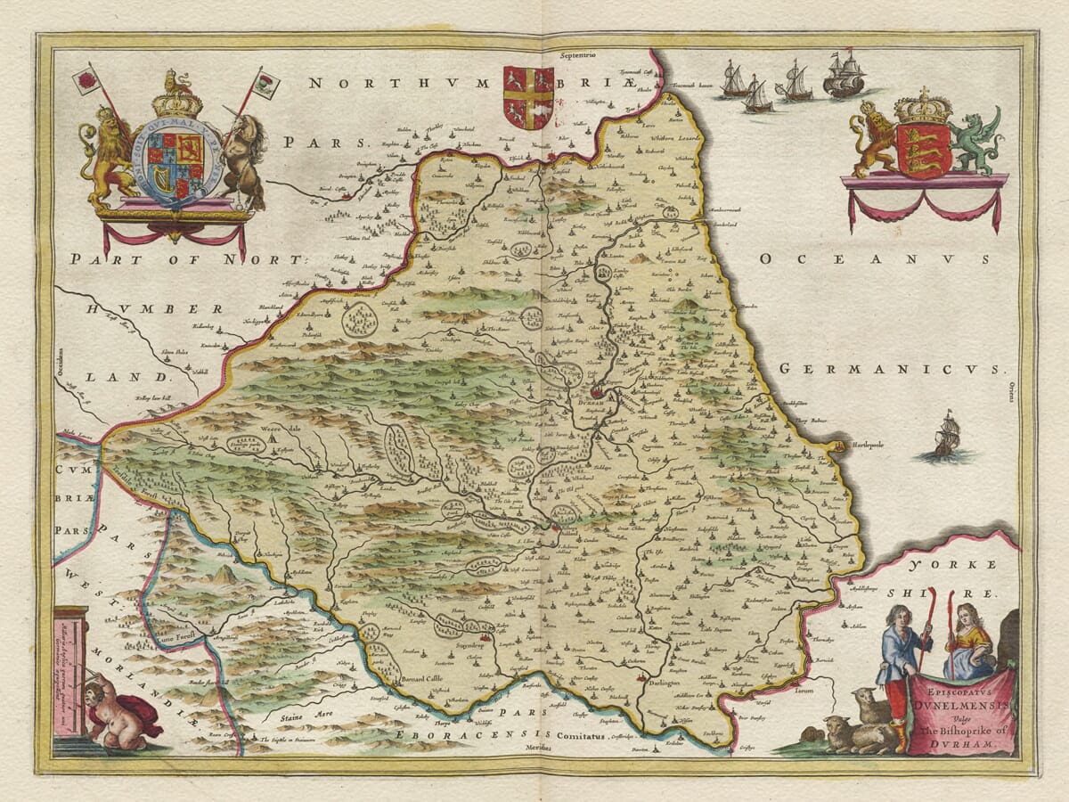
Old Map of Durham 1645 engraved and published by Joan Blaeu Circa 1645

Transport yourself to the 17th century with a faithful reproduction of Joan Blaeu’s 1645 map of Durham, originally published in his landmark atlas, Theatrum Orbis Terrarum. This masterpiece of Dutch cartography highlights the county’s distinct river valleys, historical wards, coal-mining landscapes, and ecclesiastical strongholds, embellished with exquisite heraldry and a neoclassical cartouche.
The intricate copperplate linework provides a captivating historical window into the pre-industrial North East, capturing a time when Durham operated under the semi-independent legal authority of its Prince-Bishops. Every detail of the historic palatinate has been meticulously preserved from the original hand-coloured engraving, guiding the eye past fortified Norman strongholds and ancient market towns, down to the winding river banks and North Sea bays that powered traditional regional life.


+ read more

A stunning certified FINE ART PRINT on heavy textured art paper — not a poster

  • Direct from the publisher — no middlemen
  • Printed in-house in Cornwall
  • Free UK delivery — international shipping available
  • Produced to meet — and often exceed — museum-quality standards

SELECT SIZE

Inspecting Vintage Map Reproduction

Fine Art Map Reproductions – Museum-Quality Printing

Unlike most online offerings, our maps are produced entirely in-house, not outsourced to print-on-demand or drop-shipping services. This allows complete control over quality while offering better value. Each map begins with a high-resolution original, carefully enhanced and printed to order using archival papers and pigment inks for exceptional clarity, depth, and longevity. Every piece is personally overseen — no map leaves our workshop unless it is of a quality we would be proud to display ourselves.

Hand hold a magnifying glass over West Cornwall Map

Authentic Old Map Paper & Accurate Colour Reproduction

Paper choice is essential to the authenticity of our maps. We use specially sourced 190gsm paper made in the UK from pure materials and traditionally pressed with natural woollen felts. This process creates a subtle, randomly textured surface that closely resembles an original antique document. Likewise the use of premium quality ink fully saturates the paper, producing remarkable clarity, depth, and historical character. Colour fastness and sharpness will remain good for in excess of 100 years!

Map in Postal Tube
Buy Old Maps Online in the UK Today Trading online since 1999

The Old Map Company of Great Britain offers a vast and carefully curated collection of the very finest expertly reproduced vintage maps. Our range includes works by renowned cartographers such as John Speed and Willem Blaeu, covering Scotland, England, and beyond. Free UK courier delivery is included, with EU, USA, and worldwide shipping available at cost and calculated at checkout. If you need assistance, our team is always happy to help you choose the perfect map.

RECENT REVIEWS

Daz
DazGB
Verified ownerVerified owner
5/5

Speedy delivery A beautiful representation

1 month ago
David H
David H
Verified ownerVerified owner
5/5

Got there in time and loves it! Cheers David [Gift from US to UK]

3 months ago
Ellan C-S
Ellan C-S
Verified ownerVerified owner
5/5

Thanks Lauren. We received it today - it's gorgeous! Thank you, Ellan

3 months ago
Ivano Di Battista
Ivano Di Battista
Verified ownerVerified owner
5/5

Thank you for your prompt service. I have a gallery and framing business in South Wales. I'm so pleased it is printed in the UK

4 months ago
Robert B
Robert B
Verified ownerVerified owner

5/5

My Isles of Scilly map arrived safely and I'm delighted with it!

4 months ago
Andrew T
Andrew T
Reviewer
5/5

The print arrived safely and we're delighted with it - a lovely reminder of our honeymoon 15 years ago.

4 months ago
Hannah J
Hannah J
Verified ownerVerified owner
5/5

I have just received them! I'm sure our clients will be pleased with them and there could be more projects off the back of this one where we can use more. [Interior Designers]

4 months ago
Sean MacManus
Sean MacManus
Verified ownerVerified owner
5/5

I just received my map of Ireland by Ewart today and, as usual, I am delighted by its quality. The crispness and fineness of detail is excellent and the colour reproduction surpasses my expectations. Please relay my thanks to Steve for another fine effort!

5 months ago
John G
John G
Verified ownerVerified owner
5/5

Many thanks, Lauren. Very pleased with the map and the service: would recommend The Old Map Company to anyone interested in Old Maps.

6 months ago
Lois K
Lois K
Verified ownerVerified owner
5/5

Thrilled , Lauren! Thank You

7 months ago
Ed Simpson
Ed Simpson
Verified ownerVerified owner
5/5

Many thanks, the map arrived safely this morning, and I’m really pleased with it. A stunning reproduction, just as I had hoped. I will keep browsing your website, and may yet be tempted by more of your items! Have a great weekend.

7 months ago
Daniel McCade
Daniel McCade
Verified ownerVerified owner
5/5

Just arrived, wonderful map! Thanks very much!

8 months ago
Jonathon R
Jonathon R
Verified ownerVerified owner
5/5

The map – beautiful – arrived safely, very many thanks.

1 year ago
Rasa Terbetiene
Rasa Terbetiene
Verified ownerVerified owner
5/5

Thank you, I have already found the map. It’s wonderfull! Good luck! Rasa

3 years ago
Mina M.
Mina M.
Verified ownerVerified owner
5/5

My apologies for the very late reply. I wanted to reach out to thank you so much for rushing my order. My partner absolutely loved it. I am amazed with the service so that is a five-star from me. I wish you all the best.

4 years ago
The Bishopric Palatinate of Durham in the Golden Age of European Cartography
This magnificent 1645 map of Durham stands as an extraordinary monument to the golden age of European cartography, created during a period of intense commercial, intellectual, and artistic competition between the elite printing houses of Amsterdam. Engraved and published by Joan Blaeu for his legendary Atlas Novus, this document represents the absolute pinnacle of copperplate engraving and luxury publishing. While England was internally fractured by the operational chaos, religious division, and strategic positioning of the First English Civil War—a conflict that saw the North East heavily occupied by Scottish Covenanter forces—continental masters like Blaeu were gathering, refining, and printing highly sophisticated records of the British landscape. These premium maps were far more than simple geographic guides; they were high-status luxury assets commissioned for the private libraries of European monarchs, merchant princes, and the landed gentry who collected fine art as an explicit symbol of worldly authority.
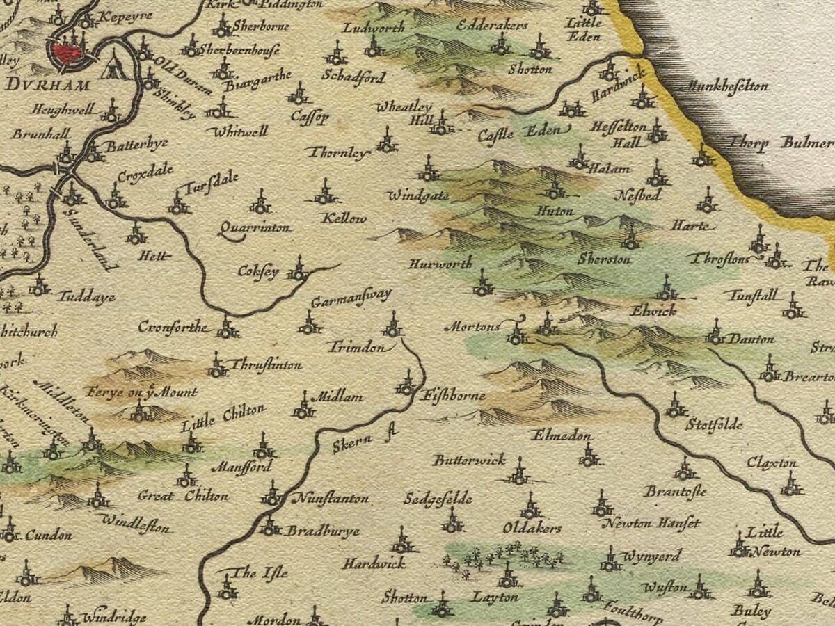
Blaeu’s depiction of Durham brilliantly captures the compact, river-carved topography that defines this historic northern county. Stretching from the wild, limestone heights of the western Pennines down to the rugged, wave-battered North Sea coastline, the county’s physical layout is presented with breathtaking clarity. By utilizing advanced copperplate techniques, Blaeu’s studio achieved a precision of linework and depth of visual contrast that allowed for an immense density of local nomenclature without cluttering the paper canvas. Every individual church spire, gated manor estate, ancient woodland boundary, and traditional watermill is rendered with its own geographic dignity, preserving a pristine historical record of a Jacobean landscape operating on the absolute cusp of modern industrial and maritime expansion.
The Ancient Wards and the Beating Heart of the Coal Liberties
A defining feature of Blaeu’s Durham survey is its careful tracking of the county’s ancient administrative divisions, known traditionally as the Wards. Unlike standard southern shires divided simply into hundreds, Durham utilized four massive Wards—Chester, Darlington, Easington, and Stockton—reflecting its unique historical evolution as a defensive buffer zone. The text characters mapping the interior landscapes reveal an era when Durham society was deeply anchored to its ancient open-field farming systems, monastic traditions, and early mineral extraction.
Though the map predates the heavy steam-pump industrial revolution, it clearly documents the early valleys where coal and lead mining had been carried out since medieval times under the unique legal jurisdictions of the Bishopric’s mineral liberties. Shoppers searching for local ancestral heritage will find immense satisfaction in tracing the historic market hubs and ecclesiastical parishes of the interior. Settlements like Darlington, Stockton-on-Tees, Hartlepool, and Bishop Auckland are rendered not as sprawling modern urban centers, but as tightly clustered, self-contained medieval borough communities. Bishop Auckland is prominently identified by its strategic manor layout, which served as a crucial country palace for the ruling Prince-Bishops. The spelling variations used by Blaeu’s Dutch engravers offer a fascinating blend of local Northumbrian phonetic pronunciations and classical Latin cartographic style, turning the exploration of smaller hamlets into a rewarding journey of historical deduction.
The Fortified Peninsula of Durham and Strategic River Networks
Given the unique physical reality of Durham’s landscape, the strategic river networks receive magnificent emphasis on this print. Blaeu’s engravers decorated the surrounding waters with elegant wave patterns and traditional deep-sea merchant vessels, highlighting the county’s growing reliance on coastal trade, maritime coal transport, and naval defense. The intricate indentations of the coast track the vital river mouths and natural havens that shaped northeastern seafaring history.
The undisputed architectural and ideological heart of the map is the historic city of Durham itself. Blaeu’s rendering pays magnificent tribute to the high, rocky peninsula wrapped in the horseshoe loop of the River Wear, where the towering Norman cathedral and fortress complex rose sharply as a bastion of spiritual and military power. Moving east along the river valleys, the map details the rising economic importance of the River Tyne corridor and Sunderland, marking the vital sea-coal shipping routes that supplied the expanding hearths of London. Further south, the gentle path of the River Tees is beautifully tracked, illustrating the rich pasture lands and border boundaries that separated Durham from the vast expanses of Yorkshire.
The Artistic Anatomy and Heraldic Splendour of the Blaeu Studio
What completely elevates this Joan Blaeu print from a regional geographic survey into a stunning work of gallery art is the magnificent arrangement of decorative and heraldic elements that frame the map. The upper portion of the canvas is adorned with beautifully rendered, high-contrast heraldic crests representing the premium noble titles connected directly to the land. The royal arms of the House of Stuart sit proudly at the top, flanked by the unique, unmistakable armorial shield of the Bishopric of Durham, featuring its traditional cross patonce and lions, symbolizing the dual temporal and spiritual authority of the palatinate. These armorial features were meticulously researched by the Amsterdam workshop to ensure absolute accuracy, serving as both a mark of historical validation and a brilliant marketing masterstroke to secure wealthy British patronage.
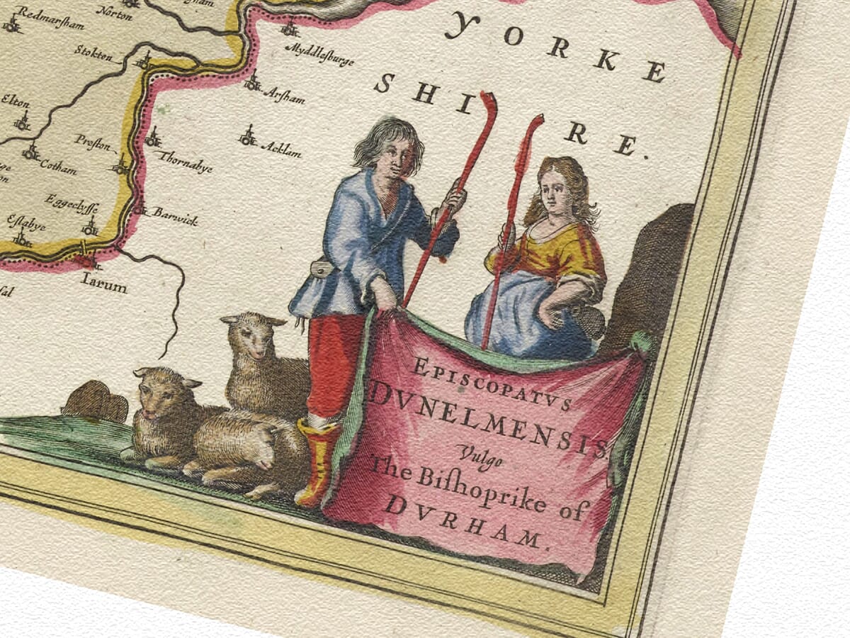
The lower margins are anchored by a highly sophisticated neoclassical title cartouche. This architectural frame is flanked by beautifully drawn figures that personify the rural wealth, mineral abundance, and ecclesiastical heritage of the Durham people. The scale of miles is nestled within its own dedicated plinth, complete with playful cherubs utilizing brass dividers and surveying chains to ground the artwork in the scientific precision of the age. By keeping all text elements separate from the background graphic layer, this print retains its status as a clean, searchable historical document while delivering the deep visual contrast of a traditional copperplate impression.

You may also like…

×
Product added to cart
No products in the cart.