Old Map of Dorset
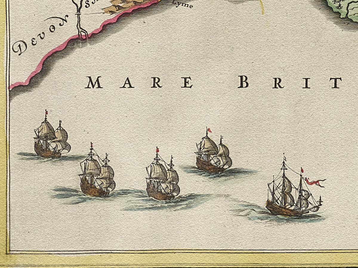
Old Map of Dorset Detail from an old map of Dorset 1645 Detail from an old map of Dorset 1645

Vintage Map of Dorset by Joan Blaeu, 1645

Price range: £35.55 through £59.95

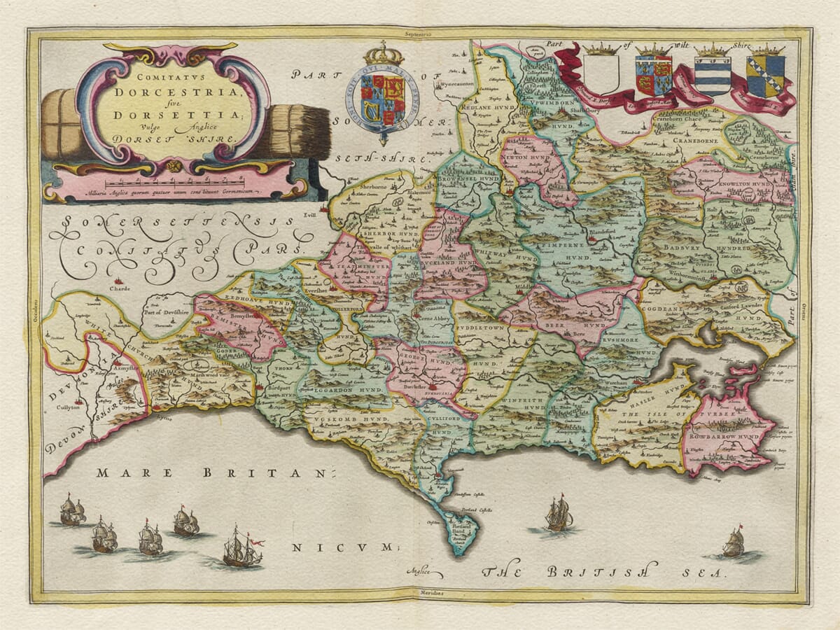
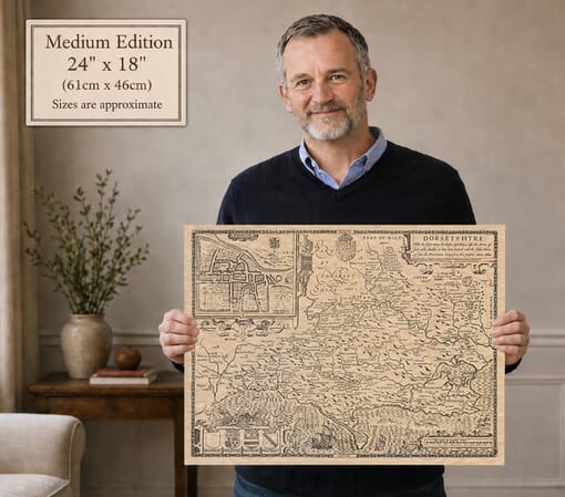
Joan Blaeu’s vintage map of Dorset, first published in Amsterdam in 1645, depicts the county beneath the elaborate Latin title Comitatus Dorcestria, sive Dorsettia; vulgo Anglice Dorset Shire.

Dorchester, Weymouth, Poole, Bridport, Lyme Regis, Sherborne, Shaftesbury and numerous smaller settlements appear across the finely engraved landscape. Dorset’s coastline is animated by sailing ships, while heraldic arms and a richly coloured title cartouche give the map its distinctive seventeenth-century character.

Bales of wool and hemp surrounding the title refer to two important Dorset products of the period, including the hemp used in Bridport’s longstanding rope-making industry. Carefully reproduced as a fine art print, the map makes an attractive gift for anyone with family, historical or personal connections to Dorset.
+ read more

A stunning certified FINE ART PRINT on heavy textured art paper — not a poster

  • Direct from the publisher — no middlemen
  • Printed in-house in Cornwall
  • Free UK delivery — international shipping available
  • Produced to meet — and often exceed — museum-quality standards

SELECT SIZE

Inspecting Vintage Map Reproduction

Fine Art Map Reproductions – Museum-Quality Printing

Unlike most online offerings, our maps are produced entirely in-house, not outsourced to print-on-demand or drop-shipping services. This allows complete control over quality while offering better value. Each map begins with a high-resolution original, carefully enhanced and printed to order using archival papers and pigment inks for exceptional clarity, depth, and longevity. Every piece is personally overseen — no map leaves our workshop unless it is of a quality we would be proud to display ourselves.

Hand hold a magnifying glass over West Cornwall Map

Authentic Old Map Paper & Accurate Colour Reproduction

Paper choice is essential to the authenticity of our maps. We use specially sourced 190gsm paper made in the UK from pure materials and traditionally pressed with natural woollen felts. This process creates a subtle, randomly textured surface that closely resembles an original antique document. Likewise the use of premium quality ink fully saturates the paper, producing remarkable clarity, depth, and historical character. Colour fastness and sharpness will remain good for in excess of 100 years!

Map in Postal Tube
Buy Old Maps Online in the UK Today Trading online since 1999

The Old Map Company of Great Britain offers a vast and carefully curated collection of the very finest expertly reproduced vintage maps. Our range includes works by renowned cartographers such as John Speed and Willem Blaeu, covering Scotland, England, and beyond. Free UK courier delivery is included, with EU, USA, and worldwide shipping available at cost and calculated at checkout. If you need assistance, our team is always happy to help you choose the perfect map.

RECENT REVIEWS

Daz
DazGB
Verified ownerVerified owner
5/5

Speedy delivery A beautiful representation

1 month ago
David H
David H
Verified ownerVerified owner
5/5

Got there in time and loves it! Cheers David [Gift from US to UK]

3 months ago
Ellan C-S
Ellan C-S
Verified ownerVerified owner
5/5

Thanks Lauren. We received it today - it's gorgeous! Thank you, Ellan

3 months ago
Ivano Di Battista
Ivano Di Battista
Verified ownerVerified owner
5/5

Thank you for your prompt service. I have a gallery and framing business in South Wales. I'm so pleased it is printed in the UK

4 months ago
Robert B
Robert B
Verified ownerVerified owner
5/5

My Isles of Scilly map arrived safely and I'm delighted with it!

4 months ago
Andrew T
Andrew T
Reviewer
5/5

The print arrived safely and we're delighted with it - a lovely reminder of our honeymoon 15 years ago.

4 months ago
Hannah J
Hannah J
Verified ownerVerified owner
5/5

I have just received them! I'm sure our clients will be pleased with them and there could be more projects off the back of this one where we can use more. [Interior Designers]

4 months ago
Sean MacManus
Sean MacManus
Verified ownerVerified owner
5/5

I just received my map of Ireland by Ewart today and, as usual, I am delighted by its quality. The crispness and fineness of detail is excellent and the colour reproduction surpasses my expectations. Please relay my thanks to Steve for another fine effort!

5 months ago
John G
John G
Verified ownerVerified owner
5/5

Many thanks, Lauren. Very pleased with the map and the service: would recommend The Old Map Company to anyone interested in Old Maps.

6 months ago
Lois K
Lois K
Verified ownerVerified owner
5/5

Thrilled , Lauren! Thank You

7 months ago
Ed Simpson
Ed Simpson
Verified ownerVerified owner
5/5

Many thanks, the map arrived safely this morning, and I’m really pleased with it. A stunning reproduction, just as I had hoped. I will keep browsing your website, and may yet be tempted by more of your items! Have a great weekend.

7 months ago
Daniel McCade
Daniel McCade
Verified ownerVerified owner
5/5

Just arrived, wonderful map! Thanks very much!

8 months ago
Jonathon R
Jonathon R
Verified ownerVerified owner
5/5

The map – beautiful – arrived safely, very many thanks.

1 year ago
Rasa Terbetiene
Rasa Terbetiene
Verified ownerVerified owner
5/5

Thank you, I have already found the map. It’s wonderfull! Good luck! Rasa

3 years ago
Mina M.
Mina M.
Verified ownerVerified owner
5/5

My apologies for the very late reply. I wanted to reach out to thank you so much for rushing my order. My partner absolutely loved it. I am amazed with the service so that is a five-star from me. I wish you all the best.

4 years ago

Dorset on Joan Blaeu’s 1645 Map

Joan Blaeu published this map in Amsterdam in 1645 under the title Comitatus Dorcestria, sive Dorsettia; vulgo Anglice Dorset Shire. The title associates the county with Dorchester and gives alternative Latin forms of Dorset before ending with its commonly used English name, Dorsetshire.

The first edition appeared in Le Théâtre du Monde ou Nouvel Atlas, the French-language edition of Blaeu’s expanding atlas. Later impressions were printed for editions in other languages, but the Dorset plate itself first appeared in 1645.

Blaeu did not undertake a new survey of the county. His English county series was based principally on earlier English cartography associated with Christopher Saxton and John Speed. The Amsterdam workshop presented this inherited geographical information through newly engraved copperplates, decorative lettering, heraldry and carefully composed cartouches.

Dorchester occupies its central position as the county town. Other recognisable places include Sherborne, Shaftesbury, Blandford, Bridport, Lyme Regis, Weymouth, Wareham and Poole, together with numerous villages and smaller settlements. Rivers and conventional pictorial hills provide a general representation of the landscape, but the engraving predates modern contour mapping and scientific topographical surveying.

Dorset’s southern coast is an important part of the composition. The Isle of Portland, coastal settlements and major inlets can be identified, while sailing ships decorate the sea. These vessels add maritime character but should not be interpreted as evidence of particular voyages, naval actions or established shipping routes.

The title cartouche is especially relevant to Dorset. Its red and gold framework is accompanied by bales representing wool and hemp. Sheep farming and wool formed important parts of the county’s rural economy, while hemp was closely connected with the production of rope, cordage and nets.

Bridport had been associated with rope-making since the Middle Ages. In 1211 King John ordered the town to produce ropes and cables for ships. Hemp and flax were cultivated in the surrounding district, and the industry became so well established that restrictions were later imposed upon competing rope production nearby. The hemp bales on Blaeu’s map therefore refer to a genuine and recognisable Dorset trade.

Four principal heraldic devices occupy the upper-right area of the map. The central device is the royal coat of arms, accompanied by arms connected with the county. These heraldic elements follow the general arrangement found on John Speed’s earlier Dorset map and form an important part of Blaeu’s decorative treatment.

The publication date places the map in the closing stages of the First English Civil War. Dorset had experienced divided loyalties, sieges and the movement of opposing armies. Sherborne Old Castle became a Royalist stronghold but fell to Parliamentarian forces in 1645 after an eleven-day siege.

The same year also saw the emergence of Dorset’s Clubmen—local people who attempted to protect their communities from the theft, requisitioning and disruption caused by armies on both sides. Around 3,000 gathered on the downs near Fontmell in 1645. These events supply valuable historical context, although Blaeu’s engraving does not identify battlefields, garrisons or troop movements.

The map should therefore be understood as decorative county cartography rather than a military, road or land-ownership survey. It records historic place names and broad geographical relationships while surrounding them with carefully chosen symbols of Dorset’s agriculture, maritime position and established trades.

Comitatus Dorcestria remains particularly appealing because its decoration is genuinely connected with the county it portrays. The ships, wool, hemp and heraldry provide visual interest while helping modern viewers understand how Dorset was represented to a seventeenth-century European atlas audience.


You may also like…

×
Product added to cart
No products in the cart.