Homann’s Map of Great Britain and Ireland
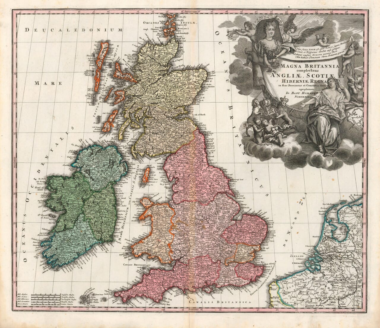
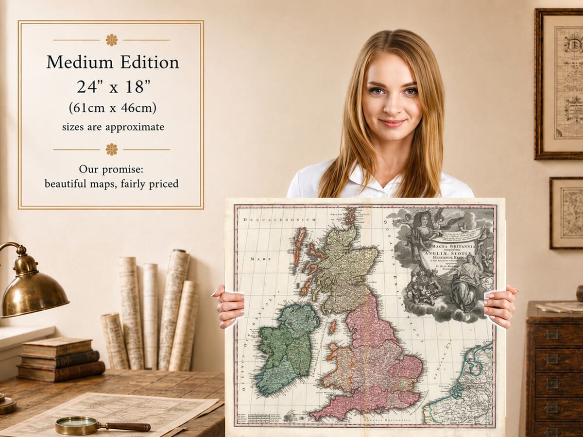
Johann Baptist Homann’s Magna Britannia places the British Isles beneath a large royal composition celebrating Queen Anne. The Latin title identifies England, Scotland and Ireland, divided into provinces and counties, while the map itself includes Wales and the surrounding islands. An example of this design is catalogued in the David Rumsey Map Collection in a Homann atlas dated approximately 1716.
Map Details
- Original title: Magna Britannia complectens Angliae, Scotiae et Hiberniae Regna, in suas Provincias et Comitatus divisa
- Cartographer and publisher: Johann Baptist Homann
- Publication place: Nuremberg
- Date: c.1716; approximate dating from a catalogued atlas example of this design
- Area shown: Great Britain, Ireland and surrounding islands, with part of the continental coast
- Orientation: North at the top
- Original technique: Engraving with historic colouring
- Distinctive features: Queen Anne portrait, royal arms, allegorical figures, coloured territories and multiple distance scales
Queen Anne Above the British Isles
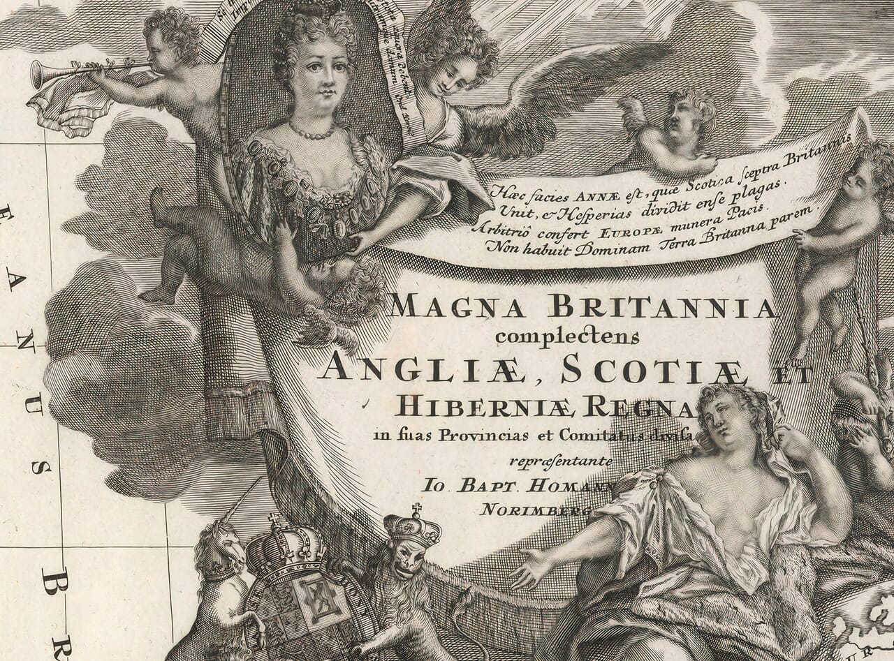
The title ornament occupies much of the upper-right sea area. Queen Anne’s portrait is set among clouds and winged figures, with a trumpet at the upper left and a Latin verse that explicitly names Annae. Below are the crowned royal arms, supported by a lion and unicorn. A seated female figure gestures towards the heraldic group, while flowing robes and deeply shaded clouds give the engraving the character of a small historical picture.
Anne reigned from 1702 to 1714. The union of the English and Scottish parliaments in 1707 made the title Magna Britannia especially apt for this royal presentation. Her presence records the design’s association with her reign; a portrait on an engraved plate does not by itself establish the date of every impression. The approximate date used here follows the catalogued atlas example, rather than a date printed on the supplied sheet.
Colour, Coastlines and Islands
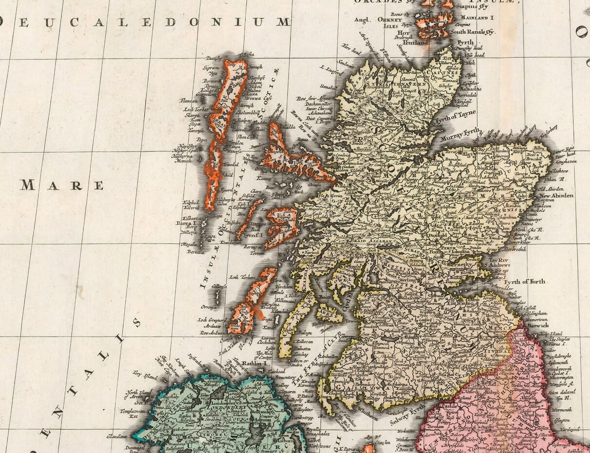
The colour makes the main divisions immediately readable. Pink extends across England, pale yellow covers much of Scotland, and green distinguishes Ireland. Orange outlines Wales and several islands, creating a lively contrast against the quieter paper tone and uncoloured decorative engraving.
Scotland stretches towards Orkney at the top of the sheet. The Hebrides form a long chain off its western coast, with the individual islands outlined and named. Across the North Channel, the northern Irish counties face the Scottish coast. The Isle of Man occupies the Irish Sea between the larger islands; farther south, Anglesey lies beside the coast of Wales.
The grid of latitude and longitude runs through land and sea. Coastal hatching gives the island outlines a darker edge, while rivers and small engraved hills fill the interior. Along the lower right, the French coast and the Dutch coastline extend the view beyond Britain and Ireland. Several differently labelled distance scales sit together in the lower-left corner.
A Close Look at the Midlands
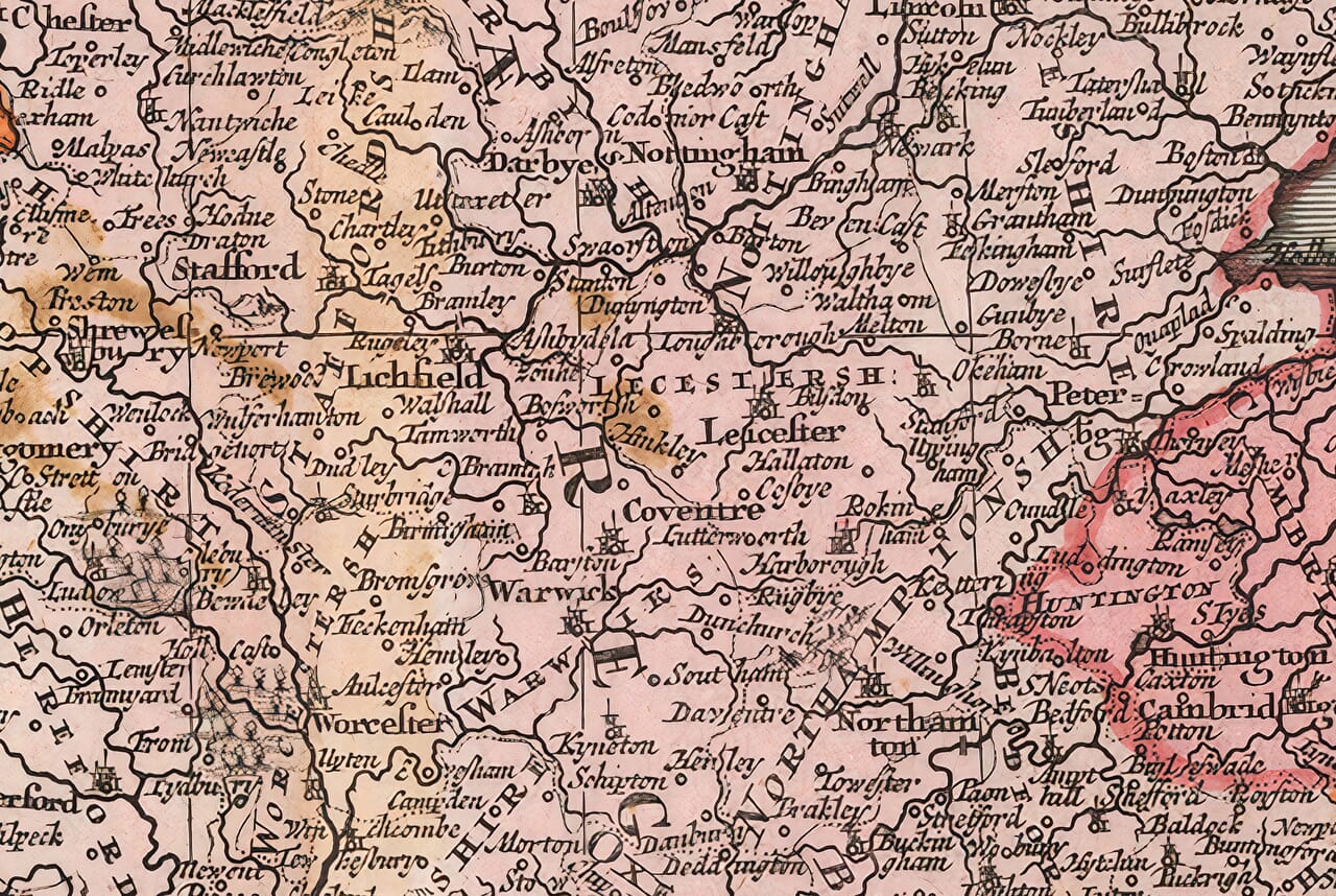
The enlarged Midlands detail shows how much information Homann fitted into the map. Nottingham, Leicester, Coventry, Warwick and Worcester appear among smaller settlements, river crossings and county names. Larger towns are marked with miniature building symbols, while simpler circles identify many of the smaller places.
Old spellings add another layer of interest. Derby appears as Darbÿe, and Birmingham as Brimigham. The Trent winds through the Nottingham area, and names such as Stafford, Lichfield and Northampton give familiar reference points within the closely engraved network. The lettering varies in size and style to distinguish counties, towns and waterways, making the detail worth reading slowly.
Homann’s Nuremberg Workshop
Homann founded his publishing business in Nuremberg in 1702 and became one of the leading German atlas publishers of the early eighteenth century. He was appointed Imperial Geographer in 1715. His maps combined extensive geographical information with elaborate engraved ornament, serving both as reference works and as objects intended to be enjoyed visually.
On this sheet, that balance is particularly clear. The dense place names and rivers describe the islands, while the Queen Anne composition presents a continental view of British royal power. The Latin title and German place of publication remind us that the map was made for readers beyond Britain itself.
Your Fine Art Print
We reproduce the map on 190gsm textured fine art paper using our twelve-pigment-ink giclée process. The historic colouring, fine linework and warm paper character are retained in the reproduction. Supplied unframed in three approximate print sizes, it leaves you free to choose a frame suited to your room.





 Verified owner









