Historical Venus and Mercury diagram with a golden circular band, paired epicycles, Latin notes and two lower insets
Historical Venus and Mercury diagram with a golden circular band, paired epicycles, Latin notes and two lower insets Unique home decor detail Unique home decor detail

Antique Astronomy Chart – Venus and Mercury

Price range: £29.95 through £59.95

Antique astronomy chart by Andreas Cellarius, illustrating historical theories of Venus and Mercury; first published in 1660.

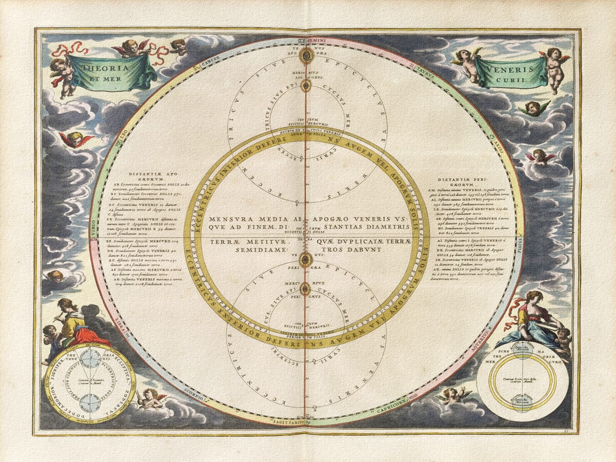
A broad golden circular band encloses paired epicycle diagrams and a fine vertical axis. Columns of Latin explanation flank the geometry, with two smaller models below and green title banners among the clouds.

A modern giclée fine art print, supplied unframed. The original atlas issue represented by this image is unconfirmed.

Its generous pale spaces and gold accents make an elegant companion to books and globes—a considered present for someone with a curiosity about the planets.

+ read more

A stunning certified FINE ART PRINT on heavy textured art paper — not a poster

  • Direct from the publisher — no middlemen
  • Printed in-house in Cornwall
  • Free UK delivery — international shipping available
  • Produced to meet — and often exceed — museum-quality standards

SELECT SIZE

Inspecting Mercator's 1623 old map of Great Britain and Ireland

Fine Art Map Reproductions – Museum-Quality Printing

Unlike most online offerings, our maps are produced entirely in-house, not outsourced to print-on-demand or drop-shipping services. This allows complete control over quality while offering better value. Each map begins with a high-resolution original, carefully enhanced and printed to order using archival papers and pigment inks for exceptional clarity, depth, and longevity. Every piece is personally overseen — no map leaves our workshop unless it is of a quality we would be proud to display ourselves.

Hand hold a magnifying glass over West Cornwall Map

Authentic Old Map Paper & Accurate Colour Reproduction

Paper choice is essential to the authenticity of our maps. We use specially sourced 190gsm paper made in the UK from pure materials and traditionally pressed with natural woollen felts. This process creates a subtle, randomly textured surface that closely resembles an original antique document. Likewise the use of premium quality ink fully saturates the paper, producing remarkable clarity, depth, and historical character. Colour fastness and sharpness will remain good for in excess of 100 years!

Map in Postal Tube
Buy Old Maps Online in the UK Today Trading online since 1999

The Old Map Company of Great Britain offers a vast and carefully curated collection of the very finest expertly reproduced vintage maps. Our range includes works by renowned cartographers such as John Speed and Willem Blaeu, covering Scotland, England, and beyond. Free UK courier delivery is included, with EU, USA, and worldwide shipping available at cost and calculated at checkout. If you need assistance, our team is always happy to help you choose the perfect map.

RECENT REVIEWS

Daz
DazGB
Verified ownerVerified owner
5/5

Speedy delivery A beautiful representation

3 months ago
David H
David H
Verified ownerVerified owner
5/5

Got there in time and loves it! Cheers David [Gift from US to UK]

5 months ago
Ellan C-S
Ellan C-S
Verified ownerVerified owner
5/5

Thanks Lauren. We received it today - it's gorgeous! Thank you, Ellan

5 months ago
Ivano Di Battista
Ivano Di Battista
Verified ownerVerified owner
5/5

Thank you for your prompt service. I have a gallery and framing business in South Wales. I'm so pleased it is printed in the UK

5 months ago
Robert B
Robert B
Verified ownerVerified owner
5/5

My Isles of Scilly map arrived safely and I'm delighted with it!

6 months ago
Andrew T
Andrew T
Reviewer
5/5

The print arrived safely and we're delighted with it - a lovely reminder of our honeymoon 15 years ago.

6 months ago
Hannah J
Hannah J
Verified ownerVerified owner
5/5

I have just received them! I'm sure our clients will be pleased with them and there could be more projects off the back of this one where we can use more. [Interior Designers]

6 months ago
Sean MacManus
Sean MacManus
Verified ownerVerified owner
5/5

I just received my map of Ireland by Ewart today and, as usual, I am delighted by its quality. The crispness and fineness of detail is excellent and the colour reproduction surpasses my expectations. Please relay my thanks to Steve for another fine effort!

6 months ago
John G
John G
Verified ownerVerified owner
5/5

Many thanks, Lauren. Very pleased with the map and the service: would recommend The Old Map Company to anyone interested in Old Maps.

8 months ago
Lois K
Lois K
Verified ownerVerified owner
5/5

Thrilled , Lauren! Thank You

8 months ago
Ed Simpson
Ed Simpson
Verified ownerVerified owner
5/5

Many thanks, the map arrived safely this morning, and I’m really pleased with it. A stunning reproduction, just as I had hoped. I will keep browsing your website, and may yet be tempted by more of your items! Have a great weekend.

8 months ago
Daniel McCade
Daniel McCade
Verified ownerVerified owner
5/5

Just arrived, wonderful map! Thanks very much!

10 months ago
Jonathon R
Jonathon R
Verified ownerVerified owner
5/5

The map – beautiful – arrived safely, very many thanks.

1 year ago
Rasa Terbetiene
Rasa Terbetiene
Verified ownerVerified owner
5/5

Thank you, I have already found the map. It’s wonderfull! Good luck! Rasa

4 years ago
Mina M.
Mina M.
Verified ownerVerified owner
5/5

My apologies for the very late reply. I wanted to reach out to thank you so much for rushing my order. My partner absolutely loved it. I am amazed with the service so that is a five-star from me. I wish you all the best.

4 years ago

Historical Background

A golden circular band and a strong vertical axis organise this antique astronomy chart of Venus and Mercury. The title identifies the two planets explicitly, distinguishing the plate from Cellarius’s neighbouring chart of Mars, Jupiter and Saturn. Engraved by Johannes van Loon for Harmonia Macrocosmica, it presents historical geometric theories of planetary motion through circles, centres, marked positions and explanatory Latin text.

Map Details

  • Original title: Theoria Veneris et Mercurii
  • Chartmaker: Andreas Cellarius
  • Engraver: Johannes van Loon
  • Source atlas: Harmonia Macrocosmica
  • First published: Amsterdam, 1660, by Johannes Janssonius
  • Edition reproduced: Exact issue unconfirmed
  • Subject: Historical theories of the motions of Venus and Mercury
  • Original format: Engraved atlas plate with colour

Two planets, one geometrical field

Venus and Mercury are treated together in the composition, but the plate is not a modern image of their surfaces or physical sizes. Its interest lies in their positional relationships and the circles used to represent motion. The small golden discs are markers within that construction. Their placement along the vertical axis gives the eye a route through a diagram that otherwise contains several overlapping scales and centres.

Above the golden band are nested circles labelled for epicycles, with a corresponding group below. The broad ring itself is labelled as a deferent, the larger circular path associated with an epicycle construction. These different elements should be followed individually before trying to read them as one system. The engraver uses the pale background to keep the fine lines distinct, allowing considerable complexity without a heavily shaded central field.

The language of centres and distances

The vertical axis passes through named reference points and marked planetary positions. Large central lettering discusses measurements associated with the construction, while smaller inscriptions identify centres and parts of the circles. Apogee and perigee references appear along the scheme. In a historical diagram of this kind, those terms concern farthest and nearest positions relative to the model’s reference, rather than a decorative naming of the top and bottom of the page.

Two columns of Latin text sit on either side of the main geometry. They discuss distances and reference points, turning the plate into more than a visual summary. The reader is given both the construction and written material connected to its interpretation. The columns also create a balanced composition: the open central axis is flanked by dense notes, with enough space between them to keep the larger circles readable.

Why epicycles appear here

An epicycle is a small circle whose centre follows a larger circular path. Historical astronomers combined such movements to represent changes in a planet’s apparent position. The method was intended to explain and predict what could be observed from Earth. The chart’s circles therefore belong to a mathematical model, rather than being physical tracks drawn around the planets.

Venus and Mercury have their own observational relationship with the Sun, and the plate gives them a separate treatment rather than including them indiscriminately in a generic star map. The original title is the safest guide to its subject. It should not be described as a constellation chart merely because a zodiac surrounds the diagram, nor as an accurate modern map of the solar system.

The insets and the zodiac

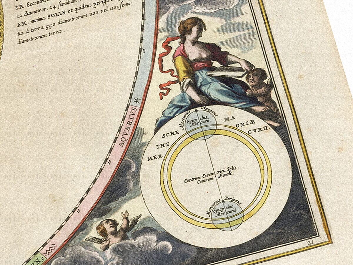
Two circular insets occupy the lower corners. Both use golden rings and fine internal geometry, but their arrangements differ. The left-hand figure contains blue circles within its construction; the right uses nested paths around marked centres. Their captions refer to theories for Venus and Mercury. These smaller models extend the plate’s comparative character, providing additional ways to examine the main problem.

Around the outside, a pastel zodiac carries sign names and symbols. Gemini lies at the top, Sagittarius at the bottom, and the other signs follow the surrounding ring. Fine graduations run along its inner edge. The zodiac supplies a positional framework, while the central geometry and text deal with the particular planetary theories.

Colour, clouds and the atlas source

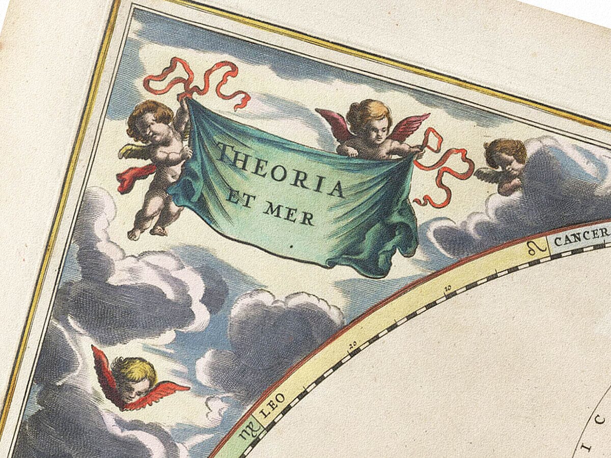
Green title banners are held by winged figures in the upper corners. More figures appear among blue-grey clouds, with larger seated figures near the lower insets. Red fabric and gold details provide small accents around a mostly pale diagram. The broad golden band is the strongest colour within the scientific field, giving the print a recognisable structure even when the tiny inscriptions cannot be read.

Harmonia Macrocosmica first appeared in Amsterdam in 1660, published by Johannes Janssonius. The exact edition represented by this source image is unconfirmed. The modern fine art print retains the central fold and the appearance of the engraved page. Its appeal is particularly suited to close viewing: the main golden circle establishes a calm composition, while the paired epicycles, written notes and lower diagrams reveal the detailed reasoning contained within it.

×
Product added to cart
No products in the cart.