Old Town Plan of Manchester & Salford
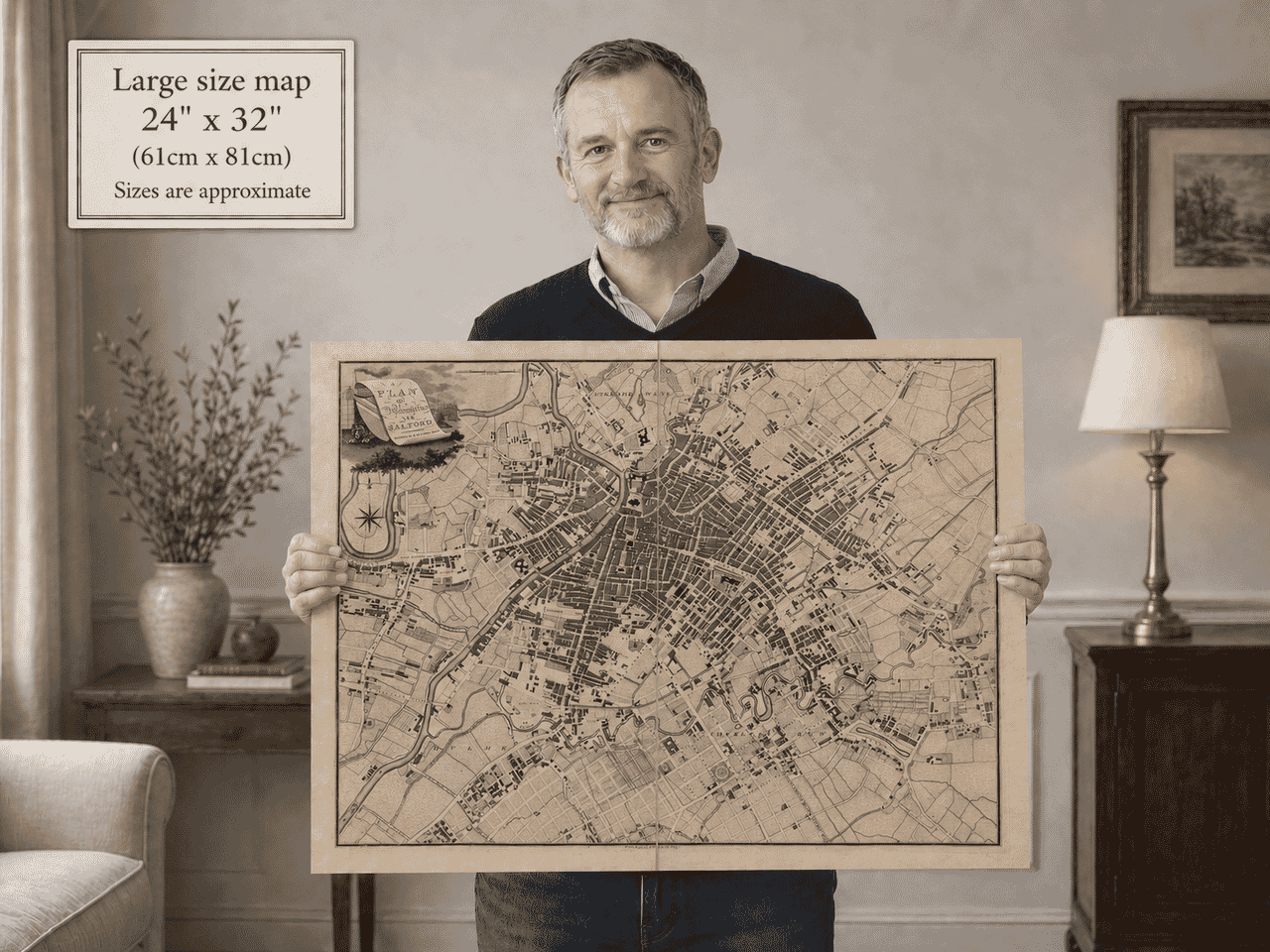
Old Town Plan of Manchester & Salford Manchester Map Size Representation Old Map of Manchester Title Piece Old Plan of Manchester Central Old Manchester Map Framed on Wall Tour guide using old map.

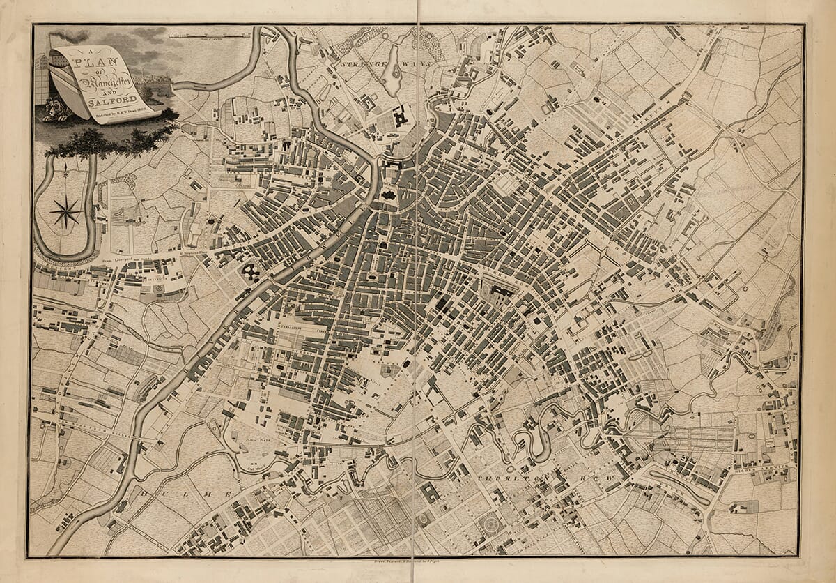
Old Town Plan of Manchester and Salford by Pigot, 1809

Price range: £35.55 through £59.95

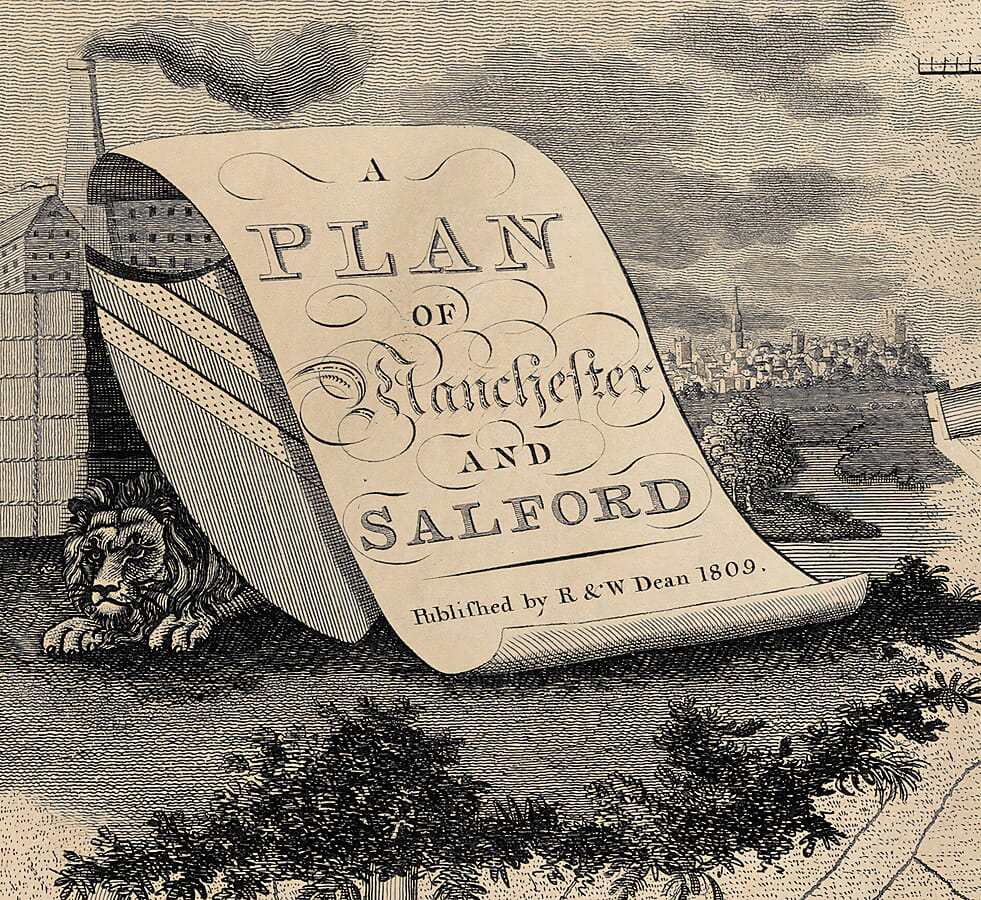
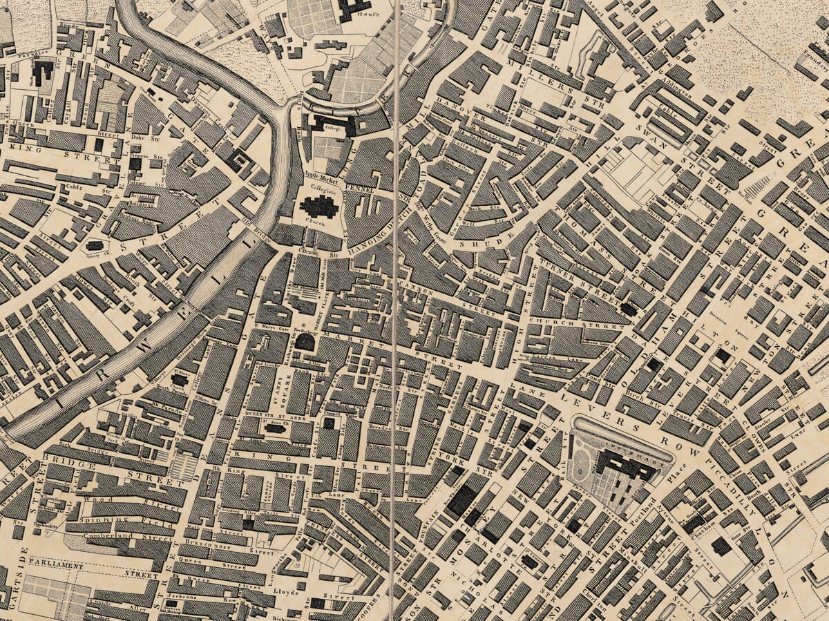
Manchester and Salford in 1809 This highly detailed old town plan of Manchester and Salford was published by R. & W. Dean in 1809 and drawn, engraved and printed by J. Pigot. It records the whole built-up area at a moment when Manchester was expanding rapidly through new streets, canals, workshops, warehouses and public institutions. Road names appear throughout, while canals, wharves, churches, markets, schools, hospitals, workhouses, theatres, gardens and other important buildings are carefully marked. The ornate title cartouche, with its heraldic shield, crouching lion, mill chimney and distant townscape, gives the map particular decorative character.
+ read more

A stunning certified FINE ART PRINT on heavy textured art paper — not a poster

  • Direct from the publisher — no middlemen
  • Printed in-house in Cornwall
  • Free UK delivery — international shipping available
  • Produced to meet — and often exceed — museum-quality standards

SELECT SIZE

Inspecting Vintage Map Reproduction

Fine Art Map Reproductions – Museum-Quality Printing

Unlike most online offerings, our maps are produced entirely in-house, not outsourced to print-on-demand or drop-shipping services. This allows complete control over quality while offering better value. Each map begins with a high-resolution original, carefully enhanced and printed to order using archival papers and pigment inks for exceptional clarity, depth, and longevity. Every piece is personally overseen — no map leaves our workshop unless it is of a quality we would be proud to display ourselves.

Hand hold a magnifying glass over West Cornwall Map

Authentic Old Map Paper & Accurate Colour Reproduction

Paper choice is essential to the authenticity of our maps. We use specially sourced 190gsm paper made in the UK from pure materials and traditionally pressed with natural woollen felts. This process creates a subtle, randomly textured surface that closely resembles an original antique document. Likewise the use of premium quality ink fully saturates the paper, producing remarkable clarity, depth, and historical character. Colour fastness and sharpness will remain good for in excess of 100 years!

Map in Postal Tube
Buy Old Maps Online in the UK Today Trading online since 1999

The Old Map Company of Great Britain offers a vast and carefully curated collection of the very finest expertly reproduced vintage maps. Our range includes works by renowned cartographers such as John Speed and Willem Blaeu, covering Scotland, England, and beyond. Free UK courier delivery is included, with EU, USA, and worldwide shipping available at cost and calculated at checkout. If you need assistance, our team is always happy to help you choose the perfect map.

RECENT REVIEWS

Daz
DazGB
Verified ownerVerified owner
5/5

Speedy delivery A beautiful representation

2 weeks ago
David H
David H
Verified ownerVerified owner
5/5

Got there in time and loves it! Cheers David [Gift from US to UK]

2 months ago
Ellan C-S
Ellan C-S
Verified ownerVerified owner
5/5

Thanks Lauren. We received it today - it's gorgeous! Thank you, Ellan

2 months ago
Ivano Di Battista
Ivano Di Battista
Verified ownerVerified owner
5/5

Thank you for your prompt service. I have a gallery and framing business in South Wales. I'm so pleased it is printed in the UK

3 months ago
Robert B
Robert B
Verified ownerVerified owner
5/5

My Isles of Scilly map arrived safely and I'm delighted with it!

3 months ago
Andrew T
Andrew T
Reviewer
5/5

The print arrived safely and we're delighted with it - a lovely reminder of our honeymoon 15 years ago.

3 months ago
Hannah J
Hannah J
Verified ownerVerified owner
5/5

I have just received them! I'm sure our clients will be pleased with them and there could be more projects off the back of this one where we can use more. [Interior Designers]

3 months ago
Sean MacManus
Sean MacManus
Verified ownerVerified owner
5/5

I just received my map of Ireland by Ewart today and, as usual, I am delighted by its quality. The crispness and fineness of detail is excellent and the colour reproduction surpasses my expectations. Please relay my thanks to Steve for another fine effort!

4 months ago
John G
John G
Verified ownerVerified owner
5/5

Many thanks, Lauren. Very pleased with the map and the service: would recommend The Old Map Company to anyone interested in Old Maps.

6 months ago
Lois K
Lois K
Verified ownerVerified owner
5/5

Thrilled , Lauren! Thank You

6 months ago
Ed Simpson
Ed Simpson
Verified ownerVerified owner
5/5

Many thanks, the map arrived safely this morning, and I’m really pleased with it. A stunning reproduction, just as I had hoped. I will keep browsing your website, and may yet be tempted by more of your items! Have a great weekend.

6 months ago
Daniel McCade
Daniel McCade
Verified ownerVerified owner
5/5

Just arrived, wonderful map! Thanks very much!

7 months ago
Jonathon R
Jonathon R
Verified ownerVerified owner
5/5

The map – beautiful – arrived safely, very many thanks.

1 year ago
Rasa Terbetiene
Rasa Terbetiene
Verified ownerVerified owner
5/5

Thank you, I have already found the map. It’s wonderfull! Good luck! Rasa

3 years ago
Mina M.
Mina M.
Verified ownerVerified owner
5/5

My apologies for the very late reply. I wanted to reach out to thank you so much for rushing my order. My partner absolutely loved it. I am amazed with the service so that is a five-star from me. I wish you all the best.

4 years ago
Manchester and Salford in 1809 This remarkable town plan captures Manchester and Salford during one of the most important periods in their history. Published in 1809 by the Manchester firm of R. & W. Dean, it was drawn, engraved and printed by J. Pigot. The original engraved sheet measured approximately 65.8 by 46.2 centimetres and was produced at a scale of about 1:5,760, allowing the whole built-up area of the two neighbouring towns to be shown in considerable detail. At the beginning of the nineteenth century, Manchester had not yet received city status, but it was already developing into one of Britain’s most important manufacturing and commercial centres. The map reveals a densely established core surrounded by large areas of new development. Many streets are already named, while others appear laid out in anticipation of further building. This makes the plan especially valuable as a record of urban growth: it shows not only the town that existed in 1809, but also the direction in which Manchester and Salford were expected to expand. The River Irwell forms one of the most prominent geographical features, dividing Manchester from Salford while also linking the two through a series of bridges. The irregular courses of rivers and smaller waterways contrast sharply with the increasingly ordered grid of new streets. Canals and wharves are also marked, reflecting the growing importance of water transport to the movement of coal, raw materials and manufactured goods. The Bridgewater Canal, opened during the previous century, had helped transform Manchester’s economy by lowering the cost of transporting coal into the town. By 1809, canals had become integral elements of the urban landscape. The central districts are shown as closely packed networks of streets and buildings. Manchester’s commercial and civic heart can be followed through areas around Market Street, Deansgate and the Collegiate Church, now Manchester Cathedral. Salford lies to the west of the Irwell, with its own established streets, institutions and areas prepared for expansion. The map does not present Manchester and Salford as separate isolated settlements; instead, it shows an increasingly interconnected urban centre whose growth was spreading outward in almost every direction. A wide variety of public and institutional buildings is represented. Places of worship are shown comprehensively, alongside markets, exchanges, schools, hospitals, workhouses and penal institutions. Chetham’s School and Library is among the educational establishments associated with the plan, while theatres, gardens and recreational grounds provide evidence that the towns supported more than industry and trade alone. One particularly interesting feature is the map’s selective treatment of industry. Although Manchester’s textile economy was central to its prosperity, the plan does not attempt to catalogue every factory or mill. The Catalogue of British Town Maps notes that even known industrial sites along the Irwell below Salford are not specifically described. Public buildings and the street pattern are given greater emphasis than individual manufacturing premises. This apparent omission is revealing. Early commercial town plans were often designed as general guides rather than complete industrial surveys. Their purpose was to help residents, travellers, merchants and visitors navigate streets and locate prominent institutions. The dense pattern of buildings, canals, wharves and developing neighbourhoods nevertheless provides unmistakable evidence of a rapidly industrialising town. The decorative title cartouche in the upper-left corner gives the plan much of its visual character. The title appears on a scroll supported by a partly concealed heraldic shield and a crouching lion. Behind these elements are a smoking mill chimney and a distant view intended to suggest Manchester and Salford. The imagery combines civic pride, heraldry and industrial progress in a compact decorative composition. The map was produced before the arrival of Manchester’s first passenger railway, which opened in 1830. It therefore records the town at the height of the canal and turnpike era, before railway viaducts, stations and extensive railway yards altered the urban landscape. Later nineteenth-century maps would show a city transformed by rail transport, municipal rebuilding and an even greater expansion of factories and housing. For modern viewers, the plan offers many opportunities for comparison. Some street names and routes remain recognisable, while others have disappeared beneath later roads, railway developments, commercial buildings and civic improvements. Open land shown near the edges of the plan was soon absorbed by the growing conurbation. The distinction between Manchester, Salford and their surrounding settlements became increasingly blurred as population and industry expanded. This 1809 plan is therefore more than an attractive historical map. It is a record of Manchester and Salford at a decisive moment: already large, prosperous and internationally important, yet still on the threshold of the dramatic Victorian growth that would make Manchester one of the defining cities of the Industrial Revolution.

You may also like…

×
Product added to cart
No products in the cart.