Tycho Brahe planisphere with Earth below the Sun, overlapping planetary circles and a coloured zodiac
Tycho Brahe planisphere with Earth below the Sun, overlapping planetary circles and a coloured zodiac old star map 6 detail 1 old star map 6 detail 2

Antique Astronomy Chart – Tycho Brahe’s System

Price range: £29.95 through £59.95

Antique astronomy chart by Andreas Cellarius, showing Tycho Brahe’s planetary system; engraved in 1656 and first published in the atlas in 1660.

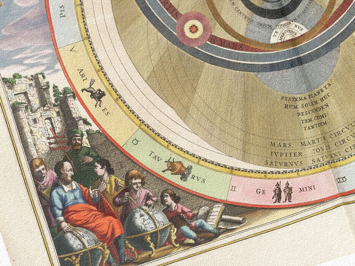
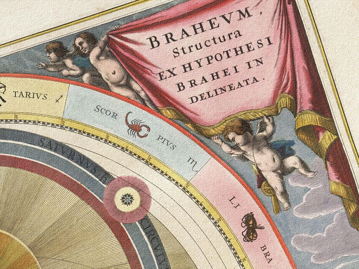
Earth remains fixed while the Sun circles it and the other planets travel around the Sun. Overlapping coloured bands explain this unusual arrangement, framed by zodiac figures, pink title curtains and groups of scholars with globes.

A modern giclée fine art print, supplied unframed. The exact atlas edition reproduced is unconfirmed.

The layered circles and theatrical pink drapery give this print a lively presence in a reading room—a fitting gift for someone drawn to astronomy’s less familiar ideas.

+ read more

A stunning certified FINE ART PRINT on heavy textured art paper — not a poster

  • Direct from the publisher — no middlemen
  • Printed in-house in Cornwall
  • Free UK delivery — international shipping available
  • Produced to meet — and often exceed — museum-quality standards

SELECT SIZE

Inspecting Mercator's 1623 old map of Great Britain and Ireland

Fine Art Map Reproductions – Museum-Quality Printing

Unlike most online offerings, our maps are produced entirely in-house, not outsourced to print-on-demand or drop-shipping services. This allows complete control over quality while offering better value. Each map begins with a high-resolution original, carefully enhanced and printed to order using archival papers and pigment inks for exceptional clarity, depth, and longevity. Every piece is personally overseen — no map leaves our workshop unless it is of a quality we would be proud to display ourselves.

Hand hold a magnifying glass over West Cornwall Map

Authentic Old Map Paper & Accurate Colour Reproduction

Paper choice is essential to the authenticity of our maps. We use specially sourced 190gsm paper made in the UK from pure materials and traditionally pressed with natural woollen felts. This process creates a subtle, randomly textured surface that closely resembles an original antique document. Likewise the use of premium quality ink fully saturates the paper, producing remarkable clarity, depth, and historical character. Colour fastness and sharpness will remain good for in excess of 100 years!

Map in Postal Tube
Buy Old Maps Online in the UK Today Trading online since 1999

The Old Map Company of Great Britain offers a vast and carefully curated collection of the very finest expertly reproduced vintage maps. Our range includes works by renowned cartographers such as John Speed and Willem Blaeu, covering Scotland, England, and beyond. Free UK courier delivery is included, with EU, USA, and worldwide shipping available at cost and calculated at checkout. If you need assistance, our team is always happy to help you choose the perfect map.

RECENT REVIEWS

Daz
DazGB
Verified ownerVerified owner
5/5

Speedy delivery A beautiful representation

3 months ago
David H
David H
Verified ownerVerified owner
5/5

Got there in time and loves it! Cheers David [Gift from US to UK]

5 months ago
Ellan C-S
Ellan C-S
Verified ownerVerified owner
5/5

Thanks Lauren. We received it today - it's gorgeous! Thank you, Ellan

5 months ago
Ivano Di Battista
Ivano Di Battista
Verified ownerVerified owner
5/5

Thank you for your prompt service. I have a gallery and framing business in South Wales. I'm so pleased it is printed in the UK

5 months ago
Robert B
Robert B
Verified ownerVerified owner
5/5

My Isles of Scilly map arrived safely and I'm delighted with it!

6 months ago
Andrew T
Andrew T
Reviewer
5/5

The print arrived safely and we're delighted with it - a lovely reminder of our honeymoon 15 years ago.

6 months ago
Hannah J
Hannah J
Verified ownerVerified owner
5/5

I have just received them! I'm sure our clients will be pleased with them and there could be more projects off the back of this one where we can use more. [Interior Designers]

6 months ago
Sean MacManus
Sean MacManus
Verified ownerVerified owner
5/5

I just received my map of Ireland by Ewart today and, as usual, I am delighted by its quality. The crispness and fineness of detail is excellent and the colour reproduction surpasses my expectations. Please relay my thanks to Steve for another fine effort!

6 months ago
John G
John G
Verified ownerVerified owner
5/5

Many thanks, Lauren. Very pleased with the map and the service: would recommend The Old Map Company to anyone interested in Old Maps.

8 months ago
Lois K
Lois K
Verified ownerVerified owner
5/5

Thrilled , Lauren! Thank You

8 months ago
Ed Simpson
Ed Simpson
Verified ownerVerified owner
5/5

Many thanks, the map arrived safely this morning, and I’m really pleased with it. A stunning reproduction, just as I had hoped. I will keep browsing your website, and may yet be tempted by more of your items! Have a great weekend.

8 months ago
Daniel McCade
Daniel McCade
Verified ownerVerified owner
5/5

Just arrived, wonderful map! Thanks very much!

10 months ago
Jonathon R
Jonathon R
Verified ownerVerified owner
5/5

The map – beautiful – arrived safely, very many thanks.

1 year ago
Rasa Terbetiene
Rasa Terbetiene
Verified ownerVerified owner
5/5

Thank you, I have already found the map. It’s wonderfull! Good luck! Rasa

4 years ago
Mina M.
Mina M.
Verified ownerVerified owner
5/5

My apologies for the very late reply. I wanted to reach out to thank you so much for rushing my order. My partner absolutely loved it. I am amazed with the service so that is a five-star from me. I wish you all the best.

4 years ago

Historical Background

Tycho Brahe’s system gives this antique celestial chart its distinctive overlapping circles. Unlike a simple Earth-centred or Sun-centred diagram, it combines two centres of motion: the Sun travels around a stationary Earth, while the other planets travel around the Sun. Andreas Cellarius presents the arrangement as a flat planisphere, enclosed by a coloured zodiac and elaborate corner scenes. The Latin heading names Brahe directly, making the theory the subject of the plate rather than an attribution to the person who engraved or published it.

Map Details

  • Original title: Planisphærium Braheum
  • Chartmaker: Andreas Cellarius
  • Source: Harmonia Macrocosmica
  • First published: Amsterdam, 1660, by Johannes Janssonius
  • Edition reproduced: Exact issue unconfirmed
  • Subject: Tycho Brahe’s combined Earth-centred and Sun-centred system
  • Plate engraved: 1656
  • Original format: Engraved atlas plate with colour

Two centres within one picture

Earth appears below the large golden Sun, surrounded by its own smaller circles. The outer planetary paths occupy much of the sheet and overlap the region containing Earth. That relationship is the key to reading the chart: Brahe retained a fixed Earth, but accepted that the planets could be organised around the Sun. The resulting picture is neither the ordinary geocentric arrangement associated with Ptolemy nor the fully heliocentric scheme of Copernicus.

The broad bands are coloured differently so their courses can be followed through a complicated field. Small planetary discs are positioned on these paths, while labels identify the wider circles of Mars, Jupiter and Saturn. The Sun’s surrounding rays spread across the centre, giving visual weight to its role without moving Earth out of Brahe’s scheme. The composition makes an abstract compromise visible through placement, colour and repeated circular forms.

Why Brahe’s alternative matters

A modern audience can be tempted to read every historic astronomy picture as a step toward a single familiar answer. This plate is more interesting when its own proposal is taken seriously. It records an attempt to explain the observed sky while keeping Earth stationary. The presence of Sun-centred planetary motion therefore does not make the entire system Copernican. Recognising that distinction changes how the overlapping bands are understood.

Brahe’s observations also became important to Johannes Kepler’s work on planetary motion. Cellarius’s chart, however, illustrates Brahe’s arrangement, not Kepler’s elliptical orbits. Its historical value lies in showing the structure of this particular model. The discs are pictorial markers and the bands are explanatory devices; neither should be treated as a modern measurement of planetary sizes or distances.

Zodiac figures and pink curtains

The zodiac runs around the outside in broad pastel sections. Each sign has both a figure and a written name, and several names are broken across the curved space to accommodate the lettering. Aries, Taurus and Gemini appear along the lower half, while Capricorn and Sagittarius sit near the top. A narrow numbered border separates the zodiac from the main planetary field. Together, these details turn the outer ring into a readable framework rather than a purely ornamental edge.

Above, small winged figures hold back two pink curtains carrying the divided title. This device allows a long Latin caption to occupy the corners while keeping the circular scheme intact. Ruined buildings appear at the sides, and groups of people gather around globes below. The left-hand scene includes books and figures engaged around a terrestrial globe; the right has another globe and several instruments. These small scenes make the diagram part of a human world of teaching and discussion.

The plate within Cellarius’s atlas

The engraving is dated 1656, earlier than the first publication of Harmonia Macrocosmica in Amsterdam in 1660. That difference is useful: a plate could be prepared before the atlas containing it was issued. The date of engraving and the date of publication describe different stages in the production of the work. The atlas appeared under the name of Andreas Cellarius and was first published by Johannes Janssonius.

The exact issue represented by this image remains unconfirmed. Colour alone cannot establish it, and the date of the original design should not be mistaken for the date of the modern print. What the reproduction preserves is the layered geometry, the contrasting zodiac compartments and the lively scholarly groups of the source. Seen together, they make the Tychonic system approachable even before the finer labels are read.

×
Product added to cart
No products in the cart.