


Got there in time and loves it! Cheers David [Gift from US to UK]

Thanks Lauren. We received it today - it's gorgeous! Thank you, Ellan

Thank you for your prompt service. I have a gallery and framing business in South Wales. I'm so pleased it is printed in the UK

My Isles of Scilly map arrived safely and I'm delighted with it!

The print arrived safely and we're delighted with it - a lovely reminder of our honeymoon 15 years ago.

I have just received them! I'm sure our clients will be pleased with them and there could be more projects off the back of this one where we can use more. [Interior Designers]

I just received my map of Ireland by Ewart today and, as usual, I am delighted by its quality. The crispness and fineness of detail is excellent and the colour reproduction surpasses my expectations. Please relay my thanks to Steve for another fine effort!

Many thanks, Lauren. Very pleased with the map and the service: would recommend The Old Map Company to anyone interested in Old Maps.

Many thanks, the map arrived safely this morning, and I’m really pleased with it. A stunning reproduction, just as I had hoped. I will keep browsing your website, and may yet be tempted by more of your items! Have a great weekend.

Just arrived, wonderful map! Thanks very much!

The map – beautiful – arrived safely, very many thanks.

Thank you, I have already found the map. It’s wonderfull! Good luck! Rasa

My apologies for the very late reply. I wanted to reach out to thank you so much for rushing my order. My partner absolutely loved it. I am amazed with the service so that is a five-star from me. I wish you all the best.
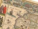
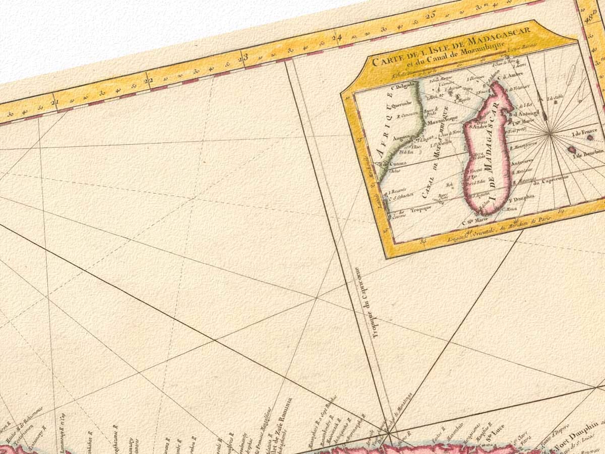
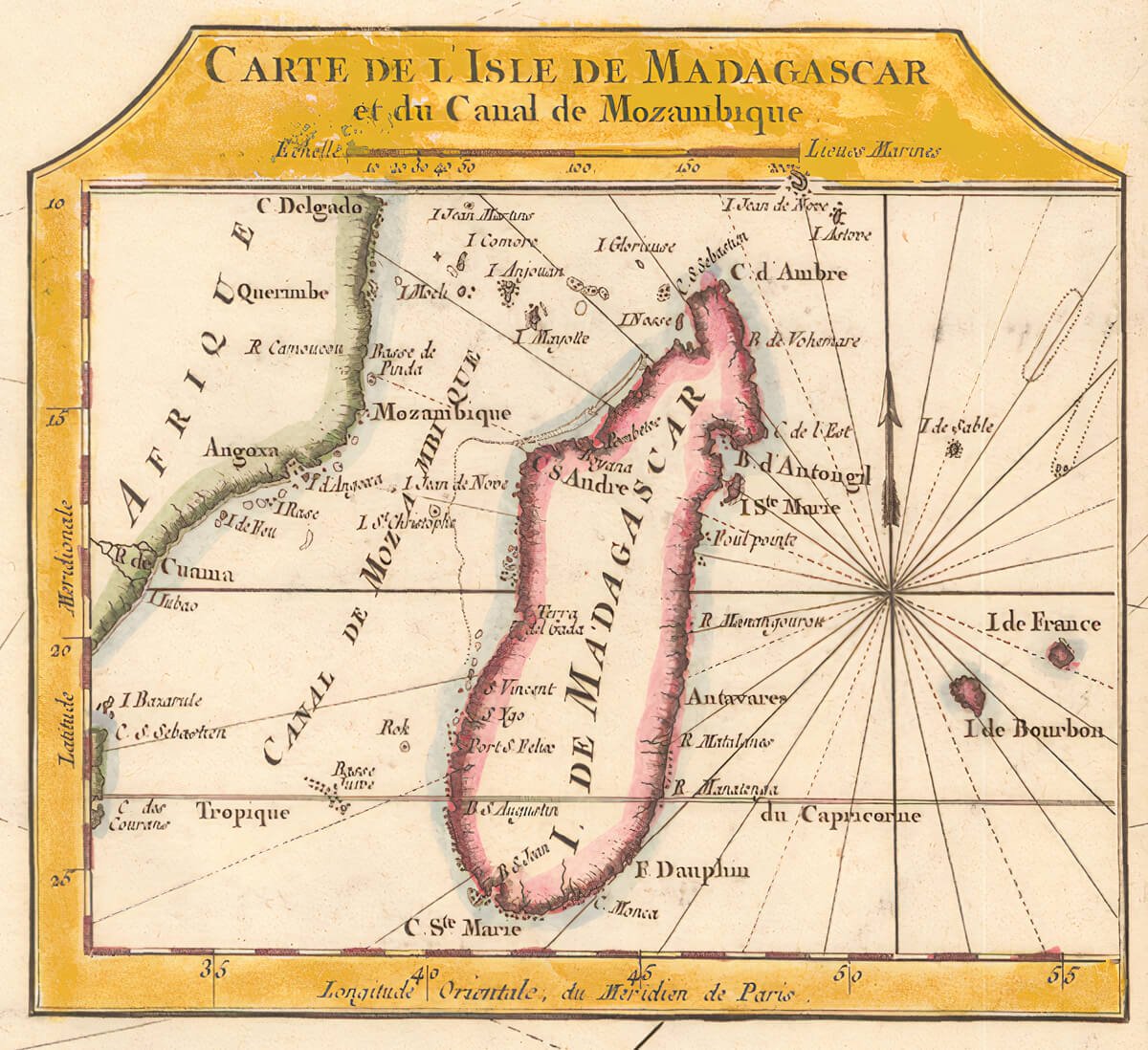
Spending time with this map, the first thing that draws the eye is the title in the lower left corner, set neatly within its cartouche and reading Carte de l’Isle de Madagascar. The French spelling and measured layout immediately place it in an earlier world of exploration and careful record-keeping. The text beneath the title explains that the map was compiled from official naval sources, which helps explain its quiet confidence. This was not made as a fantasy or a flourish, but as something meant to be trusted and used.
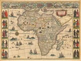
What’s striking is how restrained the decoration is. The cartouche avoids drama and instead focuses on clarity and balance. That choice feels intentional, especially when compared with earlier maps that often leaned heavily on ornament. In the upper right corner, a small inset map shows Madagascar within its wider setting, almost like a pause for orientation before returning to the main image. It’s easy to imagine how useful this would have been to someone approaching the island after a long sea journey.
The small inset map with further rhumb lines
The surrounding ocean tells its own story. Compass roses and their radiating lines spread across the water, quietly reminding us that this was a working map. These rhumb lines would have guided sailors plotting their course, while the latitude markings along the edges anchored their position in the world. There is something reassuring about this web of lines, a sense of order imposed on an otherwise uncertain sea.
Old Madagascar Map further chart details.
The contrast between the coastline and the interior feels especially human. Along the shores, names are plentiful, wrapping themselves around bays, capes, and river mouths. These were places seen, visited, and remembered. Inland, however, the map grows noticeably sparse. A simple note admits that much of the interior was not well known, and the cartographer leaves it at that. There is no attempt to fill the space with invention. Instead, the map acknowledges its limits, which somehow makes it feel more honest and more believable.
Looking at it now, the map reads not just as a record of geography, but as a snapshot of understanding at a particular moment in time. It shows where knowledge was solid and where it was still forming. The Old Map Company of Great Britain are pleased to make this map available, allowing today’s viewer to connect with both the skill of its maker and the thoughtful restraint that gives the map its enduring appeal.