



 Verified owner
Got there in time and loves it! Cheers David [Gift from US to UK]
 Verified owner
Thanks Lauren. We received it today - it's gorgeous! Thank you, Ellan
 Verified owner
Thank you for your prompt service. I have a gallery and framing business in South Wales. I'm so pleased it is printed in the UK
 Verified owner
My Isles of Scilly map arrived safely and I'm delighted with it!

The print arrived safely and we're delighted with it - a lovely reminder of our honeymoon 15 years ago.
 Verified owner
I have just received them! I'm sure our clients will be pleased with them and there could be more projects off the back of this one where we can use more. [Interior Designers]
 Verified owner
I just received my map of Ireland by Ewart today and, as usual, I am delighted by its quality. The crispness and fineness of detail is excellent and the colour reproduction surpasses my expectations. Please relay my thanks to Steve for another fine effort!
 Verified owner
Many thanks, Lauren. Very pleased with the map and the service: would recommend The Old Map Company to anyone interested in Old Maps.
 Verified owner
Many thanks, the map arrived safely this morning, and I’m really pleased with it. A stunning reproduction, just as I had hoped. I will keep browsing your website, and may yet be tempted by more of your items! Have a great weekend.
 Verified owner
Just arrived, wonderful map! Thanks very much!
 Verified owner
The map – beautiful – arrived safely, very many thanks.
 Verified owner
Thank you, I have already found the map. It’s wonderfull! Good luck! Rasa
 Verified owner
My apologies for the very late reply. I wanted to reach out to thank you so much for rushing my order. My partner absolutely loved it. I am amazed with the service so that is a five-star from me. I wish you all the best.
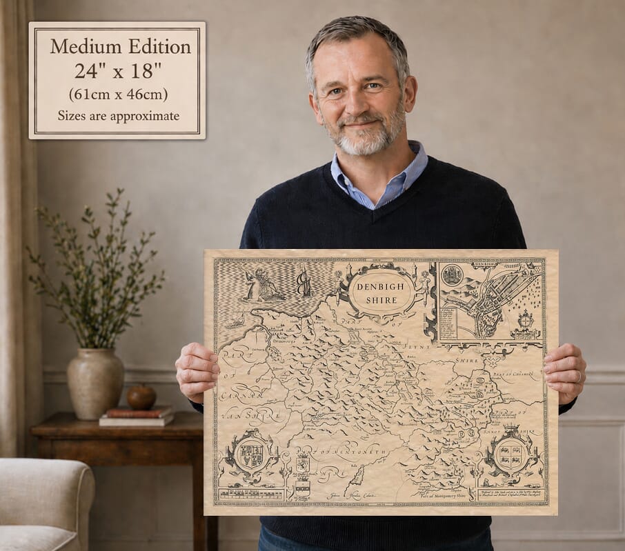
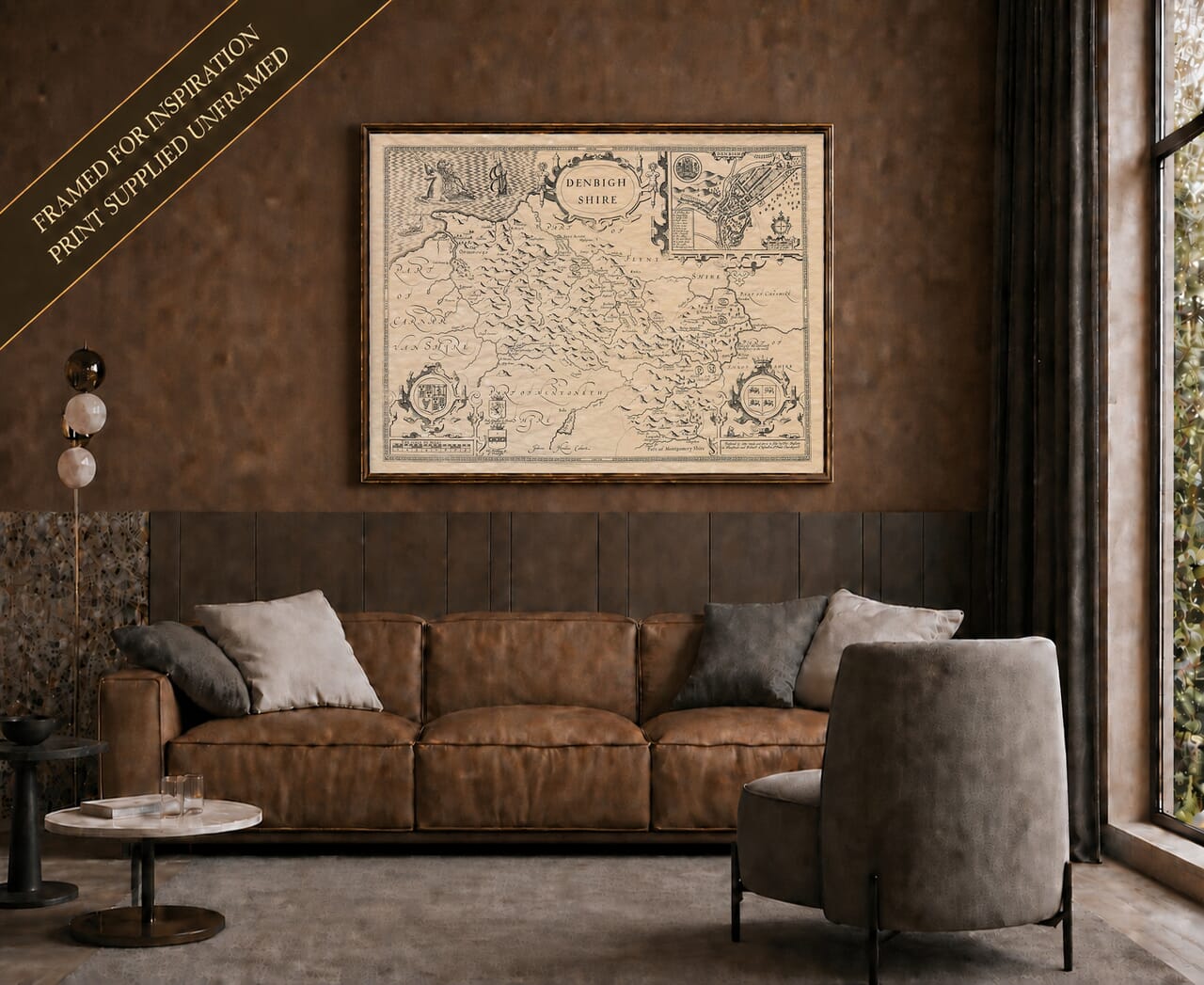
John Speed’s old map of Denbighshire follows the historic county from its northern coastline into the hills and river valleys of north-east Wales. A detailed plan of Denbigh, decorative coats of arms and sailing ships turn the county map into a striking piece of early seventeenth-century design.
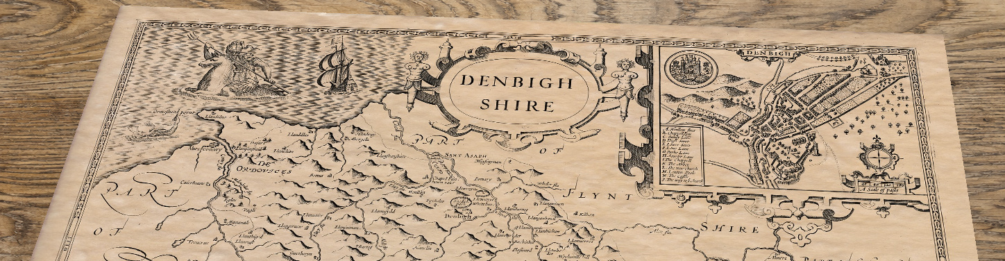
At the upper right, the inset plan shows Denbigh’s streets and buildings, with the castle and elevated ground clearly drawn. A lettered key names individual features and a separate scale measures distances in paces. The arrangement offers an intimate view of the county town alongside the much wider landscape.
The county map includes Ruthin, Wrexham and Llangollen, with rivers traced between pictorial hills and small settlement symbols. Its boundaries encompass historic Denbighshire, which differs from the modern county of the same name. Parts of Flintshire, Cheshire, Shropshire and neighbouring Welsh counties are labelled around the edges, helping place the map in its regional setting.
The royal arms and other shields occupy prominent framed panels, while ships and a sea creature animate the northern water. Small trees distinguish wooded areas and larger symbols pick out important settlements. The historical name Ordovices is printed among the hills: such references are part of Speed’s interest in Britain’s past, not a description of a contemporary administrative district.
Reproduced as a fine art print and supplied unframed, the map preserves the original’s engraved detail and warm appearance.