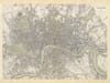
Historic map of Bengal by James Rennell, showing the Ganges and surrounding provinces
Historic map of Bengal by James Rennell, showing the Ganges and surrounding provinces Old Map Bengal detail Old Map Bengal detail

Old Map of Bengal

Price range: £35.55 through £59.95

Old Map of Bengal by James Rennell, published by William Faden in 1786

Rennell’s map follows the Ganges from Hurdwar to the sea, taking in Bengal, Bahar, Oude and Allahabad, with parts of Agra and Delhi. Its wide reach makes it a map of the river corridor and adjoining provinces, not simply Bengal as the name is used today. The route of the Ganges gives the sheet a strong visual line from the north-west through the great delta.

Hand-coloured boundaries separate the named regions, while engraved rivers, settlements and relief fill the land between them. The ornate cartouche and dedication add a human touch to a map otherwise shaped by the practical work of surveying and administration. Look closely for the dense network of waterways as it spreads toward the Bay of Bengal.

This eighteenth-century map offers a detailed view of the region during a period of rapid change in the East India Company’s power. Reproduced as an unframed fine art print.

+ Read more

Size

Size

Inspecting Mercator's 1623 old map of Great Britain and Ireland

Fine Art Map Reproductions – Museum-Quality Printing

Unlike most online offerings, our maps are produced entirely in-house, not outsourced to print-on-demand or drop-shipping services. This allows complete control over quality while offering better value. Each map begins with a high-resolution original, carefully enhanced and printed to order using archival papers and pigment inks for exceptional clarity, depth, and longevity. Every piece is personally overseen — no map leaves our workshop unless it is of a quality we would be proud to display ourselves.

Hand hold a magnifying glass over West Cornwall Map

Authentic Old Map Paper & Accurate Colour Reproduction

Paper choice is essential to the authenticity of our maps. We use specially sourced 190gsm paper made in the UK from pure materials and traditionally pressed with natural woollen felts. This process creates a subtle, randomly textured surface that closely resembles an original antique document. Likewise the use of premium quality ink fully saturates the paper, producing remarkable clarity, depth, and historical character. Colour fastness and sharpness will remain good for in excess of 100 years!

Map in Postal Tube

Buy Old Maps Online in the UK Today Trading online since 1999

The Old Map Company of Great Britain offers a vast and carefully curated collection of the very finest expertly reproduced vintage maps. Our range includes works by renowned cartographers such as John Speed and Willem Blaeu, covering Scotland, England, and beyond. Free UK courier delivery is included, with EU, USA, and worldwide shipping available at cost and calculated at checkout. If you need assistance, our team is always happy to help you choose the perfect map.

RECENT REVIEWS

Daz
DazGB
Verified ownerVerified owner
5/5

Speedy delivery A beautiful representation

3 months ago
David H
David H
Verified ownerVerified owner
5/5

Got there in time and loves it! Cheers David [Gift from US to UK]

5 months ago
Ellan C-S
Ellan C-S
Verified ownerVerified owner
5/5

Thanks Lauren. We received it today - it's gorgeous! Thank you, Ellan

5 months ago
Ivano Di Battista
Ivano Di Battista
Verified ownerVerified owner
5/5

Thank you for your prompt service. I have a gallery and framing business in South Wales. I'm so pleased it is printed in the UK

6 months ago
Robert B
Robert B
Verified ownerVerified owner
5/5

My Isles of Scilly map arrived safely and I'm delighted with it!

6 months ago
Andrew T
Andrew T
Reviewer
5/5

The print arrived safely and we're delighted with it - a lovely reminder of our honeymoon 15 years ago.

6 months ago
Hannah J
Hannah J
Verified ownerVerified owner
5/5

I have just received them! I'm sure our clients will be pleased with them and there could be more projects off the back of this one where we can use more. [Interior Designers]

6 months ago
Sean MacManus
Sean MacManus
Verified ownerVerified owner
5/5

I just received my map of Ireland by Ewart today and, as usual, I am delighted by its quality. The crispness and fineness of detail is excellent and the colour reproduction surpasses my expectations. Please relay my thanks to Steve for another fine effort!

7 months ago
John G
John G
Verified ownerVerified owner
5/5

Many thanks, Lauren. Very pleased with the map and the service: would recommend The Old Map Company to anyone interested in Old Maps.

8 months ago
Lois K
Lois K
Verified ownerVerified owner
5/5

Thrilled , Lauren! Thank You

9 months ago
Ed Simpson
Ed Simpson
Verified ownerVerified owner
5/5

Many thanks, the map arrived safely this morning, and I’m really pleased with it. A stunning reproduction, just as I had hoped. I will keep browsing your website, and may yet be tempted by more of your items! Have a great weekend.

9 months ago
Daniel McCade
Daniel McCade
Verified ownerVerified owner
5/5

Just arrived, wonderful map! Thanks very much!

10 months ago
Jonathon R
Jonathon R
Verified ownerVerified owner
5/5

The map – beautiful – arrived safely, very many thanks.

1 year ago
Rasa Terbetiene
Rasa Terbetiene
Verified ownerVerified owner
5/5

Thank you, I have already found the map. It’s wonderfull! Good luck! Rasa

4 years ago
Mina M.
Mina M.
Verified ownerVerified owner
5/5

My apologies for the very late reply. I wanted to reach out to thank you so much for rushing my order. My partner absolutely loved it. I am amazed with the service so that is a five-star from me. I wish you all the best.


4 years ago

Historical Background

James Rennell’s A Map of Bengal, Bahar, Oudes & Allahabad with Part of Agra and Delhi was published in London by William Faden in 1786. Its subtitle describes the map’s central purpose: to exhibit the course of the Ganges from Hurdwar to the sea. The sheet follows the river through a large and varied landscape, joining the delta and Bengal to inland provinces that were connected by trade, administration and the routes of the East India Company. Rennell had served as Surveyor General in Bengal, and his work helped make the region legible to British officials and readers at a time when Company authority was expanding.

Map Details

  • Original title: A Map of Bengal, Bahar, Oudes & Allahabad with Part of Agra and Delhi, Exhibiting the Course of the Ganges from Hurdwar to the Sea
  • Cartographer: James Rennell
  • Publisher: William Faden, London
  • Date: 1786
  • Area shown: Bengal, Bahar, Oude and Allahabad, with parts of Agra and Delhi
  • Map features: The Ganges river system, regional boundaries, engraved relief and a decorative cartouche

Following the Ganges

The river is the map’s organising feature. It carries the eye from Hurdwar through the north Indian plain toward the branching delta, where channels divide and rejoin before reaching the Bay of Bengal. This is not an isolated river portrait: settlements and provincial names are placed in relation to its course, making waterways and overland connections part of one geographic picture. The named areas reflect the terminology of the period and do not correspond neatly to today’s borders.

At the western edge of the subject lie Allahabad and parts of Agra and Delhi; farther east the map opens into Bengal and its network of waterways. The combination of a long river corridor and clearly differentiated regions gives the sheet its scale. Its geography can be followed from broad provincial divisions down to individual names and tributaries.

Surveying and political geography

Rennell’s experience in Bengal informed a style of mapping that joined observation with the needs of government. In 1786, the East India Company was no longer merely a trading enterprise: after the grant of revenue-collecting rights in Bengal, Bihar and Orissa in 1765, it was increasingly involved in governing territory. The map should therefore be read as both a geographic record and a product of that political moment. Its careful regional divisions and river routes helped distant readers understand an area that Company officials were administering and exploiting.

Cartouche, colour and engraved detail

The title cartouche, set among decorative figures and landscape, stands apart from the densely engraved geography. Hand-coloured boundaries mark the named provinces, while fine linework describes watercourses, settlements and the land between them. These elements reward close viewing: the decorative title signals the atlas plate’s presentation, while the river network and labels carry its practical information. The reproduction preserves the contrast between ornament and survey detail that makes this old map of Bengal compelling on the wall and at reading distance.

You may also like…