



£35.55 – £59.95Price range: £35.55 through £59.95
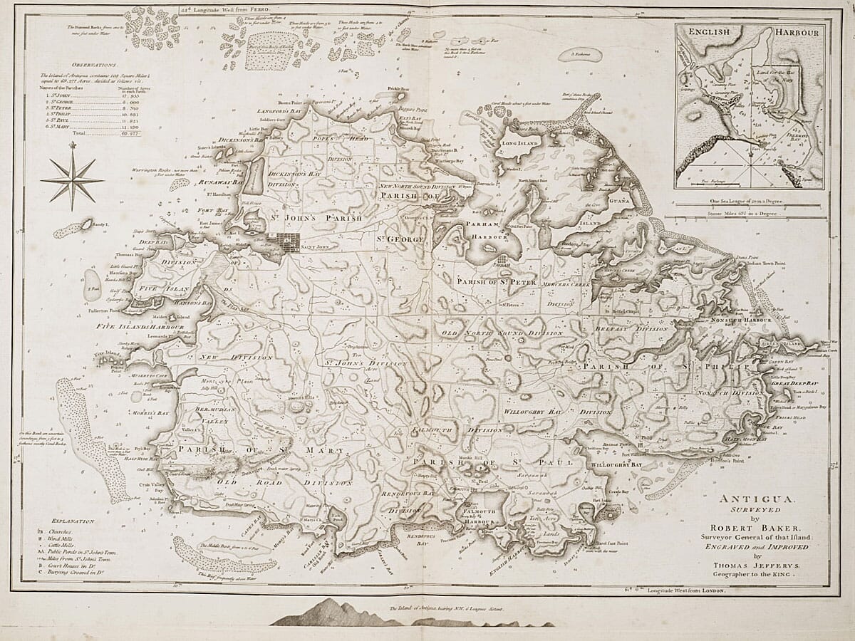
Antigua surveyed by Robert Baker and engraved by Thomas Jefferys, 1775
This large-scale island map records Antigua’s parishes, harbours, roads and coastal hazards, with an inset plan of English Harbour. Its detailed key identifies churches, mills, plantations, ponds, roads and natural features, revealing how the island’s land and resources were organised under British colonial rule. The map is a striking historic print, but its estate names and agricultural symbols also point to an economy built on enslaved labour.
A stunning certified FINE ART PRINT on heavy textured art paper — not a poster
Unlike most online offerings, our maps are produced entirely in-house, not outsourced to print-on-demand or drop-shipping services. This allows complete control over quality while offering better value. Each map begins with a high-resolution original, carefully enhanced and printed to order using archival papers and pigment inks for exceptional clarity, depth, and longevity. Every piece is personally overseen — no map leaves our workshop unless it is of a quality we would be proud to display ourselves.
Paper choice is essential to the authenticity of our maps. We use specially sourced 190gsm paper made in the UK from pure materials and traditionally pressed with natural woollen felts. This process creates a subtle, randomly textured surface that closely resembles an original antique document. Likewise the use of premium quality ink fully saturates the paper, producing remarkable clarity, depth, and historical character. Colour fastness and sharpness will remain good for in excess of 100 years!
The Old Map Company of Great Britain offers a vast and carefully curated collection of the very finest expertly reproduced vintage maps. Our range includes works by renowned cartographers such as John Speed and Willem Blaeu, covering Scotland, England, and beyond. Free UK courier delivery is included, with EU, USA, and worldwide shipping available at cost and calculated at checkout. If you need assistance, our team is always happy to help you choose the perfect map.
Speedy delivery A beautiful representation
Got there in time and loves it! Cheers David [Gift from US to UK]
Thanks Lauren. We received it today - it's gorgeous! Thank you, Ellan
Thank you for your prompt service. I have a gallery and framing business in South Wales. I'm so pleased it is printed in the UK
My Isles of Scilly map arrived safely and I'm delighted with it!
The print arrived safely and we're delighted with it - a lovely reminder of our honeymoon 15 years ago.
I have just received them! I'm sure our clients will be pleased with them and there could be more projects off the back of this one where we can use more. [Interior Designers]
I just received my map of Ireland by Ewart today and, as usual, I am delighted by its quality. The crispness and fineness of detail is excellent and the colour reproduction surpasses my expectations. Please relay my thanks to Steve for another fine effort!
Many thanks, Lauren. Very pleased with the map and the service: would recommend The Old Map Company to anyone interested in Old Maps.
Many thanks, the map arrived safely this morning, and I’m really pleased with it. A stunning reproduction, just as I had hoped. I will keep browsing your website, and may yet be tempted by more of your items! Have a great weekend.
Just arrived, wonderful map! Thanks very much!
The map – beautiful – arrived safely, very many thanks.
Thank you, I have already found the map. It’s wonderfull! Good luck! Rasa
My apologies for the very late reply. I wanted to reach out to thank you so much for rushing my order. My partner absolutely loved it. I am amazed with the service so that is a five-star from me. I wish you all the best.
Robert Baker’s survey of Antigua, engraved and improved by Thomas Jefferys, maps the island’s parishes, harbours, roads and coastal hazards in exceptional detail. An inset of English Harbour adds a closer view of a key naval anchorage, while the symbols and estate names across the main island record how the colony was organised.
The map’s key identifies churches, roads, mills, ponds, quarries, reefs and other features alongside named estates and plantation owners. Those details make the sheet useful for studying the island’s landscape, but they also expose the system the map served: Antigua’s sugar economy depended on the forced labour of enslaved Africans. The property names and measured divisions should be read in that colonial context, not as neutral signs of orderly development.
Look for the English Harbour inset, the coloured parish divisions and the marked shoals around the coast. The acreage notes and distances from St John’s add administrative precision, while the plantation labels tie the survey to land ownership and extraction. Together, these details make the map a valuable historical document as well as a richly detailed print.



