


Got there in time and loves it! Cheers David [Gift from US to UK]

Thanks Lauren. We received it today - it's gorgeous! Thank you, Ellan

Thank you for your prompt service. I have a gallery and framing business in South Wales. I'm so pleased it is printed in the UK

My Isles of Scilly map arrived safely and I'm delighted with it!

The print arrived safely and we're delighted with it - a lovely reminder of our honeymoon 15 years ago.

I have just received them! I'm sure our clients will be pleased with them and there could be more projects off the back of this one where we can use more. [Interior Designers]

I just received my map of Ireland by Ewart today and, as usual, I am delighted by its quality. The crispness and fineness of detail is excellent and the colour reproduction surpasses my expectations. Please relay my thanks to Steve for another fine effort!

Many thanks, Lauren. Very pleased with the map and the service: would recommend The Old Map Company to anyone interested in Old Maps.

Many thanks, the map arrived safely this morning, and I’m really pleased with it. A stunning reproduction, just as I had hoped. I will keep browsing your website, and may yet be tempted by more of your items! Have a great weekend.

Just arrived, wonderful map! Thanks very much!

The map – beautiful – arrived safely, very many thanks.

Thank you, I have already found the map. It’s wonderfull! Good luck! Rasa

My apologies for the very late reply. I wanted to reach out to thank you so much for rushing my order. My partner absolutely loved it. I am amazed with the service so that is a five-star from me. I wish you all the best.
The Saxon period (or Anglo-Saxon period) refers to the time in British history from around the 5th century to 1066 AD. This period is crucial for understanding the formation of England as a unified kingdom. Here’s a brief overview of the main phases and characteristics of the Saxon period:
The Saxon period laid the groundwork for many aspects of English culture, governance, and language, and its end marked the beginning of a new chapter under Norman rule.

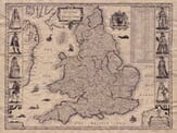
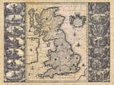
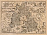
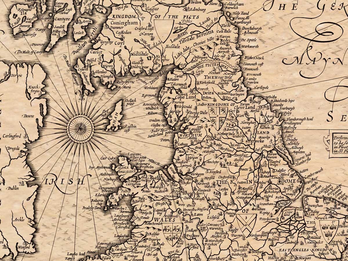
In his youth John Speede was thought to have “a very rare and ingenious capacity in the drawing and the setting forth of maps”. He compiled his maps individually between 1596 and 1610, and published them in four books known as “the Theatre of the Empire of Great Britain”. It was the first Atlas to encompass all the counties of Britain and became the best known collection of English county maps. John Speede was the son of a tailor, born in about 1552 in Cheshire. Like his father, he became a Freeman of Merchant Taylor’s Company, but devoted most of his leisure time to map making. In 1598 he found a wealthy patron, Sir Fulke Greville, who secured him a post in Her Majesty’s Customs where, with Queen Elizabeth’s support, he continued his map making. The inclusion of Royal portraits and battle sites elevated his craft to an elaborate work of art.
As Samuel Pepys remarked in 1662 whist searching the Forest of Dean for sources of timber to build ships for the Navy, “Speede’s maps there showed me how it lies”.
To own a John Speede map, is to own a part of history.
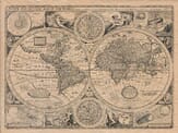
Everyone with a love of this country and an interest in her local and national history should own and enjoy at least one of these masterpieces. Speede also mapped other countries – be sure to look through the Europe & World sections of our site.
Portrait courtesy of the National Portrait Gallery