Europe Map OMC
Europe Map OMC Uk in Europe Map Uk in Europe Map

Old Map of Europe / Carte de Europa

Price range: £35.55 through £59.95

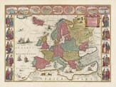
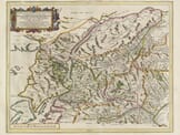
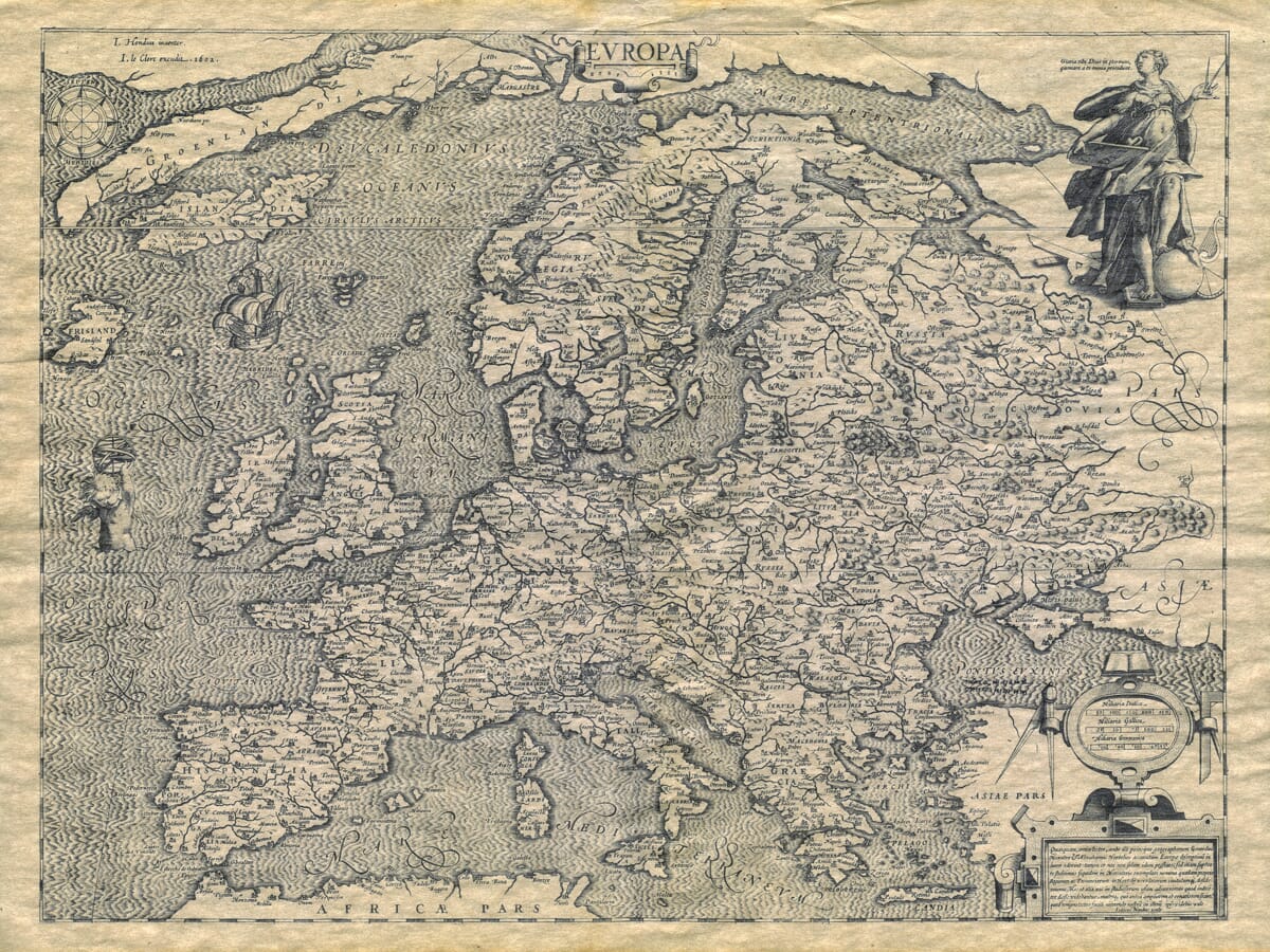
by Ioann Hondius c.1602

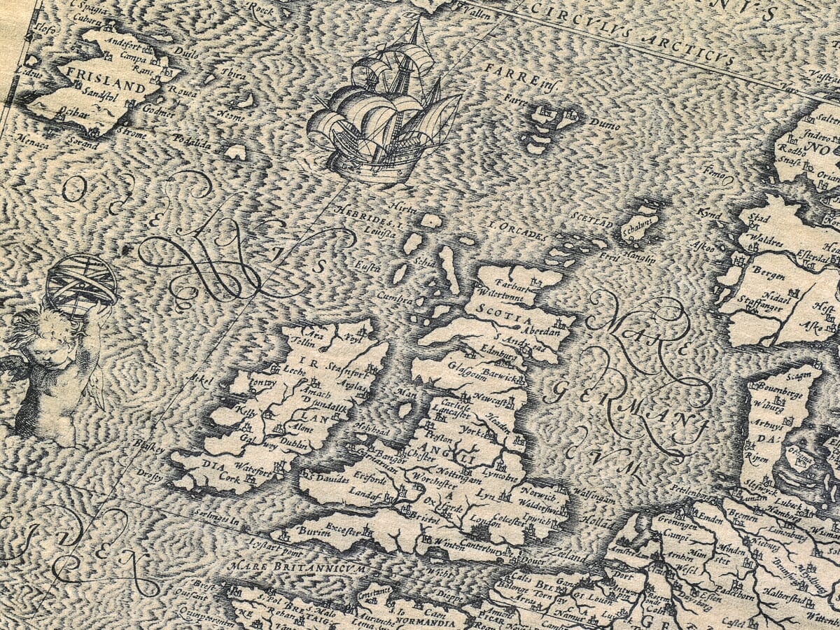
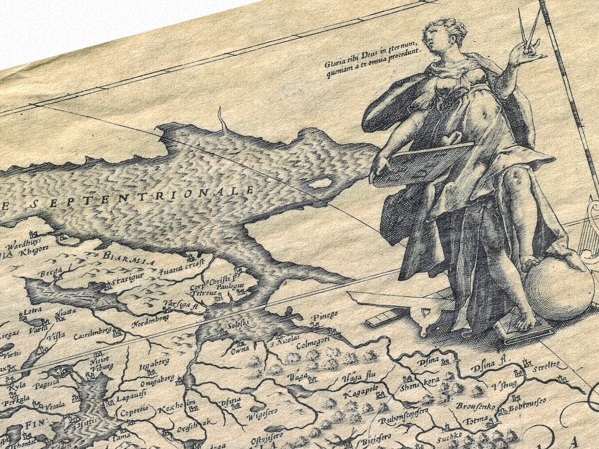
A beautifully drawn figure to the top right of the map goes to illustrate the culture and knowledge enjoyed by the region. Castles abound and there are many tiny and intricate drawings of major towns and forests featured. To the left there’s a very fine cherub holding high a globe or armillary ring above his head. Includes nicely detailed Greek Islands.

  • Authentically aged heavy textured paper  •  12 Colour printing technology  •  Guaranteed to pass or exceed museum quality standards  •  Bespoke framing service   •  Free UK Courier Delivery with tracking

Available in three sizes: Large: 24″ x 31″ (78.7 x 61cms)   Medium: 18″ x 24″ (45.5 x 61cms)  Small: 19.5″ x 14″ (49.5 x 35.5cms)

SKU: N/A Categories: ,

Additional information

Dimensions N/A
Size

, ,

You may also like…

  • Early map of Europe - detailEarly Map of EuropeSelect options This product has multiple variants. The options may be chosen on the product page

    A Europe Map

    Price range: £35.55 through £59.95
  • Detail from an old map of the Roman EmpireOld Map of the Roman EmpireSelect options This product has multiple variants. The options may be chosen on the product page

    Roman Empire – an old map by John Speed

    Price range: £35.55 through £59.95
  • Antique Map Europe DetailAntique Map EuropeSelect options This product has multiple variants. The options may be chosen on the product page

    Europe Map

    Price range: £35.55 through £59.95
  • Detail from an old map of EuropeEurope in 1650Select options This product has multiple variants. The options may be chosen on the product page

    Europe 1560

    Price range: £35.55 through £59.95
×
Product added to cart

No products in the cart.