
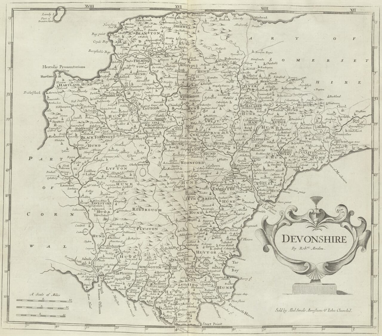
What did Britain look like to a mapmaker more than 330 years ago? In 1693, Robert Morden described a country of fertile fields, valuable minerals, thriving ports, ancient towns and sharply contrasting landscapes. His book Geography Rectified offers something that a map alone cannot: the voice of a seventeenth-century geographer explaining the places and people he believed mattered.
Rather than viewing Morden solely through his surviving maps, we have returned to his own words. The passages below are drawn from the enlarged third edition of Geography Rectified (1693). Short quotations retain the period spelling where practical; the accompanying modern-English passages are interpretations, not verbatim quotations. His assessments of people and nations reflect the assumptions and prejudices of his age.
A mapmaker working in a changing Britain
Robert Morden (c.1650–1703) worked in London as a mapmaker, publisher, bookseller and seller of mathematical instruments. By the time the enlarged third edition of Geography Rectified appeared in 1693, he was already an established figure in the London map trade. The title page advertised a description of the world, its kingdoms, provinces, islands, cities, rivers and ports, together with customs, government, commerce, coins, weights and measures. It promised seventy-eight maps.
Morden addressed his dedication to the London merchant Thomas Goddard and spoke candidly about the difficulty of producing such an ambitious work. In his preface, he acknowledged drawing on the efforts of earlier writers. That admission is revealing. Seventeenth-century geographical books were often compilations: accumulated knowledge, travellers’ reports, classical authorities and new information brought together for readers eager to understand the wider world.
Britain’s political circumstances also matter. The 1693 edition was published during the joint reign of William III and Mary II. England and Scotland shared monarchs but remained separate kingdoms with separate parliaments; the political union that created Great Britain lay fourteen years in the future.
England: fertile fields, minerals and market towns
Morden begins his principal account of England with its name, boundaries and former divisions, then moves from institutions and counties to climate and resources. He describes a temperate country in which summer showers temper the heat and winter frosts improve the cultivated soil.
“The whole Countrey is exceeding Fertile, abounding with all sorts of Grain, Rich in Pasture…”
Original source: Robert Morden, Geography Rectified, third edition (1693), “Of England”, p. 27 (page 41 of the digitised scan). The long s is represented by the modern letter s; otherwise the passage retains Morden’s spelling and capitalisation.
In modern English: England is exceptionally productive. Its fields grow grain, its pasture supports livestock, its rivers and seas supply fish, and its earth contains valuable deposits of lead, tin, iron, copper and coal. Orchards, gardens, springs and medicinal waters add to its natural riches.
What stands out is the economic eye of the geographer. Morden does not simply admire the countryside. He catalogues what can be grown, mined, traded and used. For readers in Cornwall, the mention of tin is especially evocative: a local industry appears in a national inventory of wealth.
His tables record shires, market towns, parishes and distances from London. Such information helped readers understand England as a network of administrative units and commercial centres. A county was not merely a coloured shape on a map; it was a functioning district with courts, markets, settlements and long-established institutions.
Oxford, Cambridge and the pride of learning
Morden’s admiration for England’s universities is unmistakable. He calls Oxford and Cambridge the “two Eyes” of the kingdom and praises their libraries, colleges, teachers and students. In modern terms, he presents them as the country’s outstanding centres of scholarship, preparing people for service in church and state.
He follows with short notices of distinguished towns. York is celebrated for its antiquity and cathedral; Canterbury for its archbishopric; Bristol for commerce; Norwich for woollen manufacturing; Windsor for its castle and royal palace. Each place receives attention for a different reason. The result is a vivid outline of late seventeenth-century urban Britain, drawn through the occupations, buildings and institutions that Morden considered worthy of remembrance.
Intriguingly, Morden says he had intended to describe more English towns but would reserve fuller accounts for a separate pocket-sized treatment of the counties. It is a reminder that geographical publishing was an evolving business, with readers seeking increasingly convenient and detailed local knowledge.
Wales: language, mountains and ancient kingdoms
Morden opens his account of Wales by connecting its inhabitants with the ancient Britons. He gives special attention to the survival of the Welsh language, though his comment on its sound reflects an English outsider’s judgement rather than any objective linguistic assessment. He also emphasises Welsh hospitality and attachment to family history.
In modern English: Wales is largely mountainous, but its valleys are fertile, producing grain and supporting cattle. Butter, cheese, textiles, fish, hides, honey and wax are among its useful products, while lead, coal and building stone come from beneath the ground.
His Welsh chapter is particularly rewarding for place-name enthusiasts. He moves through Anglesey, Caernarfon, Bangor, Denbigh, Flint, Harlech, Bala, Aberystwyth and many other places, frequently giving older spellings, Latin names, local associations and stories. He notes Holyhead as a crossing point for Ireland, describes Caernarfon’s defences and identifies Swansea’s commercial importance in relation to its coal pits.
Some passages repeat legendary or inherited historical claims that should not be treated as established fact. That is part of the attraction of reading an early geography: it shows not only what people knew, but what they believed they knew.
Scotland: contrasting Highlands and Lowlands
Scotland presented Morden with a landscape he regarded as markedly varied. He describes mountains, woods and lochs in the west and more productive grain-growing country towards the east. Barley, oats, fish, linen, coarse cloth and other goods feature in his account.
In modern English: Scotland contains very different regions. Its western districts are rugged and mountainous, with extensive waters and woodland, while some eastern districts provide more suitable land for cultivation. Fish and birds are abundant, and the country’s trade includes textiles and natural products.
Morden also contrasts Highland and Lowland communities in terms that reveal the cultural assumptions of his day. His disparaging description of Highland society is not a fair modern characterisation; it is evidence of how some English writers perceived Scotland in the 1690s. Such passages deserve to be read critically, rather than quietly repeated as fact.
His list of Scottish regions and jurisdictions is especially interesting beside an old map. Carrick, Cunningham, Kyle, Lothian, Galloway, Fife, Atholl, Moray, Ross and many other names appear in forms that collectors of historic Scottish maps will recognise. These divisions do not always correspond neatly to today’s council areas or historic county boundaries.
Morden’s account of Edinburgh evokes a fortified town dominated by a long principal street and a castle on its rock. He also notices Glasgow, Stirling, Leith, Perth and Aberdeen, selecting features such as bridges, ports, universities and strongholds to establish their importance.
Ireland: rivers, commerce and the four provinces
For Ireland, Morden turns to rivers, lakes, seaports, agriculture and the provincial divisions of Leinster, Ulster, Munster and Connacht. He describes fertile grassland, plentiful fish, woods and navigable waters, and he identifies livestock, hides, butter, wool, linen and other products as important commodities.
In modern English: Ireland is a beautiful and productive island with many rivers, lakes and sheltered harbours. Its mild, damp climate particularly favours pasture, although Morden considers it less favourable for ripening some crops than England’s. Cattle, dairy products, cloth and fish form part of its commercial wealth.
His notice of Dublin is notably expansive. He praises its position on the River Liffey, its harbour, buildings, trade and access across the Irish Sea to Holyhead. For Morden, location was inseparable from prosperity: a good port connected a city to merchants, goods and travellers.
Readers should approach the political passages with caution. Morden writes about Ireland from an explicitly English governing perspective following the Williamite war, and uses prejudicial language when describing some Irish communities. These statements illuminate the outlook of the author and his intended readership, not the character of the population he describes.
From descriptions to county maps
Two years after this edition of Geography Rectified, Morden’s celebrated county maps appeared in the 1695 edition of William Camden’s Britannia, edited by Edmund Gibson. Those engraved maps would become some of his best-known work. They recorded towns, rivers, woods, roads in places, county divisions and other geographical detail, frequently within decorative cartouches.
Read together, the book and maps enrich one another. The map shows the position of a river, town or county boundary; the written geography reveals which resources, institutions and histories contemporaries thought most important. Morden’s geography is not a perfectly accurate survey by modern standards. It is something equally valuable to historians: a record of how Britain was organised, described and imagined in the late seventeenth century.
These three original map illustrations complement Morden’s written descriptions. Herefordshire illustrates a predominantly rural county; Middlesex records the capital’s surroundings before the great expansion of London; and Ireland reveals the wider geographical reach of his published cartography. Click through to our historic UK county maps or maps of Ireland to browse related reproductions.
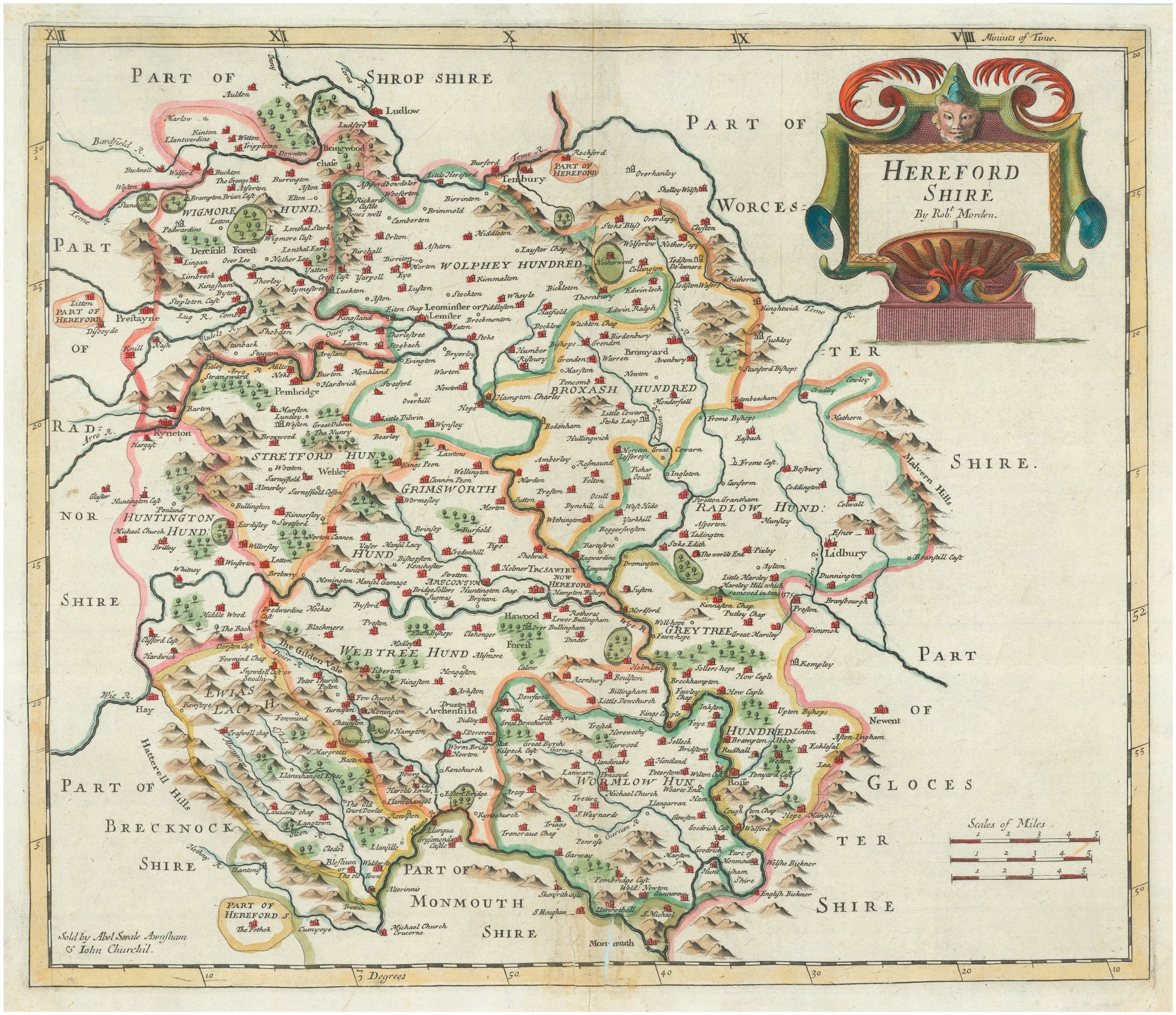
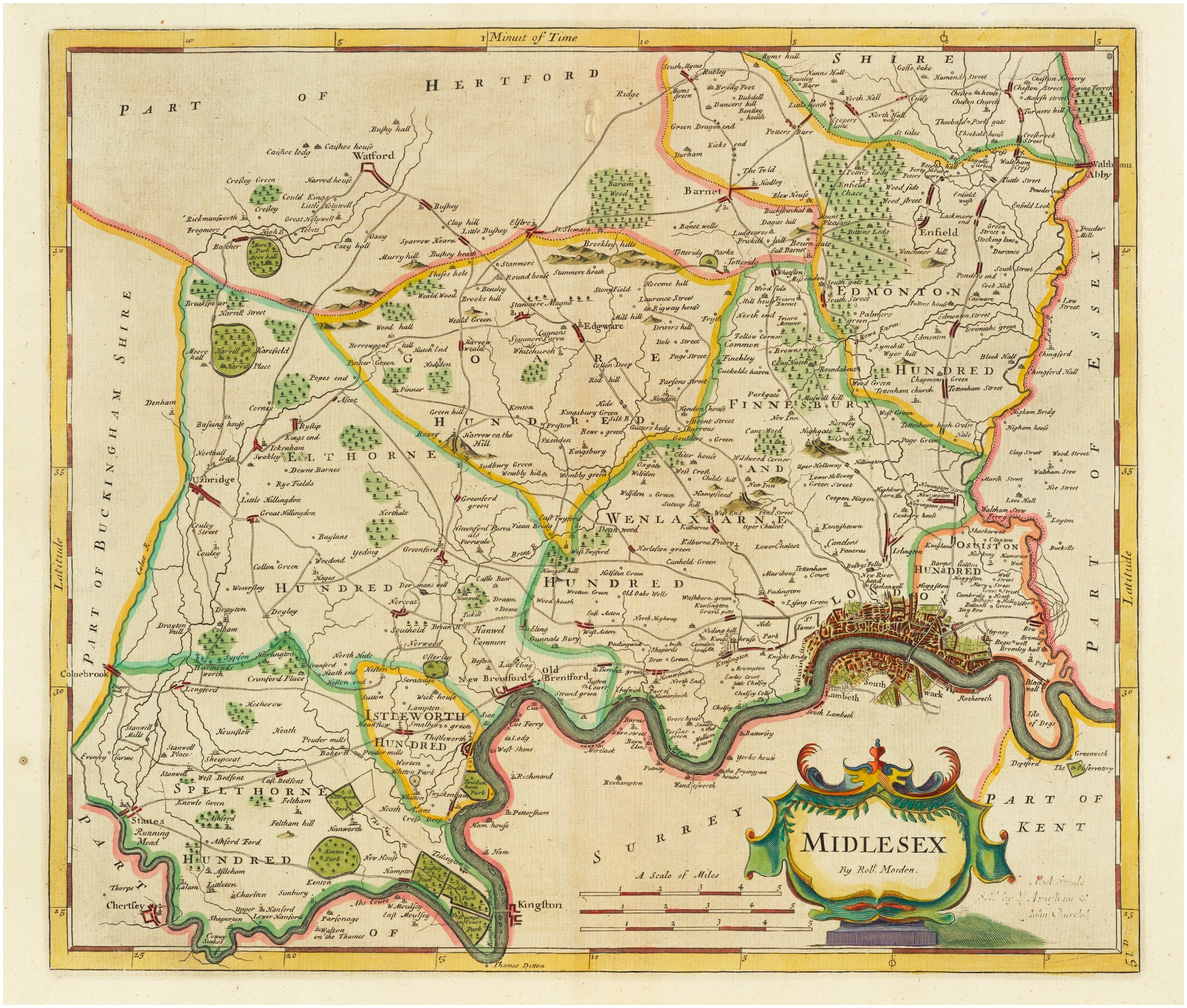
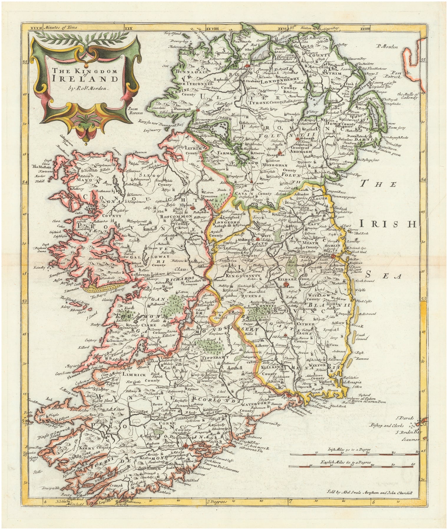
Explore Robert Morden’s 1695 Maps
The examples above are part of our newly published Robert Morden collection. Each reproduction is printed on textured fine-art paper and supplied unframed. You can view the full map and additional engraved details on the individual product pages:
- Cumberland by Robert Morden, 1695
- Herefordshire by Robert Morden, 1695
- Ireland by Robert Morden, 1695
- Middlesex by Robert Morden, 1695
- Northamptonshire by Robert Morden, 1695
- Staffordshire by Robert Morden, 1695
- Sussex by Robert Morden, 1695
Seeing Britain through seventeenth-century eyes
The attraction of Geography Rectified lies in its mixture of practical detail and period character. Market towns sit beside ancient legends; coal and wool appear alongside cathedrals and castles; river crossings and harbour approaches reveal the workings of trade. Familiar places emerge under unfamiliar spellings and administrative divisions.
For anyone who owns or studies a reproduction of a seventeenth-century map, these descriptions add another dimension. They invite us to look beyond the decorative border and consider the landscape as its original readers understood it: a place of routes, livelihoods, history and changing ideas.
Primary source: Robert Morden, Geography Rectified, third edition, enlarged (London, 1693), especially the chapters on England, Wales, Scotland and Ireland. Modern-English passages above are editorial paraphrases. For additional context, see the Government Art Collection’s records of Morden’s 1695 county maps.