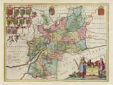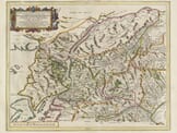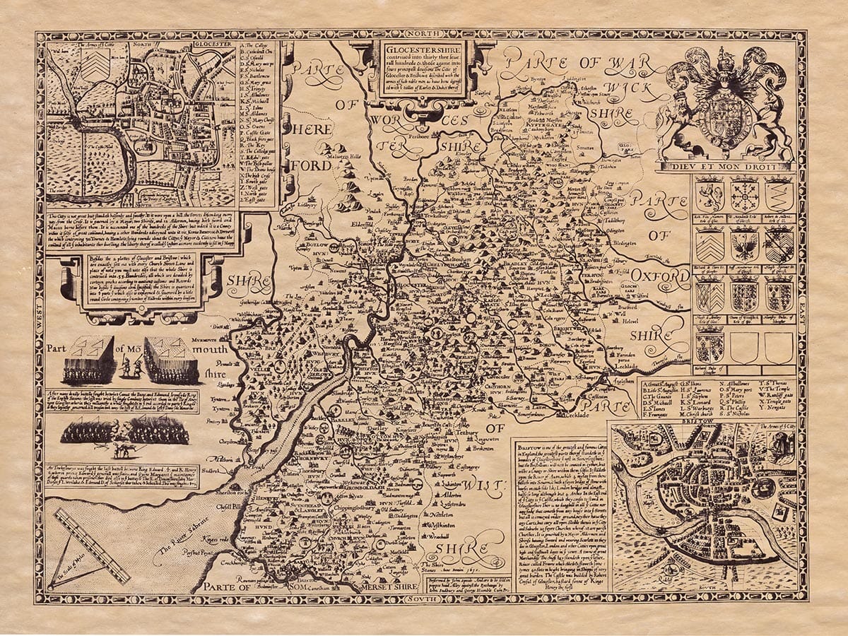
Description
John Speed added a short essay which was published on the rear (the verso) of
the old map of Gloucestershire which we have translated into modern English . . .
Boundaries:
Gloucestershire, formerly called Gleaucerbenrchyne in Old Saxon, is bordered by Worcestershire and Warwickshire to the north, Oxfordshire and Wiltshire to the east, Somerset to the south, and the River Wye and Herefordshire to the west.
Size and Shape:
The county stretches about 48 miles from Bristol on the River Avon in the south to Clifford on another River Avon in the north. Its widest point, from Lechlade in the east to Preston in the west, spans roughly 28 miles. The total length of its borders is about 138 miles. Gloucestershire is long and narrow, with a mild and pleasant climate and fertile soil. According to the medieval writer William of Malmesbury, the county produces plenty of grain and fruit, both wild and cultivated. Even the laziest person would be inspired to farm here. Wild apple and pear trees grow along roads and footpaths, bearing sweet, beautiful fruit that keeps well. The county has more vineyards than anywhere else in England, producing rich, sweet wine that nearly rivals French varieties. The countryside is dotted with homes, impressive churches, and bustling towns.
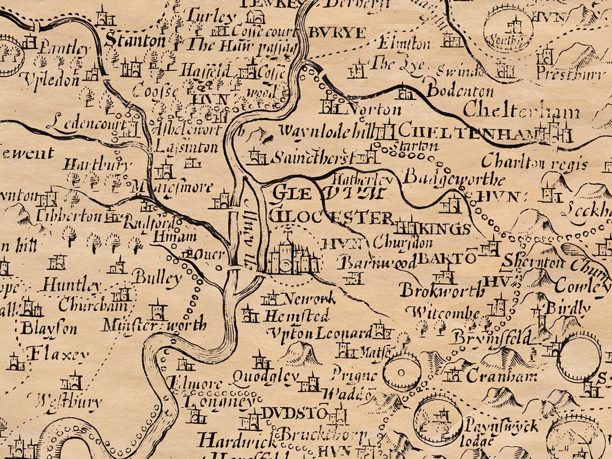
The River Severn is the county’s pride. It’s the widest, fastest, and most fish-rich river in England. Its waters can rise violently, stirring up sand and flooding like a tide — dangerous for inexperienced boaters, but locals who know the river well navigate it with ease.
Early Inhabitants and Customs:
The area was once inhabited by the Dobuni tribe, whose territory stretched into what is now Oxfordshire. Between the Severn and Wye rivers, part of the Silures tribe from South Wales lived. A unique local custom remains: when someone is convicted of a crime, their property goes to the Crown for just one year and one day. After that, it is returned to their heirs, unlike in other parts of England.
Natural Resources:
Gloucestershire is rich in grain, high-quality iron, and wool. The county also has excellent pastureland, fruit, and woodlands. However, much of the woodland has been cleared to support the iron industry, which uses oak, elm, and beech trees for fuel.
Market Towns and Cities:
Gloucestershire’s resources are traded in 25 market towns, two of which are cities.
The first city is Gloucester, the county seat, located on the Severn. In Roman times, it was called Glevum, established as a military outpost to control the Silures and house a Roman legion. Parts of the Roman walls still stand. The city was taken from the Britons around AD 570 by Ceawlin, King of the West Saxons, and thrived under the Mercian kings. Osric, King of Northumbria, supported by Æthelred of Mercia, founded a large nunnery there, where Queens Kyneburga, Eadburga, and Eve served as abbesses. Lady Æthelflæd, sister of King Edward the Elder, built a beautiful church in Gloucester and was buried there. Though destroyed by Danish invaders, it was later rebuilt and became St. Peter’s Cathedral. King Edward II — murdered at Berkeley Castle on the orders of his wife, Queen Isabella of France — is buried there in an alabaster tomb. Nearby lies Robert Curthose, the eldest son of William the Conqueror, who was blinded and imprisoned for 26 years before his death. According to tradition, Lucius, believed to be Britain’s first Christian king, was buried here even before King Arviragus’ time.
Gloucester is located at latitude 52°14′ and longitude 18°5′ west.
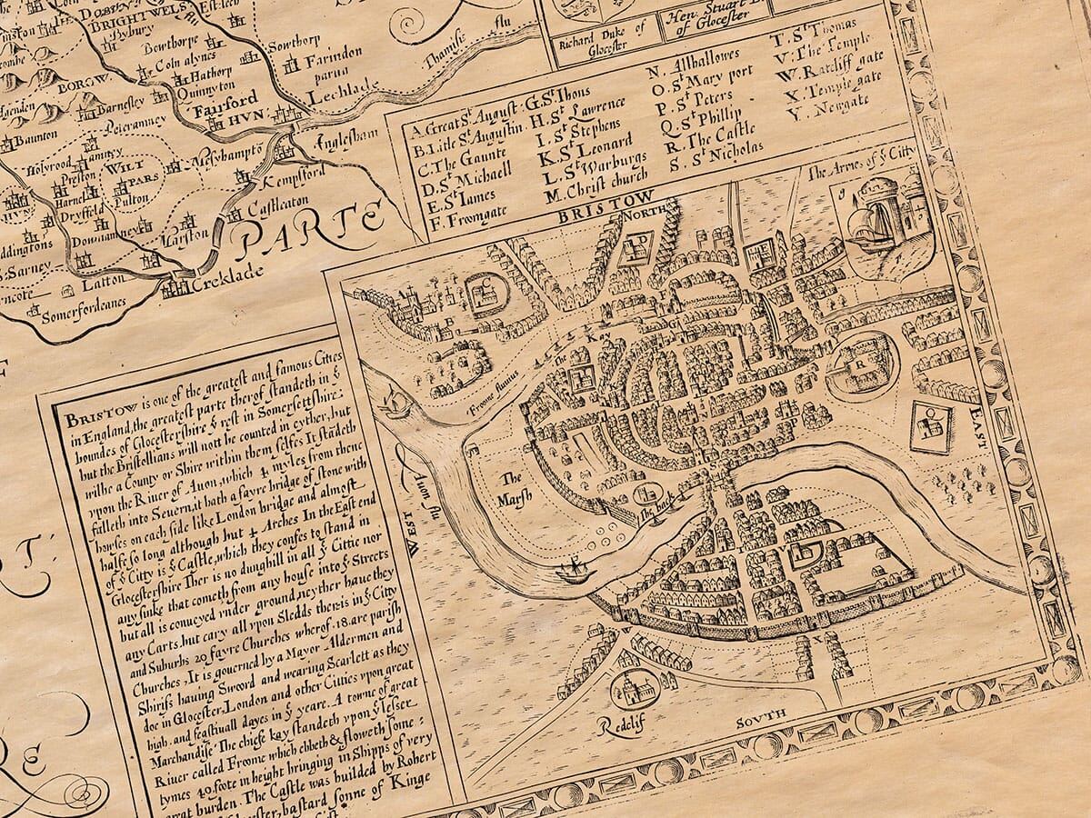
The second major city is Bristol, a thriving trade hub often called a “second London.” Although it lies partly in Gloucestershire and partly in Somerset, it has its own county status and doesn’t belong to either.
Other Towns:
Cirencester, once even more prominent, was known as Corinium to the Romans and Durocornovium in the Antonine Itinerary. Giraldus called it the “City of Sparrows” after a legend that an African warlord, Gurmund, burned it down using sparrows with fire attached to them. It was a major crossroads for Roman roads. Ceawlin took it from the Britons, and it later fell to the Mercians and then the Danes in 879. It has not been rebuilt within its original Roman walls.
Historical Sites:
Notable historical sites include:
Alney Island near Gloucester, where Edmund Ironside and Canute fought in single combat before agreeing to divide the kingdom.
Berkeley Castle, where King Edward II was murdered.
Tewkesbury, where a major 1471 battle ended King Henry VI’s rule and doomed the Lancastrian cause. Prince Edward, Henry’s son, was killed there.
Alderley Hills, where you can still find cockles, periwinkles, and oyster shells — possibly fossils or natural oddities.
Religious Institutions:
The county is home to many religious houses, many founded by royalty. These include Tewkesbury, Deerhurst, Gloucester, Minchinhampton, Berkeley, Kingswood, Cirencester, Winchcombe, and Hailes Abbey. Hailes Abbey, founded by Richard, Earl of Cornwall, claimed to house a relic of Christ’s blood, drawing large numbers of pilgrims until it was exposed as a fake during the Reformation.
Dukes and Earls of Gloucester:
Several noble Dukes of Gloucester met tragic ends:
Thomas of Woodstock, son of Edward III, was smothered in Calais.
Humphrey, brother to Henry V, was killed through the schemes of Queen Margaret and Cardinal Beaufort.
Richard, brother to Edward IV, was killed at the Battle of Bosworth by Henry VII.
Administrative Divisions:
Gloucestershire is divided into four major regions, further split into 30 hundreds and 280 parishes (which are listed elsewhere).