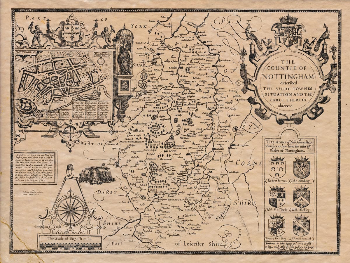

Description
John Speed’s notes and list of places that appeared on the rear (verso) of the atlas page.
The following translation is digitally created and so should not be fully relied upon for accuracy.
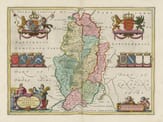
(1) Nottinghamshire (from Nottingham, the chief town that gives the county its name; and possibly derived from the Saxons’ Snosengaham, due to the many dens or caves worked into its rocks and underground) lies bordered on the north and northwest by Yorkshire; to the east, at some distance by the River Trent, is Lincolnshire; to the south is Leicestershire; and to the west, by the River Erewash, it is separated from Derbyshire.

(2) The county is long and oval-shaped, doubling in length compared to its width. Its rivers are well-distributed and flow from Frinley in the north to Steanford in the south, about 38 English miles; west to east, from Teversal to Bebhop is a bit more than 19 miles, so the total circuit is about 110 miles.
(3) The air is good, wholesome, and pleasant; the soil is rich, sandy, and clayey. According to the names of the county divisions, it’s fruitful in corn and grass, with excellent woods, waters, and fields abundant in game.
(4) There is a kind of stone found here called Alablaster, used for plaster, and considered better than the one from Paris. It’s used for upper rooms and flooring, being tough and solid like mortar. In the west near Worksop, there’s an abundance of excellent liquor.
(5) Further south, in Stoke, in the reign of King Henry VII, a battle was fought between John de la Pole, Earl of Lincoln (supporting Richard III) and the king’s forces. John died in the battle, and Lambert Simnel, whom they had tried to set up as king, was taken. After several more troubles, King John made peace at Newark.
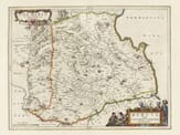
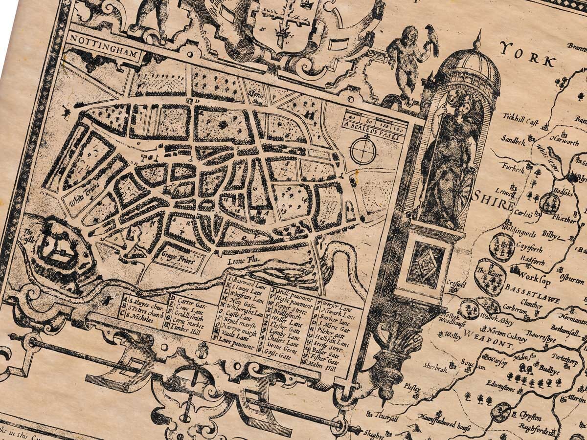
(6) Trade and commerce are active, with 10 market towns. Nottingham is the greatest and best of them: a beautiful town, seated on a hill with strong buildings and broad streets. Its market is spacious and among the best in the land. Many storage vaults have been carved into the rocks of the town. The castle has special note, with engravings of Christ’s Passion, and was once the prison of David II, King of the Scots. Another legend tells how Lord Mortimer was captured there during King Edward III’s reign, giving the name Mortimer’s Hole to the staircases and rooms made within the rock. There are houses with winding stairs, windows, and chimneys all carved from solid rock.
The castle is strong, and once kept by the Danes against Burhred, Ethelred, and Alfred the Great, with a stone raised by King Edward the Elder, believed to mark the foundation. Nearby, the River Trent runs, and one may see how the castle and streets are built on stone. The entire circuit of the town is about two miles.
(7) In the wars between Stephen and Maud the Empress, Robert, Earl of Gloucester, destroyed the castle walls. Though it suffered during the Wars of the Roses, it has since regained beauty and wealth. Now, it is governed by a mayor and aldermen, with several officers including sheriffs, sergeants, and others. The town holds significant status in this region.
The county contains several religious houses, especially in Newstead, Lenton, Shelford, Southwell, Thurgarton, Blyth, Welbeck, and Radford. In Nottingham itself are both white and gray friars, and a chapel dedicated to St. John.
(8) The shire’s land is mostly sand and clay. For government purposes, it is divided into eight Wapentakes (or Hundreds), with 168 Parish Churches.