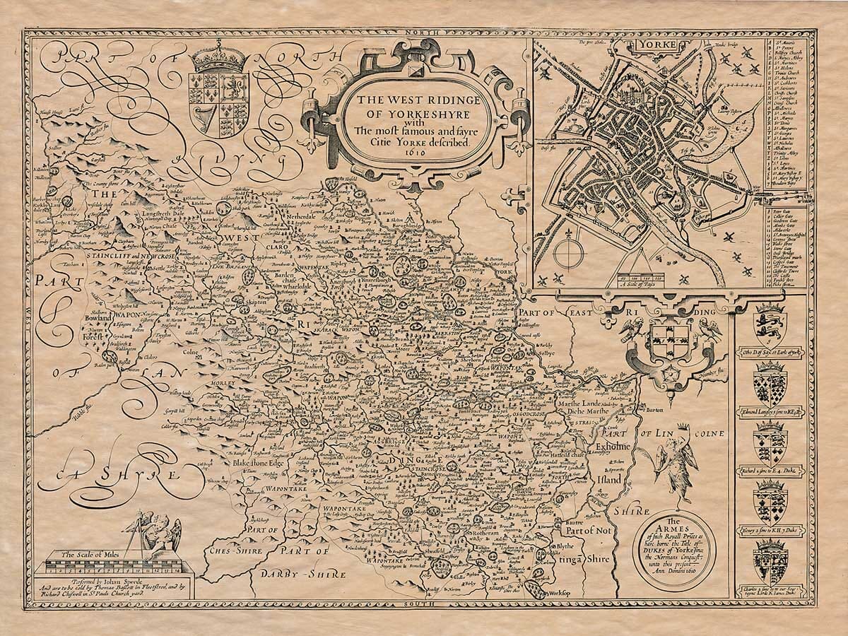
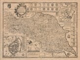
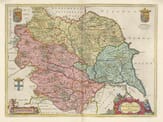
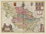
John Speed added a short essay which would have been published on the rear (the verso) of this old map of the West Riding of Yorkshire which we have translated into modern English. It should be noted that some errors may have occurred within the translation.
The West Riding of Yorkshire, located in the northwest, covers a vast area. To the north, it borders part of the North Riding; to the east, it shares boundaries with part of the East Riding and Lincolnshire. On the west, it neighbors Lancashire, and to the south, it is bordered by Nottinghamshire and parts of Derbyshire.
The climate in this county is generally cold and harsh, subject to strong winds, severe frosts, and other harsh, winter-like weather. As a result, the people here have adapted to maintain a steady body temperature through hard labor, which helps them stay healthy and less prone to sickness compared to those who live in easier conditions.
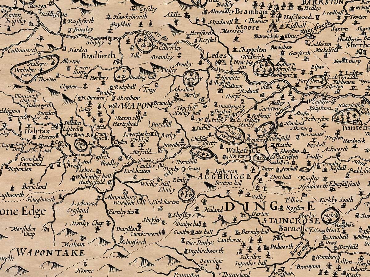
Although the land is mostly unproductive due to its high altitude, rocky terrain, and mountainous features, some areas with sloping sides support good grass, and the valleys are not entirely barren. The part bordering Lancashire is mountainous, desolate, and unattractive, with some local rivers referred to dismissively as “Hell Becks.” On the other hand, the area along the River Ure in the Wentdale valley has fertile land suitable for large flocks of sheep and naturally produces plenty of lead ore. In other parts, where the land is barren and unsuitable for crops and livestock, the people compensate by mining for copper, lead, stone, and coal, which they have in abundance. The area around the River Swale, flowing eastward from the western mountains with swift currents, is rich in lead ore. Though the lack of trees is a challenge, the area is compensated with abundant grass. Nature has, in this way, provided for every disadvantage with a contrasting benefit.
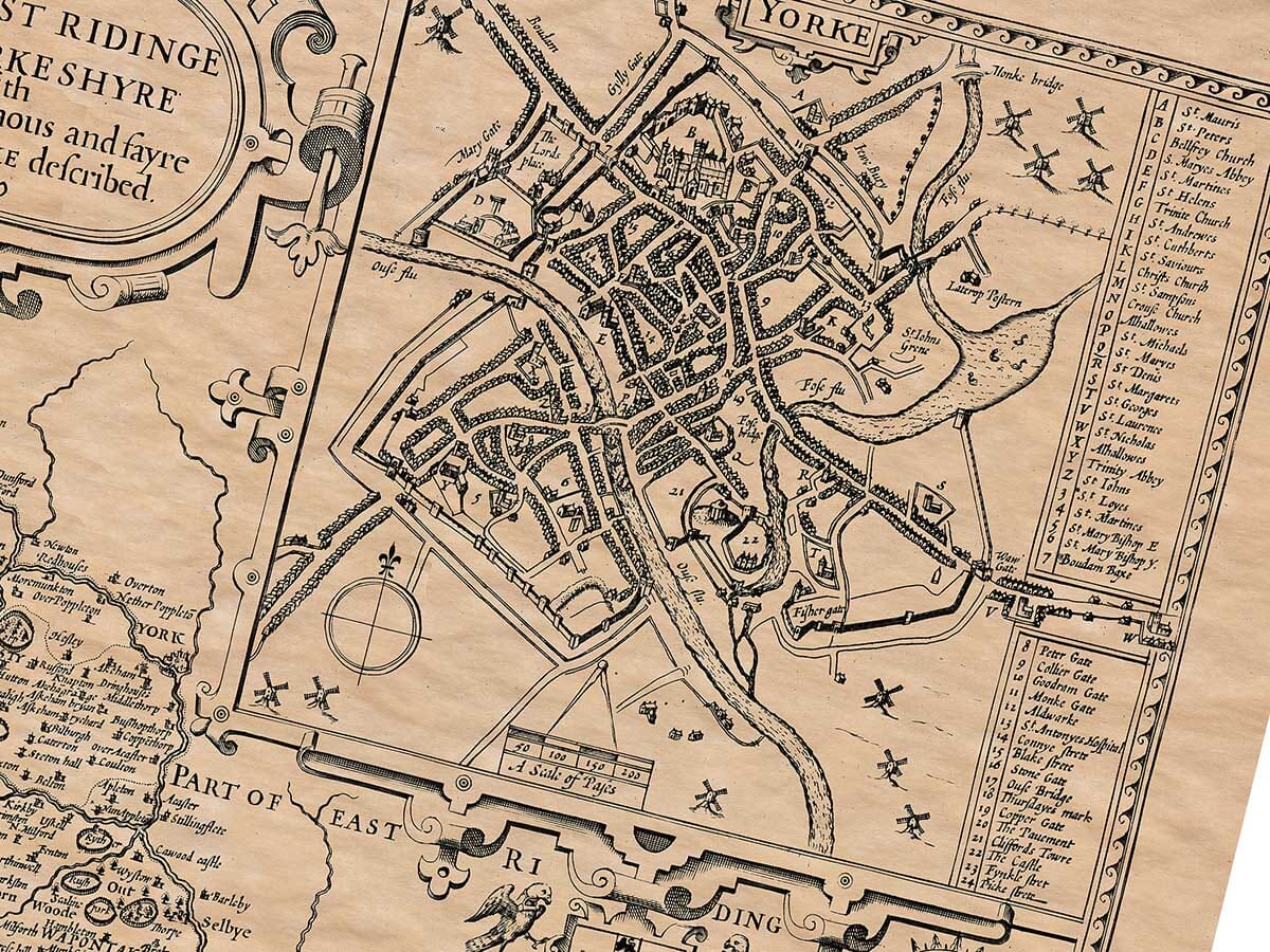
The ancient inhabitants of this region were the Brigantes, as noted by Ptolemy. They were eventually conquered by the Romans. As for York, I have placed its description in the main section, as it fits better there. The North Riding, which includes the towns of Hull and Richmond, has been mentioned, but due to space constraints, I must speak of Richmond here. Richmond, the main town in the North Riding, is located on the River Swale. The town seems to have once been surrounded by a wall, with the gates still standing in the middle of town, so the suburbs extend far beyond the wall. It is moderately populated, with many people engaged in the knitting of stockings, which even the elderly and children rely on for their livelihood.
Alan, the first Earl of Richmond, distrustful of the strength of Gilling (a nearby manor house), built the town to withstand attacks by the Danes and English, whom the Normans had displaced. He named it Richmond, meaning “The Rich Mount,” and fortified it with a wall and a strong castle built on a rock. Gilling, which had been of more religious than military importance since the murder of Oswy, King of Northumberland, was regarded as a religious site rather than a place of defense. A monastery was established there to atone for the murder. In Richmond, the administration is managed by an alderman elected yearly from twelve brothers, assisted by twenty-four burgesses, a recorder, four chamberlains, and two sergeants at mace. The town is situated at latitude 55°17′ North, and longitude 18°50′ West.
Notable features in the county include copper mines near Richmond, mentioned in a charter of King Edward IV, though they have yet to be explored. The mountains are also home to stones resembling sea creatures like cockles and sea snails, which might be signs of the great flood described in the Bible. The River Swale, which was considered sacred by the ancient English, is famous for the mass baptisms of over ten thousand people by Paulinus, Archbishop of York, in a single day after the Anglo-Saxons embraced Christianity. This event marked a holy moment in history.
Roman sites of interest include Bainbridge, where the Romans once had a garrison, and Bowes, known as Lavatra or Levatre in the Antonine Itinerary, where remnants of a Roman altar with an inscription honoring Emperor Hadrian have been found. The first cohort of Thracians was stationed here, and other Roman sites include Maiden Castle, a small fort, and a cross known as the “Kings Cross,” which marked the border between England and Scotland. In Burgh (formerly Bracchium), a Roman garrison was established, and a statue of Emperor Commodus was discovered, depicting him in the style of Hercules.
Religious sites of importance included the monastery near Richmond, the abbey at Coverham in Coverdale (now Corham), and the abbey of Cistercians at Fois (later moved to Jeruis or Feruvall). These religious centers flourished during the Dark Ages, attracting many followers, though today these sites have fallen into ruin, as the once-widespread superstition has been replaced by the light of true faith.
The West Riding of Yorkshire is home to four strong castles, twenty-one market towns, and one hundred and four parish churches where divine services are held, in addition to various chapels. An alphabetical list of these places can be found in the table that follows.