Old Map of Wessex
Old Map of Wessex Title piece of old map of Wessex Detail from the centre of the old map of Wessex Launceston

Wessex from oldmap.co.uk

Price range: £49.95 through £59.95

Old Map of Wiltshire 1645 

A beautifully engraved mid-17th-century map of southern England by Nicolas Sanson. Hand-coloured and full of character, it shows the western counties as they were once understood, blending careful scholarship with the quiet charm of an object made to be looked at, lived with, and enjoyed.
  • Stunning giclée fine art print on authentically aged heavy textured paper
  • 12 Colour printing technology  •  Guaranteed to pass or exceed museum quality standards
  • Bespoke framing service   •  Free UK Courier Delivery with tracking
Available in two sizes: Large: 24″ x 32″ (61 x 78.7cms)   Medium: 18″ x 24″ (45.5 x 61cms) 
+ read more

A stunning certified FINE ART PRINT on heavy textured art paper — not a poster

  • Direct from the publisher — no middlemen
  • Printed in-house in Cornwall
  • Free UK delivery — international shipping available
  • Produced to meet — and often exceed — museum-quality standards
Inspecting Vintage Map Reproduction

Fine Art Map Reproductions – Museum-Quality Printing

Unlike most online offerings, our maps are produced entirely in-house, not outsourced to print-on-demand or drop-shipping services. This allows complete control over quality while offering better value. Each map begins with a high-resolution original, carefully enhanced and printed to order using archival papers and pigment inks for exceptional clarity, depth, and longevity. Every piece is personally overseen — no map leaves our workshop unless it is of a quality we would be proud to display ourselves.

Hand hold a magnifying glass over West Cornwall Map

Authentic Old Map Paper & Accurate Colour Reproduction

Paper choice is essential to the authenticity of our maps. We use specially sourced 190gsm paper made in the UK from pure materials and traditionally pressed with natural woollen felts. This process creates a subtle, randomly textured surface that closely resembles an original antique document. Likewise the use of premium quality ink fully saturates the paper, producing remarkable clarity, depth, and historical character. Colour fastness and sharpness will remain good for in excess of 100 years!

Map in Postal Tube
Buy Old Maps Online in the UK Today Trading online since 1999

The Old Map Company of Great Britain offers a vast and carefully curated collection of the very finest expertly reproduced vintage maps. Our range includes works by renowned cartographers such as John Speed and Willem Blaeu, covering Scotland, England, and beyond. Free UK courier delivery is included, with EU, USA, and worldwide shipping available at cost and calculated at checkout. If you need assistance, our team is always happy to help you choose the perfect map.

RECENT REVIEWS

M.F. Leicestershire
M.F. Leicestershire
Very impressed . . . exceeded my expectations. My son would now like one for Christmas!
Julia Ballester
Julia Ballester
Very pleased with the quality of the map and it even arrived before it was supposed too.
Nikki
Nikki
Amazed to find the church where we married on a 400 year old map. Bought as a 1st anniversary gift.
K.H. Middlewhich
K.H. Middlewhich
I am absolutely delighted with the my antique map. It is so interesting. I would now like to purchase another Map for my sister as a Christmas present.
There’s a particular pleasure in spending time with a map like this. Not just glancing at it, but really looking — following the coastlines with your eyes, recognising familiar names, and noticing others that feel just out of reach. It doesn’t shout for attention. Instead, it quietly invites you in. 
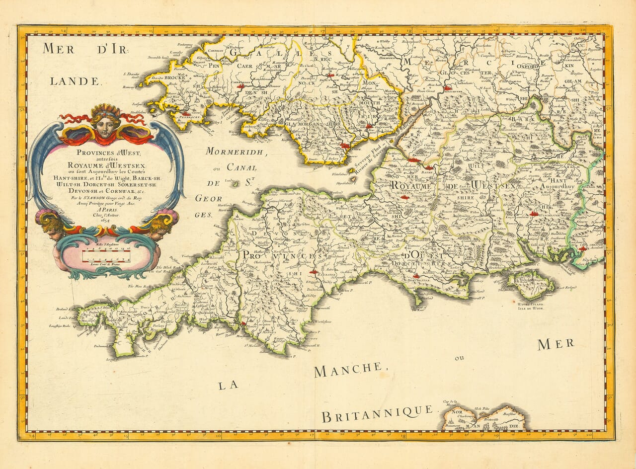
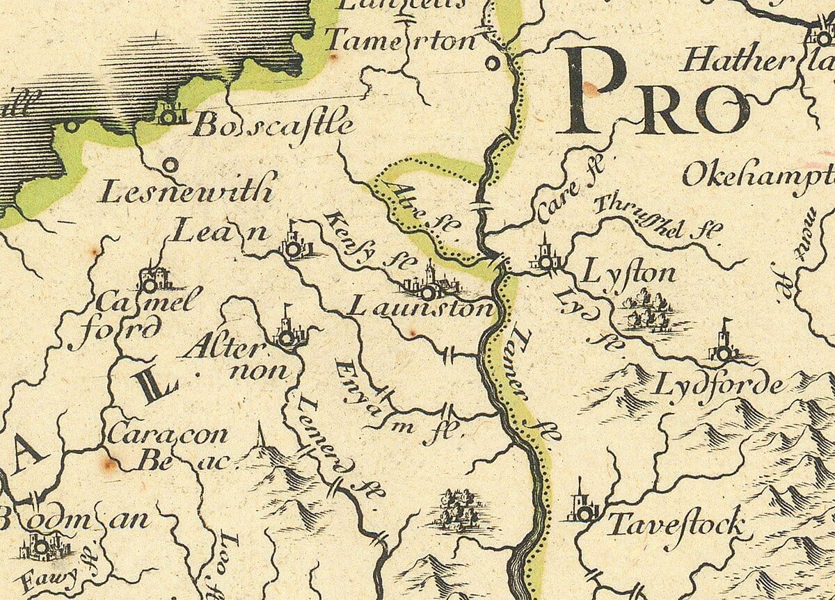
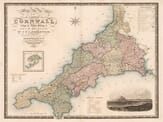
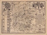
This map was produced in the mid-seventeenth century, yet it is already consciously historical. Rather than showing southern England simply as it existed at the time, it looks further back, framing these counties as lands that once formed the Kingdom of Wessex. Winchester isn’t just another town here; it carries the weight of an old capital. Wilton still appears alongside Salisbury, quietly acknowledging a moment of change, while Dorchester holds its separate place as Dorset’s long-standing county town. In Cornwall, Launceston retains its prominence, long before Truro would later assume that role. The map is comfortable with overlap and transition — something modern maps rarely allow. 
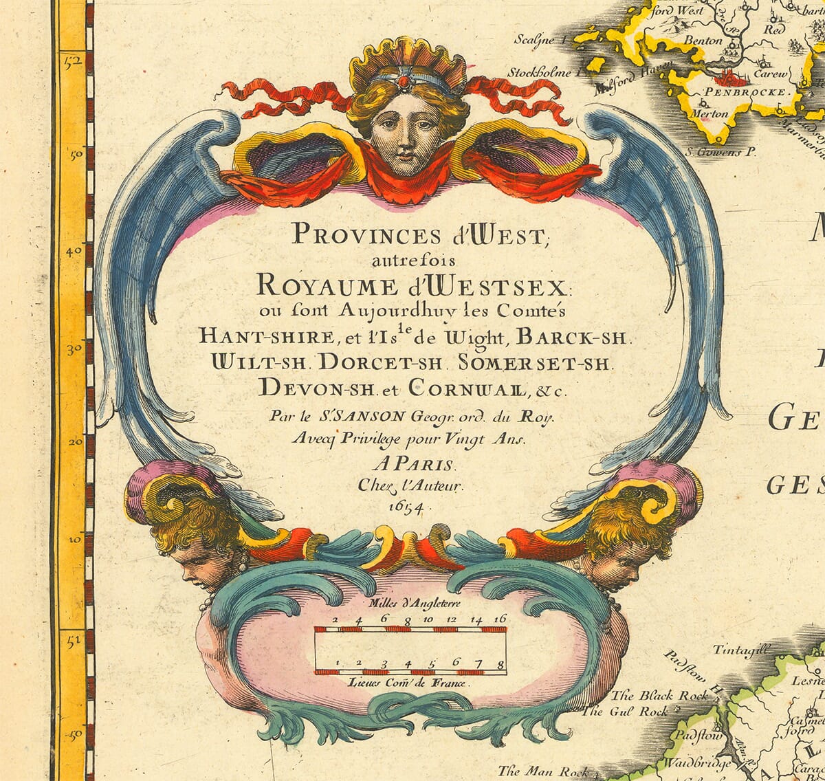
The hand colouring plays its part as well. The borders are not perfectly uniform, and that is exactly the point. Each example was coloured by hand after printing, with small variations that remind us this was once a new object, worked on by an individual rather than produced by a machine. That human presence remains visible centuries later. What makes this map especially rewarding is the way it responds to patience. The longer you spend with it, the more it gives back — a forest marked where none now survives, a place-name spelled differently, a county town whose importance has quietly shifted over time. Gradually, it becomes less about geography alone and more about how people once understood the world around them. At oldmap.co.uk, we are proud to offer this map not only for its age or quality, but for its ability to connect people to place and to history in a direct, personal way. It is the kind of map that may be framed and admired, but just as often it is returned to, talked about, and lived with. That, in the end, is what makes it endure.

You may also like…

×
Product added to cart
No products in the cart.