Large Edition
Large Edition Thames through London Map Section from place names Panell Locks and Bridges along the Thames Thames Map Medium Size The Thames River from its source to the sea

Old Map of the River Thames

Price range: £49.95 through £79.95

By Carington Bowles (1724–1793) This remarkably large fine art panorama carefully remastered from Bowles’s New Map of the River Thames is a stunning piece of historical cartography, uniquely capturing the intricate details of the Thames in the 18th century. From its source in Gloucestershire to its mouth at the North Sea, this map beautifully traces the river’s course, highlighting key towns like Oxford, Reading, Windsor, and London. The engraving by John Ellis, cleverly captures the river’s locks, wears, bridges, tolls, and the hazards of its estuary; an intricate task resulting in an exceptional piece of craftsmanship for the time. Printed to your order on high-quality archival paper, this large-scale reproduction is available from us in a choice of two sizes that both bring Bowles’s original map to life, making it a striking focal point for any home or office. Its vintage charm, combined with the stunning level of detail, will captivate history lovers, cartography enthusiasts, and anyone with a passion for the River Thames. The map is not just a decorative piece; it’s a conversation starter – its rich history and visual appeal will draw attention and spark intriguing discussions about the Thames’ role in England’s past. This fine art print is the perfect way to add a unique, elegant touch to any space, blending history with art in a timeless display that will continue to inspire for years to come.

DIRECT FROM THE PUBLISHERS – EXCEPTIONAL VALUE

Medium: 12″ x 46.8″ (30.5 x 119 cms)   Large: 24″ x 90″ (70 x 262 cms) (sizes are approximate to within an inch)  
+ read more

A stunning certified FINE ART PRINT on heavy textured art paper — not a poster

  • Direct from the publisher — no middlemen
  • Printed in-house in Cornwall
  • Free UK delivery — international shipping available
  • Produced to meet — and often exceed — museum-quality standards
Inspecting Vintage Map Reproduction

Fine Art Map Reproductions – Museum-Quality Printing

Unlike most online offerings, our maps are produced entirely in-house, not outsourced to print-on-demand or drop-shipping services. This allows complete control over quality while offering better value. Each map begins with a high-resolution original, carefully enhanced and printed to order using archival papers and pigment inks for exceptional clarity, depth, and longevity. Every piece is personally overseen — no map leaves our workshop unless it is of a quality we would be proud to display ourselves.

Hand hold a magnifying glass over West Cornwall Map

Authentic Old Map Paper & Accurate Colour Reproduction

Paper choice is essential to the authenticity of our maps. We use specially sourced 190gsm paper made in the UK from pure materials and traditionally pressed with natural woollen felts. This process creates a subtle, randomly textured surface that closely resembles an original antique document. Likewise the use of premium quality ink fully saturates the paper, producing remarkable clarity, depth, and historical character. Colour fastness and sharpness will remain good for in excess of 100 years!

Map in Postal Tube
Buy Old Maps Online in the UK Today Trading online since 1999

The Old Map Company of Great Britain offers a vast and carefully curated collection of the very finest expertly reproduced vintage maps. Our range includes works by renowned cartographers such as John Speed and Willem Blaeu, covering Scotland, England, and beyond. Free UK courier delivery is included, with EU, USA, and worldwide shipping available at cost and calculated at checkout. If you need assistance, our team is always happy to help you choose the perfect map.

RECENT REVIEWS

M.F. Leicestershire
M.F. Leicestershire
Very impressed . . . exceeded my expectations. My son would now like one for Christmas!
Julia Ballester
Julia Ballester
Very pleased with the quality of the map and it even arrived before it was supposed too.
Nikki
Nikki
Amazed to find the church where we married on a 400 year old map. Bought as a 1st anniversary gift.
K.H. Middlewhich
K.H. Middlewhich
I am absolutely delighted with the my antique map. It is so interesting. I would now like to purchase another Map for my sister as a Christmas present.
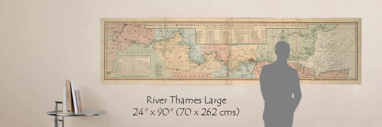
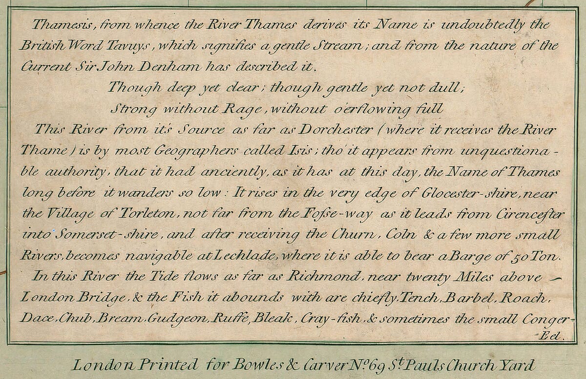
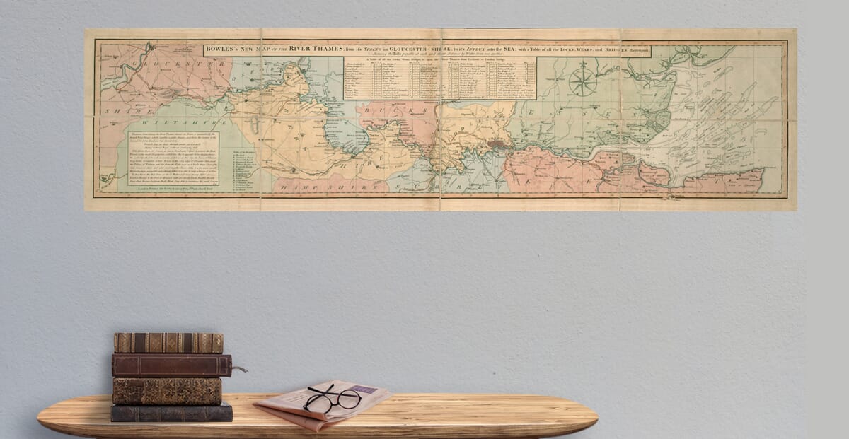
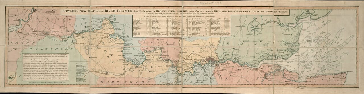
Carington Bowles’s New Map of the River Thames, originally produced in the 18th century, affords a stunning rendition of the most important and historically significant river in England. The old map covers the full course of the River Thames, stretching from its source in Gloucestershire near Torleton all the way to its mouth at the North Sea. This map was crafted by Bowles, a well known cartographer, and engraved by John Ellis. It was an invaluable resource for river navigation and a vital reference for travellers, merchants, and boatmen during the period. 
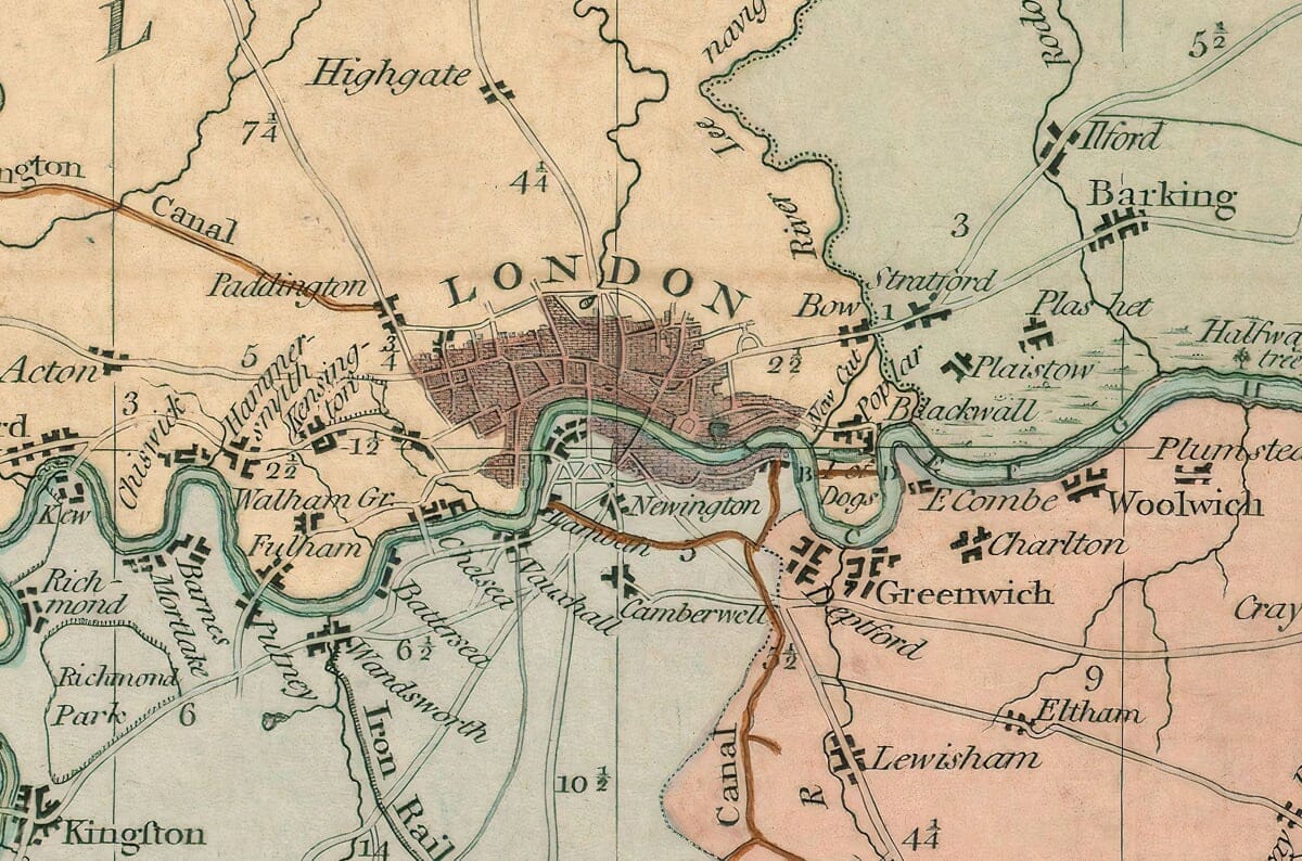
The map meticulously traces the entire course of the river through the towns including Lechlade, Oxford, Abingdon, Wallingford, Reading, Henley, Maidenhead, Windsor, and the City of London, before finally flowing into the sea. Most notable are its depictions of various geographical landmarks and features along the river’s length. These include numerous locks, wears, and bridges along with their respective tolls, which were payable at each. Tolls and Distances: Bowles’s map also features a table of all the locks, wears, and bridges. This was particularly useful for those using the river for transport, as it allowed them to calculate both the distances and costs associated with traveling along the river. Distances between landmarks were measured by water, offering an accurate and accessible means of planning trips. In addition to the general river features, Bowles’s old River Thames map includes important navigational data such as sandbars, shoals, and soundings in the estuary. This was essential for understanding the river’s flow and the potential hazards that could be encountered, especially in the tidal sections closer to the river’s mouth. Such details would have been indispensable for the safe navigation of ships and boats, particularly as the river widened toward its entrance into the sea.

You may also like…

×
Product added to cart
No products in the cart.