Isle of Mull
Isle of Mull Early map of The Isle of Mull Early map of The Isle of Mull detail

Isle of Mull – Inner Hebrides

Price range: £35.55 through £59.95

The Isle of Mull – Engraved and published by William Blaeu Circa 1645

A stunningly beautiful map that any lover of this special place will rejoice in with every viewing.
  • Stunning giclée fine art print on authentically aged heavy textured paper
  • 12 Colour printing technology  •  Guaranteed to pass or exceed museum quality standards
  • Free UK Courier Delivery with tracking
Available in two sizes: Large: 24″ x 31″ (61 x 78.7cms)   Medium: 18″ x 24″ (45.5 x 61cms) 
+ read more

A stunning certified FINE ART PRINT on heavy textured art paper — not a poster

  • Direct from the publisher — no middlemen
  • Printed in-house in Cornwall
  • Free UK delivery — international shipping available
  • Produced to meet — and often exceed — museum-quality standards
Inspecting Vintage Map Reproduction

Fine Art Map Reproductions – Museum-Quality Printing

Unlike most online offerings, our maps are produced entirely in-house, not outsourced to print-on-demand or drop-shipping services. This allows complete control over quality while offering better value. Each map begins with a high-resolution original, carefully enhanced and printed to order using archival papers and pigment inks for exceptional clarity, depth, and longevity. Every piece is personally overseen — no map leaves our workshop unless it is of a quality we would be proud to display ourselves.

Hand hold a magnifying glass over West Cornwall Map

Authentic Old Map Paper & Accurate Colour Reproduction

Paper choice is essential to the authenticity of our maps. We use specially sourced 190gsm paper made in the UK from pure materials and traditionally pressed with natural woollen felts. This process creates a subtle, randomly textured surface that closely resembles an original antique document. Likewise the use of premium quality ink fully saturates the paper, producing remarkable clarity, depth, and historical character. Colour fastness and sharpness will remain good for in excess of 100 years!

Map in Postal Tube
Buy Old Maps Online in the UK Today Trading online since 1999

The Old Map Company of Great Britain offers a vast and carefully curated collection of the very finest expertly reproduced vintage maps. Our range includes works by renowned cartographers such as John Speed and Willem Blaeu, covering Scotland, England, and beyond. Free UK courier delivery is included, with EU, USA, and worldwide shipping available at cost and calculated at checkout. If you need assistance, our team is always happy to help you choose the perfect map.

RECENT REVIEWS

M.F. Leicestershire
M.F. Leicestershire
Very impressed . . . exceeded my expectations. My son would now like one for Christmas!
Julia Ballester
Julia Ballester
Very pleased with the quality of the map and it even arrived before it was supposed too.
Nikki
Nikki
Amazed to find the church where we married on a 400 year old map. Bought as a 1st anniversary gift.
K.H. Middlewhich
K.H. Middlewhich
I am absolutely delighted with the my antique map. It is so interesting. I would now like to purchase another Map for my sister as a Christmas present.
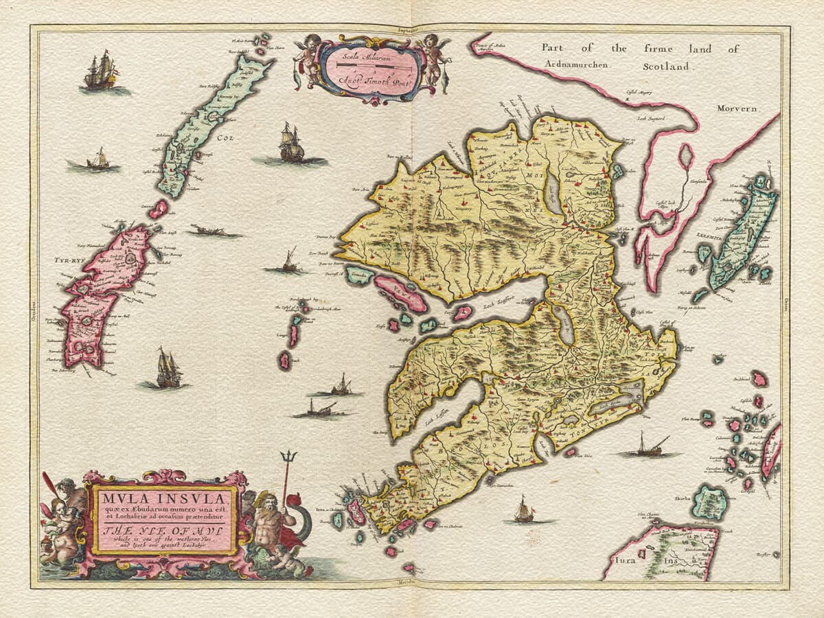
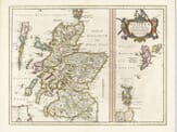
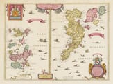
The 1645 map of the Isle of Mull, engraved and published by Willem Blaeu, is a remarkable example of 17th-century cartography. Part of Blaeu’s Scotia Regnum series, this map showcases the intricate artistry and geographical knowledge of the period. ️ Detailed Description of the Map 
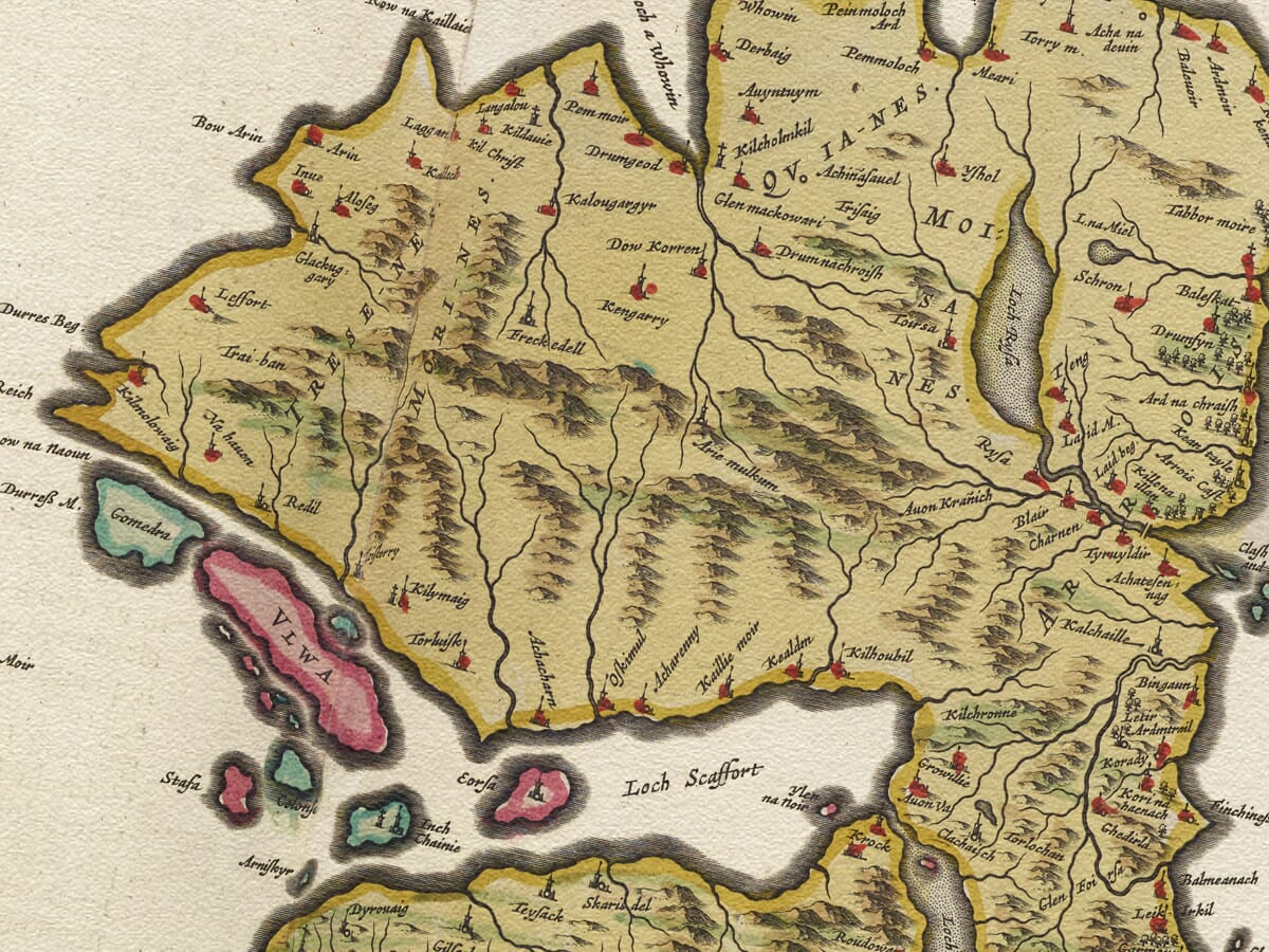
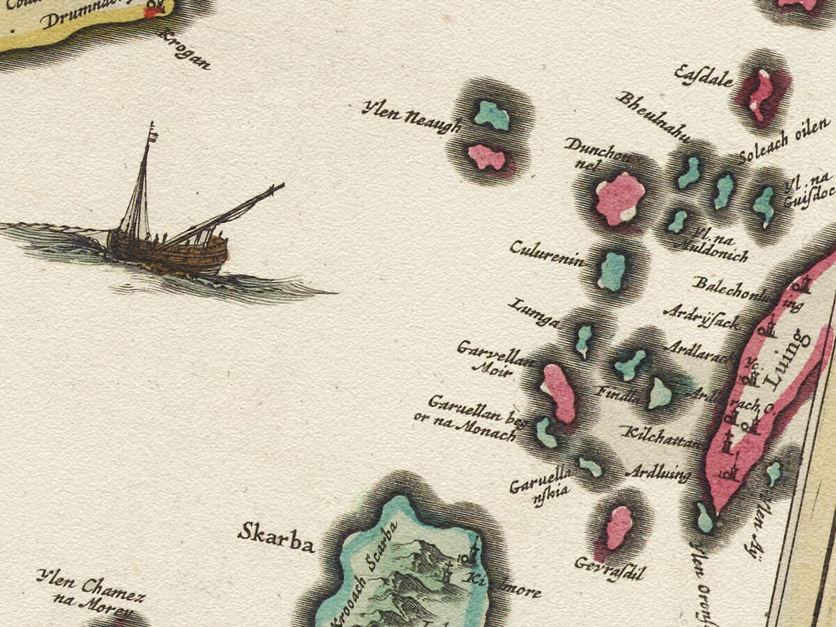
Orientation and Layout: The map is oriented with north to the top, featuring the Isle of Mull prominently in the center. Surrounding the island are numerous smaller isles, reflecting the intricate geography of the Inner Hebrides. Topography and Hydrography: Mull’s rugged coastline is depicted with precision, including notable peninsulas and inlets. The surrounding seas are illustrated with stylized waves and sea monsters, common in Blaeu’s works, adding a mythical dimension to the maritime landscape. Cartouches and Heraldry: A decorative title cartouche adorns the upper part of the map, embellished with floral motifs and scrollwork. The cartouche includes the Latin title and Blaeu’s imprint. Additionally, coats of arms representing Scottish nobility or regions may be featured, underscoring the map’s noble patronage and the cartographic tradition of heraldic inclusion. Decorative Elements: Sailing ships navigate the surrounding waters, and compass roses are placed to indicate direction. These elements not only serve a navigational purpose but also enhance the map’s aesthetic appeal. Cartographic Sources: The map is based on earlier surveys by Timothy Pont, a Scottish cartographer, and later augmented by Robert Gordon of Straloch. Their contributions reflect the evolving understanding of Scotland’s geography during the Renaissance. Significance This map is not merely a geographical tool but a work of art that encapsulates the Renaissance’s blend of science, art, and exploration. Its detailed portrayal of the Isle of Mull offers insights into the cartographic practices of the 17th century and serves as a historical document reflecting the era’s understanding of the Scottish landscape.

You may also like…

×
Product added to cart
No products in the cart.