Old Britain Map
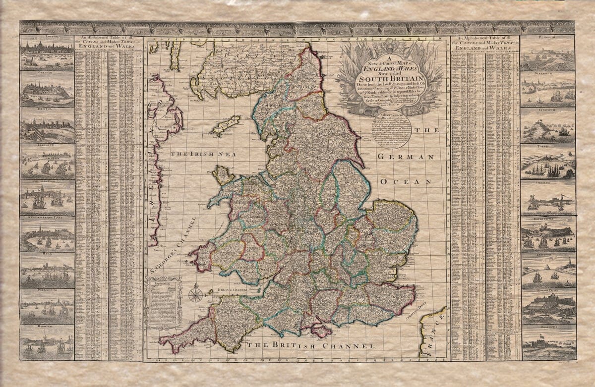
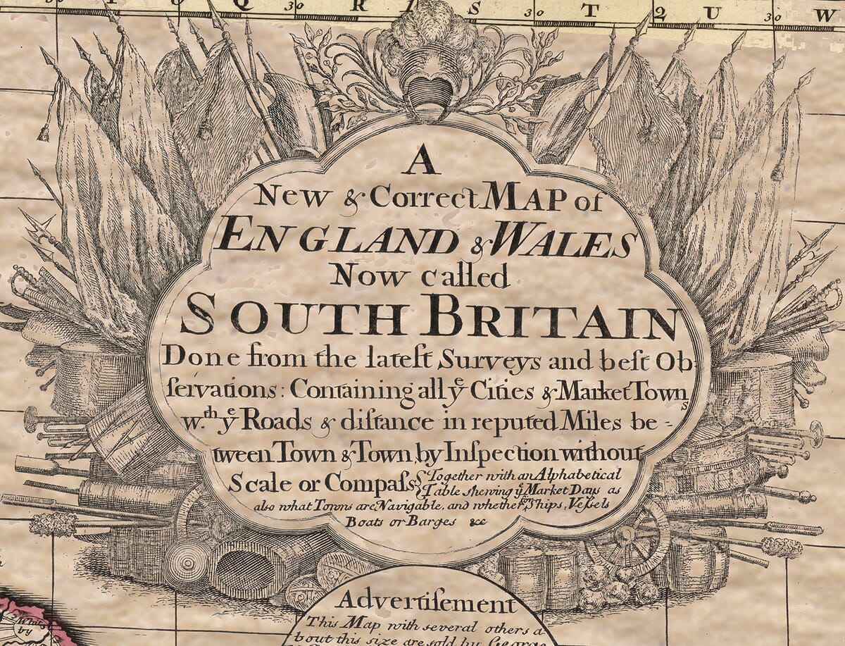
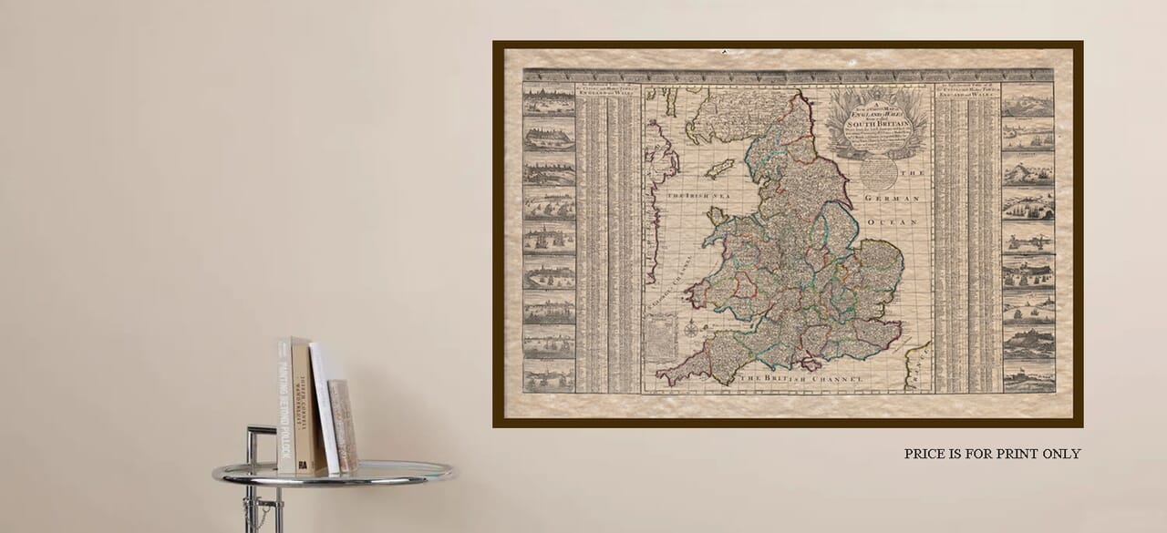
George Willdey is known as a prominent British mapmaker and publisher and produced this quite extraordinary map entitled “A New & Correct Map of England & Wales, Now Called South Britain” in 1717. This map holds a worthy notoriety in the history of Britain’s history of old maps, both for its content and for the historical context in which it was created. The intricate detail provides a valuable insight into 18th century history and the changing political and cultural landscape of the period.
Historical Content: The Early 18th Century
The map was produced during a time of great political change in Britain. In 1707, the Acts of Union merged the Kingdom of England and the Kingdom of Scotland into the Kingdom of Great Britain. The British monarchy, under Queen Anne, consolidated the union, and the term “Great Britain” became the official designation for the united realms. However, there remained a transition period where older terms continued to be used informally or in specific contexts. For instance, England and Wales, even after the Union, continued to be referred to as “South Britain” in certain cartographic and official documents. The map reflects this historical confusion or ongoing usage of the term “South Britain,” even though the official name for the island was now “Great Britain.” It is a product of a transitional moment in British cartography, where both old and new geographical identities coexisted.
Description and Features of the Map
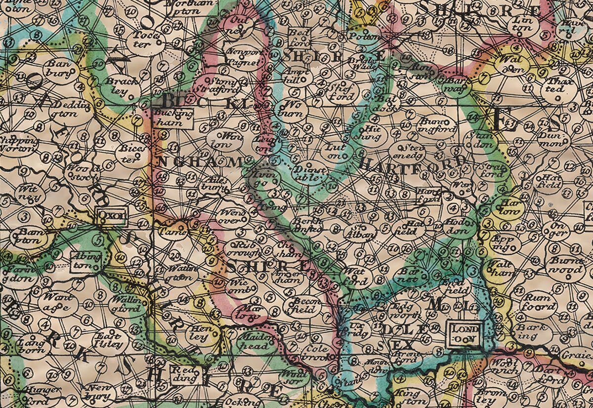
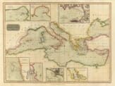
George Willdey’s A New & Correct Map of England & Wales, Now Called South Britain is an intricately detailed map of the island, capturing the landscape of England and Wales with unsurpassed detail and accuracy. As was customary for maps of this period, the map includes a wealth of topographical details, from coastlines to major roads, towns, and cities. What elevates this Old Britain Map and sets it apart is its lavish refinement and attention to detail, which are typical of Willdey’s work. One of the key features of the map is the use of elaborate cartouches (ornate frames that were often employed by 17th and 18th-century mapmakers). These cartouches typically contained information about the map’s origin and publisher, and in Willdey’s map, they provide many additional insights into the political climate of the time.
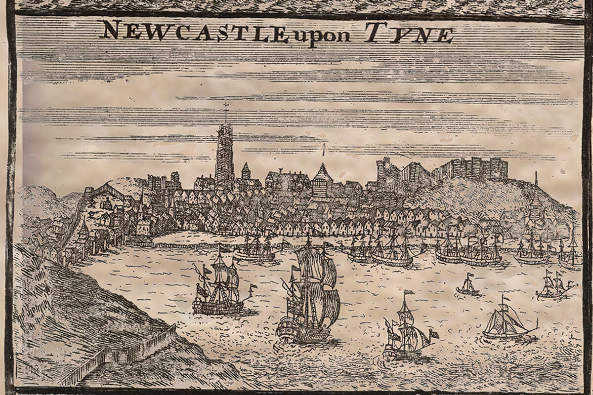
Important Town, Port, City Plans and Places including London, Chester, Bristol, Yarmouth, Southampton, Newcastle-upon-Tyne, Hull, Portsmouth and Harwich to the left hand side and Plymouth, Dartmouth, Falmouth, Torbay, Sheerness, Dover, Liverpool and Windsor & Deal Castles appear to the right. Adjacent to these illustrations there are hundreds of towns and villages listed and keyed to map as a gazetteer.
Aesthetic Appeal and Cartographic Style
The map showcases the stylistic qualities that were typical of maps from the early 18th century. The maps of this era were highly decorative and designed not only to inform but also to impress. The inclusion of a title cartouche at the top of the map and the ornamental borders around the map itself were characteristic of maps meant to appeal to a broader audience, including collectors, scholars, and those interested in the artistic and scientific aspects of cartography. Furthermore, the geographical accuracy of the map reflects the advancements in the art of mapmaking during this period. By the early 18th century, mapping techniques had significantly improved, with greater attention to longitude and latitude, topography, and the emerging understanding of the geography of the British Isles. Willdey’s work typifies this new and sophisticated approach to cartography, providing a highly accurate views of Old Britain at the time.
The Market for the Old Britain Map
This map would have been typically sold to the public, often as part of atlases or as standalone prints a tradition we have been proud to continue here at The Old Map Company since 1956. Willdey’s publications were aimed at both the scholarly community and the general-public, indicating a growing interest in geography and exploration during this period. Willdey was part of a tradition of mapmakers who were instrumental in imparting rapidly expanding geographical knowledge making it more accessible to a wider audience through its interpretation through maps.


