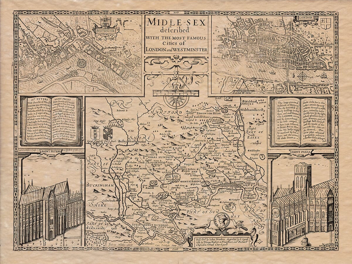
Description
Modern English Translation from the verso of the map:
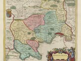
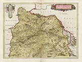
Description of Middlesex
Middlesex, so called because of its location between the West Saxons and the East Angles, was once part of the territory ruled by the East Saxons, along with Essex and Hertfordshire. It is bordered to the north by Hertfordshire, to the west by the River Colne separating it from Buckinghamshire, to the south by the River Thames separating it from Surrey and Kent, and to the east by the River Lea separating it from Essex.
The county stretches about 19 English miles from Stratford in the east to Uxbridge in the west, and around 16 miles from South Mimms in the north to Hampton Court in the south. The total circumference is about 90 miles.
The land is roughly square in shape, with a temperate climate, very fertile soil, and excellent pastures. The grain grown here, especially wheat, has long been used to make fine bread for the royal household. It lies in a wholesome and rich valley, with some scenic hills that offer broad views of the surrounding landscape. It’s compared to the biblical Zoar in Egypt or even to the Garden of Eden.
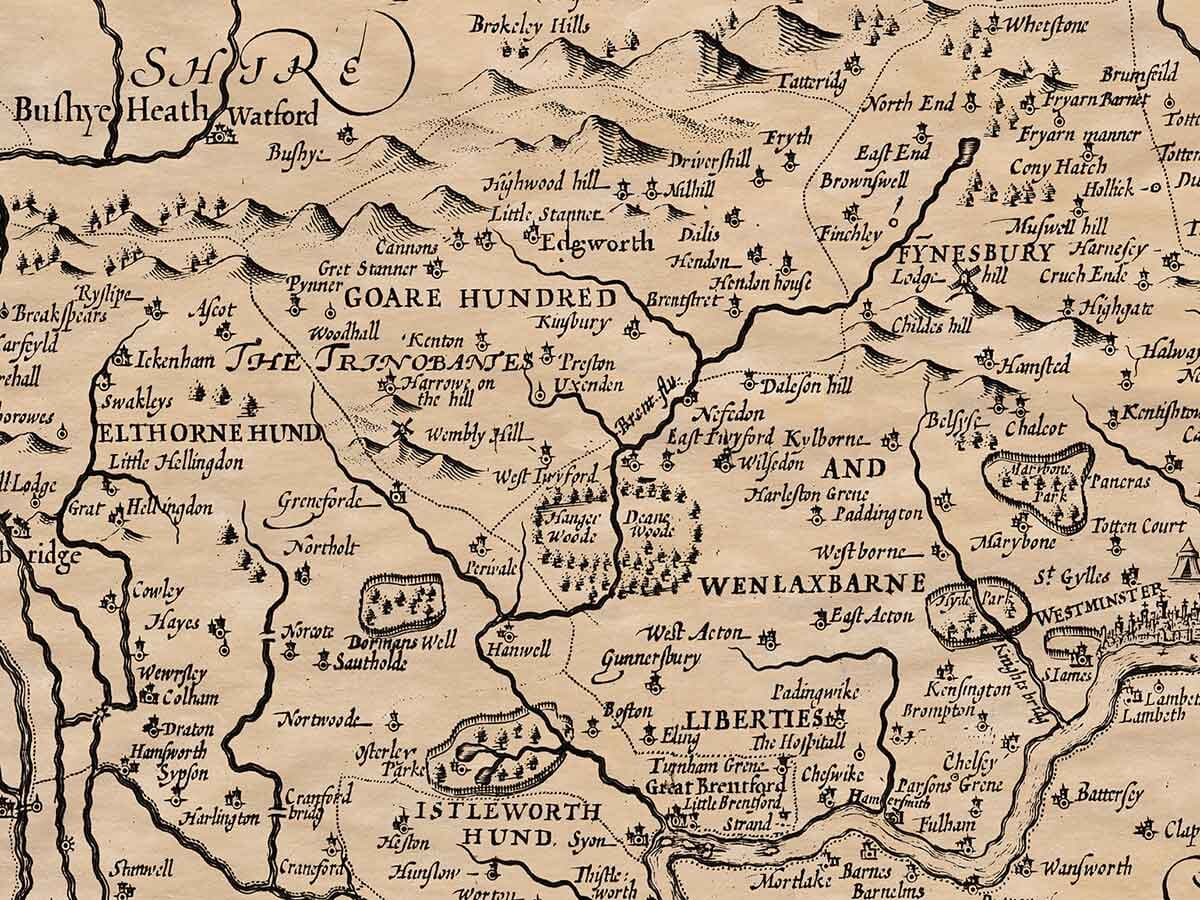
The earliest known inhabitants, according to Julius Caesar, were the Trinobants—a powerful people who ruled much of the region. They submitted to Caesar with minimal resistance and entered into a peace agreement with the Romans. Later, during times of civil unrest within the Roman Empire, the Saxons took advantage of the area and settled here, becoming part of the East Saxon kingdom.
There are five royal estates in Middlesex that belong to the English Crown: Enfield, Hanworth, Whitehall, St. James, and Hampton Court. Hampton Court is more like a city than a palace and is among the most magnificent buildings in Europe. At Isleworth once stood the palace of Richard, King of the Romans and Earl of Cornwall, which was burned down during a London uprising. The county contains many other grand houses belonging to the English nobility, knights, gentlemen, and wealthy London citizens.
Near the entrance of the Thames into Middlesex is a site called “Coway Stakes,” commemorating Caesar’s crossing of the river. Further down at Staines, a stone once marked the extent of London’s jurisdiction over the Thames.
The city of London is said to be more ancient than any surviving records can prove. Legends tie it to Brutus, who called it “Troynovant,” and King Lud, from whom the name Ludgate is said to derive. Ancient Roman writers such as Tacitus and Ptolemy called it Londinium. Due to its prosperity, it was given the title Augusta. The Saxons called it Lundayn, and today we know it as London.
London stands out like a cedar among smaller trees. It was the seat of British kings, the administrative centre of England, and the commercial hub of the world. Goods from across the globe arrived here—from Asian silks and African spices to Grecian balms and the riches of the East and West Indies. Few cities have matched its political governance or global fame.
Its walls were first built by the Emperor Constantine the Great, at the request of his mother Queen Helena, using rough stone and British brick. The wall spanned three miles and had seven main gates, plus three other entrances. Two gates opened onto the Thames: Dowgate and Billingsgate, which served as ports. A milestone known as London Stone stood in the city centre and was used to measure distances.
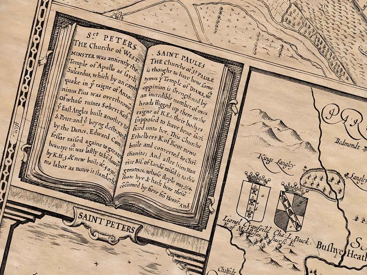
East of the city was the Church of St. Peter, believed to be the seat of Bishop Restitutus during Constantine’s reign. Eventually, St. Paul’s Cathedral in the west took over as the city’s main church. This grand cathedral has been struck by lightning twice and destroyed. In addition to St. Paul’s, there are 121 churches in London—96 within the city walls, 16 just outside but still within the liberties, and 9 in the suburbs. During Fitz-Stephen’s time, there were 13 religious monasteries. St. Peter’s an St. Paul’s feature within an inset at the top right of the old map.
London is divided into 26 wards, each governed by an alderman, and is administered by a Lord Mayor and two Sheriffs. This structure was granted by King John. During his reign, London Bridge was rebuilt in stone with 19 arches—unmatched in size and beauty.
London has expanded far beyond its original walls and continues to grow. The city’s strength lies not in its walls, which are now largely symbolic, but in its citizens. Its economic power comes from the River Thames, much like ancient Tyre’s came from its trade. The river is navigable and connects the city to the North Sea, making it a centre of global trade. Twice, London has launched successful global circumnavigation voyages from the Thames.
The Thames was once diverted by the Danes during their siege, and later by William the Conqueror. Yet King Alfred restored order and the river’s course. The city has faced civil unrest, including during King John’s time and the uprising of Wat Tyler in 1380.
London lies at 51 degrees 45 minutes latitude and 20 degrees 39 minutes longitude.
In Middlesex, at Barnet, a major battle was fought on Easter Day between King Henry VI and King Edward IV. Many nobles were killed, including a marquess, an earl, and three lords, along with 10,000 soldiers.
The county is divided into seven hundreds (administrative divisions), containing two cities, four market towns, and 73 parish churches (not including those in London). In Greyfriars Church, three queens are buried: Queen Margaret (wife of Edward I), Queen Isabel (wife of Edward II), and Queen Joan (daughter of Edward II and wife of David, King of Scotland).

Old Middlesex Map verso