Magellan
Magellan magellan detail Magellan-Detail-2

Antique Map of the Strait of Magellan | Historic Maritime Chart Print

Price range: £35.55 through £59.95

Magellan Strait

This antique map of the Strait of Magellan depicts one of the most important and dangerous sea routes in the history of exploration. First navigated in 1520 by Ferdinand Magellan, the strait forms a natural passage between the Atlantic and Pacific Oceans at the southern tip of South America. Rich in historical detail and maritime character, this vintage chart captures a moment when the edges of the world were still being mapped.

  • Stunning giclée fine art print on authentically aged heavy textured paper
  • 12 Colour printing technology  •  Guaranteed to pass or exceed museum quality standards
  • Bespoke framing service   •  Free UK Courier Delivery with tracking
Available in three sizes: Large: 24″ x 24″ (78.7 x 78.7cms)   Medium: 18″ x 18″ (45.5 x 45.5cms)   Small: 19.5″ x 14″ (49.5 x 35.5cms)
+ read more

A stunning certified FINE ART PRINT on heavy textured art paper — not a poster

  • Direct from the publisher — no middlemen
  • Printed in-house in Cornwall
  • Free UK delivery — international shipping available
  • Produced to meet — and often exceed — museum-quality standards
Inspecting Vintage Map Reproduction

Fine Art Map Reproductions – Museum-Quality Printing

Unlike most online offerings, our maps are produced entirely in-house, not outsourced to print-on-demand or drop-shipping services. This allows complete control over quality while offering better value. Each map begins with a high-resolution original, carefully enhanced and printed to order using archival papers and pigment inks for exceptional clarity, depth, and longevity. Every piece is personally overseen — no map leaves our workshop unless it is of a quality we would be proud to display ourselves.

Hand hold a magnifying glass over West Cornwall Map

Authentic Old Map Paper & Accurate Colour Reproduction

Paper choice is essential to the authenticity of our maps. We use specially sourced 190gsm paper made in the UK from pure materials and traditionally pressed with natural woollen felts. This process creates a subtle, randomly textured surface that closely resembles an original antique document. Likewise the use of premium quality ink fully saturates the paper, producing remarkable clarity, depth, and historical character. Colour fastness and sharpness will remain good for in excess of 100 years!

Map in Postal Tube
Buy Old Maps Online in the UK Today Trading online since 1999

The Old Map Company of Great Britain offers a vast and carefully curated collection of the very finest expertly reproduced vintage maps. Our range includes works by renowned cartographers such as John Speed and Willem Blaeu, covering Scotland, England, and beyond. Free UK courier delivery is included, with EU, USA, and worldwide shipping available at cost and calculated at checkout. If you need assistance, our team is always happy to help you choose the perfect map.

RECENT REVIEWS

M.F. Leicestershire
M.F. Leicestershire
Very impressed . . . exceeded my expectations. My son would now like one for Christmas!
Julia Ballester
Julia Ballester
Very pleased with the quality of the map and it even arrived before it was supposed too.
Nikki
Nikki
Amazed to find the church where we married on a 400 year old map. Bought as a 1st anniversary gift.
K.H. Middlewhich
K.H. Middlewhich
I am absolutely delighted with the my antique map. It is so interesting. I would now like to purchase another Map for my sister as a Christmas present.
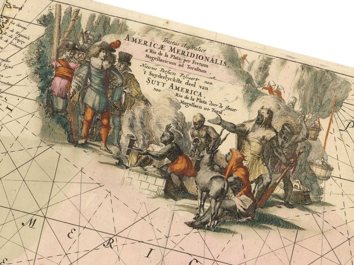
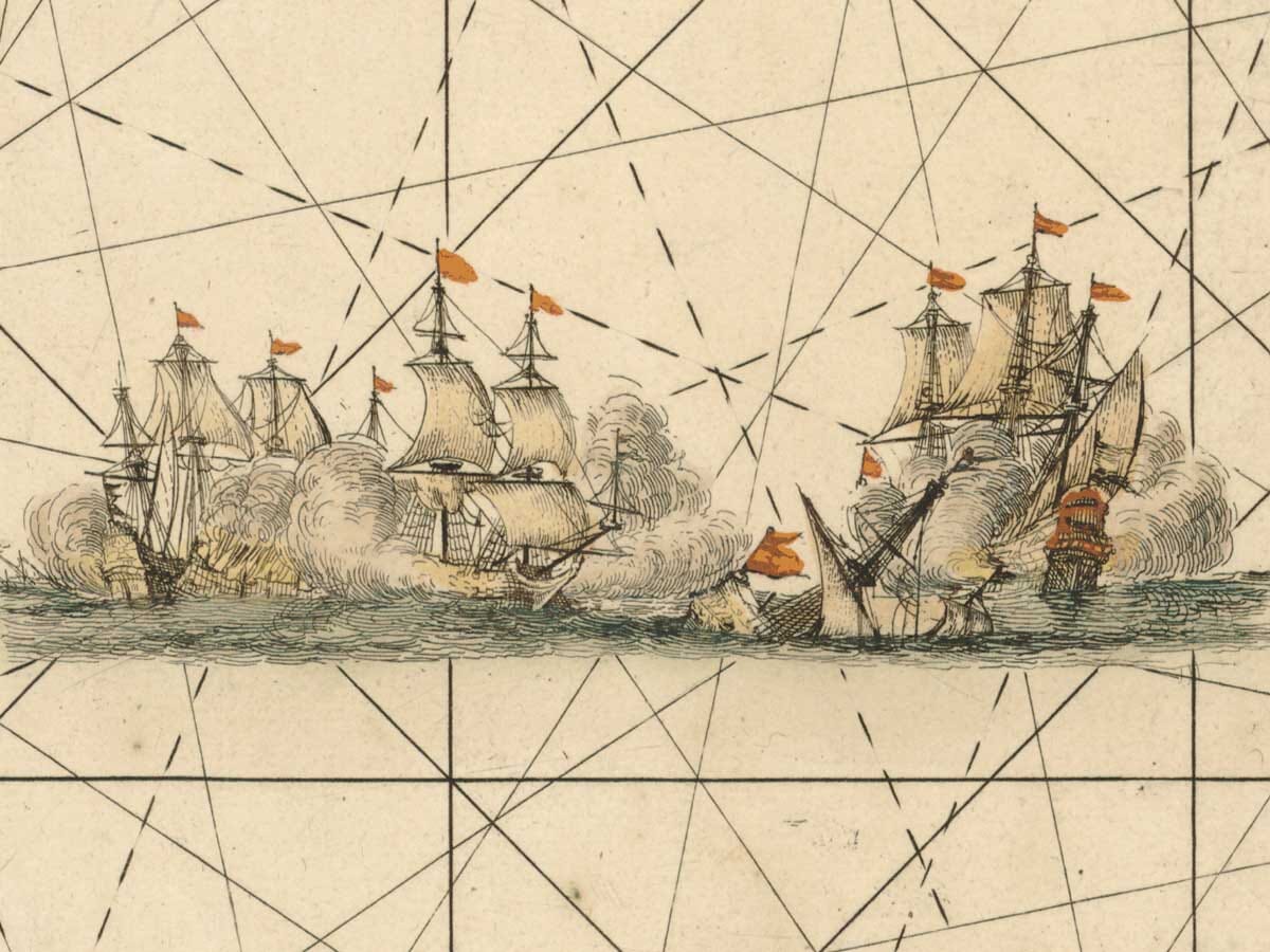
This is one of those maps that was functional and decorative and it’s quietly become one of my favourite pieces in the collection. 
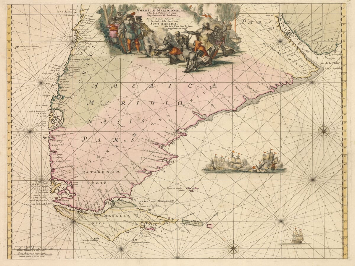
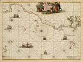
The Strait of Magellan sits right at the bottom of South America, where land breaks apart into islands and channels and the weather rarely behaves. Even today it feels remote. Five hundred years ago, it must have felt almost unreal. For sailors heading south, this was not a known route so much as a question mark. The strait is named after Ferdinand Magellan, who sailed through it in 1520 while searching for a passage between the oceans. He didn’t know what lay ahead, only that something might be there. Early charts of the area were built slowly, from observation and repetition rather than certainty. They were revised, argued over, and sometimes wrong. You can see that uncertainty here. The coastline doesn’t feel fixed or confident. It bends and shifts, as though it’s still being worked out. There’s a sense that the map is recording experience rather than presenting fact. The islands around Tierra del Fuego feel scattered and restless, just as they would have appeared from the deck of a ship fighting wind and tide. We’ve taken great care to ensure that our reproduction stays as close to the character of the original. Printed on textured paper using fine art giclée methods, it keeps the softness and depth you expect from an old chart, without trying to sharpen it into something modern. It doesn’t shout for attention. It rewards looking. Placed on a wall, it works quietly. Over time you start to notice small details — a curve of coast, an unfamiliar name, the space left blank where knowledge once ran out. It’s a map from a moment when the world wasn’t finished yet, and that’s exactly where its appeal lies.

You may also like…

×
Product added to cart
No products in the cart.